Free Downloads: Editable State Map
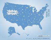
US States Flash Map Silver (with FLA source)
for web sites, interactive applications, presentations, and more.
With this fully-clickable Map you will be able to improve navigation and provide visitors with better and quicker access to information as well as improve the way you present the information. The Map can be easily customizable. In just a few minutes you can...
Category: Web Authoring / Web Design Utilities
Publisher: Fla-shop.com Inc., License: Demo, Price: USD $44.90, File Size: 140.0 KB
Platform: Windows
Northwest Topos is a mapset containing contours, hydrology, roads, trails, points of interest and more for the State of Washington and adjoining regions. It is designed for upload to any Map-enabled Garmin GPS receiver.
As of this release, it covers all of the State of Washington along with the North Idaho Panhandle, much of northern and western Oregon, the...
Category: Home & Education / Miscellaneous
Publisher: Jon F. Stanley, License: Freeware, Price: USD $0.00, File Size: 820.2 MB
Platform: Windows
Remere's Map Editor is a map editor for the OpenTibia Project which was created by Remere.
Remere's Map Editor is a Map editor for the OpenTibia Project which was created by Remere.
Remere's Map Editor is a Map editor coded in C to be used with OpenTibia. It supports many advanced features such as autobordering and placing of composite objects. Runs under both Linux and Windows using wxWidgets and OpenGL.
Category: Games / Tools & Editors
Publisher: Remere, License: Shareware, Price: USD $0.00, File Size: 4.2 MB
Platform: Windows
 Freeware
LanTopolog is a freeware application that provides physical network topology discovery, visualization and monitoring Key features: - Automatic physical network topology discovery based on SNMP - Provide detailed and searchable physical network topology Map so you can quickly isolate network connectivity failures - Topology views show which network devices are connected to each...
Category: Utilities / Network
Publisher: Yuriy Volokitin, License: Freeware, Price: USD $0.00, File Size: 854.3 KB
Platform: Windows
Anychart is a flexible Macromedia Flash based-solution, which allows you to easily display any sort of data dealing with geographical locations. It contains United States Maps with Counties, World Map, etc. XML data file and a set of customizable options make AnyChart Maps a universal solution for web developers. AnyChart allows you to create superb, compact, interactive maps....
Category: Software Development
Publisher: AnyChart.Com, License: Shareware, Price: USD $199.00, File Size: 2.8 MB
Platform: Windows, Mac, Linux, Palm,
StateBuilderDotNet is a state machine code generator for C# and VB.
StateBuilderDotNet is a State machine code generator for C# and VB.NET, it transforms a State machine description into an extended version of the State pattern. The State machine description, also known as State machine model, is written in a simple XML format, that is both human readable and writable.
Category: Software Development / Misc. Programming
Publisher: StateForge, License: Demo, Price: USD $0.00, File Size: 9.4 MB
Platform: Windows
It is a very good tool which helps you to better understand how ASP.
It is a very good tool which helps you to better understand how ASP.NET works.
Category: Home & Education / Teaching Tools
Understanding ASP.NET View State looks at how an ASP.NET page maintains its State changes across postbacks, examining:
- The ASP.NET Page Life Cycle
- The Role of View State
- The Cost of View State
- How View State is Serialized/Deserialized
Publisher: Scott Mitchell, License: Freeware, Price: USD $0.00, File Size: 159.0 KB
Platform: Windows
Map of Africa is one of the many maps created for GPS TrackMaker.
Map of Africa is one of the many maps created for GPS TrackMaker. You are able to download the installation package from the TrackMaker website. In order to preview the contents of this package, you need to install GPS TrackMaker.
Using the above mentioned application, you will be able to see the Map of Africa. Just click on the "Open Temporary...
Category: Home & Education / Miscellaneous
Publisher: Geo Studio Technology, License: Freeware, Price: USD $0.00, File Size: 18.3 MB
Platform: Windows
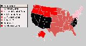
Major USA Cities and Highway Map has been developed for the business-minded people, who need quick and on-hand access to the network of US roads. It is a rather simple version of professional software with several background images and a nice monitor glass projection. With our user-friendly USA Cities and Highways Map it is possible to:? add/remove locations? hide/show roadways...
Category: Web Authoring / Flash Utilities
Publisher: USFlashMap.com, License: Shareware, Price: USD $399.00, File Size: 13.4 MB
Platform: Windows, Mac, Linux, Unix, MS-DOS, AS, 400
Program shows you an actual X3 sector-map, with detailed information about most in-game objects.
Program shows you an actual X3 sector-Map, with detailed information about most in-game objects. The Map is based on a log-file that is created with an in-game script (by Andrei[<>Ace]). If you just want to view the standard Map (or if you don’t have the game) the program will work with the included default Map, which was created with an English X3 game...
Category: Games / Misc. Games
Publisher: SUU Design, License: Freeware, Price: USD $0.00, File Size: 1.4 MB
Platform: Windows
New Zealand Map Reference Converter (NZMapConv) is software that LINZ provides to convert Map references between the old NZMS260 Map series and the new NZTopo50 Map series.NZMapConv is a Windows programme designed to convert individual coordinates entered manually.
Category: Multimedia & Design / Media Management
Publisher: Land Information New Zealand, License: Freeware, Price: USD $0.00, File Size: 2.4 MB
Platform: Windows
VentureForth is the state of the art multicore programming language.
VentureForth is the State of the art multicore programming language.The VentureForth language is used to program the SEAforth family of multicore processors. It contains low level primitives as well as the high level tools necessary to Map programs across the array of cores in a SEAforth processor.
Category: Software Development / Misc. Programming
Publisher: Technology Properties Limited, IntellaSys, License: Freeware, Price: USD $0.00, File Size: 1.3 MB
Platform: Windows
When the XMAP software is communicating with an XEDE via the comms cable each Map will show, at the top of the Map display, an RPM and load value (x and y axis for the Map) in real time. Also in each Map a yellow highlighted block will show the current position within the Map. Beside the real-time display on each Map are the undo and redo buttons which...
Category: Home & Education / Miscellaneous
Publisher: ChipTorque, License: Freeware, Price: USD $0.00, File Size: 1.7 MB
Platform: Windows
Sig Panama Has :
Digital maps of Panama, Digital Map of Panama-City, digital Map of Taboga, digital Map of Bocas del Toro, digital Map of Colon and Free Zone, digital Map of Contadora Island, digital Map of Coronado, Panama, Zona Libre, Map of Panama, Map of Panama City, Map of Colon, Map of Zona Libre, Map of...
Category: Internet / Misc. Plugins
Publisher: DP Imperial, LLC., License: Freeware, Price: USD $0.00, File Size: 44.9 MB
Platform: Windows
Shareware
GPS SDK to add GPS and coordinate conversion functionality to your software and scripts). All NMEA0183 protocol versions are supported and can be filtered by NMEA sentence type and talker ID. Garmin USB PVT support. Information on GPS status can also be retrieved: GPS fix quality, satellites used in fix, satellites in view, satellite azimuth, elevation and signal strengths. The toolkit also...
Category: Software Development
Publisher: Eye4Software B.V., License: Shareware, Price: USD $99.00, EUR79, File Size: 2.3 MB
Platform: Windows
ExpertGPS is helpful in viewing map points, Topo Maps, arial photos and many more.
ExpertGPS is helpful in viewing Map points, Topo Maps, arial photos and many more. This is a revolutionary product called Expert GPS, Expert GPS is highly useful for people interested in Hunting, Scouting, Mountain biking, Fishing, Tracking, State and local agencies in the US as well as geometric studies.
Category: Internet / Communications
Publisher: TopoGrafix, License: Shareware, Price: USD $200.00, File Size: 9.2 MB
Platform: Windows
Freeware
Arm Map Explorer recreates all the functionalities of Google Maps on your desktop while expanding them with new extras. Map Explorer lets you locate and view any place on the planet using dynamic interactive maps. These maps are draggable, which means there is no need for you to click and wait for graphics to reload each time you want to view adjacent parts of a Map....
Category: Internet / Flash Tools
Publisher: ArmCode, License: Freeware, Price: USD $0.00, File Size: 5.5 MB
Platform: Windows
Time Zones Map is the flash world time Map featuring the time peculiarities of more then 50 cities all over the world. Its eye-catching but still pleasant design, varied functions and multiple application abilities combine everything the ultra-modern flash world time Map must have. You can put our Time Zone Map either on one of your website?s pages or put a banner,...
Category: Web Authoring / Flash Utilities
Publisher: USFlashMap.com, License: Shareware, Price: USD $249.00, File Size: 45.0 KB
Platform: Windows, Mac, Linux, Unix, MS-DOS, AS, 400
Shareware
Image to Editable Word Converter can recognize six kinds of languages, including English, French, German, Italian, Spanish and Portuguese. The application also enables users to specify the converted page range. Features of Image to Editable Word Converter: 1.Support Windows 2000 and later systems of both 32bit and 64bit. 2.Convert scanned PDF files to Editable Word or...
Category: Business & Finance / Business Finance
Publisher: verypdf.com Inc, License: Shareware, Price: USD $79.95, AED100, File Size: 15.1 MB
Platform: Windows
The easiest way to get a paper map with MapPlot is the Plot Map menu.
The easiest way to get a paper Map with MapPlot is the Plot Map menu.
On the following dialog, simply paper size and scale have to be chosen - the result is ready to be printed directly, edited (e.g. for additional entries) or to be displayed as a preview.
Category: Utilities / Misc. Utilities
Publisher: AGIS GmbH, License: Freeware, Price: USD $0.00, File Size: 5.4 MB
Platform: Windows
LanTopolog 2.xx is an application that provides physical network topology discovery, visualization and monitoring Key features: - Automatic physical network topology discovery based on SNMP - Provide detailed and searchable physical network topology Map so you can quickly isolate network connectivity failures - Topology views show which network devices are connected to each...
Category: Utilities / Network
Publisher: Yuriy Volokitin, License: Shareware, Price: USD $30.00, File Size: 1.0 MB
Platform: Windows
With LocationWizard you can easily map multiple addresses on a map.
With LocationWizard you can easily Map multiple addresses on a Map. LocationWizard helps you visualize the locations of customers or shops. LocationWizard supports the following database formats: MySQL, PostgreSQL, SQLite, FireBird, InterBase, Microsoft Access, Microsoft Excel and CSV.
Category: Business & Finance / Business Finance
Publisher: Location Wizard team, License: Shareware, Price: USD $85.00, File Size: 7.3 MB
Platform: Windows
OziExplorer3D is an impeccable application for viewing Map images in 3D, along with the options of rotating it in every possible direction, zoom in/out and lots more. The application actually creates grid of heights using the height data that has been obtained and writes it to a file, along with the other required information, loads the file and the Map image or the image section...
Category: Multimedia & Design / Multimedia App's
Publisher: Des Newman, License: Shareware, Price: USD $30.00, File Size: 1.9 MB
Platform: Windows
Tibia Map Viewer is a useful freeware and Open Source application that allows you to view maps generated by Tibia game client and create or edit Map symbols.
You can view the entire Tibia Map you have explored, both upper and lower levels of the Map, with zoom ratio from 25 to 400 percents. It also allows you to export to BMP file.
Category: Games / Tools & Editors
Publisher: Yury Sidorov, License: Freeware, Price: USD $0.00, File Size: 193.7 KB
Platform: Windows
Site Map for osCMax - osCMax Module - is very powerful and flexible module for dynamic site Map generation. With help of this module you will achieve two important goals: 1.your customers always will be able to find correct page on your site without any problem. Your visitors will like your site! 2.Search Engine Optimization. If you will use this module in conjunction with SEO...
Category: Software Development
Publisher: MagneticOne, License: Commercial, Price: USD $39.00, File Size: 70.3 KB
Platform: Windows, Linux, Unix, BEOS