Free Downloads: Esri Production Mapping


 Shareware
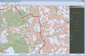
GPS Mapping Software for Windows, Loading topographic maps, manage GPS devices and more. The software can be used with various map formats including: GeoTiff, BSB Nautical Charts, AutoCad DXF files, Esri Shapefiles. Using calibration you can also use scanned or downloaded JPG, BMP, GIF, PNG and TIF maps. The software can be used for survey, research, track and trace, real time...
Category: Home & Education / Science
Publisher: Eye4Software B.V., License: Shareware, Price: USD $75.04, EUR49, File Size: 6.7 MB
Platform: Windows
MapObjects—Java Edition 2 is the newest version of Esri's pure Java solution for the GIS Java developer.Support for additional file formats such as MrSID, CAD (DGN, DXG, and DWG), SDC, military formats, and much more.Support for Mac OS X and IBM AIX operating systems in addition to continued support for HP-UX, Linux, Solaris, and Windows.
MapObjects—Java Edition is...
Category: Software Development / Misc. Programming
Publisher: ESRI, License: Demo, Price: USD $0.00, File Size: 2.2 MB
Platform: Windows
CMSDialog offers an efficient solution for coding and displaying information with ESRI software.
CMSDialog offers an efficient solution for coding and displaying information with Esri software. Using drag-&-drop operations, you can create forms that feature standard Windows editing options such as drop-down lists, tab sheets, check boxes, radio groups, date pickers, hyperlinks and more.
Category: Utilities / Misc. Utilities
Publisher: Coulter Mapping Solutions Inc, License: Shareware, Price: USD $150.00, File Size: 4.1 MB
Platform: Windows
Arcv2CAD is an application that is able to convert ESRI shapefiles to AutoCAD DXF and DWG formats.
Arcv2CAD is an application that is able to convert Esri shapefiles to AutoCAD DXF and DWG formats. This allows shapefiles to be read by virtually all CAD software, for example AutoCAD, MicroStation, CivilCAD, DesignCAD, SolidWorks, as well as numerous other Mapping and Graphics software, eg CorelDraw, Surfer, World Construction Set.
Category: Multimedia & Design / Media Management
Publisher: Guthrie CAD/GIS Software Pty Ltd, License: Shareware, Price: USD $224.91, File Size: 10.9 MB
Platform: Windows


 Shareware
GPS Mapping Software for Windows, Loading topographic maps, realtime navigation, track recording, manage GPS devices and more. The software can be used with various map formats including: GeoTiff, BSB Nautical Charts, AutoCad DXF files, Esri Shapefiles. Using calibration you can also use scanned or downloaded JPG, BMP, GIF, PNG and TIF maps. The software can be used for survey,...
Category: Home & Education / Science
Publisher: Eye4Software B.V., License: Shareware, Price: USD $149.00, EUR99, File Size: 11.1 MB
Platform: Windows
PDAT Classic/SE (CLSE) is an Esri ArcMap™ Extension that provides the means to load PODS centerline and event data from from a PODS data model to a Esri route Shapefiles™ or Personal Geodatabase™ and into an enterprise Esri ArcSDE™ database.
Manage the spatial component of the data stored in PODS.
Category: Business & Finance / MS Office Addons
Publisher: Eagle Information Mapping, Inc., License: Demo, Price: USD $0.00, File Size: 131.8 KB
Platform: Windows
This utility scans exe or dll files of your choosing and detects usage of .
This utility scans exe or dll files of your choosing and detects usage of .NET types released by Esri. It then generates a report of this usage for your review.
Among other things, you can use the information provided to verify that you are not using types from assemblies that require licenses beyond your target license level or to generate a list of types that you can...
Category: Utilities / Misc. Utilities
Publisher: Environmental Systems Research Institute, Inc., License: Freeware, Price: USD $0.00, File Size: 743.3 KB
Platform: Windows
MAPublisher® cartography software seamlessly integrates over 50 GIS Mapping tools into the Adobe Illustrator environment to help you create maps the way you want, how you want.
MAPublisher supports Esri ArcGIS 10 geodatabases and ArcMap document (MXD) files.
Category: Multimedia & Design / Multimedia App's
Publisher: Avenza Systems Inc., License: Shareware, Price: USD $1399.00, File Size: 157.2 MB
Platform: Windows
Spatial Workshop is Mapping software used for spatial information integration, query, analysis and reporting.
You build spatial applications with a few clicks or support complex business processes with geospatial and business data from Oracle, Smallworld, Esri, maps, files, spreadsheets and other sources.
You can combine and model geospatial data,...
Category: Multimedia & Design / Multimedia App's
Publisher: Spatial Eye bv, License: Freeware, Price: USD $0.00, File Size: 176.7 MB
Platform: Windows
Mipsis Production Control Software is a program used after the production planning stage.
Mipsis Production Control Software is a program used after the Production planning stage. It tracks work orders opened for the manufacturing process and collects information about Production. This data -- such as Production duration, quantity of material used, actual manhours worked, and the number of discards -- can then be used in costing and performance reports.
Category: Business & Finance / Applications
Publisher: Mipsis Sofware, License: Commercial, Price: USD $195.00, File Size: 72.9 MB
Platform: Windows
It`s a FREE Esri shape files (*.shp), MapInfo interchange (*.mif) and AutoCAD *.dxf viewer. Using this utility you can view *.shp files (Esri shape files), *.mif files (MapInfo interchange) and AutoDesk AutoCAD *.dxf. No other files are needed.
Category: Multimedia & Design
Publisher: Avangardo, License: Freeware, Price: USD $0.00, File Size: 420.9 KB
Platform: Windows
Geosoft's Target™ for ArcGIS software, built on Geosoft's industry-leading Oasis montaj™ software, simplifies the visualization and analysis of subsurface drillhole and borehole geology data within your Esri GIS environment.
Target for ArcGIS processes large volume drillhole data with ease and generates professional-quality maps for presentation, adding...
Category: Software Development / Misc. Programming
Publisher: Geosoft Inc., License: Shareware, Price: USD $0.00, File Size: 0
Platform: Windows
WOFOST distinguishes three levels of crop production:
1.
WOFOST distinguishes three levels of crop Production:
Category: Business & Finance / Project Management
1. Potential Production: determined by crop variety, crop management, radiation and temperature;
2. Water-limited Production, where water availability limits the potential Production.
3. Nutrient-limited Production where nutrient availability limits the water-limited Production
Publisher: Alterra, License: Freeware, Price: USD $0.00, File Size: 9.1 MB
Platform: Windows
Analyse your QTL experiments with interval Mapping, with the powerful MQM Mapping (=composite interval Mapping), or with a nonparametric method. MapQTL is easy to use, is very fast and presents the analysis results in tables and (adjustable) charts, that can be exported to MS-Windows text processing and presentation software.
Category: Business & Finance / Business Finance
Publisher: Kyazma B.V., Wageningen, Netherlands, License: Shareware, Price: USD $4534.00, File Size: 6.5 MB
Platform: Windows
Lasser Production Data (LPDTM) is a oil and gas production data software.
Lasser Production Data (LPDTM) is a oil and gas Production data software.
Designed specifically for the active operator, Lasser Production Data is the most effective and efficient way to access oil and gas Production data. With this product running in your office, you'll have capabilities previously available only to large oil companies using...
Category: Business & Finance / Database Management
Publisher: Lasser, Inc., License: Demo, Price: USD $0.00, File Size: 100.0 MB
Platform: Windows
ArcScripts is intended for the free exchange of scripts and tools related to ESRI software products.
ArcScripts is intended for the free exchange of scripts and tools related to Esri software products. Please alert the moderator if this script is a demo, trial-version, or an advertisement for a retail product.
New implementation of the toolbar, plus fixed an issue that was preventing the button from appearing for some users
Category: Home & Education / Miscellaneous
Publisher: ESRI, License: Freeware, Price: USD $0.00, File Size: 406.3 KB
Platform: Windows
AXMEDIS Content Production Tools: AXMEDIS editor and GRID AXCP tools, PnP, DRM editor, etc.
AXMEDIS Content Production Tools: AXMEDIS editor and GRID AXCP tools, PnP, DRM editor, etc., all you need to create and processing any kind of content and process any kind of content manually and automatically: SMIl, HTML, content adptation, fingerprint, crawling, indexing, cms, search, retrieval, control of P2P, etc. Automating: content ingestions, processing, adaptation, protection,...
Category: Audio / Music Creation
Publisher: AXMEDIS, License: Freeware, Price: USD $0.00, File Size: 323.6 MB
Platform: Windows
One of the basic relations conditioning the Production financial success is optimally low consumption of the material during Production. The best way to drop the Production costs is to review a technological process, especially amount of after Production wastage. It has been proved that if we would provide proper limitation of wastage it would be possible to save...
Category: Multimedia & Design / Image Editing
Publisher: CadProjekt K&A, License: Shareware, Price: USD $0.00, File Size: 0
Platform: Windows
Eye4Software GPS Mapping is a professional GPS Mapping software tool that can be used in numerous applications. Use the software to load, view and edit your maps, display your position realtime and record all your movements.
The software will work with almost any GPS and can be used on any desktop, laptop or needbook computer running Windows XP or higher. The...
Category: Home & Education / Miscellaneous
Publisher: Eye4Software B.V., License: Shareware, Price: USD $130.61, File Size: 14.6 MB
Platform: Windows
iMindMap Basic is a Mind Mapping software which will get you Mind Mapping quickly and easily.
iMindMap Basic is a Mind Mapping software which will get you Mind Mapping quickly and easily. A simple tool to help you start thinking in a clear and creative way, iMindMap Basic uses a process that has been enhancing the way people think for decades. iMindMap Basic is completely free for life and is a great starter package for those who want to start exploring the uses of Mind...
Category: Home & Education / Teaching Tools
Publisher: Buzan Online, License: Freeware, Price: USD $0.00, File Size: 213.6 MB
Platform: Windows
Small production or construction automation software.
Small Production or construction automation software. This program makes it possible to plan and maintain the necessary equipment and materials for the construction or Production. It is the integration of material requirements planning (MRP), supply chain management (SCM) and warehouse management system (WMS).
Category: Business & Finance / Inventory Systems
Publisher: Berdaflex, License: Shareware, Price: USD $50.00, File Size: 2.9 MB
Platform: Windows
CAD2Shape converts AutoCAD DXF/DWG drawing files to ESRI shapefile format.
CAD2Shape converts AutoCAD DXF/DWG drawing files to Esri shapefile format. It can translate holes / islands /donuts from originating CAD drawing to Polygon shapefile. It can translate 3D surfaces to MultiPatch shapefile types.
The new version has MPolygon support and has additional XDATA types.
Category: Multimedia & Design / Image Editing
Publisher: Guthrie CAD/GIS Software Pty Ltd., License: Shareware, Price: USD $224.91, File Size: 10.7 MB
Platform: Windows
PDAT Graphics Engine (GE) is an ESRI ArcMap™ Extension that performs pipeline centerline edits.
PDAT Graphics Engine (GE) is an Esri ArcMap™ Extension that performs pipeline centerline edits.
PDAT GE is designed to manage pipeline geometries within ArcMap™ while supporting all facets of centerline coordinate modifications within the corresponding PODS database.
Category: Business & Finance / MS Office Addons
Publisher: Eagle Information Mapping, Inc, License: Demo, Price: USD $0.00, File Size: 1.0 MB
Platform: Windows
SWIFT WX Professional runs on any desktop or laptop computer and provides you with up-to-the-minute Radar, Satellite, Storm Warnings, and Hail Reports. It will even alert you up to an hour in advance of approaching rain or thunderstorms, and predict to the nearest minute when those storms will arrive. FEATURES & BENEFITS: - Track Hurricanes, Tornadoes, Flash Floods, and more- Choose from...
Category: Home & Education / Miscellaneous
Publisher: SWIFT Weather, License: Shareware, Price: USD $159.50, File Size: 20.4 MB
Platform: Windows
gSpatial Toolbar allows you to import, display and manipulate ESRI shapefile data in Google Earth.
gSpatial Toolbar allows you to import, display and manipulate Esri shapefile data in Google Earth. Annotate your data and perform thematic queries on your Excel spreadsheet data or ODBC data sources, visualize results in Google Earth
Category: Multimedia & Design / Graphics Viewers
Publisher: gSpatial, License: Freeware, Price: USD $0.00, File Size: 686.1 KB
Platform: Windows


