Free Downloads: Fill Maps World
 Shareware
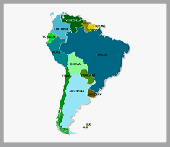
Offline Map Maker is a tool that help you to get offline tile images from Google Maps, Openstreetmap, Yandex Maps, Yahoo Maps, Mapquest, Gaode map, Tencent Maps, Baidu Maps, Tianditu, Arcgis Online, OneMap, Whereis, mapy.cz, Mappy, Waze, Sentinel-2 map, Strava Gloabal Heatmap, Wikimapia, GoMap.Az, Longdo Map, Bhuvan, National Map Australia, New Zealand...
Category: Internet / Download Managers
Publisher: allmapsoft.com, License: Shareware, Price: USD $79.00, File Size: 31.1 MB
Platform: Windows
Covering every month of every theatre of World War II, this huge atlas is for wargamers and anyone interested in World War II. It provides a highly interactive and thought-provoking view of the war, and is a great starting point for what-if scenarios. Each map contains date, movement, unit strengths and other military details.
From the World overview you can...
Category: Home & Education / Miscellaneous
Publisher: ProFantasy Software, License: Shareware, Price: USD $27.95, File Size: 57.0 MB
Platform: Windows
PlanetGIS Explorer is a free viewer for PlanetGIS maps and GIS exchange files.
PlanetGIS Explorer is a free viewer for PlanetGIS Maps and GIS exchange files. PlanetGIS Explorer allows you to navigate through Maps, query map elements and view attribute information from linked database tables. Also PlanetGIS Explorer allows you to customize the appearance of Maps for purposes of creating hardcopy printouts, but does not allow you to save any changes to...
Category: Multimedia & Design / Graphics Viewers
Publisher: Planet GIS, License: Freeware, Price: USD $0.00, File Size: 5.4 MB
Platform: Windows
Free Satellite Maps is a free tool from Google which offers a satellite mapping service worldwide.
Free Satellite Maps is a free tool from Google which offers a satellite mapping service worldwide.These are accompanied by a street service, a route planner and information about business in almost all countries.In this way we can fly the World from satellite view or in birds eye.The level of detail is different depending on where you are located.Major cities have a very excellent...
Category: Home & Education / Science
Publisher: www.satelliteview-of-my-house.com, License: Freeware, Price: USD $0.00, File Size: 612.0 KB
Platform: Windows
News Maps visually reflect news aggregated from numerous sources including Reuters, Wall Street Journal, NY Times, Washington Post, BBC, Digg, Reddit and many more news outlets from around the World.
The most popular stories occupy the largest rectangles while less popular stories fall into progressively smaller rectangles. You can see all the headlines and read any...
Category: Utilities / Misc. Utilities
Publisher: TimBukOne (Pty) Ltd, License: Freeware, Price: USD $0.00, File Size: 5.9 MB
Platform: Windows
Shareware
FPS Maps for WPF is a brand new component with a set of built-in country Maps. There are 15 Inbuilt Countries. FPS Maps for WPF contains samples of how to work with it and customize. Maps navigation can be performed via Navigation bar which supports Themes and mouse. You can pan with mouse or zoom in/out with mouse scroll. More options will be added in future...
Category: Software Development / Components & Libraries
Publisher: FPS Components, License: Shareware, Price: USD $199.00, File Size: 1.1 MB
Platform: Windows
Fill out forms on your computer.
Fill out forms on your computer. You don't need your typewriter anymore to Fill out forms! You scan the form. The you create some form fields. Then you can Fill out the forms. After that you can print on the original form or you may print out the scanned form with the texts on a white sheet of paper. With this program you can Fill out every form, e.g. transfer...
Category: Business & Finance / Applications
Publisher: CAD-KAS GbR, License: Demo, Price: USD $20.00, File Size: 921.6 KB
Platform: Windows
With yalips maps you get 4 products in 1.
With yalips Maps you get 4 products in 1. You are more productive, more creative and perform better on your job when using visual software tools. With the resulting visualizations you can communicate more effectively and convincingly to your collegues, your boss, your customer or the chairman of the board. Therefore many companies spent a lot of money on such tools. Unfortunately, most...
Category: Business & Finance / Project Management
Publisher: yalips Software, License: Shareware, Price: USD $80.00, File Size: 29.6 MB
Platform: Windows
DominateGame is an online game of world domination.
DominateGame is an online game of World domination. It is a simple board game that guarantees hours of fun. Not only do you get to play with players across the World in customized Maps; you can also create your own Maps.
The program is quite lightweight and user-friendly, so new players will not find it that hard to learn the ropes. All you need to do is join a...
Category: Games / Strategy & War
Publisher: Emiel Bruijntjes, License: Freeware, Price: USD $0.00, File Size: 2.4 MB
Platform: Windows
Nevron Map for Reporting Services is an advanced report for all versions Microsoft Reporting Services. It is designed to provide report authors with an easy and powerful way to create choropleth Maps that are tightly integrated with your data. The component delivers an unmatched set of features related to visual quality, layout, data integration and data analysis. Nevron Map for SSRS...
Category: Business & Finance / Database Management
Publisher: Nevron Software LLC, License: Shareware, Price: USD $589.00, File Size: 182.2 MB
Platform: Windows
TopoGun is a stand-alone resurfacing, and maps baking application.
TopoGun is a stand-alone resurfacing, and Maps baking application. The resurfacing functions in TopoGun will help you modify and/or recreate the edgeflow of your digital 3D models.
The Maps baking functions, will help you bake various types of texture Maps from your high resolution 3D models and then allow you to apply them to your newly created optimized...
Category: Multimedia & Design / Animation
Publisher: SC PIXELMACHINE SRL, License: Shareware, Price: USD $100.00, File Size: 55.5 MB
Platform: Windows
You can create a backup of your maps with JaVaWa GMTK and restore these (e.
You can create a backup of your Maps with JaVaWa GMTK and restore these (e.g. on another computer) including unlock codes. Re-installing Maps is unnecessary.
Migration of your Garmin Maps from and old computer to a new one is straightforward with this application.
Category: Utilities / Backup
Publisher: JaVaWa GPS-tools, License: Shareware, Price: USD $0.00, File Size: 5.4 MB
Platform: Windows
Conquest! is a simple game to learn, but you will need strategy, tactics and cunning if you expect to defeat all of your enemies and rule the World.
Play as the English or the French in the Hundred Years War, or fight the Wars of the Roses.
Play games with up to 8 human players across a LAN or the internet.
Try your skill against 5 levels of AI in the campaign or...
Category: Games / Strategy & War
Publisher: Illustrious Software, License: Shareware, Price: USD $0.00, File Size: 0
Platform: Windows
This program allows you to get current weather information for forecasts, Maps, storms and traffic news for your hometown or anywhere else in the World. Find out the weather anywhere in the World. Track weather at your own home location. You also get a free customizable Crawler Toolbar for your browser (if selected during installation).
For Platforms: Win95,...
Category: Desktop Enhancements / Shell & Desktop Managers
Publisher: Crawler, LLC, License: Freeware, Price: USD $0.00, File Size: 3.9 MB
Platform: Windows
Form Auto Fill Portable provides a cost effective solution to Fill and submit forms, login websites and email accounts and manage passwords on different computers. Form Auto Fill Portable can be installed on any kind of removable storage media (USB disk, flash drive, etc.), so you can use it on any computer you need. With Form Auto Fill Portable you can Fill...
Category: Security & Privacy / Password Managers & Generators
Publisher: Form Auto Fill.com, License: Shareware, Price: USD $49.95, File Size: 4.5 MB
Platform: Windows
Live Satellite Maps or Google maps is a web server mapping applications.
Live Satellite Maps or Google Maps is a web server mapping applications.Provides scrolling map images and satellite photos around the earth and even the route between different places.Since 6 October 2005, live satellite Maps is part of local Google.Google live satellite Map provides the ability to zoom in or zoom out to show the map.The user can control the map with your...
Category: Home & Education / Science
Publisher: www.satelliteview-of-my-house.com, License: Freeware, Price: USD $0.00, File Size: 643.0 KB
Platform: Windows
Html Form Filler is a useful form Fill software.It will help you Fill any html form easily and quickly.By menu items in the ie right button menu you can Fill every form item.One ie menu item Fill one form item.Operation is very conveniently,you just need to select the menu item which you have setbefore filling form. Html Form Filler Key Wordsform filler,Fill...
Category: Web Authoring / Reference & Tutorials
Publisher: AchenSoft Inc, License: Shareware, Price: USD $14.95, File Size: 1.2 MB
Platform: Unknown

OkCustomMap is a software to produce Garmin Custom Maps.
OkCustomMap is a software to produce Garmin Custom Maps.
Supports many map formats:
- OkMap
- Ecw
- GeoTiff
- World files
- OziExplorer
- GpsTuner
You can customize:
- The quality of the output JPEG images (0=Bad, 100=Good)
- The KML transparency (0=Transparent, 255=Opaque)
- The KML draw order (0=Invisible, 1-49=Under the vectorial...
Category: Business & Finance / Applications
Publisher: Gian Paolo Saliola, License: Freeware, Price: USD $0.00, File Size: 3.2 MB
Platform: Windows
World Display is a fun new way to automatically update your Desktops Wallpaper to beautiful pictures from all across the globe! Using Google Maps and Panoramio images, World Display lets the user choose and add locations from all over the earth to display
Category: Desktop Enhancements / Wallpaper
Publisher: o2slim.com, License: Freeware, Price: USD $0.00, File Size: 400.0 KB
Platform: Windows, Vista
Electronic World atlas for Radio Amateurs.
Electronic World atlas for Radio Amateurs. Scrollable World map with smooth zoom, DXCC territories, province/state prefixes, Grid Squares, CQ and ITU Zones in the rectangular, azimuthal and Globe projections, 3D relief, Gray Line, city and island index, unique hierarchical prefix database, local time with DST for all cities, islands and call areas, unique ionospheric Maps.
Category: Home & Education / Miscellaneous
Publisher: Afreet Software, Inc., License: Freeware, Price: USD $0.00, File Size: 7.6 MB
Platform: Windows
World Empire V For Windows is the newest entry in the award-winning global strategy game from Viable Software. New realistic Maps and 205 countries, country flags, and new generals. WEV is a truly a player-driven game design. If you are a RISK(TM) fan, you'll love World Empire!
Category: Games / Strategy & War
Publisher: Viable Software Alternatives, License: Shareware, Price: USD $29.95, File Size: 6.0 MB
Platform: Windows
From the Sacre Coeur to the Arc de Triomphe, your holiday to Paris starts from the moment you open your guide, plus you get Paris Maps and transport Maps.
Discover the best cafe terraces, unmissable museums and galleries, loveliest parks and gardens, best areas to shop or browse, unforgettable shows and live music venues, most fun places for children, and best restaurants to...
Category: Internet / Communications
Publisher: Mobile Systems, License: Shareware, Price: USD $9.80, File Size: 0
Platform: Windows
World Time is a simple to use but intelligent graphical utility that displays in real time, not only the time in cities around the World, but it also features viewable time zones, which displays night and day around the World. World Time features cloud Maps, which allow you to view animated cloud formations from around the World using satellite imaging...
Category: Home & Education / Miscellaneous
Publisher: Trellian Limited, License: Shareware, Price: USD $0.00, File Size: 0
Platform: Windows
When you are looking for a powerful tool to satisfy various needs regarding vectors, raster and satellite imagery, you will find ILWIS Academic an efficient application. The program comes with such useful features as points to create Maps, lines for segment Maps, closed area segments for polygon Maps, spatial operations for raster Maps and so on. Whilst using images...
Category: Home & Education / Miscellaneous
Publisher: ITC, License: Freeware, Price: USD $0.00, File Size: 19.4 MB
Platform: Unknown
Anychart is a flexible Macromedia Flash based-solution, which allows you to easily display any sort of data dealing with geographical locations. It contains United States Maps with Counties, World Map, etc. XML data file and a set of customizable options make AnyChart Maps a universal solution for web developers. AnyChart allows you to create superb, compact, interactive...
Category: Software Development
Publisher: AnyChart.Com, License: Shareware, Price: USD $199.00, File Size: 2.8 MB
Platform: Windows, Mac, Linux, Palm,