Free Downloads: Flash Gis Mapping
MICRODEM is a freeware microcomputer Mapping program written by Professor Peter Guth of the Oceanography Department, U.S. Naval Academy. It requires a 32 bit version of Windows (NT/2000/XP or 95/98/ME). You may freely use MICRODEM with no restrictions.
MICRODEM displays and merges
- digital elevation models
- satellite imagery
- scanned maps
...
Category: Multimedia & Design / Graphics Viewers
Publisher: Petmar Triilobite Breeding Ranch, License: Freeware, Price: USD $0.00, File Size: 84.9 MB
Platform: Windows
MapInfo Professional® is a powerful Microsoft® Windows®-based Mapping and geographic analysis application from the experts in location intelligence. Designed to easily visualize the relationships between data and geography, MapInfo Professional helps business analysts, planners, Gis professionals – even non-Gis users – gain new insights into their...
Category: Home & Education / Miscellaneous
Publisher: Pitney Bowes Software Inc., License: Shareware, Price: USD $0.00, File Size: 58.8 KB
Platform: Windows
The MapInfo License Server must be installed on your network and be accessible to all MapInfo Professional users. MapInfo Professional is a powerful Microsoft Windows-based Mapping and geographic analysis application from the experts in location intelligence. Designed to easily visualize the relationships between data and geography, MapInfo Professional helps business analysts, planners,...
Category: Home & Education / Miscellaneous
Publisher: Pitney Bowes MapInfo, License: Freeware, Price: USD $0.00, File Size: 12.1 MB
Platform: Windows
AccuGlobe Desktop 2007,a standardized platform for delivering solutions to the global Gis community, offers even more of what you demand in a desktop Gis application. Combining user-friendly design with significantly increased functionality, AccuGlobe Desktop 2007 gives you greater freedom in analyzing spatial data. In addition to functioning as the core engine behind many...
Category: Multimedia & Design / Multimedia App's
Publisher: Digital Data Technologies, Inc., License: Freeware, Price: USD $0.00, File Size: 9.8 MB
Platform: Windows
GeoBase is a high performance OEM tool for embedding Gis functions in client and server applications. GeoBase has a small memory footprint - both on the hard disk for storage and in RAM during use. Compatible with both .NET and Linux, GeoBase is designed for a rapid development cycle and low deployment cost. The Map Engine displays rich, detailed maps for use in server or client...
Category: Software Development / Compilers & Interpreters
Publisher: Telogis, License: Freeware, Price: USD $0.00, File Size: 87.0 MB
Platform: Windows
GeoSurveillance is software that combines spatial statistical routines with some basic Geographic Information Systems (Gis) functions to carry out retrospective and prospective statistical tests for the detection of geographic clustering. In this software, the focus is primarily on the spatial statistical analysis. Consequently, full Gis functionality is not provided. Gis...
Category: Home & Education / Miscellaneous
Publisher: NCGIA, License: Freeware, Price: USD $0.00, File Size: 2.4 MB
Platform: Windows
TerraSync is designed for fast and efficient field GIS data collection.
TerraSync is designed for fast and efficient field Gis data collection.Trimble® TerraSync™ software is designed for fast and efficient field Gis data collection and maintenance.
Integrating all the ways you collect data—with a GNSS handheld computer, laser rangefinder, or centimeter-grade equipment—it's a powerful system for the collection...
Category: Utilities / Misc. Utilities
Publisher: Trimble, License: Shareware, Price: USD $7000.00, File Size: 20.6 MB
Platform: Windows
Geosoft's Target™ for ArcGIS software, built on Geosoft's industry-leading Oasis montaj™ software, simplifies the visualization and analysis of subsurface drillhole and borehole geology data within your ESRI Gis environment.
Target for ArcGIS processes large volume drillhole data with ease and generates professional-quality maps for presentation, adding...
Category: Software Development / Misc. Programming
Publisher: Geosoft Inc., License: Shareware, Price: USD $0.00, File Size: 0
Platform: Windows
 Freeware
VSceneGIS Desktop. (Gis) Analysis, Computing and Editing. Customer Project Development, Analysis, Computing and Gis editing. VSceneGIS Desktop applies the concept of Tree and Graph Topology to implement the data model in a Gis. Validation, Editing and Topological Behavior Export and import of data sources: PostgreSQL / PostGIS, Oracle, MySQL, SQLite / SpatiaLite,...
Category: Home & Education / Science
Publisher: vscenegis.com, License: Freeware, Price: USD $0.00, File Size: 118.4 MB
Platform: Windows
Shareware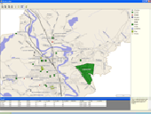
ActualMap is a set of high-performance, .NET Mapping components and controls for embedding maps in desktop (Windows Forms) applications. ActualMap gives you the ability to generate maps, drill-down capability, thematic Mapping, routing, vehicle tracking and other features that will make the maps fully interactive. Features : Multiple map layers. Dynamic map layers. Pan and...
Category: Software Development / Components & Libraries
Publisher: VDS Technologies, License: Shareware, Price: USD $799.00, File Size: 8.0 MB
Platform: Windows
With this release, ArcGIS transforms the way you use GIS.
With this release, ArcGIS transforms the way you use Gis.Be more productive with your work and take advantage of Gis everywhere: via individual local desktops, across desktops and browsers leveraging central servers, and in the cloud.ArcGIS Desktop contains two applications: ArcMap and ArcCatalog. ArcMap provides data display, query, and analysis. ArcCatalog provides data management.
Category: Business & Finance / Business Finance
Publisher: Environmental Systems Research Institute, Inc., License: Demo, Price: USD $0.00, File Size: 2.0 GB
Platform: Windows
Analyse your QTL experiments with interval Mapping, with the powerful MQM Mapping (=composite interval Mapping), or with a nonparametric method. MapQTL is easy to use, is very fast and presents the analysis results in tables and (adjustable) charts, that can be exported to MS-Windows text processing and presentation software.
Category: Business & Finance / Business Finance
Publisher: Kyazma B.V., Wageningen, Netherlands, License: Shareware, Price: USD $4534.00, File Size: 6.5 MB
Platform: Windows
ArcGIS Workflow Manager (formerly Job Tracking for ArcGIS [JTX]) is an extension to ArcGIS Desktop and ArcGIS Server that lets organizations develop and enforce standard, repeatable Gis workflows across the enterprise.
Workflow Manager greatly improves the efficiency of Gis operations by organizing and automating the relationships between the activities in a Gis...
Category: Home & Education / Miscellaneous
Publisher: ESRI, License: Shareware, Price: USD $2500.00, File Size: 1.1 MB
Platform: Windows
AEGIS– the leading GIS software in UK secondary schools.
AEGIS– the leading Gis software in UK secondary schools.
One-off software purchase and free upgrades – no subscriptions.
Brings industry-standard Gis maps to the classroom – Goad town plans, large-scale OS MasterMaps.
Try before you buy with the free AEGIS Viewer download.
Free materials: resources, help sheets,...
Category: Home & Education / Miscellaneous
Publisher: AU Enterprises Limited, License: Shareware, Price: USD $0.00, File Size: 0
Platform: Windows
My World Gis™ is a Geographic Information System (Gis) designed specifically for use in middle school through college classrooms. It has been developed by the GEODE Initiative at Northwestern University as part of a research program on the adaptation of scientific visualization and data analysis tools to support inquiry-based learning.
My World gives learners...
Category: Home & Education / Miscellaneous
Publisher: Northwestern University, License: Shareware, Price: USD $59.00, File Size: 100.2 MB
Platform: Windows
ArcGIS Explorer is a free, downloadable Gis viewer that gives you an easy way to explore, visualize and share Gis information. ArcGIS Explorer adds value to any Gis because it helps you deliver your authoritative data to a broad audience.
The ArcGIS Explorer Desktop Current User setup is intended for users who do not have administrator access on their computers and...
Category: Desktop Enhancements / Shell & Desktop Managers
Publisher: Environmental Systems Research Institute, Inc., License: Freeware, Price: USD $0.00, File Size: 94.0 MB
Platform: Windows
Christine-GIS is a useful, easy-to-use tool that brings geographic information to your desktop.
Christine-Gis is a useful, easy-to-use tool that brings geographic information to your desktop. Christine gives you the power to visualize, explore, query and analyze data spatially. A key feature of Christine is that it's easy to load tabular data, such as dBASE files and data from database servers.
Category: Home & Education / Miscellaneous
Publisher: christine-gis.com, License: Shareware, Price: USD $0.00, File Size: 0
Platform: Windows
With Geodesy.NET, you can quickly and easily convert geographic coordinates from one system to another. Several hundred coordinate system conversions are supported, and all conversions can be done in under three lines of code. Full support is included for both desktops as well as mobile devices! This software is included FREE with any purchase of our Gis.NET 3.0 Mapping component...
Category: Software Development / Components & Libraries
Publisher: GeoFrameworks, LLC, License: Commercial, Price: USD $799.00, File Size: 123.7 MB
Platform: Windows,
Quantum Gis provides a continously growing number of capabilities provided by core functions and plugins. You can visualize, manage, edit, analyse data, and compose printable maps. QGIS is an official project of the Open Source Geospatial Foundation (OSGeo). It runs on Linux, Unix, Mac OSX, and Windows and supports numerous vector, raster, and database formats and functionalities.
Category: Home & Education / Miscellaneous
Publisher: qgis.org, License: Freeware, Price: USD $0.00, File Size: 92.2 MB
Platform: Windows
Cool Flash Map Maker is a powerful Flash Map software for developing interactive Flash Mapping solutions and products for Real Estate, Spacial Statistics, Business Locator Applications, Vector USA map,World map, Germany map,ASIA map, Canada map, Europe map, Australia map, Austria map, Africa map, UK map, South America map, Central America map, Denmark map, Greece...
Category: Multimedia & Design / Multimedia App's
Publisher: Go2Share, License: Shareware, Price: USD $29.95, File Size: 17.9 MB
Platform: Windows
ArcGIS Explorer Desktop is a free Gis viewer that gives you an easy way to explore, visualize, and share Gis information. ArcGIS Explorer adds value to any Gis because it helps you deliver your authoritative data to a broad audience.
Easy and intuitive to use it's easy for anyone to begin working with ArcGIS Explorer, with its intuitive and easy to use...
Category: Home & Education / Miscellaneous
Publisher: Environmental Systems Research Institute, Inc., License: Freeware, Price: USD $0.00, File Size: 100.5 MB
Platform: Windows
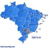
Dongsoft Interactive Brazil Flash Maps for websites, interactive map applications, presentations, and more.
The innovation of this fully-clickable map will revolutionize your website navigation and provide visitors with a simple and seamless method of accessing information. Using the map as a central navigation tool, information can be accessed with greater speed, enhanced...
Category: Software Development / Help File Utilities
Publisher: maps flash, License: Freeware, Price: USD $0.00, File Size: 156.0 KB
Platform: Windows
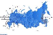
Dongsoft Interactive Russia Flash Maps for websites, interactive map applications, presentations, and more.
The innovation of this fully-clickable map will revolutionize your website navigation and provide visitors with a simple and seamless method of accessing information. Using the map as a central navigation tool, information can be accessed with greater speed, enhanced...
Category: Software Development / Help File Utilities
Publisher: clickable map, License: Freeware, Price: USD $0.00, File Size: 156.0 KB
Platform: Windows
Eye4Software GPS Mapping is a professional GPS Mapping software tool that can be used in numerous applications. Use the software to load, view and edit your maps, display your position realtime and record all your movements.
The software will work with almost any GPS and can be used on any desktop, laptop or needbook computer running Windows XP or higher. The...
Category: Home & Education / Miscellaneous
Publisher: Eye4Software B.V., License: Shareware, Price: USD $130.61, File Size: 14.6 MB
Platform: Windows
Shareware
Total Gis Converter is an affordable converter of Gis files. It converts AEP, GRD, ADF, E00, FLT, APR, SHP, DXF, BT, TOC, RT1, DEM, DLG, ECW, IMG, DGF, GML, SID, MIF, TAB, WOR, DNG, DDF, BIL, TIF, JPEG, TTKPS, TTKGP, TTKLS, LFT, PFT, and TFT files. The target formats are TIFF, PNG, JPEG, BMP. The program can scale your Gis files to optimize their size. Besides, it can slice...
Category: Multimedia & Design / Graphics Viewers
Publisher: Softplicity, License: Shareware, Price: USD $99.90, File Size: 7.6 MB
Platform: Windows