Free Downloads: Free Atlas Maps


 Shareware
Google Maps Terrain Downloader is a tool that can automatically download the google terrain Maps images to your PC. It can download the small tiles and save them to your hard disk. After downloading, you can view the Maps offline by its tool Maps Viewer, or you can combine the small images into one big map image. If you want to make a map of your city by yourself, it...
Category: Internet / Download Managers
Publisher: allmapsoft.com, License: Shareware, Price: USD $29.99, File Size: 305.3 MB
Platform: Windows


 Shareware
Google Hybrid Maps Downloader is a tool that can automatically download the google hybrid Maps images to your PC. It can download the small tiles and save them to your hard disk. After downloading, you can view the Maps offline by its tool Maps Viewer, or you can combine the small images into one big map image. If you want to make a map of your city by yourself, it...
Category: Internet / Download Managers
Publisher: allmapsoft.com, License: Shareware, Price: USD $29.99, File Size: 30.6 MB
Platform: Windows
EZ-Locate is an Internet-based geocoding service that provides real-time access to the Tele Atlas address database and geocoding technology. It is designed to let users enjoy the benefits of high volume batch geocoding without the hassles or high price.
EZ-Locate geocoding client software allows you to access our high-performance batch geocoding engine from your desktop....
Category: Internet / Misc. Plugins
Publisher: Tele Atlas, License: Freeware, Price: USD $0.00, File Size: 31.5 MB
Platform: Windows
Nokia Maps 3D browser plugin is a Free mapping product and service by Nokia for its mobile phones and for internet browsers. Nokia Maps includes voice guided navigation for both pedestrians and drivers for 74 countries in 46 different languages and there are Maps for over 180 countries.
See the world in high-resolution 3D. Everything from the sky to the street....
Category: Internet / Browser Accessories
Publisher: Nokia, License: Freeware, Price: USD $0.00, File Size: 9.8 MB
Platform: Windows
think! Bubble Maps is a Windows tool for creating bubble Maps and capturing your thought. Using simple mouse click, drags and typing, your thoughts get put to paper (virtual), quickly and effectively.
The key feature of think! Bubble Maps is speed which makes it an excellent tool for live capture. You can use this program during meetings, workshops, and seminars.
Category: Multimedia & Design / Multimedia App's
Publisher: Lowrie Associates Ltd, License: Shareware, Price: USD $41.90, File Size: 5.9 MB
Platform: Windows
This software development kit (SDK) provides the binaries and programming reference for the Bing Maps Silverlight Control. You can use this control to build your own web sites that use Bing Maps.
The Bing Maps Silverlight Control combines the power of Silverlight and Bing Maps to provide an enhanced mapping experience. Developers can use the Bing...
Category: Utilities / Misc. Utilities
Publisher: Microsoft, License: Freeware, Price: USD $0.00, File Size: 3.8 MB
Platform: Windows
W4MapLauncher is a free software application that contains more than 85 standard maps of W4.
W4MapLauncher is a Free software application that contains more than 85 standard Maps of W4.This software application allows you to play on the new Maps in multiplayer or on-line.This launcher has also an aspect mode of 4:3 and 16:10, it is easy to install and to use
Category: Games / Misc. Games
Publisher: AlexBond, License: Freeware, Price: USD $0.00, File Size: 23.8 MB
Platform: Windows
MapCreator combines a cartography and a graphics programme.
MapCreator combines a cartography and a graphics programme. The software is designed to create Maps and animated Maps of the highest quality as often required for presentations. For example, this could be Maps needed for a travel presentation. But also in
Category: Multimedia & Design
Publisher: primap.com, License: Freeware, Price: USD $0.00, File Size: 103.3 MB
Platform: Windows, Vista
SensAct -SENSORS CONVERSION Maps AND ACTUATORS COMMAND Maps
This software pack contents the sensors conversion Maps and the actuators command Maps like motorized throttles, gasoline injectors corrections, ...
It is mandatory to install it to select the type of sensor and actuators that are equiping the ECUs, because these Maps are no longer...
Category: Business & Finance / Applications
Publisher: Skynam, License: Freeware, Price: USD $0.00, File Size: 3.4 MB
Platform: Windows


 Shareware
FPS Maps for WPF is a brand new component with a set of built-in country Maps. There are 15 Inbuilt Countries. FPS Maps for WPF contains samples of how to work with it and customize. Maps navigation can be performed via Navigation bar which supports Themes and mouse. You can pan with mouse or zoom in/out with mouse scroll. More options will be added in future...
Category: Software Development / Components & Libraries
Publisher: FPS Components, License: Shareware, Price: USD $199.00, File Size: 1.1 MB
Platform: Windows
With yalips maps you get 4 products in 1.
With yalips Maps you get 4 products in 1. You are more productive, more creative and perform better on your job when using visual software tools. With the resulting visualizations you can communicate more effectively and convincingly to your collegues, your boss, your customer or the chairman of the board. Therefore many companies spent a lot of money on such tools. Unfortunately, most...
Category: Business & Finance / Project Management
Publisher: yalips Software, License: Shareware, Price: USD $80.00, File Size: 29.6 MB
Platform: Windows
Free Satellite Maps is a free tool from Google which offers a satellite mapping service worldwide.
Free Satellite Maps is a Free tool from Google which offers a satellite mapping service worldwide.These are accompanied by a street service, a route planner and information about business in almost all countries.In this way we can fly the world from satellite view or in birds eye.The level of detail is different depending on where you are located.Major cities have a very...
Category: Home & Education / Science
Publisher: www.satelliteview-of-my-house.com, License: Freeware, Price: USD $0.00, File Size: 612.0 KB
Platform: Windows


 Freeware
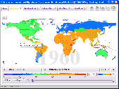
Free standalone software DataPult Desktop creates heat Maps from your data quickly and efficiently. Key features: Direct data import from MS Excel with one click. The ability to create animated Maps of data over several years. Interactive Maps and diagrams. 39 map colorings for making heat Maps. Intelligent identification of...
Category: Business & Finance / MS Office Addons
Publisher: DataPult, License: Freeware, Price: USD $0.00, File Size: 21.0 MB
Platform: Windows
Fitzpatrick's Color Atlas and Synopsis of Clinical Dermatology combines over 900 color images with succinct descriptions of skin diseases and systemic diseases with skin manifestations. It is invaluable resource to a non-dermatologist learning or practicing medicine in any field in any country too. This latest update is based on the 6th edition and 2009 print edition with additional...
Category: Home & Education / Miscellaneous
Publisher: Skyscape, Inc, License: Shareware, Price: USD $19.95, File Size: 62.9 MB
Platform: Windows
AstroSrc contains natal chart interpretations, daily transit interpretations, single and dual chartwheels, two types of keyword features, 7 different house systems. AstroLine graphic planetary display, a meanings form that allows you to select and read various natal interpretations for any planet in a house, sign, or aspect, plus any rising sign, a natal chart report writer, a daily transit...
Category: Home & Education / Astrology & Numerology
Publisher: Edwall&Percec, License: Shareware, Price: USD $0.00, File Size: 2.8 MB
Platform: Windows
TopoGun is a stand-alone resurfacing, and maps baking application.
TopoGun is a stand-alone resurfacing, and Maps baking application. The resurfacing functions in TopoGun will help you modify and/or recreate the edgeflow of your digital 3D models.
The Maps baking functions, will help you bake various types of texture Maps from your high resolution 3D models and then allow you to apply them to your newly created optimized...
Category: Multimedia & Design / Animation
Publisher: SC PIXELMACHINE SRL, License: Shareware, Price: USD $100.00, File Size: 55.5 MB
Platform: Windows
Avoid getting lost with Nokia Maps, whether you're driving or walking.
Avoid getting lost with Nokia Maps, whether you're driving or walking.It's Free and here's what you get:
-full navigation and Maps for over 70 countries
-Drive and Walk navigation in over 90 countries
- real-time voice guidance for Drive and Walk
- Maps for over 180 countries with Free updates
- real-time weather...
Category: Internet / Download Managers
Publisher: Nokia, License: Freeware, Price: USD $0.00, File Size: 2.7 MB
Platform: Windows
The Atlas of Agrobiological Resources of Russia and Neighbouring Countries (hereunder the
Agroatlas) contains descriptive and cartographic information about agroecological conditions, main
cultivated crops and their wild congeners, diseases, pests and weeds of the territory of the former
USSR. The readers of the Agroatlas belong to the following target groups: research...
Category: Business & Finance / MS Office Addons
Publisher: Vadim Shumilin / Yurij Li, License: Freeware, Price: USD $0.00, File Size: 492.8 MB
Platform: Windows
You can create a backup of your maps with JaVaWa GMTK and restore these (e.
You can create a backup of your Maps with JaVaWa GMTK and restore these (e.g. on another computer) including unlock codes. Re-installing Maps is unnecessary.
Migration of your Garmin Maps from and old computer to a new one is straightforward with this application.
Category: Utilities / Backup
Publisher: JaVaWa GPS-tools, License: Shareware, Price: USD $0.00, File Size: 5.4 MB
Platform: Windows
Control Assistant software provides powerful troubleshooting and maintenance tools for
Woodward's MicroNet family, Atlas family, and NetCon product lines. Control Assistant
provides the tools to perform advanced system diagnostics, adjustment management, and
other functions.
Category: Utilities / System Utilities
Publisher: Woodward Industrial Controls, License: Demo, Price: USD $0.00, File Size: 2.7 MB
Platform: Windows
You have the choice of spherical, cylindrical, Lambert and Mercator projections.
You have the choice of spherical, cylindrical, Lambert and Mercator projections.
All coordinates are precessed to the nearest Julian day at which the sky is being viewed. If proper motions are available then these are used to correct star positions. Planet positions are accurate to 30 arcseconds over the next 180 years.
Main Features:
- Creates simple Maps...
Category: Home & Education / Astrology & Numerology
Publisher: Marc R. Baril, License: Freeware, Price: USD $0.00, File Size: 18.5 MB
Platform: Windows
Live Satellite Maps or Google maps is a web server mapping applications.
Live Satellite Maps or Google Maps is a web server mapping applications.Provides scrolling map images and satellite photos around the earth and even the route between different places.Since 6 October 2005, live satellite Maps is part of local Google.Google live satellite Map provides the ability to zoom in or zoom out to show the map.The user can control the map with your...
Category: Home & Education / Science
Publisher: www.satelliteview-of-my-house.com, License: Freeware, Price: USD $0.00, File Size: 643.0 KB
Platform: Windows
Java package that provides foundation for atlas web apps.
Java package that provides foundation for Atlas web apps. Classes provide the following functionality: Display and process HTML forms to view and edit objects. Display and process HTML forms to search and list objects. Manage request context. Time display and conversion. Manage selection lists. Generate dynamic SQL. Read/write flat files. Access database connections and query management....
Category: Web Authoring / JavaScript
Publisher: Eden Systems LLC, License: Shareware, Price: USD $49.99, File Size: 177.0 KB
Platform: Windows, Linux, Unix, Java
It can run as a full-featured internal intelligent digipeater with the TNC in KISS mode, and with modification to the UI-View2.INI file, supports the new WIDEn-N settings, and has full support for connecting to APRS servers on the Internet and running as an IGate or Internet Gateway.
UI-View uses bitmap images for its Maps. Also, the 32 bit version has full support for...
Category: Utilities / Misc. Utilities
Publisher: Roger Barker, License: Freeware, Price: USD $0.00, File Size: 2.5 MB
Platform: Windows
Britannica's Deluxe Edition 2006 CD-ROM brings the entire Encyclopædia Britannica and other first-rate reference works right to your computer screen. Complete with a dictionary and thesaurus, rich multimedia, a complete Atlas, timelines, online magazines, and more, it’s ideal for students, lifetime learners, curious adults, or anyone who wants easy access to the best...
Category: Home & Education / Miscellaneous
Publisher: EncyclopA¶dia Britannica, License: Shareware, Price: USD $0.00, File Size: 0
Platform: Windows


