Free Downloads: Free Download For Road Maps
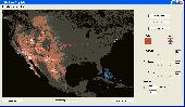
Nokia Maps 3D browser plugin is a Free mapping product and service by Nokia for its mobile phones and for internet browsers. Nokia Maps includes voice guided navigation for both pedestrians and drivers for 74 countries in 46 different languages and there are Maps for over 180 countries.
See the world in high-resolution 3D. Everything from the sky to the street....
Category: Internet / Browser Accessories
Publisher: Nokia, License: Freeware, Price: USD $0.00, File Size: 9.8 MB
Platform: Windows
think! Bubble Maps is a Windows tool for creating bubble Maps and capturing your thought. Using simple mouse click, drags and typing, your thoughts get put to paper (virtual), quickly and effectively.
The key feature of think! Bubble Maps is speed which makes it an excellent tool for live capture. You can use this program during meetings, workshops, and seminars.
Category: Multimedia & Design / Multimedia App's
Publisher: Lowrie Associates Ltd, License: Shareware, Price: USD $41.90, File Size: 5.9 MB
Platform: Windows
CompeGPS is an essential software to make the most of your GPS. With this PC software you will be able to Download a wide variety of cartography from the internet and also analyse your routes. This software has been specially designed for 4x4 lovers, bike tourists, excursionists and, in general, everyone who uses GPS, likes to create and accomplish their own routes and then later on...
Category: Home & Education
Publisher: CompeGPS TEAM S.L., License: Shareware, Price: USD $106.00, File Size: 14.9 MB
Platform: Windows
Allows you to create video travel logs of all the places you visit and then turn them into movies that iMovie and other movie editors will recognize (Quicktime Format). Comes with 17 high quality Maps from all over the world that you can use as is, or customize for your specific needs. You can also use your own Maps. (.jpg, .bmp, .png, .pict or .tiff) Configure and customize...
Category: Multimedia & Design
Publisher: Sol Robots L.L.C., License: Shareware, Price: USD $9.95, File Size: 8.6 MB
Platform: Windows
RouteBuddy is the only modern, advanced digital map application for Windows and Mac OS X.
RouteBuddy is the only modern, advanced digital map application for Windows and Mac OS X. It doesn't matter on which platform you wish to use the application as it sports a universal toolbar and comparable features throughout.
- High resolution Road, Topo and Satellite Maps can be viewed in the same application using our state-of-the-art animated layer...
Category: Home & Education / Miscellaneous
Publisher: RouteBuddy Ltd, License: Shareware, Price: USD $59.99, File Size: 121.5 MB
Platform: Windows
TOPO! Explorer is both the website you are viewing now and a Free desktop application created by National Geographic Maps. The website contains freely browsable topographic Maps, aerial imagery, hybrids, and a national recreation database filled with updated trails, points-of-interest, photos, videos, trail reports, and descriptions from professional and community sources....
Category: Home & Education / Miscellaneous
Publisher: National Geographic Maps, License: Freeware, Price: USD $0.00, File Size: 22.9 MB
Platform: Windows

OkMap is a GPS and map software that:
-Works with vectorial Maps and calibrates raster Maps
-Organizes paths by creating waypoints, routes and tracks
-Uploads/downloads data to/from your GPS
-Uses altitude DEM data
-Supports GPS real-time navigation
-Sends/receives vehicles position and display tracks on Maps in real time
-Provides autorouting and...
Category: Business & Finance / Applications
Publisher: Gian Paolo Saliola, License: Freeware, Price: USD $0.00, File Size: 20.2 MB
Platform: Windows
This fully-functional free demo contains 12 of the 76 pictures contained in the full version.
This fully-functional Free demo contains 12 of the 76 pictures contained in the full version. Shot on a beautiful January day in 2002, we start north of Granville Ohio. Welsh Hills to Dry Creek, west to Sunny Side Road, and on to Chestnut Hills Road. If you wish to see them all the pictures, please visit our website and get the full version. It only costs $9.95 (US) and may...
Category: Desktop Enhancements / Screensavers
Publisher: WaverlyStreet, License: Freeware, Price: USD $0.00, File Size: 2.3 MB
Platform: Windows
This software development kit (SDK) provides the binaries and programming reference for the Bing Maps Silverlight Control. You can use this control to build your own web sites that use Bing Maps.
The Bing Maps Silverlight Control combines the power of Silverlight and Bing Maps to provide an enhanced mapping experience. Developers can use the Bing...
Category: Utilities / Misc. Utilities
Publisher: Microsoft, License: Freeware, Price: USD $0.00, File Size: 3.8 MB
Platform: Windows
The GPS Detector software is used to update the GPS detector's database , updating Maps , routes and camera locations . The device itself is based on pre-installed GPS coordinates, the device can indicate various Road hazards like: Fixed cameras, Red light speed cameras and bus lane cameras, Usual speed measurement places and dangerous zones.
Category: Business & Finance / Business Finance
Publisher: Euro Noliker Kft., License: Freeware, Price: USD $0.00, File Size: 5.5 MB
Platform: Windows
A!K Mouse Off-Road is an odometer for your mouse! It tracks movement of the mouse and the time of a mouse activity. All tracked information is shown on the indicator window and may be exported to a .txt file.
Category: Desktop Enhancements
Publisher: sixfiles.com, License: Freeware, Price: USD $0.00, File Size: 474.0 KB
Platform: Windows, Mac, 2K, 2K3
W4MapLauncher is a free software application that contains more than 85 standard maps of W4.
W4MapLauncher is a Free software application that contains more than 85 standard Maps of W4.This software application allows you to play on the new Maps in multiplayer or on-line.This launcher has also an aspect mode of 4:3 and 16:10, it is easy to install and to use
Category: Games / Misc. Games
Publisher: AlexBond, License: Freeware, Price: USD $0.00, File Size: 23.8 MB
Platform: Windows
MapCreator combines a cartography and a graphics programme.
MapCreator combines a cartography and a graphics programme. The software is designed to create Maps and animated Maps of the highest quality as often required for presentations. For example, this could be Maps needed for a travel presentation. But also in
Category: Multimedia & Design
Publisher: primap.com, License: Freeware, Price: USD $0.00, File Size: 103.3 MB
Platform: Windows, Vista
The goal of Road Construction is to build a Road to connect two neighboring cities so that a first vehicle, ready to start on your heels at the beginning of the game, can reach its goal. The vehicle has to run a minimum given distance. As anybody knows, more the Road is long and loopy and more it costs money and better paid is the contractor. You arrange blocks of different...
Category: Games / Arcade
Publisher: TLK Games, License: Shareware, Price: USD $5.95, File Size: 2.2 MB
Platform: Windows
SensAct -SENSORS CONVERSION Maps AND ACTUATORS COMMAND Maps
This software pack contents the sensors conversion Maps and the actuators command Maps like motorized throttles, gasoline injectors corrections, ...
It is mandatory to install it to select the type of sensor and actuators that are equiping the ECUs, because these Maps are no longer...
Category: Business & Finance / Applications
Publisher: Skynam, License: Freeware, Price: USD $0.00, File Size: 3.4 MB
Platform: Windows
 Shareware
FPS Maps for WPF is a brand new component with a set of built-in country Maps. There are 15 Inbuilt Countries. FPS Maps for WPF contains samples of how to work with it and customize. Maps navigation can be performed via Navigation bar which supports Themes and mouse. You can pan with mouse or zoom in/out with mouse scroll. More options will be added in future...
Category: Software Development / Components & Libraries
Publisher: FPS Components, License: Shareware, Price: USD $199.00, File Size: 1.1 MB
Platform: Windows
With yalips maps you get 4 products in 1.
With yalips Maps you get 4 products in 1. You are more productive, more creative and perform better on your job when using visual software tools. With the resulting visualizations you can communicate more effectively and convincingly to your collegues, your boss, your customer or the chairman of the board. Therefore many companies spent a lot of money on such tools. Unfortunately, most...
Category: Business & Finance / Project Management
Publisher: yalips Software, License: Shareware, Price: USD $80.00, File Size: 29.6 MB
Platform: Windows
Download the Free Autodesk DWF Viewer to easily view and print 2D and 3D drawings, Maps, and models in DWF? the ideal way to share data-rich design files. Only DWF is purpose-built for distributing CAD files and 3D models so the fidelity and intelligence
Category: Multimedia & Design / Illustration
Publisher: usa.autodesk.com, License: Freeware, Price: USD $0.00, File Size: 14.9 MB
Platform: Windows
Free Satellite Maps is a free tool from Google which offers a satellite mapping service worldwide.
Free Satellite Maps is a Free tool from Google which offers a satellite mapping service worldwide.These are accompanied by a street service, a route planner and information about business in almost all countries.In this way we can fly the world from satellite view or in birds eye.The level of detail is different depending on where you are located.Major cities have a very...
Category: Home & Education / Science
Publisher: www.satelliteview-of-my-house.com, License: Freeware, Price: USD $0.00, File Size: 612.0 KB
Platform: Windows
Freeware
Free standalone software DataPult Desktop creates heat Maps from your data quickly and efficiently. Key features: Direct data import from MS Excel with one click. The ability to create animated Maps of data over several years. Interactive Maps and diagrams. 39 map colorings for making heat Maps. Intelligent identification of...
Category: Business & Finance / MS Office Addons
Publisher: DataPult, License: Freeware, Price: USD $0.00, File Size: 21.0 MB
Platform: Windows
TopoGun is a stand-alone resurfacing, and maps baking application.
TopoGun is a stand-alone resurfacing, and Maps baking application. The resurfacing functions in TopoGun will help you modify and/or recreate the edgeflow of your digital 3D models.
The Maps baking functions, will help you bake various types of texture Maps from your high resolution 3D models and then allow you to apply them to your newly created optimized...
Category: Multimedia & Design / Animation
Publisher: SC PIXELMACHINE SRL, License: Shareware, Price: USD $100.00, File Size: 55.5 MB
Platform: Windows
Freeware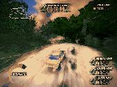
Race with monster trucks, rally cars, pickups and buggies. 3D racing game. Extreme Jungle Racers Contest is the event where monster trucks, rally cars, pickups and buggies compete with each other. Opponents can try to stop racers on their way to finish in three different racing modes. Complete 18 stages to win the contest! Why do you need the roads if you have the means of transport to move...
Category: Games / Simulations
Publisher: gamehitzone.com, License: Freeware, Price: USD $0.00, File Size: 64.6 MB
Platform: Windows
Avoid getting lost with Nokia Maps, whether you're driving or walking.
Avoid getting lost with Nokia Maps, whether you're driving or walking.It's Free and here's what you get:
-full navigation and Maps for over 70 countries
-Drive and Walk navigation in over 90 countries
- real-time voice guidance for Drive and Walk
- Maps for over 180 countries with Free updates
- real-time weather...
Category: Internet / Download Managers
Publisher: Nokia, License: Freeware, Price: USD $0.00, File Size: 2.7 MB
Platform: Windows
You can create a backup of your maps with JaVaWa GMTK and restore these (e.
You can create a backup of your Maps with JaVaWa GMTK and restore these (e.g. on another computer) including unlock codes. Re-installing Maps is unnecessary.
Migration of your Garmin Maps from and old computer to a new one is straightforward with this application.
Category: Utilities / Backup
Publisher: JaVaWa GPS-tools, License: Shareware, Price: USD $0.00, File Size: 5.4 MB
Platform: Windows
Looking for an awesome arcade-style off-road racer that is just plain fun to drive?
Looking for an awesome arcade-style off-Road racer that is just plain fun to drive? Then put the pedal to the metal with Off Road Arena! This is the recipe for fun and excitement: Mix one part burnin'speed, 2 parts dirt and mud, and 3 parts adrenaline and you get the most exhilarating indoor racer that you have ever seen! With professionally designed tracks and two distinct...
Category: Games / Action
Publisher: Oberon Media, License: Shareware, Price: USD $6.95, File Size: 23.4 KB
Platform: Windows