Free Downloads: Free Maps Plans
 Shareware
FPS Maps for WPF is a brand new component with a set of built-in country Maps. There are 15 Inbuilt Countries. FPS Maps for WPF contains samples of how to work with it and customize. Maps navigation can be performed via Navigation bar which supports Themes and mouse. You can pan with mouse or zoom in/out with mouse scroll. More options will be added in future...
Category: Software Development / Components & Libraries
Publisher: FPS Components, License: Shareware, Price: USD $199.00, File Size: 1.1 MB
Platform: Windows
With yalips maps you get 4 products in 1.
With yalips Maps you get 4 products in 1. You are more productive, more creative and perform better on your job when using visual software tools. With the resulting visualizations you can communicate more effectively and convincingly to your collegues, your boss, your customer or the chairman of the board. Therefore many companies spent a lot of money on such tools. Unfortunately, most...
Category: Business & Finance / Project Management
Publisher: yalips Software, License: Shareware, Price: USD $80.00, File Size: 29.6 MB
Platform: Windows
Free Satellite Maps is a free tool from Google which offers a satellite mapping service worldwide.
Free Satellite Maps is a Free tool from Google which offers a satellite mapping service worldwide.These are accompanied by a street service, a route planner and information about business in almost all countries.In this way we can fly the world from satellite view or in birds eye.The level of detail is different depending on where you are located.Major cities have a very...
Category: Home & Education / Science
Publisher: www.satelliteview-of-my-house.com, License: Freeware, Price: USD $0.00, File Size: 612.0 KB
Platform: Windows
A FREE program available for download by anyone.
A Free program available for download by anyone. The ArchiTECH.PC Viewer may be used by customer and contractor alike to display a full project in either 2D or 3D. Though the viewer does not allow Plans to be modified, it does enable comments to be appended (with the architect’s permission). Plans may also be saved in DXF/DWG format.
Category: Multimedia & Design / Graphics Viewers
Publisher: SoftCAD, License: Freeware, Price: USD $0.00, File Size: 20.0 MB
Platform: Windows
Freeware
Free standalone software DataPult Desktop creates heat Maps from your data quickly and efficiently. Key features: Direct data import from MS Excel with one click. The ability to create animated Maps of data over several years. Interactive Maps and diagrams. 39 map colorings for making heat Maps. Intelligent identification of...
Category: Business & Finance / MS Office Addons
Publisher: DataPult, License: Freeware, Price: USD $0.00, File Size: 21.0 MB
Platform: Windows
Plan Builder helps you develop comprehensive financial plans, quickly and easily.
Plan Builder helps you develop comprehensive financial Plans, quickly and easily. With this program you can create unlimited "what-if" scenarios including Monte Carlo simulations and then illustrate your Plans in real time with colorful charts and graphs. Plan Builder's compelling, easy-to-understand presentation helps your clients to see the wisdom of your...
Category: Business & Finance / Business Finance
Publisher: EnterAct Software, License: Commercial, Price: USD $995.00, File Size: 0
Platform: Windows
An all-inclusive diagramming software for OS X that is capable for 260+ drawing types including flowcharts, mind Maps, org charts, infographics, floor Plans, AWS network diagrams, Gantt charts, electrical schematics... and that is just the beginning! More than 260 kinds of diagrams help you analyze data easily and present information nicely. Make complex statistics understandable...
Category: Multimedia & Design / Digital Media Editors
Publisher: EdrawSoft, License: Shareware, Price: USD $99.00, File Size: 229.1 MB
Platform: Linux, Unix
TopoGun is a stand-alone resurfacing, and maps baking application.
TopoGun is a stand-alone resurfacing, and Maps baking application. The resurfacing functions in TopoGun will help you modify and/or recreate the edgeflow of your digital 3D models.
The Maps baking functions, will help you bake various types of texture Maps from your high resolution 3D models and then allow you to apply them to your newly created optimized...
Category: Multimedia & Design / Animation
Publisher: SC PIXELMACHINE SRL, License: Shareware, Price: USD $100.00, File Size: 55.5 MB
Platform: Windows
Avoid getting lost with Nokia Maps, whether you're driving or walking.
Avoid getting lost with Nokia Maps, whether you're driving or walking.It's Free and here's what you get:
-full navigation and Maps for over 70 countries
-Drive and Walk navigation in over 90 countries
- real-time voice guidance for Drive and Walk
- Maps for over 180 countries with Free updates
- real-time weather...
Category: Internet / Download Managers
Publisher: Nokia, License: Freeware, Price: USD $0.00, File Size: 2.7 MB
Platform: Windows
You can create a backup of your maps with JaVaWa GMTK and restore these (e.
You can create a backup of your Maps with JaVaWa GMTK and restore these (e.g. on another computer) including unlock codes. Re-installing Maps is unnecessary.
Migration of your Garmin Maps from and old computer to a new one is straightforward with this application.
Category: Utilities / Backup
Publisher: JaVaWa GPS-tools, License: Shareware, Price: USD $0.00, File Size: 5.4 MB
Platform: Windows
Live Satellite Maps or Google maps is a web server mapping applications.
Live Satellite Maps or Google Maps is a web server mapping applications.Provides scrolling map images and satellite photos around the earth and even the route between different places.Since 6 October 2005, live satellite Maps is part of local Google.Google live satellite Map provides the ability to zoom in or zoom out to show the map.The user can control the map with your...
Category: Home & Education / Science
Publisher: www.satelliteview-of-my-house.com, License: Freeware, Price: USD $0.00, File Size: 643.0 KB
Platform: Windows
Plans For Bed - An interior design Java application for quickly choosing and placing furniture on a house 2D plan drawn by the end-user, with a 3D preview. You can know put your Plans for your bed to good use with this application. For those that have Plans for bed frames and want to know if the bed will fit in a particular room, this application will certainly help you...
Category: Audio / Utilities & Plug-Ins
Publisher: Plans for Bed, License: Freeware, Price: USD $0.00, File Size: 30.6 MB
Platform: Windows
HistorAtlas: free historical atlas.
HistorAtlas: Free historical atlas. World history
HistorAtlas is a Free software that you can download and install on your computer. It has 168 historical Maps with their description and a timeline that helps you on navigation. You find also an illustrated chronology and animated Maps.
Category: Home & Education / Miscellaneous
Publisher: romano.mazzini, License: Freeware, Price: USD $0.00, File Size: 4.9 MB
Platform: Windows
ARCHline.XP 2010 Free Edition its a Professional CAD software for architects and interior designers. Choose a tool that makes your vision come true. ARCHLine.XP® is a Building Information Modeller, which supports the creation of planning- and implementation documentation, tender Plans, interior design Plans, calculation of energy performance of buildings, and quantity...
Category: Multimedia & Design / Image Editing
Publisher: Cadline Ltd. (Eng), License: Freeware, Price: USD $0.00, File Size: 413.4 MB
Platform: Windows
CareScribble is a tool to create Nursing Care Plans without any handwriting task.
CareScribble is a tool to create Nursing Care Plans without any handwriting task.
Features:
- Creation and Maintenance of Care Plans with help of :
Nursing Diagnosis; Nursing Interventions; Nursing Tasks (related to Intervention); Risk factors (related to Nursing Diagnosis); Related factors (related to Nursing Diagnosis); Outcomes (related to Nursing...
Category: Business & Finance / Business Finance
Publisher: Stofukerfi ehf, License: Shareware, Price: USD $0.00, File Size: 0
Platform: Windows
PlanEasy2D software can be used to draw floor Plans, building exit Plans and other Plans easily and quickly. The software includes a collection of furniture and textures. The drawing units and scale can be configured for each floor and supports zoom,pan operations.
Main features:
-Create realistic architectural Plans and specify dimensions in...
Category: Multimedia & Design / Image Editing
Publisher: PlanAndVisualize, License: Shareware, Price: USD $19.00, File Size: 13.4 MB
Platform: Windows
You will either mess up your work place with huge Maps and travel guides or just switch on to Schmap Player to guide you for your travel.
This amazing travel guide with elaborated Maps and destinations can be downloaded and used for Free. The main interface of this application comprises the guide menu with: European guides, US guides, Canadian guides, Australian...
Category: Internet / Web Search Utilities
Publisher: Schmap, Inc., License: Freeware, Price: USD $0.00, File Size: 2.0 MB
Platform: Windows
From the Sacre Coeur to the Arc de Triomphe, your holiday to Paris starts from the moment you open your guide, plus you get Paris Maps and transport Maps.
Discover the best cafe terraces, unmissable museums and galleries, loveliest parks and gardens, best areas to shop or browse, unforgettable shows and live music venues, most fun places for children, and best restaurants to...
Category: Internet / Communications
Publisher: Mobile Systems, License: Shareware, Price: USD $9.80, File Size: 0
Platform: Windows
Shareware
Offline Map Maker is a tool that help you to get offline tile images from Google Maps, Openstreetmap, Yandex Maps, Yahoo Maps, Mapquest, Gaode map, Tencent Maps, Baidu Maps, Tianditu, Arcgis Online, OneMap, Whereis, mapy.cz, Mappy, Waze, Sentinel-2 map, Strava Gloabal Heatmap, Wikimapia, GoMap.Az, Longdo Map, Bhuvan, National Map Australia, New Zealand...
Category: Internet / Download Managers
Publisher: allmapsoft.com, License: Shareware, Price: USD $79.00, File Size: 31.1 MB
Platform: Windows
With this program you can create time plans for teams.
With this program you can create time Plans for teams. TimePlanner can help if several people share locations, objects, and other resources, have to do some tasks and must have finished until a given time (like in the morning), arranging these tasks. It collects the persons, resources, tasks, and possible profiles with their dependencies and creates a selection of printable personal...
Category: Utilities / Misc. Utilities
Publisher: Thomas Jacob, License: Freeware, Price: USD $0.00, File Size: 505.8 KB
Platform: Windows
TOPO! Explorer is both the website you are viewing now and a Free desktop application created by National Geographic Maps. The website contains freely browsable topographic Maps, aerial imagery, hybrids, and a national recreation database filled with updated trails, points-of-interest, photos, videos, trail reports, and descriptions from professional and community sources....
Category: Home & Education / Miscellaneous
Publisher: National Geographic Maps, License: Freeware, Price: USD $0.00, File Size: 22.9 MB
Platform: Windows
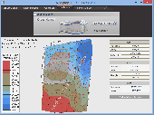
When you are looking for a powerful tool to satisfy various needs regarding vectors, raster and satellite imagery, you will find ILWIS Academic an efficient application. The program comes with such useful features as points to create Maps, lines for segment Maps, closed area segments for polygon Maps, spatial operations for raster Maps and so on. Whilst using images...
Category: Home & Education / Miscellaneous
Publisher: ITC, License: Freeware, Price: USD $0.00, File Size: 19.4 MB
Platform: Unknown
GDS Images and Document Maps is a unique document search utility.
GDS Images and Document Maps is a unique document search utility. GDS Images and Document Maps is a rather unique application that will enable you to store all your documents and images alongside other important files and folders right on your desktop so that you can use it straight from there, without the need to bother around with looking with looking for every single file...
Category: Utilities / Misc. Utilities
Publisher: toggle, License: Freeware, Price: USD $0.00, File Size: 558.8 KB
Platform: Windows
Terra Excess is land surveying and civil engineering CAD software developed to be extremely intuitive. Even by those without previous experience, Terra Excess will allow you to handle the following tasks in just a few minutes - GENERATING AND LABELING CONTOUR LINES IN ORDER TO PRODUCE TOPOGRAPHIC Plans AND Maps: Terra Excess can generate contour lines from topographic...
Category: Multimedia & Design / Graphics Viewers
Publisher: Terra Excess Software, License: Shareware, Price: USD $298.00, File Size: 46.0 MB
Platform: Windows
CompeGPS is an essential software to make the most of your GPS. With this PC software you will be able to download a wide variety of cartography from the internet and also analyse your routes. This software has been specially designed for Free flight and motor flight pilots they use GPS and likes to create and accomplish their own routes and then later on analyse. CompeGPS allows...
Category: Home & Education
Publisher: CompeGPS TEAM S.L., License: Shareware, Price: USD $106.00, File Size: 14.9 MB
Platform: Windows