Free Downloads: Garmin Adria Route
GeePeeEx Editor is specifically designed to produce and edit GPX files destined for Garmin's® Automotive Satnav (GPSr) systems. These files can be used as input to Garmin's® POI Loader to produce enhanced Custom POI's (Points of Interest).
Convert CSV files to GPX. Optionally and uniquely, GeePeeEx Editor will search for valid telephone numbers...
Category: Audio / Rippers & Encoders
Publisher: Them, License: Freeware, Price: USD $0.00, File Size: 2.6 MB
Platform: Windows
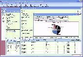
You will be able to enjoy many of CompeGPS Lands features such as waypoint and Route creation and edition, full communication between PDA and GPS, use of maps and the moving map (real-time navigation). CompeGPS Pocket Land allows full communication between GPS and PDA (tracks, waypoints and routes). You will be able to create waypoints and routes, use maps and real-time...
Category: Home & Education
Publisher: CompeGPS TEAM S.L., License: Shareware, Price: USD $76.00, File Size: 3.9 MB
Platform:
Track tropical storms and calculate closest point of approach from a certain Route.NavTools Stormtrack uses the same database as NavTools Route version 5 and will use voyages and routes constructed in NavTools Route, however it can be used as a stand-alone application.Version 5.09 is intended as a final beta test, please report any bugs or comments to support@navtools.nl or...
Category: Home & Education / Miscellaneous
Publisher: Andromeda Productions, License: Shareware, Price: USD $25.00, File Size: 2.1 MB
Platform: Unknown
Route Manager is a complete application that allows vending operators to easily manage and track every aspect of a vending operation. Track new and potential leads that become customers. Quickly place equipment in accounts and track the products, commissions and expenses for all your accounts. Route manager not only manages the standard Route information but has a built in...
Category: Business & Finance / Applications
Publisher: Nexphaze, License: Commercial, Price: USD $39.95, File Size: 1.1 MB
Platform: Windows
Now you can plan and organize trips with MapSource, a very useful computer software.
Now you can plan and organize trips with MapSource, a very useful computer software.
MapSource is included with the purchase of a Garmin map on DVD or CD. With MapSource, you can:
- Back up important trip data separately from your Garmin device.
- Plan routes from the convenience of your computer instead of on your device.
- Create, view, and edit...
Category: Business & Finance / Database Management
Publisher: Garmin Ltd or its subsidiaries, License: Shareware, Price: USD $0.00, File Size: 54.4 MB
Platform: Windows
This tool allows to preview route files.
This tool allows to preview Route files. The camera can be moved, rotated and zoomed, you can jump to stations and points of interest, and also enable a series of options. If routes contain errors, a report can be optionally displayed.
A file that is passed as a command line argument is automatically opened at startup. If a CSV file is determined to be a CSV object instead...
Category: Multimedia & Design / Multimedia App's
Publisher: trainsimframework, License: Freeware, Price: USD $0.00, File Size: 171.3 KB
Platform: Windows
AutoPlan IFR generates a Route, validates it using the Eurocontrol IFPS vaidator (CFMUV), interprets any error messages Eurocontrol generates, and excludes the Route segments in these error messages from the next attempt.
Features:
- Automatic airways Route generation
- European Navigation Data
- Shortest Path Routing
- Custom DCT...
Category: Business & Finance / Business Finance
Publisher: Christof Edel, License: Freeware, Price: USD $0.00, File Size: 6.1 MB
Platform: Windows
KMLCSV Converter is a tool that enables you to convert the KML file generated from Google Earth (free version) into a formatted CSV file (and vice versa). This CSV file can then be uploaded into your Garmin GPS by using Garmin POI Loader, which can be downloaded for free. This allows you to plot all the custom point of interests (POI) with Google Earth first. Then, you can...
Category: Business & Finance / Calculators
Publisher: Choon-Chern Lim, License: Freeware, Price: USD $0.00, File Size: 2.3 MB
Platform: Windows
Moagu: The Mother Of All GPS Utilities.
Moagu: The Mother Of All GPS Utilities.
You can convert USGS topographic maps, aerial/satellite imagery, and any other raster map imagery for use on Garmin handled GPS units.
Garmin maps have been in a "vector" format; Moagu creates maps using a "bitmap" format.
Category: Home & Education / Miscellaneous
Publisher: Moagu, License: Shareware, Price: USD $19.95, File Size: 38.2 MB
Platform: Windows
OziExplorer is a flamboyant GPS Mapping Software that runs on the PC and works with varieties of GPS receivers such as Garmin, Lowrance, Magellan, Eagle, Brunton, Silva and MLR for the uploading or downloading the waypoints, routes and tracks and most brands of GPS receivers for real time tracking of GPS position.
Using this software, the user can use maps and charts that...
Category: Internet / Communications
Publisher: Des Newman, License: Shareware, Price: USD $95.00, File Size: 6.8 MB
Platform: Windows
Home
Disclaimer
Alternate Route Project
Home
Disclaimer
Alternate Route Project
Support
...
Category: Business & Finance / Business Finance
Publisher: Alternate Route Project, License: Freeware, Price: USD $0.00, File Size: 10.2 MB
Platform: Windows
The GPS map will help you give you with turn by turn directions to your destination using a POI, city point and/or longitude and latitude.It has the ability to preplan driving destinations before getting into your car. Compatible with ALL Garmin GPS units. Don't pay more than US$10 per day when you already own a Garmin, this is the most comprehensive GPS map available at such...
Category: Home & Education / Miscellaneous
Publisher: GPSTravelMaps.com, License: Shareware, Price: USD $0.00, File Size: 0
Platform: Windows
MetroGold is a Windows tool with which you can upgrade your Garmin MetroGuide Europe or Metroguide North America installation. After the upgrade it's possible to include routing calculation data in your upload of maps to your GPS. No extra software, apart from Mapsource, is needed, you can transfer the maps with Mapsource.
Category: Utilities / Misc. Utilities
Publisher: Geodude, License: Shareware, Price: USD $0.00, File Size: 0
Platform: Windows
PoiEditor is a software solution package for downloading and customizing road safety data.
PoiEditor is a software solution package for downloading and customizing road safety data. The software makes it easy to stay up to date with the latest road safety data also know as POI's(Points of interest), it also applies your personal preferences to the downloaded data. The PoiEditor also sends the data to your Garmin device or SSD Card by utilizing the Garmin Poi loader...
Category: Internet / Misc. Plugins
Publisher: Tinus Strauss, License: Shareware, Price: USD $12.59, File Size: 2.7 MB
Platform: Windows
DNRGarmin is a smart tool used to directly transfer data between Garmin GPS handheld receivers and various GIS software packages.
DNRGarmin was built to provide users the ability to directly transfer data between Garmin GPS handheld receivers and various GIS software packages. Using DNRGarmin a user can use point features (graphics or shapefile) and upload them to the...
Category: Utilities / Misc. Utilities
Publisher: GIS Section, Minnesota Department of Natural Resources, License: Freeware, Price: USD $0.00, File Size: 11.3 MB
Platform: Windows
Visual Passage Planner 2 (VPP2) was designed to bring the power of the computer to the passage planning process. Visual Passage Planner (VPP) automates the tedious, time consuming task of off-shore passage planning by using the historic weather data contained in the official Pilot Charts to evaluate passage conditions and estimate passage elapsed times.
Using VPP, many...
Category: Utilities / System Utilities
Publisher: Digital Wave, License: Shareware, Price: USD $119.00, File Size: 26.7 MB
Platform: Windows
While testing RailDriver® on Trainz 2004, they created their own virtual railroad.
While testing RailDriver® on Trainz 2004, they created their own virtual railroad. Now they're sharing it, and hope you have as much fun running it as they did making it. They decided to make the Route available to you as a free download, along with some extra trains and a session that is sure to test your skill as a dispatcher. Covering 99 baseboards, this Route is...
Category: Games / Simulations
Publisher: P. I. Engineering, Inc., License: Freeware, Price: USD $0.00, File Size: 9.8 MB
Platform: Windows
map&guide base is the ideal solution for anyone who requires a high performance Route planner - whether they work in transport and logistics, as sales professionals or as frequent drivers.
Map material for all of Europe is constantly and automatically updated
Fast, seamless navigation around the map thanks to "speed maps" and a high-performance map server.
...
Category: Home & Education / Hobbies
Publisher: MAP&GUIDE GmbH, License: Shareware, Price: USD $0.00, File Size: 25.3 MB
Platform: Windows
SimSRD is a utility for simulation and virtual air traffic control users (e.
SimSRD is a utility for simulation and virtual air traffic control users (e.g. VATSIM) to perform lookups against the UK Standard Route Document when planning flights. SimSRD offers various features:
- Modern user interface.
-Reverse Route lookups: a Route can be searched for by choosing the arrival airfield or waypoint. The list of valid departure...
Category: Multimedia & Design / Multimedia App's
Publisher: James Reynolds, License: Freeware, Price: USD $0.00, File Size: 4.1 MB
Platform: Windows
map&guide base is the ideal solution for anyone who requires a high performance Route planner - whether they work in transport and logistics, as sales professionals or as frequent drivers.
* Map material for all of Europe is constantly and automatically updated
* Fast, seamless navigation around the map thanks to "speed maps" and a high-performance map...
Category: Home & Education / Miscellaneous
Publisher: mapandguide, License: Shareware, Price: USD $0.00, File Size: 0
Platform: Windows
The purpose of this software is provide support for cartographic formats like Garmin® IMG, or Polish cGPSmapper files. Provides a plataform for designing plugins that allow increase the features of the application, such as AVL support and monitoring.
This software allow the user to simplify certain tasks that require cartographic support. In this situation we offer a...
Category: Home & Education / Miscellaneous
Publisher: Movilbit, Inc., License: Shareware, Price: USD $18.00, File Size: 3.7 MB
Platform: Windows
Bluewater Racing lets you view and manipulate Grib files, competition management, Route optimization, and GPS data. A NMEA instrument panel and and support for currents in the performance and optimization calculations is in development, as well as support for the NOAA vector chart format.
Bluewater Racing exclusively uses high-quality, free, publicly available data from NOAA...
Category: Home & Education / Miscellaneous
Publisher: 2FB, Inc., License: Shareware, Price: USD $0.00, File Size: 0
Platform: Windows
Whether you're exploring new coastline or cruising your favorite bay, BlueChart Atlantic contains the most detailed marine cartography around. These electronic nautical maps give you peace of mind when navigating offshore.
The BlueChart Atlantic CD-ROM includes coverage for several offshore regions — select one of these regions to view and download charts with this purchase....
Category: Home & Education / Miscellaneous
Publisher: Garmin Ltd or its subsidiaries, License: Shareware, Price: USD $0.00, File Size: 0
Platform: Windows
System for control and tracing.
System for control and tracing.
With this system you can trace the Route towards a particular IP-address or domain.
The report preparation process is fully automatic. Additional information for each point along the Route is given.
The basic version traces the Route to one address. The professional versions use lists of addresses which can be processed...
Category: Internet / Tools & Utilities
Publisher: G-92 Developers Group, License: Shareware, Price: USD $2.50, File Size: 4.0 KB
Platform: Windows
AdriaROUTE Lite version of map is made without Garmin NT technology so users with older device can use AdriaROUTE map. Some of devices that not support NT technology are: (eTrex Legend, eTrex Vista, eTrex LegendC, eTrex VistaC, GPSMAP 60C, GPSMAP 60CS, CPSMAP 76C, GPSMAP 76CS, iQue3600; iQue M4; iQue M5..).
Category: Utilities / Misc. Utilities
Publisher: Navigo Sistem d.o.o., License: Freeware, Price: USD $0.00, File Size: 149.6 MB
Platform: Windows