Free Downloads: Garmin Application Software
KMLCSV Converter is a tool that enables you to convert the KML file generated from Google Earth (free version) into a formatted CSV file (and vice versa). This CSV file can then be uploaded into your Garmin GPS by using Garmin POI Loader, which can be downloaded for free. This allows you to plot all the custom point of interests (POI) with Google Earth first. Then, you can...
Category: Business & Finance / Calculators
Publisher: Choon-Chern Lim, License: Freeware, Price: USD $0.00, File Size: 2.3 MB
Platform: Windows
Moagu: The Mother Of All GPS Utilities.
Moagu: The Mother Of All GPS Utilities.
You can convert USGS topographic maps, aerial/satellite imagery, and any other raster map imagery for use on Garmin handled GPS units.
Garmin maps have been in a "vector" format; Moagu creates maps using a "bitmap" format.
Category: Home & Education / Miscellaneous
Publisher: Moagu, License: Shareware, Price: USD $19.95, File Size: 38.2 MB
Platform: Windows
The GPS map will help you give you with turn by turn directions to your destination using a POI, city point and/or longitude and latitude.It has the ability to preplan driving destinations before getting into your car. Compatible with ALL Garmin GPS units. Don't pay more than US$10 per day when you already own a Garmin, this is the most comprehensive GPS map available at such...
Category: Home & Education / Miscellaneous
Publisher: GPSTravelMaps.com, License: Shareware, Price: USD $0.00, File Size: 0
Platform: Windows
Whether you're exploring new coastline or cruising your favorite bay, BlueChart Atlantic contains the most detailed marine cartography around. These electronic nautical maps give you peace of mind when navigating offshore.
The BlueChart Atlantic CD-ROM includes coverage for several offshore regions — select one of these regions to view and download charts with this purchase....
Category: Home & Education / Miscellaneous
Publisher: Garmin Ltd or its subsidiaries, License: Shareware, Price: USD $0.00, File Size: 0
Platform: Windows
AdriaROUTE Lite version of map is made without Garmin NT technology so users with older device can use AdriaROUTE map. Some of devices that not support NT technology are: (eTrex Legend, eTrex Vista, eTrex LegendC, eTrex VistaC, GPSMAP 60C, GPSMAP 60CS, CPSMAP 76C, GPSMAP 76CS, iQue3600; iQue M4; iQue M5..).
Category: Utilities / Misc. Utilities
Publisher: Navigo Sistem d.o.o., License: Freeware, Price: USD $0.00, File Size: 149.6 MB
Platform: Windows
MapToaster Topo New Zealand is New Zealand's only topographical mapping suite, with options for your computer and Garmin GPS, including:
- all the rich detail of the LINZ topo maps - seamless across NZ. Now includes Topo50 and Topo250 map series.
- 1:50,000 though 1:2 million scale maps on your PC and 1:50,000 on your GPS
- integrated aerial and satellite...
Category: Home & Education / Miscellaneous
Publisher: Integrated Mapping Ltd, License: Shareware, Price: USD $0.00, File Size: 38.5 MB
Platform: Windows
The Windows PC shareware program for Garmin and Magellan GPS receivers.
The Windows PC shareware program for Garmin and Magellan GPS receivers.
Main Features:
- transfer your waypoints, routes, and tracks from and to the GPS receiver, and save it on your computer disk
- review your waypoints
- enter and edit your waypoints
- define your routes and get the estimated traveling time
- review and edit your...
Category: Home & Education / Miscellaneous
Publisher: Heinrich Pfeifer, License: Freeware, Price: USD $0.00, File Size: 2.9 MB
Platform: Windows
GPSCAD Transfer is an application for transferring points between a gps device and autocad.
GPSCAD Transfer is an Application for transferring points between a gps device and autocad. The present version works with a Magellan GPS device, but the next release will also work with a Garmin gps device. It allows you to convert latitude and longitude to utm zone nad 83 in either the US or in metric measurement system.
Category: Multimedia & Design / Image Editing
Publisher: Timberwolf Software Solutions, LLC, License: Shareware, Price: USD $0.00, File Size: 2.6 MB
Platform: Windows
The G600 Trainer is partitioned into three downloads, including a Base Installation, and Add-ons for Garmin SVT™ Synthetic Vision Technology and FlightCharts®. The Base installation should be installed first. The Base installation is required to be installed first.
Category: Games / Simulations
Publisher: Garmin Ltd or its subsidiaries, License: Shareware, Price: USD $159.00, File Size: 654.4 MB
Platform: Windows
Northwest Trails is a mapset of trails designed for upload to any map-enabled Garmin GPS receiver.
Northwest Trails is a mapset of trails designed for upload to any map-enabled Garmin GPS receiver. It is more than just a mapset, though; it is also a community effort initiated to record and collect GPS data for trails in the Northwest (Washington, Idaho, Oregon, Montana, Wyoming, Alaska, British Columbia and Alberta) and provide that data for general public use.
The mapset...
Category: Internet / Misc. Plugins
Publisher: Jon F. Stanley, License: Freeware, Price: USD $0.00, File Size: 31.7 MB
Platform: Windows
The GPS TrackManager is an Application for planning routes and managing routes, waypoints and trackpoints.
The Application support functions such as: open and save trackpoints files in various formats (GPX, Ozi Trackpoint file, Ozi Waypoint file, NMEA log, EasyGPS file), transmit Trackpoints, Waypoints and Routes to Garmin GPS receivers (Geko 201, GPSmap 60C), saves...
Category: Internet / Communications
Publisher: Frank Hamaekers, Write4u, License: Freeware, Price: USD $0.00, File Size: 4.8 MB
Platform: Windows
GeoVisu is a program that displays georeferenced data (images, graphics) and downloads data recorded by some GPS devices.
GeoVisu has a "Moving map" navigation function, which can be used with any NMEA 0183 compatible or Garmin USB GPS device.
Main features:
- Displays georeferenced image formats : GeoTiff, ECW and ECWP, MrSID, OziExplorer...
Category: Multimedia & Design / Graphics Viewers
Publisher: GeoVisu, License: Freeware, Price: USD $0.00, File Size: 1.7 MB
Platform: Windows
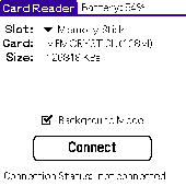
Card Reader allows to use Palm-powered handhelds as an ordinary USB card reader for quick and easy file exchange. It has the unique ability to export the card in the background mode allowing you e.g. to transfer MP3s simultaneously with web browsing. Supported devices : palm T|X; Treo 600; Treo 650; Tungsten|T5; Tungsten|T3; Tungsten|E2; Tungsten|E; GSL Xplore M68; Tungsten|C; Zire 31; Zire...
Category: Utilities
Publisher: Mobile Stream, License: Shareware, Price: USD $11.95, File Size: 29.0 KB
Platform: Palm
You can create a backup of your maps with JaVaWa GMTK and restore these (e.
You can create a backup of your maps with JaVaWa GMTK and restore these (e.g. on another computer) including unlock codes. Re-installing maps is unnecessary.
Migration of your Garmin maps from and old computer to a new one is straightforward with this Application.
Category: Utilities / Backup
Publisher: JaVaWa GPS-tools, License: Shareware, Price: USD $0.00, File Size: 5.4 MB
Platform: Windows
OziExplorer is a flamboyant GPS Mapping Software that runs on the PC and works with varieties of GPS receivers such as Garmin, Lowrance, Magellan, Eagle, Brunton, Silva and MLR for the uploading or downloading the waypoints, routes and tracks and most brands of GPS receivers for real time tracking of GPS position.
Using this Software, the user can use maps and...
Category: Internet / Communications
Publisher: Des Newman, License: Shareware, Price: USD $95.00, File Size: 6.8 MB
Platform: Windows
Trimble Adventure Planner Software is a PC-based trip planning, mapping and trip journaling Application for lovers of hiking, biking, walking, fishing, running, geocaching and other outdoor activities.
Adventure Planner can be used as a standalone product or with the Trimble Outdoors phone Application. Is it NOT intended to be used with the AllSport GPS...
Category: Home & Education / Miscellaneous
Publisher: Trimble Navigation Ltd., License: Freeware, Price: USD $0.00, File Size: 8.6 MB
Platform: Windows
MyGPS is a Freeware Software for the creation and the management of longitude and latitude calibrated maps.
The Software can define points of interest obtaining their coordinates (waypoints), can create routes (routepoints), can visualize track paths (trackpoints).
Using a serial link, points routes and tracks can be shared with "eTrex" and "Geko"...
Category: Home & Education / Miscellaneous
Publisher: GPSInfo, License: Freeware, Price: USD $0.00, File Size: 2.3 MB
Platform: Windows
Rocanda Land Tracker Software will allow you to convert any LSD location in Alberta, British Columbia, Saskatchewan or Manitoba into a corresponding latitude/longitude coordinate. which you can then input into mapping Software such as Garmin's Mapsource products, or OziExplorer.
Category: Business & Finance / MS Office Addons
Publisher: Rocanda, License: Shareware, Price: USD $179.00, File Size: 8.6 MB
Platform: Windows
 Shareware
GPS SDK to add GPS and coordinate conversion functionality to your Software and scripts). All NMEA0183 protocol versions are supported and can be filtered by NMEA sentence type and talker ID. Garmin USB PVT support. Information on GPS status can also be retrieved: GPS fix quality, satellites used in fix, satellites in view, satellite azimuth, elevation and signal strengths....
Category: Software Development
Publisher: Eye4Software B.V., License: Shareware, Price: USD $99.00, EUR79, File Size: 2.3 MB
Platform: Windows
Portable GPS Navigation toolbar for Internet Explorer.
Portable GPS Navigation toolbar for Internet Explorer. Find portable gps units for your car, truck or minvan from top name brands including Tom Tom, Magellan and Garmin. Discover the world of eBay and shop for portable gps navigation systems directly from your browser toolbar.
Category: Internet / Browsers
Publisher: Portable GPS Navigation System, License: Freeware, Price: USD $0.00, File Size: 1.1 MB
Platform: Windows
This mapset contains topographic, hydro, road, trail, POI, and public land data for the state of Montana. Topo lines dissipate quicker as zoom scale increases. Much improved over the Garmin 24K series when zoomed out. Specialized Night Mode colors to maximize viewability while retaining useful landowner colorization scheme.
Category: Home & Education / Miscellaneous
Publisher: Northwest Environmental Services, License: Freeware, Price: USD $0.00, File Size: 421.3 MB
Platform: Windows
Kinoma Producer will help you to prepare your videos, optimizing them depending on the mobile device, to which you are sending them. The interface of the program is simple and the process is straightforward. You just have to choose the files to be converted, select the preset that better suits your needs, and the target mobile device. After that, you'll need to press the “Convert...
Category: Audio / Rippers & Encoders
Publisher: Kinoma Inc., License: Shareware, Price: USD $29.99, File Size: 0
Platform: Windows
Shareware
GPS Mapping Software for Windows, Loading topographic maps, manage GPS devices and more. The Software can be used with various map formats including: GeoTiff, BSB Nautical Charts, AutoCad DXF files, ESRI Shapefiles. Using calibration you can also use scanned or downloaded JPG, BMP, GIF, PNG and TIF maps. The Software can be used for survey, research, track and trace, real...
Category: Home & Education / Science
Publisher: Eye4Software B.V., License: Shareware, Price: USD $75.04, EUR49, File Size: 6.7 MB
Platform: Windows
The Palm Media Studio 2.0 presents a quick solution for conversion of DVD videos to Palm PDA supported formats, and helps the user in enjoying the favorite videos in full screen landscape mode, with good sound clarity. Not only does the Software convert the videos into Palm compatible formats, but also compresses them so that the user may enjoy few episodes of favorite TV-serials,...
Category: Audio / Rippers & Encoders
Publisher: Makayama, License: Shareware, Price: USD $29.95, File Size: 5.1 MB
Platform: Windows
AGIS for Windows is a mapping and simple GIS shareware package.
AGIS for Windows is a mapping and simple GIS shareware package. Plot your own geographic data on the map of the world provided without the high cost and steep learning curve usually associated with this kind of Software. Create high resolution publication quality images that can be pasted into popular packages such as MS Word. Animation, web serving, distance measuring, searching, GPS...
Category: Multimedia & Design / Multimedia App's
Publisher: AGIS Software Pty Ltd, License: Shareware, Price: USD $49.00, File Size: 3.6 MB
Platform: Windows