Free Downloads: Garmin Distance Malaysia Map
Whether you're exploring new coastline or cruising your favorite bay, BlueChart Atlantic contains the most detailed marine cartography around. These electronic nautical maps give you peace of mind when navigating offshore.
The BlueChart Atlantic CD-ROM includes coverage for several offshore regions — select one of these regions to view and download charts with this purchase....
Category: Home & Education / Miscellaneous
Publisher: Garmin Ltd or its subsidiaries, License: Shareware, Price: USD $0.00, File Size: 0
Platform: Windows
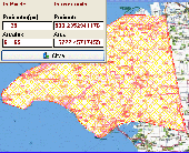
AGIS for Windows is a mapping and simple GIS shareware package.
AGIS for Windows is a mapping and simple GIS shareware package. Plot your own geographic data on the Map of the world provided without the high cost and steep learning curve usually associated with this kind of software. Create high resolution publication quality images that can be pasted into popular packages such as MS Word. Animation, web serving, Distance measuring, searching,...
Category: Multimedia & Design / Multimedia App's
Publisher: AGIS Software Pty Ltd, License: Shareware, Price: USD $49.00, File Size: 3.6 MB
Platform: Windows
Netpas Distance is a piece of software for those in the ship voyage business: ship agents and managers, cargo holders, charterers, and others. The utility will help them find ports on the Map, see the Distance between different ports, track vessels, and manage voyages.
The utility includes more than 11000 ports, and a comprehensive table with distances, which...
Category: Business & Finance / Business Finance
Publisher: Seafuture Inc., License: Shareware, Price: USD $139.00, File Size: 24.6 MB
Platform: Windows
wedoo™ photobook Malaysia (formally known as Canonfoto) is the latest service provided by Canon to create and print your personalized photo print albums. With wedoo™ photobook Malaysia you can now turn your photographs into stylish photo print albums with ease. It’s fast and convenient.
Category: Multimedia & Design / Media Catalogers
Publisher: e-Prinzworks Corporation Sdn. Bhd., License: Freeware, Price: USD $0.00, File Size: 25.5 MB
Platform: Windows
Univerasl Desktop Ruler allows you to measure not only a straight line Distance but any curved Distance on the Screen. It allows you to measure quickly and accurately distances, areas and perimeters of figures on the screen. You can determine your own scale and get results in pixels and your units of measurement (feet, inches, meters, ...). It is useful for measuring...
Category: Utilities / Desktop Enhancements
Publisher: AVPSoft, License: Shareware, Price: USD $19.95, File Size: 921.6 KB
Platform: Unknown
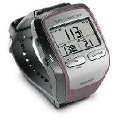
Screensaver with a Garmin Forerunner theme. .
Screensaver with a Garmin Forerunner theme.
Category: Desktop Enhancements / Screensavers
Publisher: Garmin Forerunner 305, License: Freeware, Price: USD $0.00, File Size: 1.5 MB
Platform: Windows
DNRGarmin is a smart tool used to directly transfer data between Garmin GPS handheld receivers and various GIS software packages.
DNRGarmin was built to provide users the ability to directly transfer data between Garmin GPS handheld receivers and various GIS software packages. Using DNRGarmin a user can use point features (graphics or shapefile) and upload them to the...
Category: Utilities / Misc. Utilities
Publisher: GIS Section, Minnesota Department of Natural Resources, License: Freeware, Price: USD $0.00, File Size: 11.3 MB
Platform: Windows
FREE GPS Software for your Garmin, Magellan or Lowrance GPS.
FREE GPS Software for your Garmin, Magellan or Lowrance GPS.
EasyGPS is the fast and easy way to upload and download waypoints, routes, and tracks between your Windows computer and your Garmin, Magellan, or Lowrance GPS. EasyGPS lists all of your waypoints on the left side of the screen, and shows a plot of your GPS data on the right. Use EasyGPS to back up and organize...
Category: Internet / Communications
Publisher: TopoGrafix, License: Freeware, Price: USD $0.00, File Size: 3.9 MB
Platform: Windows
Distance is a Windows-based computer package that allows you to design and analyze Distance sampling surveys of wildlife populations.
Distance evolved from program TRANSECT. However, Distance is quite different from its predecessor as a result of changes in analysis methods and expanded capabilities. The name Distance was chosen because it can be used to...
Category: Home & Education / Miscellaneous
Publisher: Research Unit for Wildlife Population Assessment, University of St Andrews, License: Freeware, Price: USD $0.00, File Size: 20.3 MB
Platform: Windows
 Shareware
GPS SDK to add GPS and coordinate conversion functionality to your software and scripts). All NMEA0183 protocol versions are supported and can be filtered by NMEA sentence type and talker ID. Garmin USB PVT support. Information on GPS status can also be retrieved: GPS fix quality, satellites used in fix, satellites in view, satellite azimuth, elevation and signal strengths. The...
Category: Software Development
Publisher: Eye4Software B.V., License: Shareware, Price: USD $99.00, EUR79, File Size: 2.3 MB
Platform: Windows
MapToaster Topo New Zealand is New Zealand's only topographical mapping suite, with options for your computer and Garmin GPS, including:
- all the rich detail of the LINZ topo maps - seamless across NZ. Now includes Topo50 and Topo250 Map series.
- 1:50,000 though 1:2 million scale maps on your PC and 1:50,000 on your GPS
- integrated aerial and...
Category: Home & Education / Miscellaneous
Publisher: Integrated Mapping Ltd, License: Shareware, Price: USD $0.00, File Size: 38.5 MB
Platform: Windows
Garmin MapConverter was developed to be a tool that will allow you to convert maps and unlock codes on your Windows PC to the Macintosh format. Transferred maps will remain fully accessible on your Windows PC. It works on Windows XP, Windows Vista, Windows 7.
Category: Utilities / Misc. Utilities
Publisher: Garmin Ltd or its subsidiaries, License: Freeware, Price: USD $0.00, File Size: 2.6 MB
Platform: Windows
Cool Flash Map Maker is a powerful Flash Map software for developing interactive flash mapping solutions and products for Real Estate, Spacial Statistics, Business Locator Applications, Vector USA Map,World Map, Germany Map,ASIA Map, Canada Map, Europe Map, Australia Map, Austria Map, Africa Map, UK Map, South...
Category: Multimedia & Design / Multimedia App's
Publisher: Go2Share, License: Shareware, Price: USD $29.95, File Size: 17.9 MB
Platform: Windows
Palm Desktop for Garmin iQue 3600 is one of the first PDAs to offer built-in GPS, as opposed to the jackets often used with other models.
Mapping integrates well - you can add a location to any address book entry, for example - but you can only route to an address from your present location, not from one distant one to another.
Category: Multimedia & Design / Multimedia App's
Publisher: Garmin Ltd or its subsidiaries, License: Freeware, Price: USD $0.00, File Size: 11.7 MB
Platform: Windows
Versamap draws outline maps on 16 map projections.
Versamap draws outline maps on 16 Map projections. The program allows users to print publication quality maps; and to export maps in vector graphic (WMF, CGM, DXF, ASCII) and bitmapped (BMP) formats. Versamap is supplied with digital maps from the Versamap Micro World Database, a world Map with 220,000 points in 10 geographic features. Versamap may be ordered with more detailed...
Category: Home & Education / Genealogy
Publisher: Versamap, License: Shareware, Price: USD $30.00, File Size: 4.0 MB
Platform: Windows
Freeware
org, uses file and position names that suit to the display of the TomTom Rider, uses file, route and position names that suit to the display of the Map&Guide Motorrad Tourenplaner, remembers language, paths, window size and position. . .
Category: Business & Finance / Conversion Applications
Publisher: Christian Pesch, License: Freeware, Price: USD $0.00, File Size: 6.6 MB
Platform: Windows, Mac, Linux, Solaris, FreeBSD, OpenBSD, Java
Map Suite Winforms Edition is a powerful set of user controls enabling you to build compelling mapping applications. Leveraging Microsoft's .NET framework, our APIs incorporate the latest technology to deliver ease of coding and intuitive streamlined interfaces. Developers using any .NET compatible language (VB.NET, C# ect...) can easily build mapping applications with royalty free...
Category: Software Development / Misc. Programming
Publisher: Spatially Aware, License: Demo, Price: USD $3995.00, File Size: 9.6 MB
Platform: Windows
The market leading accounting software in Malaysia,Brunei, Singapore and other ASEAN countries with over 500,000 users Here at Sage UBS, our objective is to offer business solutions that make it easier for our customers to manage their business processes resulting in lower operational costs and reduced risk,leading to a more protable and sustainable business.This is achieved by...
Category: Business & Finance / Business Finance
Publisher: PC Mart Sdn Bhd (374159-W), License: Shareware, Price: USD $456.00, MYR1488, File Size: 140.5 MB
Platform: Windows
GPSBabel is a program that allows users to transfer GPS data files to and from numerous GPS devices.
GPSBabel is a program that allows users to transfer GPS data files to and from numerous GPS devices. It also enables the transfer of waypoints, routes and tracks between GPS receivers and mapping programs. As already mentioned before, this application offers support for several popular GPS devices, such as Tom Tom, Garmin, Magellan, Columbus, etc.
GPSBabel comes with plenty...
Category: Multimedia & Design / Media Management
Publisher: Robert Lipe, License: Freeware, Price: USD $0.00, File Size: 973.5 KB
Platform: Windows
GPSMapEdit is an application designed for visual authoring of GPS-maps in various cartographic formats: Polish format, Garmin MapSource, Lowrance MapCreate, Navitel Navigator (navigation software for Windows Mobile, Android, Symbian, iPhone), ALAN Map 500/600, Holux MapSho, and custom POIs and speedcams.
The program may also load and convert GPS-tracks, waypoints and...
Category: Utilities / Misc. Utilities
Publisher: Konstantin Galichsky, License: Shareware, Price: USD $65.00, File Size: 2.4 MB
Platform: Windows
GeePeeEx Editor is specifically designed to produce and edit GPX files destined for Garmin's® Automotive Satnav (GPSr) systems. These files can be used as input to Garmin's® POI Loader to produce enhanced Custom POI's (Points of Interest).
Convert CSV files to GPX. Optionally and uniquely, GeePeeEx Editor will search for valid telephone numbers...
Category: Audio / Rippers & Encoders
Publisher: Them, License: Freeware, Price: USD $0.00, File Size: 2.6 MB
Platform: Windows
The most popular account or accounting software in Malaysia, famous of its easy-to-use features and great flexibility. Now comes with UBS Assets Register, a handy tool to manage your fixed assets and calculate depreciation.
Very well-merged inventory control, order processing and purchasing system. Formerly known as UBS Stock Control, it is famous of wide range of features,...
Category: Business & Finance / Business Finance
Publisher: UBS Corporation Berhad, License: Shareware, Price: USD $0.00, File Size: 0
Platform: Windows
Filters is a image processing library designed to offer you: filter sobel, convolution, morphology, vectorization, blob, blur, histogram, segmentation, susan, threshold, texture, contrast, standard deviation, canny, contour, Distance Map, matrix, edge, rotation, correlation, gradient anisotropic. It works on Windows operating system.
Category: Software Development / Components & Libraries
Publisher: Eric Burgel, License: Freeware, Price: USD $0.00, File Size: 10.1 MB
Platform: Windows
AZMap is a freeware Windows program which will generate, and display an Azimuthal-Equidistance Map of the world, centered on any point on the surface of the earth (except very near the poles). The A-E Map is also known as a Great Circle Map since straight lines from the center point to any other point always fall along a great circle path and represent the shortest...
Category: Home & Education / Miscellaneous
Publisher: Paul Burton, License: Freeware, Price: USD $0.00, File Size: 1.1 MB
Platform: Windows
Our countrywide database, road network, and thousands of georeferenced points have been specially created for businesses, public institutions, and tourist attractions, among others.By purchasing a Costa Rica Smart Ways Map, you are also acquiring Garmin’s authorization, which meets all the technical requirements for an accurate performance of your device. In order to...
Category: Home & Education / Miscellaneous
Publisher: COSTA RICA SMART WAYS, License: Demo, Price: USD $0.00, File Size: 5.8 MB
Platform: Windows