Free Downloads: Garmin Navi Maps Updates Nikia
GPSMapEdit is an application designed for visual authoring of GPS-Maps in various cartographic formats: Polish format, Garmin MapSource, Lowrance MapCreate, Navitel Navigator (navigation software for Windows Mobile, Android, Symbian, iPhone), ALAN Map 500/600, Holux MapSho, and custom POIs and speedcams.
The program may also load and convert GPS-tracks, waypoints and...
Category: Utilities / Misc. Utilities
Publisher: Konstantin Galichsky, License: Shareware, Price: USD $65.00, File Size: 2.4 MB
Platform: Windows
This is a GUI application that changes your Counter-Strike interface,weapon skins,character skins etc.
This GUI has been developed by Natus Vincere (Navi),an Ukrainian Counter-Strike team.It comes in three versions (640x480,800x600 or 1024x768) of resolution each with it's own installer.
Category: Games / Misc. Games
Publisher: Natus Vincere, License: Freeware, Price: USD $0.00, File Size: 2.6 MB
Platform: Windows
Whether you're exploring new coastline or cruising your favorite bay, BlueChart Atlantic contains the most detailed marine cartography around. These electronic nautical Maps give you peace of mind when navigating offshore.
The BlueChart Atlantic CD-ROM includes coverage for several offshore regions — select one of these regions to view and download charts with this...
Category: Home & Education / Miscellaneous
Publisher: Garmin Ltd or its subsidiaries, License: Shareware, Price: USD $0.00, File Size: 0
Platform: Windows
To get started, download the free Garmin Voice Studio program and install it on your PC¹.
To get started, download the free Garmin Voice Studio program and install it on your PC¹. You will be led through a series of phrases that can be edited and reviewed directly within the application.
To achieve the best quality recordings, an external microphone is recommended. Once finished, you’ll be ready to go with custom voices on your compatible device!...
Category: Audio / Music Management
Publisher: Garmin Ltd or its subsidiaries, License: Shareware, Price: USD $0.00, File Size: 0
Platform: Windows
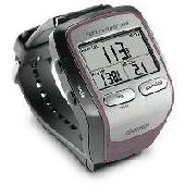
Screensaver with a Garmin Forerunner theme. .
Screensaver with a Garmin Forerunner theme.
Category: Desktop Enhancements / Screensavers
Publisher: Garmin Forerunner 305, License: Freeware, Price: USD $0.00, File Size: 1.5 MB
Platform: Windows
MyGPS is a Freeware software for the creation and the management of longitude and latitude calibrated Maps.
The software can define points of interest obtaining their coordinates (waypoints), can create routes (routepoints), can visualize track paths (trackpoints).
Using a serial link, points routes and tracks can be shared with "eTrex" and "Geko"...
Category: Home & Education / Miscellaneous
Publisher: GPSInfo, License: Freeware, Price: USD $0.00, File Size: 2.3 MB
Platform: Windows
 Shareware
GPS Mapping Software for Windows, Loading topographic Maps, manage GPS devices and more. The software can be used with various map formats including: GeoTiff, BSB Nautical Charts, AutoCad DXF files, ESRI Shapefiles. Using calibration you can also use scanned or downloaded JPG, BMP, GIF, PNG and TIF Maps. The software can be used for survey, research, track and trace, real time...
Category: Home & Education / Science
Publisher: Eye4Software B.V., License: Shareware, Price: USD $75.04, EUR49, File Size: 6.7 MB
Platform: Windows
This is a flash player in which you can view your .
This is a flash player in which you can view your .swf files and .jpg files at one place.
Navi's Flash Viewer - view your flash movies with JPG This is a flash player in which you can view your .swf files and .jpg files at one place.You can download it for free directly from site.
Category: Utilities / Misc. Utilities
Publisher: Navi, License: Freeware, Price: USD $0.00, File Size: 114.2 KB
Platform: Windows
Turtle Sport is a free software developed to communicate with Garmin fitness products (forerunner and edge).
Turtle Sport retrieves yours training sessions from your Garmin and it makes diagram. You can also order your training sessions by category and training mode. With Turtle Sport, it is also possible to map your GPS training paths in Google Earth.
Athlete...
Category: Home & Education / Miscellaneous
Publisher: TurtleSport, License: Freeware, Price: USD $0.00, File Size: 6.9 MB
Platform: Windows
Palm Desktop for Garmin iQue 3600 is one of the first PDAs to offer built-in GPS, as opposed to the jackets often used with other models.
Mapping integrates well - you can add a location to any address book entry, for example - but you can only route to an address from your present location, not from one distant one to another.
Category: Multimedia & Design / Multimedia App's
Publisher: Garmin Ltd or its subsidiaries, License: Freeware, Price: USD $0.00, File Size: 11.7 MB
Platform: Windows

FSS Google Maps Downloader is a tool that can download the Google Maps images to your PC. This is a clearly free program. There is no spyware or adware. It's absolutely safe to install and to run. The interface is very simple and self explaining. It runs low on system resources consumption and is supported on all Windows versions. It can save them to your hard disk,...
Category: Internet / Download Managers
Publisher: FreeSmartSoft, License: Freeware, Price: USD $0.00, File Size: 874.0 KB
Platform: Windows
This software will not work unless you already own a MapSource product.
This software will not work unless you already own a MapSource product.
Main Features:
- Improved memory issues when running on Windows 7.
- Improved map projection for many map products.
- Changed mouse-wheel functionality to zoom in and out.
- Added support for enhanced map security.
- Fixed unlocking issue.
...
Category: Home & Education / Miscellaneous
Publisher: Garmin Ltd or its subsidiaries, License: Freeware, Price: USD $0.00, File Size: 8.4 MB
Platform: Windows
GeePeeEx Editor is specifically designed to produce and edit GPX files destined for Garmin's® Automotive Satnav (GPSr) systems. These files can be used as input to Garmin's® POI Loader to produce enhanced Custom POI's (Points of Interest).
Convert CSV files to GPX. Optionally and uniquely, GeePeeEx Editor will search for valid telephone numbers...
Category: Audio / Rippers & Encoders
Publisher: Them, License: Freeware, Price: USD $0.00, File Size: 2.6 MB
Platform: Windows
Diffuse maps represent the absorption of light.
Diffuse Maps represent the absorption of light. Diffuse Maps are what people call "textures". They are the color textures or photographic textures usually applied to 3d models.
ShaderMap creates displacement Maps using the light data stored inside of diffuse Maps. Evenly lit diffuse Maps generally create better quality Maps with ShaderMap.
Category: Home & Education / Miscellaneous
Publisher: Rendering Systems Inc., License: Freeware, Price: USD $0.00, File Size: 4.0 MB
Platform: Windows
NOVA Maps provides appraisers and appraisal users with complete, high-resolution location Maps (also known as “street Maps”) for forms and addenda in seconds. NOVA Maps even automatically places labels for subject properties and comparables.
For just pennies per map and with just a click of the mouse, users have access to the entire United...
Category: Home & Education / Miscellaneous
Publisher: Day One, License: Demo, Price: USD $0.00, File Size: 5.7 MB
Platform: Windows
Avoid getting lost with Nokia Maps, whether you're driving or walking.
Avoid getting lost with Nokia Maps, whether you're driving or walking.It's free and here's what you get:
-full navigation and Maps for over 70 countries
-Drive and Walk navigation in over 90 countries
- real-time voice guidance for Drive and Walk
- Maps for over 180 countries with free Updates
- real-time weather...
Category: Internet / Download Managers
Publisher: Nokia, License: Freeware, Price: USD $0.00, File Size: 2.7 MB
Platform: Windows
Shareware
Google Maps Terrain Downloader is a tool that can automatically download the google terrain Maps images to your PC. It can download the small tiles and save them to your hard disk. After downloading, you can view the Maps offline by its tool Maps Viewer, or you can combine the small images into one big map image. If you want to make a map of your city by yourself, it...
Category: Internet / Download Managers
Publisher: allmapsoft.com, License: Shareware, Price: USD $29.99, File Size: 305.3 MB
Platform: Windows
Shareware
Google Hybrid Maps Downloader is a tool that can automatically download the google hybrid Maps images to your PC. It can download the small tiles and save them to your hard disk. After downloading, you can view the Maps offline by its tool Maps Viewer, or you can combine the small images into one big map image. If you want to make a map of your city by yourself, it...
Category: Internet / Download Managers
Publisher: allmapsoft.com, License: Shareware, Price: USD $29.99, File Size: 30.6 MB
Platform: Windows
think! Bubble Maps is a Windows tool for creating bubble Maps and capturing your thought. Using simple mouse click, drags and typing, your thoughts get put to paper (virtual), quickly and effectively.
The key feature of think! Bubble Maps is speed which makes it an excellent tool for live capture. You can use this program during meetings, workshops, and seminars.
Category: Multimedia & Design / Multimedia App's
Publisher: Lowrie Associates Ltd, License: Shareware, Price: USD $41.90, File Size: 5.9 MB
Platform: Windows
MapComp is a powerful and free Windows Software for drawing images of linkage Maps and to compare linkage Maps and indicate common markers.
MapInspect can display, print and save images, and has no limit to the number of Maps it can compare (but only neighbouring Maps are compared). Maps can be flipped within MapINspect, an the on-screen order of...
Category: Multimedia & Design / Multimedia App's
Publisher: MapInspect, License: Freeware, Price: USD $0.00, File Size: 616.7 KB
Platform: Windows
GeoVisu is a program that displays georeferenced data (images, graphics) and downloads data recorded by some GPS devices.
GeoVisu has a "Moving map" navigation function, which can be used with any NMEA 0183 compatible or Garmin USB GPS device.
Main features:
- Displays georeferenced image formats : GeoTiff, ECW and ECWP, MrSID, OziExplorer...
Category: Multimedia & Design / Graphics Viewers
Publisher: GeoVisu, License: Freeware, Price: USD $0.00, File Size: 1.7 MB
Platform: Windows
KMLCSV Converter is a tool that enables you to convert the KML file generated from Google Earth (free version) into a formatted CSV file (and vice versa). This CSV file can then be uploaded into your Garmin GPS by using Garmin POI Loader, which can be downloaded for free. This allows you to plot all the custom point of interests (POI) with Google Earth first. Then, you can...
Category: Business & Finance / Calculators
Publisher: Choon-Chern Lim, License: Freeware, Price: USD $0.00, File Size: 2.3 MB
Platform: Windows

Commercial realtors require accurate and reliable tools to publish available properties online and show them on the website (specifying region, county, state, and city). We have created a unique Interactive Real Estate Map with all USA states and counties on it for real estate business. USA Real Estate Map is a unique and amazing vector-based tool that is very simple to use. We applied...
Category: Internet
Publisher: USFlashMap.com, License: Shareware, Price: USD $399.00, File Size: 3.9 MB
Platform: Windows, Mac, Linux, Unix, MS-DOS, AS/400, OS/2
This software development kit (SDK) provides the binaries and programming reference for the Bing Maps Silverlight Control. You can use this control to build your own web sites that use Bing Maps.
The Bing Maps Silverlight Control combines the power of Silverlight and Bing Maps to provide an enhanced mapping experience. Developers can use the Bing...
Category: Utilities / Misc. Utilities
Publisher: Microsoft, License: Freeware, Price: USD $0.00, File Size: 3.8 MB
Platform: Windows

Geocode digital images with latitude, longitude, altitude, and direction information when collecting GIS field data. RoboGEO stamps this information onto the actual photo or writes it to the EXIF headers, allowing you to permanently geotag and link your photos to the GPS coordinates. All writing to the EXIF and IPTC headers is lossless and all of the existing comments (including the MakerNote...
Category: Multimedia & Design
Publisher: Pretek, Inc., License: Demo, Price: USD $34.95, File Size: 6.4 MB
Platform: Windows