Free Downloads: Garmin Topo Maps
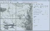
MapToaster Topo New Zealand is New Zealand's only topographical mapping suite, with options for your computer and Garmin GPS, including:
- all the rich detail of the LINZ Topo Maps - seamless across NZ. Now includes Topo50 and Topo250 map series.
- 1:50,000 though 1:2 million scale Maps on your PC and 1:50,000 on your GPS
-...
Category: Home & Education / Miscellaneous
Publisher: Integrated Mapping Ltd, License: Shareware, Price: USD $0.00, File Size: 38.5 MB
Platform: Windows
Topo! Explorer is both the website you are viewing now and a free desktop application created by National Geographic Maps. The website contains freely browsable topographic Maps, aerial imagery, hybrids, and a national recreation database filled with updated trails, points-of-interest, photos, videos, trail reports, and descriptions from professional and community sources....
Category: Home & Education / Miscellaneous
Publisher: National Geographic Maps, License: Freeware, Price: USD $0.00, File Size: 22.9 MB
Platform: Windows
A very powerful plugin that seamlessly integrates GPS waypoints and Garmin courses into SportTracks, features for which you would have to use Garmin Mapsource™ and Garmin TrainingCenter™ or similar 3rd party applications otherwise.
Some of the outstanding features of this plugin are:
-create courses with autorouting
-create waypoints...
Category: Home & Education / Miscellaneous
Publisher: Old Man Biking's SportTracks Plugins, License: Shareware, Price: USD $13.08, File Size: 1.4 MB
Platform: Windows
OZtopo provides an alternative set of maps, suitable for use on Garmin GPS units.
OZtopo provides an alternative set of Maps, suitable for use on Garmin GPS units. It has been designed as a detailed set of topographical Maps suitable for bushwalking, 4WDing and general touring . It is comprised of two mapsets, 10m Contours and Roads and Tracks. Both mapsets can be loaded onto a GPS at the same time. They can also be loaded concurrently with any of...
Category: Business & Finance / Business Finance
Publisher: Oztopo, License: Shareware, Price: USD $0.00, File Size: 75.7 MB
Platform: Windows
The Garmin Communicator Plugin is a free Internet browser plugin that transfers data between your Garmin GPS device and your computer.
For example, with the Garmin Communicator Plugin you can add the Maps you purchase at Garmin.com to your device. Or, you can upload your training data from your Garmin fitness device to Garmin Connect™.
Category: Internet / Communications
Publisher: Garmin Ltd or its subsidiaries, License: Freeware, Price: USD $0.00, File Size: 14.2 MB
Platform: Windows
OkCustomMap is a software to produce Garmin Custom Maps.
OkCustomMap is a software to produce Garmin Custom Maps.
Supports many map formats:
- OkMap
- Ecw
- GeoTiff
- World files
- OziExplorer
- GpsTuner
You can customize:
- The quality of the output JPEG images (0=Bad, 100=Good)
- The KML transparency (0=Transparent, 255=Opaque)
- The KML draw order (0=Invisible, 1-49=Under the vectorial...
Category: Business & Finance / Applications
Publisher: Gian Paolo Saliola, License: Freeware, Price: USD $0.00, File Size: 3.2 MB
Platform: Windows
ExpertGPS is helpful in viewing map points, Topo Maps, arial photos and many more.
ExpertGPS is helpful in viewing map points, Topo Maps, arial photos and many more. This is a revolutionary product called Expert GPS, Expert GPS is highly useful for people interested in Hunting, Scouting, Mountain biking, Fishing, Tracking, state and local agencies in the US as well as geometric studies.
Category: Internet / Communications
Publisher: TopoGrafix, License: Shareware, Price: USD $200.00, File Size: 9.2 MB
Platform: Windows
Garmin MapConverter was developed to be a tool that will allow you to convert Maps and unlock codes on your Windows PC to the Macintosh format. Transferred Maps will remain fully accessible on your Windows PC. It works on Windows XP, Windows Vista, Windows 7.
Category: Utilities / Misc. Utilities
Publisher: Garmin Ltd or its subsidiaries, License: Freeware, Price: USD $0.00, File Size: 2.6 MB
Platform: Windows
Topo North America is the Most Complete Mapping Software for Recreation.
Topo North America is the Most Complete Mapping Software for Recreation.
Topo North America is the most comprehensive computer mapping program for outdoor recreation, with unsurpassed Maps, available imagery, trip planning features, on-road navigation, and GPS capabilities.
Topo North America is by far the best value for the price -...
Category: Home & Education / Miscellaneous
Publisher: DeLorme, License: Shareware, Price: USD $0.00, File Size: 0
Platform: Windows
GeoBuddy is a complete geocaching solution that can display all of the geocaches in your area, as well as your own personal GPS data, over USGS Topo Maps, aerial photos, your own scanned paper trail and road Maps. A built-in Web browser lists all of the information about each geocache, including pictures and hints left by the cache owner, and logs by recent visitors to the...
Category: Internet / Communications
Publisher: TopoGrafix, License: Shareware, Price: USD $49.95, File Size: 10.3 MB
Platform: Windows
This mapset contains topographic, hydro, road, trail, POI, and public land data for the state of Montana. Topo lines dissipate quicker as zoom scale increases. Much improved over the Garmin 24K series when zoomed out. Specialized Night Mode colors to maximize viewability while retaining useful landowner colorization scheme.
Category: Home & Education / Miscellaneous
Publisher: Northwest Environmental Services, License: Freeware, Price: USD $0.00, File Size: 421.3 MB
Platform: Windows
Moagu: The Mother Of All GPS Utilities.
Moagu: The Mother Of All GPS Utilities.
You can convert USGS topographic Maps, aerial/satellite imagery, and any other raster map imagery for use on Garmin handled GPS units.
Garmin Maps have been in a "vector" format; Moagu creates Maps using a "bitmap" format.
Category: Home & Education / Miscellaneous
Publisher: Moagu, License: Shareware, Price: USD $19.95, File Size: 38.2 MB
Platform: Windows
Garmin nRoute is the popular piece of software that allows for auto-routing on a laptop computer with a Garmin GPS unit.
Category: Internet / Misc. Plugins
nRoute is a powerful and feature-rich tool that supports waypoints, tracks, points of interest, addresses and more, but is primarily for navigating and tracking in real time.
nRoute is also compatible with most Garmin units.
Publisher: Garmin Ltd or its subsidiaries, License: Freeware, Price: USD $0.00, File Size: 105.4 MB
Platform: Windows
A volume of data with map names, map numbers, corner coordinates and completing data of all official topographic Maps of the Federal Republic of Germany. TK25: Data base table with data of the Maps on a scale 1:25000. TK50: Table with data of the Maps on a scale 1:50000. TK100: Table with data of the Maps on a scale 1:100000. TK200: Table with data of the...
Category: Business & Finance
Publisher: Killet Software Ing.-GbR, License: Demo, Price: USD $30.00, File Size: 29.3 KB
Platform: Windows, Linux, Unix, MS-DOS, Not Applicable
USAPhotoMaps downloads USGS aerial photo and topo map data from Microsoft?
USAPhotoMaps downloads USGS aerial photo and Topo map data from Microsoft?s free TerraServer Web site, saves it on your hard drive, and creates seamless Maps from it.
Category: Home & Education / Miscellaneous
Publisher: jdmcox.com, License: Freeware, Price: USD $0.00, File Size: 598.4 KB
Platform: Windows, Mac, 2K, 2K3, Vista
MagicMap is a software for extracting color layers from scanned images - topo maps and logos. .
MagicMap is a software for extracting color layers from scanned images - topo maps and logos.
Category: Multimedia & Design / Image Editing
Publisher: Two Pilots, License: Demo, Price: USD $29.95, File Size: 3.4 MB
Platform: Windows
MetroGold is a Windows tool with which you can upgrade your Garmin MetroGuide Europe or Metroguide North America installation. After the upgrade it's possible to include routing calculation data in your upload of Maps to your GPS. No extra software, apart from Mapsource, is needed, you can transfer the Maps with Mapsource.
Category: Utilities / Misc. Utilities
Publisher: Geodude, License: Shareware, Price: USD $0.00, File Size: 0
Platform: Windows
You can create a backup of your maps with JaVaWa GMTK and restore these (e.
You can create a backup of your Maps with JaVaWa GMTK and restore these (e.g. on another computer) including unlock codes. Re-installing Maps is unnecessary.
Migration of your Garmin Maps from and old computer to a new one is straightforward with this application.
Category: Utilities / Backup
Publisher: JaVaWa GPS-tools, License: Shareware, Price: USD $0.00, File Size: 5.4 MB
Platform: Windows
Keep track of discount Garmin GPS deals on with this Firefox toolbar.
Keep track of discount Garmin GPS deals on with this Firefox toolbar.compare and buy all the latest Garmin satellite navigation systems. If you want a discount Garmin GPS system this is the Firefox toolbar to use. We also provide information on the latest offers, price cuts and discount voucher codes to help you buy the latest Garmin GPS at the cheapest price...
Category: Internet / Browsers
Publisher: Discount Garmin GPS, License: Freeware, Price: USD $0.00, File Size: 1.1 MB
Platform: Windows
FREE GPS Software for your Garmin, Magellan or Lowrance GPS.
FREE GPS Software for your Garmin, Magellan or Lowrance GPS.
EasyGPS is the fast and easy way to upload and download waypoints, routes, and tracks between your Windows computer and your Garmin, Magellan, or Lowrance GPS. EasyGPS lists all of your waypoints on the left side of the screen, and shows a plot of your GPS data on the right. Use EasyGPS to back up and organize...
Category: Internet / Communications
Publisher: TopoGrafix, License: Freeware, Price: USD $0.00, File Size: 3.9 MB
Platform: Windows
Upgrading software for your Garmin GPS just got easier thanks to WebUpdater—Garmin's free new application that automatically detects and installs the most recent version of operating software for your compatible Garmin GPS. WebUpdater's simple interface makes it easy to upgrade your operating software. Just connect your Garmin GPS to your computer,...
Category: Utilities / Misc. Utilities
Publisher: Garmin Ltd or its subsidiaries, License: Freeware, Price: USD $0.00, File Size: 7.2 MB
Platform: Windows
The purpose of this software is provide support for cartographic formats like Garmin® IMG, or Polish cGPSmapper files. Provides a plataform for designing plugins that allow increase the features of the application, such as AVL support and monitoring.
This software allow the user to simplify certain tasks that require cartographic support. In this situation we offer a...
Category: Home & Education / Miscellaneous
Publisher: Movilbit, Inc., License: Shareware, Price: USD $18.00, File Size: 3.7 MB
Platform: Windows
GPS Software for Garmin. Download waypoints, routes and tracks from Garmin GPS. Upload waypoints, routes and tracks to Garmin GPS. Excel and Text files supported! This software is very easy to use!
Category: Utilities / System Utilities
Publisher: Oy Frontbase Ltd, License: Shareware, Price: USD $29.95, File Size: 1.4 MB
Platform: Windows
Free Fleet Management Windows-Desktop standalone application work with Garmin and A1.
Free Fleet Management Windows-Desktop standalone application work with Garmin and A1.You can send messages and STOPs (destinations on Garmin MAP) with short message to driver, direct to his Garmin navigation device.Driver can send message to you using touch-screen keyboard. Ideal for taxi / delivery dispatch. Lowest communication cost by GPRS. Tracking vehicles at map at...
Category: Security & Privacy / Other
Publisher: Clarion LLC, License: Freeware, Price: USD $0.00, File Size: 3.4 MB
Platform: Windows
GPSMaster.NET can best be described as a mixture of Google Earth, World Wind, SeeYou, OziExplorer and Garmin Mapsource. GPSMaster.NET is a Windows application (for both x86 and x64) and can communicate (via serial or USB) with any Garmin GPS that implements the Garmin communication protocol. Support for other brands of GPS or logger will be added in future releases.
Category: Internet / Communications
Publisher: Edwin Oude Vrielink, License: Shareware, Price: USD $141.85, File Size: 11.6 MB
Platform: Windows


