Free Downloads: Garmin Xt Europe
Protect your monitor with satellite-eye views of different parts of Europe.
Protect your monitor with satellite-eye views of different parts of Europe. See pictures of Spain, England, France, Germany, Italy and more. This 32-bit screen-saver engine rotates photos of different locations of Europe as seen on clear days from the earth's orbit. Over a dozen visual effects can appear between images. Plus, each of the photos can be displayed as your desktop...
Category: Desktop Enhancements / Screensavers
Publisher: Tazmaniacs, License: Shareware, Price: USD $12.95, File Size: 1.9 MB
Platform: Windows
Know Your Europe is a map based Geography application designed to help people of all ages to develop and test their knowledge of European geography through both English and Irish.
Know Your Europe works great with an interactive whiteboard, in a group, or one-on-one with the computer. The software is suitable for anyone who wishes to extend their knowledge of European...
Category: Home & Education / Miscellaneous
Publisher: EdWare, License: Shareware, Price: USD $170.85, File Size: 48.2 MB
Platform: Windows
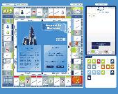
Invest in Europe is a game wich is based on MONOPOLY type boardgames.
Invest in Europe is a game wich is based on MONOPOLY type boardgames.
Players aim is tomake a fortune.
Players may purchase and trade properties, build houses and hotels, participate in auction and take part in the lottery.
on the board you find popular european cities.
Game can be played by up to 5 players.
Category: Games / Misc. Games
Publisher: Jupo Games, License: Shareware, Price: USD $17.90, File Size: 4.8 MB
Platform: Windows
Invest in Europe is a game which is based on MONOPOLY type board games.
Invest in Europe is a game which is based on MONOPOLY type board games. Players aim is to make a fortune. Players may purchase and trade properties, build houses and hotels, participate in auction and take part in the lottery. On the board you find popular European cities.
Game can be played by up to 5 players. Number of computer players is optional. Demo version enables play for only...
Category: Games / Misc. Games
Publisher: Jupo Games, License: Shareware, Price: USD $17.90, File Size: 3.9 MB
Platform: Windows
Adore Puzzle 2 "Flavors of Europe" is a sequel of Adore Puzzle, a game for Mac.
Adore Puzzle 2 "Flavors of Europe" is a sequel of Adore Puzzle, a game for Mac. This time the collection of images is dedicated to gastronomy and created to initiate you into the cuisine varieties of European countries. Bright colors and challenging gamep
Category: Games / Puzzles
Publisher: adoregames.com, License: Freeware, Price: USD $0.00, File Size: 92.0 MB
Platform: Mac, Linux, 10.x
Priceless antiques have been stolen and hidden throughout Europe.
Priceless antiques have been stolen and hidden throughout Europe. The Professor calls upon her star student Adrianna to help her retrieve the stolen antiques. You will help Adrianna evade the evil thief as she travels Europe in search of the antiques. Mr. Gadget is also there to assist you. Solve his puzzles and he will give you cool gadgets like x-ray goggles, a diamond detector...
Category: Games / Puzzles
Publisher: YourGamesWorld.com, License: Shareware, Price: USD $19.99, File Size: 92.4 MB
Platform: Windows
KMLCSV Converter is a tool that enables you to convert the KML file generated from Google Earth (free version) into a formatted CSV file (and vice versa). This CSV file can then be uploaded into your Garmin GPS by using Garmin POI Loader, which can be downloaded for free. This allows you to plot all the custom point of interests (POI) with Google Earth first. Then, you can...
Category: Business & Finance / Calculators
Publisher: Choon-Chern Lim, License: Freeware, Price: USD $0.00, File Size: 2.3 MB
Platform: Windows
Absolute Europe Mega is a spectacular photographic Windows screen saver that captures the mountains, forests, wilderness, villages, and towns of central and northern Europe. These evocative pictures from veteran photographer Eric Fookes are saved as high-resolution images, allowing outstanding viewing at screen settings as high as 1600 by 1200 pixels. Absolute Europe Mega...
Category: Desktop Enhancements / Screensavers
Publisher: Fookes Software, License: Shareware, Price: USD $24.95, File Size: 16.1 KB
Platform: Unknown
Moagu: The Mother Of All GPS Utilities.
Moagu: The Mother Of All GPS Utilities.
You can convert USGS topographic maps, aerial/satellite imagery, and any other raster map imagery for use on Garmin handled GPS units.
Garmin maps have been in a "vector" format; Moagu creates maps using a "bitmap" format.
Category: Home & Education / Miscellaneous
Publisher: Moagu, License: Shareware, Price: USD $19.95, File Size: 38.2 MB
Platform: Windows
The GPS map will help you give you with turn by turn directions to your destination using a POI, city point and/or longitude and latitude.It has the ability to preplan driving destinations before getting into your car. Compatible with ALL Garmin GPS units. Don't pay more than US$10 per day when you already own a Garmin, this is the most comprehensive GPS map available at such...
Category: Home & Education / Miscellaneous
Publisher: GPSTravelMaps.com, License: Shareware, Price: USD $0.00, File Size: 0
Platform: Windows
PoiEditor is a software solution package for downloading and customizing road safety data.
PoiEditor is a software solution package for downloading and customizing road safety data. The software makes it easy to stay up to date with the latest road safety data also know as POI's(Points of interest), it also applies your personal preferences to the downloaded data. The PoiEditor also sends the data to your Garmin device or SSD Card by utilizing the Garmin Poi loader...
Category: Internet / Misc. Plugins
Publisher: Tinus Strauss, License: Shareware, Price: USD $12.59, File Size: 2.7 MB
Platform: Windows
DNRGarmin is a smart tool used to directly transfer data between Garmin GPS handheld receivers and various GIS software packages.
DNRGarmin was built to provide users the ability to directly transfer data between Garmin GPS handheld receivers and various GIS software packages. Using DNRGarmin a user can use point features (graphics or shapefile) and upload them to the...
Category: Utilities / Misc. Utilities
Publisher: GIS Section, Minnesota Department of Natural Resources, License: Freeware, Price: USD $0.00, File Size: 11.3 MB
Platform: Windows
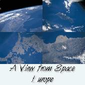
See satellite-eye views of different parts of Europe. See pictures of Spain, England, France, Denmark, Sweden, Ireland, Germany, Italy and more. This 32-bit screen-saver engine rotates photos of different locations of Europe as seen on clear days from the earth's orbit. Over a dozen visual effects can appear between images. Plus, each of the photos can be displayed as your...
Category: Utilities / Screensavers
Publisher: !13-Soft, License: Shareware, Price: USD $14.95, EUR10.25, File Size: 2.2 MB
Platform: Windows
The Rhine Falls of Schaffhausen are a magnificent spectacle of nature and the largest plain waterfalls of Europe. This screensaver displays the beauty of one of Europe's most famous nature sceneries
Category: Desktop Enhancements / Screensavers
Publisher: erotikblog24, License: Freeware, Price: USD $0.00, File Size: 1013.8 KB
Platform: Windows,
Program converts measure units that are commonly used in Europe and the U.
Program converts measure units that are commonly used in Europe and the U.S.A. There are six categories which the application calculates with: Temperature, Length, Area, Weight, Volume and Pressure. It also contains standard MS calculator since it can be
Category: Home & Education / Miscellaneous
Publisher: dutchthewiz.com, License: Freeware, Price: USD $0.00, File Size: 1.5 MB
Platform: Windows, Mac, 2K
Aviasoft European Birds is a program dedicated to bird watching in Europe.
Aviasoft European Birds is a program dedicated to bird watching in Europe. It has over 600 birds with bird songs, text descriptions, illustrations, photographs, distribution maps and detailed seasonal and regional plumage images. The bird record set can be edited, birds can be deleted or added using the lists editor.
A limited version of this program is part of Nature...
Category: Home & Education / Miscellaneous
Publisher: AviaSoft, License: Freeware, Price: USD $0.00, File Size: 121.3 MB
Platform: Windows
The purpose of this software is provide support for cartographic formats like Garmin® IMG, or Polish cGPSmapper files. Provides a plataform for designing plugins that allow increase the features of the application, such as AVL support and monitoring.
This software allow the user to simplify certain tasks that require cartographic support. In this situation we offer a...
Category: Home & Education / Miscellaneous
Publisher: Movilbit, Inc., License: Shareware, Price: USD $18.00, File Size: 3.7 MB
Platform: Windows
Euratlas Periodis Expert is a database and a historical atlas of Europe with editing functions.
Euratlas Periodis Expert is a database and a historical atlas of Europe with editing functions. It describes the political status of Europe, North Africa and Near East at fixed intervals, from year 1 until year 2000.
Stress is put on the precise drawing of territories at one exact instant defined by fixed length intervals, that is the first day of each centennial...
Category: Home & Education / Miscellaneous
Publisher: Euratlas, License: Shareware, Price: USD $77.80, File Size: 33.2 MB
Platform: Windows
Whether you're exploring new coastline or cruising your favorite bay, BlueChart Atlantic contains the most detailed marine cartography around. These electronic nautical maps give you peace of mind when navigating offshore.
The BlueChart Atlantic CD-ROM includes coverage for several offshore regions — select one of these regions to view and download charts with this purchase....
Category: Home & Education / Miscellaneous
Publisher: Garmin Ltd or its subsidiaries, License: Shareware, Price: USD $0.00, File Size: 0
Platform: Windows
AdriaROUTE Lite version of map is made without Garmin NT technology so users with older device can use AdriaROUTE map. Some of devices that not support NT technology are: (eTrex Legend, eTrex Vista, eTrex LegendC, eTrex VistaC, GPSMAP 60C, GPSMAP 60CS, CPSMAP 76C, GPSMAP 76CS, iQue3600; iQue M4; iQue M5..).
Category: Utilities / Misc. Utilities
Publisher: Navigo Sistem d.o.o., License: Freeware, Price: USD $0.00, File Size: 149.6 MB
Platform: Windows
The Windows PC shareware program for Garmin and Magellan GPS receivers.
The Windows PC shareware program for Garmin and Magellan GPS receivers.
Main Features:
- transfer your waypoints, routes, and tracks from and to the GPS receiver, and save it on your computer disk
- review your waypoints
- enter and edit your waypoints
- define your routes and get the estimated traveling time
- review and edit your...
Category: Home & Education / Miscellaneous
Publisher: Heinrich Pfeifer, License: Freeware, Price: USD $0.00, File Size: 2.9 MB
Platform: Windows
Projectplace is Europe’s Leading Online Service for Project Collaboration.
Projectplace is Europe’s Leading Online Service for Project Collaboration. More and more organizations are using web-based IT solutions as online services. The advantages are many:
- no hardware, no installation
- quick and easy to set up
- always available, anywhere, anytime
Category: Audio / Utilities & Plug-Ins
Publisher: Projectplace International AB, License: Shareware, Price: USD $0.00, File Size: 0
Platform: Windows
Absolute Europe is a spectacular photographic Windows screen saver that captures the mountains, forests, wilderness, villages, and towns of central and northern Europe. These evocative pictures from veteran photographer Eric Fookes are saved as high-resolution images, allowing outstanding viewing at screen settings as high as 1600 by 1200 pixels. Absolute Europe screen...
Category: Desktop Enhancements / Screensavers
Publisher: Fookes Software, License: Shareware, Price: USD $14.95, File Size: 8.8 MB
Platform: Unknown
Want to brush up on the names and locations of the 40 or so countries of the new Europe?
Want to brush up on the names and locations of the 40 or so countries of the new Europe? This program from the Family Games Web Center will help you. European Geography Tutor presents a scrolling map of Europe along with a list of countries. As your mouse pointer passes over the map, the country under the pointer highlights, along with its entry in the list. Simply browse the map...
Category: Home & Education / Genealogy
Publisher: AHA! Software Inc., License: Freeware, Price: USD $0.00, File Size: 508.0 KB
Platform: Windows
Europe Flash map Silver (with FLA source) 1.
Europe Flash map Silver (with FLA source) 1.0for web sites, interactive applications, presentations, and more.With this fully-clickable map you will be able to improve navigation and provide visitors with better and quicker access to information as well as improve the way you present the information. The map can be easily customizable. In just a few minutes you can make any required...
Category: Web Authoring / Flash Utilities
Publisher: Fla-shop.com Inc., License: Demo, Price: USD $69.00, File Size: 140.0 KB
Platform: Windows