Free Downloads: Garmin Xt Philippine Map Free Download
DNRGarmin is a smart tool used to directly transfer data between Garmin GPS handheld receivers and various GIS software packages.
DNRGarmin was built to provide users the ability to directly transfer data between Garmin GPS handheld receivers and various GIS software packages. Using DNRGarmin a user can use point features (graphics or shapefile) and upload them to the...
Category: Utilities / Misc. Utilities
Publisher: GIS Section, Minnesota Department of Natural Resources, License: Freeware, Price: USD $0.00, File Size: 11.3 MB
Platform: Windows


 Shareware
GPS SDK to add GPS and coordinate conversion functionality to your software and scripts). All NMEA0183 protocol versions are supported and can be filtered by NMEA sentence type and talker ID. Garmin USB PVT support. Information on GPS status can also be retrieved: GPS fix quality, satellites used in fix, satellites in view, satellite azimuth, elevation and signal strengths. The...
Category: Software Development
Publisher: Eye4Software B.V., License: Shareware, Price: USD $99.00, EUR79, File Size: 2.3 MB
Platform: Windows
MapToaster Topo New Zealand is New Zealand's only topographical mapping suite, with options for your computer and Garmin GPS, including:
- all the rich detail of the LINZ topo maps - seamless across NZ. Now includes Topo50 and Topo250 Map series.
- 1:50,000 though 1:2 million scale maps on your PC and 1:50,000 on your GPS
- integrated aerial and...
Category: Home & Education / Miscellaneous
Publisher: Integrated Mapping Ltd, License: Shareware, Price: USD $0.00, File Size: 38.5 MB
Platform: Windows
KMLCSV Converter is a tool that enables you to convert the KML file generated from Google Earth (Free version) into a formatted CSV file (and vice versa). This CSV file can then be uploaded into your Garmin GPS by using Garmin POI Loader, which can be downloaded for Free. This allows you to plot all the custom point of interests (POI) with Google Earth first. Then,...
Category: Business & Finance / Calculators
Publisher: Choon-Chern Lim, License: Freeware, Price: USD $0.00, File Size: 2.3 MB
Platform: Windows
Garmin MapConverter was developed to be a tool that will allow you to convert maps and unlock codes on your Windows PC to the Macintosh format. Transferred maps will remain fully accessible on your Windows PC. It works on Windows XP, Windows Vista, Windows 7.
Category: Utilities / Misc. Utilities
Publisher: Garmin Ltd or its subsidiaries, License: Freeware, Price: USD $0.00, File Size: 2.6 MB
Platform: Windows
Cool Flash Map Maker is a powerful Flash Map software for developing interactive flash mapping solutions and products for Real Estate, Spacial Statistics, Business Locator Applications, Vector USA Map,World Map, Germany Map,ASIA Map, Canada Map, Europe Map, Australia Map, Austria Map, Africa Map, UK Map, South...
Category: Multimedia & Design / Multimedia App's
Publisher: Go2Share, License: Shareware, Price: USD $29.95, File Size: 17.9 MB
Platform: Windows
Palm Desktop for Garmin iQue 3600 is one of the first PDAs to offer built-in GPS, as opposed to the jackets often used with other models.
Mapping integrates well - you can add a location to any address book entry, for example - but you can only route to an address from your present location, not from one distant one to another.
Category: Multimedia & Design / Multimedia App's
Publisher: Garmin Ltd or its subsidiaries, License: Freeware, Price: USD $0.00, File Size: 11.7 MB
Platform: Windows


 Freeware
org, uses file and position names that suit to the display of the TomTom Rider, uses file, route and position names that suit to the display of the Map&Guide Motorrad Tourenplaner, remembers language, paths, window size and position. . .
Category: Business & Finance / Conversion Applications
Publisher: Christian Pesch, License: Freeware, Price: USD $0.00, File Size: 6.6 MB
Platform: Windows, Mac, Linux, Solaris, FreeBSD, OpenBSD, Java
Map of Africa is one of the many maps created for GPS TrackMaker.
Map of Africa is one of the many maps created for GPS TrackMaker. You are able to Download the installation package from the TrackMaker website. In order to preview the contents of this package, you need to install GPS TrackMaker.
Using the above mentioned application, you will be able to see the Map of Africa. Just click on the "Open Temporary...
Category: Home & Education / Miscellaneous
Publisher: Geo Studio Technology, License: Freeware, Price: USD $0.00, File Size: 18.3 MB
Platform: Windows
GPSMapEdit is an application designed for visual authoring of GPS-maps in various cartographic formats: Polish format, Garmin MapSource, Lowrance MapCreate, Navitel Navigator (navigation software for Windows Mobile, Android, Symbian, iPhone), ALAN Map 500/600, Holux MapSho, and custom POIs and speedcams.
The program may also load and convert GPS-tracks, waypoints and...
Category: Utilities / Misc. Utilities
Publisher: Konstantin Galichsky, License: Shareware, Price: USD $65.00, File Size: 2.4 MB
Platform: Windows
GeePeeEx Editor is specifically designed to produce and edit GPX files destined for Garmin's® Automotive Satnav (GPSr) systems. These files can be used as input to Garmin's® POI Loader to produce enhanced Custom POI's (Points of Interest).
Convert CSV files to GPX. Optionally and uniquely, GeePeeEx Editor will search for valid telephone numbers...
Category: Audio / Rippers & Encoders
Publisher: Them, License: Freeware, Price: USD $0.00, File Size: 2.6 MB
Platform: Windows
Sig Panama Has :
Digital maps of Panama, Digital Map of Panama-City, digital Map of Taboga, digital Map of Bocas del Toro, digital Map of Colon and Free Zone, digital Map of Contadora Island, digital Map of Coronado, Panama, Zona Libre, Map of Panama, Map of Panama City, Map of Colon, Map of Zona Libre,...
Category: Internet / Misc. Plugins
Publisher: DP Imperial, LLC., License: Freeware, Price: USD $0.00, File Size: 44.9 MB
Platform: Windows
Our countrywide database, road network, and thousands of georeferenced points have been specially created for businesses, public institutions, and tourist attractions, among others.By purchasing a Costa Rica Smart Ways Map, you are also acquiring Garmin’s authorization, which meets all the technical requirements for an accurate performance of your device. In order to...
Category: Home & Education / Miscellaneous
Publisher: COSTA RICA SMART WAYS, License: Demo, Price: USD $0.00, File Size: 5.8 MB
Platform: Windows
CaddyConnect is a software that helps you to connect the Caddy devices to your computer and Download the required course Map (subject to a valid Golf Plus membership or Map Credit being available). Once the Map has been successfully downloaded onto the Caddy Lite, it is ready for use when the device is switched on and the course selected when the player arrives at...
Category: Business & Finance / Business Finance
Publisher: GolfPlus UK Limited, License: Freeware, Price: USD $0.00, File Size: 10.2 MB
Platform: Windows
nfsParisMetroMap is a free animated screensaver, featuring a map of metro in Paris, with stations.
nfsParisMetroMap is a Free animated screensaver, featuring a Map of metro in Paris, with stations. Going to Paris? Download nfsParisMetroMap. There is no need in a paper Map. No spy/adware, virus-Free. It is safe to install and run.
Category: Desktop Enhancements / Screensavers
Publisher: newfreescreensavers.com, License: Freeware, Price: USD $0.00, File Size: 1.1 MB
Platform: Windows, Vista, 7 (x86, x64)
QuakeMap is a powerful GPS/mapping program for your Windows computer.
QuakeMap is a powerful GPS/mapping program for your Windows computer. It can be downloaded here for Free. The trial mode allows you to use most features indefinitely. When you need to unlock certain powerful features, a License Key can be ordered here. QuakeMap is designed for ease of use. It eatures intuitive user interface, supports most popular Garmin and Magellan receivers,...
Category: Utilities / Misc. Utilities
Publisher: quakemap.com, License: Freeware, Price: USD $0.00, File Size: 821.2 KB
Platform: Windows
You will be able to enjoy many of CompeGPS Landís features such as waypoint and route creation and edition, full communication between PDA and GPS, use of maps and the moving Map (real-time navigation). CompeGPS Pocket Land allows full communication between GPS and PDA (tracks, waypoints and routes). You will be able to create waypoints and routes, use maps and real-time...
Category: Home & Education
Publisher: CompeGPS TEAM S.L., License: Shareware, Price: USD $76.00, File Size: 3.9 MB
Platform:
MetroGold is a Windows tool with which you can upgrade your Garmin MetroGuide Europe or Metroguide North America installation. After the upgrade it's possible to include routing calculation data in your upload of maps to your GPS. No extra software, apart from Mapsource, is needed, you can transfer the maps with Mapsource.
Category: Utilities / Misc. Utilities
Publisher: Geodude, License: Shareware, Price: USD $0.00, File Size: 0
Platform: Windows
Remere's Map Editor is a map editor for the OpenTibia Project which was created by Remere.
Remere's Map Editor is a Map editor for the OpenTibia Project which was created by Remere.
Remere's Map Editor is a Map editor coded in C to be used with OpenTibia. It supports many advanced features such as autobordering and placing of composite objects. Runs under both Linux and Windows using wxWidgets and OpenGL.
Category: Games / Tools & Editors
Publisher: Remere, License: Shareware, Price: USD $0.00, File Size: 4.2 MB
Platform: Windows


 Shareware
Google Satellite Maps Downloader is a cute tool that can automatically Download Google Maps satellite tile images and then combine them into one big Map image. It supports multithreads, so the Download speed is very fast. And it is very easy to use. All downloaded small images are saved on the disk. You can combine them after downloading or later. Isn't it very cool that...
Category: Internet / Download Managers
Publisher: allmapsoft.com, License: Shareware, Price: USD $39.00, File Size: 30.6 MB
Platform: Windows


 Freeware
An interactive Flash USA Map with all the features you need for your web site or project. This is the ideal solution for dealer maps, real-estate listings, or visualizing state statistics. Nearly every aspect of the Map is customizable. However, unlike competing products, our Map is very simple to install and edit. Just upload XML and SWF files and embed.
Category: Internet / Flash Tools
Publisher: http://www.flashusamap.com/trial/flashus, License: Freeware, Price: USD $0.00, File Size: 93.8 KB
Platform: Unknown
PoiEditor is a software solution package for downloading and customizing road safety data.
PoiEditor is a software solution package for downloading and customizing road safety data. The software makes it easy to stay up to date with the latest road safety data also know as POI's(Points of interest), it also applies your personal preferences to the downloaded data. The PoiEditor also sends the data to your Garmin device or SSD Card by utilizing the Garmin Poi loader...
Category: Internet / Misc. Plugins
Publisher: Tinus Strauss, License: Shareware, Price: USD $12.59, File Size: 2.7 MB
Platform: Windows
Site Map for osCMax - osCMax Module - is very powerful and flexible module for dynamic site Map generation. With help of this module you will achieve two important goals: 1.your customers always will be able to find correct page on your site without any problem. Your visitors will like your site! 2.Search Engine Optimization. If you will use this module in conjunction with SEO...
Category: Software Development
Publisher: MagneticOne, License: Commercial, Price: USD $39.00, File Size: 70.3 KB
Platform: Windows, Linux, Unix, BEOS
Site Map for Zen Cart - Zen Cart Module - is very powerful and flexible module for dynamic site Map generation. With help of this module you will achieve two important goals: 1.your customers always will be able to find correct page on your site without any problem. Your visitors will like your site! 2.Search Engine Optimization. If you will use this module in conjunction with SEO...
Category: Internet
Publisher: MagneticOne, License: Commercial, Price: USD $39.00, File Size: 61.5 KB
Platform: Windows, Linux, Unix, BEOS


 Shareware
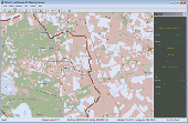
GPS Mapping Software for Windows, Loading topographic maps, manage GPS devices and more. The software can be used with various Map formats including: GeoTiff, BSB Nautical Charts, AutoCad DXF files, ESRI Shapefiles. Using calibration you can also use scanned or downloaded JPG, BMP, GIF, PNG and TIF maps. The software can be used for survey, research, track and trace, real time...
Category: Home & Education / Science
Publisher: Eye4Software B.V., License: Shareware, Price: USD $75.04, EUR49, File Size: 6.7 MB
Platform: Windows

