Free Downloads: Geo Data German Houses
For the area of the Federal Republic of Germany more than 19 million House Coordinates with a coverage of 100% are available. The Geo Data offered here are in high-precision quality and are present in different coordinate and reference systems. House Coordinates are the cartographically representable positions of buildings, which are defined by their postal addresses. They are...
Category: Business & Finance
Publisher: C. Killet Software Ing.-GbR, License: Demo, Price: USD $1250.00, File Size: 111.7 KB
Platform: Unknown

For the area of the Federal Republic of Germany more than 19 million House Coordinates with a coverage of 100% are available. The Geo Data offered here are in high-precision quality and are present in different coordinate and reference systems. House Coordinates are the cartographically representable positions of buildings, which are defined by their postal addresses. They are...
Category: Software Development
Publisher: C. Killet Software Ing.-GbR, License: Demo, Price: USD $1250.00, File Size: 111.7 KB
Platform: Unknown
For many countries house coordinates are present with coverage degrees upto 100 percent. The Geo Data offered here are in high-precision quality and are present in different coordinate and reference systems. House Coordinates or also called Geo Coded Building Addresses are meaning the connection between the postal addresses of buildings and their accurate positions. The...
Category: Business & Finance
Publisher: C. Killet Software Ing.-GbR, License: Demo, Price: USD $1250.00, File Size: 111.7 KB
Platform: Unknown

For the area of the Federal Republic of Germany more than 2,7 million street coordinates with a coverage of 100% are available. The Geo Data offered here are in high-precision quality and are present in different coordinate and reference systems. Street coordinates or also called street section coordinates are meaning the summary of several postal house addresses to an averaged...
Category: Business & Finance
Publisher: C. Killet Software Ing.-GbR, License: Demo, Price: USD $625.00, File Size: 68.4 KB
Platform: Unknown
For many countries house coordinates are present with coverage degrees upto 100 percent.
For many countries house coordinates are present with coverage degrees upto 100 percent. The Geo Data offered here are in high-precision quality and are present in different coordinate and reference systems. House Coordinates or also called Geo Coded Building Addresses are meaning the connection between the postal addresses of buildings or building complexes and their...
Category: Business & Finance / Database Management
Publisher: C. Killet Software Ing.-GbR, License: Demo, Price: USD $1420.00, File Size: 234.0 KB
Platform: Windows
In this game there will be a number of Houses on the screen, paths will appear between the Houses one by one. After all the paths are shown, they will disappear and then you will need to click the Houses one by one in the exact sequence to reconstruct the paths. As the game progresses there will be more and more Houses and the game will be more and more difficult. If...
Category: Games / Misc. Games
Publisher: Novel Games Limited, License: Freeware, Price: USD $0.00, File Size: 254.5 KB
Platform: Windows
For many countries street coordinates are present with coverage degrees upto 100 percent. The Geo Data offered here are in high-precision quality and are present in different coordinate and reference systems. Street coordinates or also called street section coordinates are meaning the summary of several postal house addresses to an averaged position on street or street section...
Category: Business & Finance
Publisher: C. Killet Software Ing.-GbR, License: Demo, Price: USD $625.00, File Size: 66.6 KB
Platform: Unknown
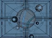
Welcome to the nanoworld of the Pixel Paradox universe of 2099 AD.
Welcome to the nanoworld of the Pixel Paradox universe of 2099 AD. Geo Gizmo is a pollution-free nanodevice that acts as a perpetual-motion machine to generate electricity from artificial gravitons in motion above a quantum energy plate, without any loss of kinetic energy. A constant electrostatic charge flows to the quantum energy plate, which can be linked to vast numbers of identical...
Category: Desktop Enhancements / Screensavers
Publisher: Pixel Paradox, License: Shareware, Price: USD $11.00, File Size: 1.7 MB
Platform: Windows
For many countries street coordinates are present with coverage degrees upto 100 percent. The Geo Data offered here are in high-precision quality and are present in different coordinate and reference systems. Street coordinates or also called street section coordinates are meaning the summary of several postal house addresses to an averaged position on street or street section...
Category: Business & Finance
Publisher: C. Killet Software Ing.-GbR, License: Demo, Price: USD $625.00, File Size: 66.6 KB
Platform: Unknown
When posting a photo on your favorite Social Network, online photo gallery, or web page, you are inviting danger.Most smartphones and some cameras made today are equipped with Geo tags. Geo tags are imbedded in the picture and use the same concept as GPS.
The Geo tag in the photo is a smart tool that allows the photo to be tagged to an exact location. Unless you know...
Category: Security & Privacy / Other
Publisher: Geotag Security Software, Inc, License: Freeware, Price: USD $0.00, File Size: 2.2 MB
Platform: Windows
In this game there are 8 pieces of land, each land has 3 houses.
In this game there are 8 pieces of land, each land has 3 Houses. You and the computer will take turns to buy Houses from those lands, the one who have bought all the Houses on a piece of land is the winner.
You can also download this game and install it in your computer so that you can play it simply by clicking an icon on your desktop.
You can register an...
Category: Games / Misc. Games
Publisher: Novel Games Limited, License: Freeware, Price: USD $0.00, File Size: 255.2 KB
Platform: Windows
The Balloon Browser recognizes and highlights geo-coordinates in web pages.
The Balloon Browser recognizes and highlights Geo-coordinates in web pages. Hovering over a recognized location advises another application to show a map of the corresponding area. For now the only program Balloon Browser can interact with is Google Earth.
Instead of waiting for the one true Geo-notation and markup standard, Balloon Browser tries to parse a variety of...
Category: Internet / Browsers
Publisher: Michael Krause, License: Freeware, Price: USD $0.00, File Size: 5.6 MB
Platform: Windows
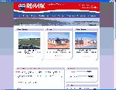
Langebaan Houses For Sale - Easy to use and quickly installed.
Langebaan Houses For Sale - Easy to use and quickly installed. This application will help you find Houses that are for sale in Langebaan allowing you to choose the house that you want to buy from a varied selection. The application is simple and easy to use. Langebaan Houses For Sale.
Category: Home & Education / Miscellaneous
Publisher: Langebaan Houses For Sale, License: Freeware, Price: USD $0.00, File Size: 7.0 KB
Platform: Windows
 Shareware
TOPOWIN is a state-wide register of the German Topographic Cartographies, the German Basic Cartography and of localities with Geo references in different coordinate systems. It is also a topographic information system. In the division of planning and execution of economical and scientific projects frequently topographic documents are used. The program TOPOWIN makes...
Category: Home & Education / Miscellaneous
Publisher: Killet GeoSoftware Ing.-GbR, License: Shareware, Price: USD $125.00, EUR110, File Size: 4.5 MB
Platform: Windows
Successful on-site measurement, whether checking, staking or using machine control systems depends upon the preparation and integrity of the design Data. The software application used to prepare design Data for on-site measurement and machine control systems must maintain this integrity whether design Data comes in the form of a paper plan or a complete 3D digital model....
Category: Multimedia & Design / Image Editing
Publisher: SBG AB, License: Demo, Price: USD $0.00, File Size: 50.0 MB
Platform: Windows
GeoSetter is a freeware tool for Windows (XP or higher) for showing and changing Geo Data and other metadata (IPTC/XMP/Exif) of image files (e.g. images taken by digital cameras).
fEATURES:
- Reads and writes the formats JPEG and TIFF as well as camera RAW formats DNG (Adobe), CRW, CR2 and THM (Canon), NEF and NRW (Nikon), MRW (Konica Minolta), PEF (Pentax), ORF...
Category: Multimedia & Design / Media Management
Publisher: Friedemann Schmidt, License: Freeware, Price: USD $0.00, File Size: 18.8 MB
Platform: Windows
This is about Houses for sale in TX and includes articles and guides based on the property market all over Texas. It also looks at different sorts of real estate such as apartments, Houses and villas.
Category: Internet / Browsers
Publisher: houses for sale in TX, License: Freeware, Price: USD $0.00, File Size: 2.6 MB
Platform: Windows
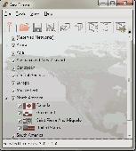
Create the GeoDatabase for the entire world. This program create the geographical location Latitude, Longitude, and Altitude (Elevation) for every city, village, region, state, county in the World. The program crawls the Data from the website www.heavens-above.com which collect Data from US Geological Survey for the USA (and dependencies) and The National Imaging and Mapping...
Category: Software Development
Publisher: Mewsoft, License: Freeware, Price: USD $0.00, File Size: 1.1 MB
Platform: Windows
The 'German Postal Codes' package will provide you with the extended German Postal Codes database as well as German geographical Data like latitude and longitude. The 'German Postal Codes' package includes the information on: German Postal code, Latitude, Longitude. 14 958 precise records are in the 'German Postal Codes' package. German...
Category: Business & Finance / Business Finance
Publisher: Zip Postal Codes, License: Shareware, Price: USD $24.95, File Size: 99.0 KB
Platform: Windows
This is a simple and yet reliable protection from accidentally accessing Internet websites located in at-risk geographical countries. Save your preferences into a file and load when you need it. 200+ countries and territories. It blocks all TCP/IP and UDP/IP traffic coming out/in from/to computer. Up until recently, the geographical blocking was only available to large companies with...
Category: Internet / Proxy Servers
Publisher: Verigio Communications, License: Shareware, Price: USD $24.95, File Size: 6.8 MB
Platform: Windows
How MobiAudit™ helps:
On-the-spot Data collection and submission
Data validation during entry
Instantaneous Data submission
Increased accuracy and efficiency of the shoppers
Geo-verification and time-validation of all answers
Seamless integration with the Shopmetrics™ mystery shopping platform
Category: Home & Education / Miscellaneous
Publisher: Research Metrics, LLC, License: Freeware, Price: USD $0.00, File Size: 2.4 MB
Platform: Windows
Panoply is a Java application which enables the user to plot raster images of Geo-gridded Data from netCDF datasets. Panoply is an utility that enable user to plot raster image. Depending on the Data, it can draw global longitude-latitude images or pole-t
Category: Multimedia & Design / Illustration
Publisher: giss.nasa.gov, License: Freeware, Price: USD $0.00, File Size: 9.4 MB
Platform: Windows, Mac, 2K, 2K3, Vista
The MapSys Cadastral GIS offers specialized functionality for each stage of processing including the digital map creation, plotting cadastral and topographical plans, generating and combining Geo-referenced Data in order to obtain a validated relational Geo-database. This can be used in MapSys or in other GIS programs or database application.
Category: Home & Education / Teaching Tools
Publisher: GEOTOP, License: Freeware, Price: USD $0.00, File Size: 143.9 MB
Platform: Windows