Free Downloads: Geo Information
GeoSetter is a freeware tool for Windows (XP or higher) for showing and changing Geo data and other metadata (IPTC/XMP/Exif) of image files (e.g. images taken by digital cameras).
fEATURES:
- Reads and writes the formats JPEG and TIFF as well as camera RAW formats DNG (Adobe), CRW, CR2 and THM (Canon), NEF and NRW (Nikon), MRW (Konica Minolta), PEF (Pentax), ORF (Olympus),...
Category: Multimedia & Design / Media Management
Publisher: Friedemann Schmidt, License: Freeware, Price: USD $0.00, File Size: 18.8 MB
Platform: Windows
Create the GeoDatabase for the entire world. This program create the geographical location Latitude, Longitude, and Altitude (Elevation) for every city, village, region, state, county in the World. The program crawls the data from the website www.heavens-above.com which collect data from US Geological Survey for the USA (and dependencies) and The National Imaging and Mapping Agency for all...
Category: Software Development
Publisher: Mewsoft, License: Freeware, Price: USD $0.00, File Size: 1.1 MB
Platform: Windows
GTrek-IV, is a digital Image Viewer and Geo Tagging tool!
GTrek-IV, is a digital Image Viewer and Geo Tagging tool! Any picture taken by you can be tagged by the program to locate it with Google Earth. Of course, the place in the picture must be visible on Google Earth. GeoTagged data is stored in textural form as geographical coordinates. The program can be used to tag it as well as to view the image along with the Google Earth photo.
Category: Multimedia & Design / Multimedia App's
Publisher: GTrek Ltd., License: Shareware, Price: USD $11.30, File Size: 5.8 MB
Platform: Windows
Create GPS enabled Geo maps directly on the background of aereal photos and road maps from the internet. Import geodata from Google-Earth, OpenStreetMap, GPS tracks and GPS logger. Map editor , manually digitizing. Specifical graphical objects (borderlines, borderareas) to guarantee exact same borders of neighbour areas..Screen calibration for true to display on the screnn.
Category: Multimedia & Design / Digital Media Editors
Publisher: GPSur Dr. Erhard Regener, License: Shareware, Price: USD $65.00, File Size: 6.4 MB
Platform: Windows
The MapSys Cadastral GIS offers specialized functionality for each stage of processing including the digital map creation, plotting cadastral and topographical plans, generating and combining Geo-referenced data in order to obtain a validated relational Geo-database. This can be used in MapSys or in other GIS programs or database application.
Category: Home & Education / Teaching Tools
Publisher: GEOTOP, License: Freeware, Price: USD $0.00, File Size: 143.9 MB
Platform: Windows
World Heroes is a fighting game series created by ADK.
World Heroes is a fighting game series created by ADK.Originally released for the Neo Geo. Also ported onto Sega Genesis on August 16, 1994 and SNES in September of 1993 by Sega Midwest Development Division/ Sega Midwest Studio and Sunsoft, respectively. The Neo-Geo version has been released through Nintendo's Virtual Console service and in SNK Arcade Classics Vol. 1 as a...
Category: Games / Misc. Games
Publisher: Sega, License: Freeware, Price: USD $0.00, File Size: 1.8 MB
Platform: Windows
GEOCatalog is an application to allow easy management of the files created by the authoring programs that comprise the Geo Software Suite.
GEOCatalog finds and collates all ODF files within any defined local or network path(s), and displays them within a customizable 'spread-sheet' format.
Category: Utilities / Misc. Utilities
Publisher: SDC Software Ltd., License: Freeware, Price: USD $0.00, File Size: 15.3 MB
Platform: Windows
Utilizing the latest Geo-Mapping technology, PhotoTrackr allows you to precisely record and review your trip no matter where you have traveled. If you took pictures on your trip, it will show you the exact location and time of your pictures. Furthermore, if you loved sharing, PhotoTrackr will enable you to share your whole vacation experience with others.
Category: Home & Education / Miscellaneous
Publisher: GiSTEQ, License: Freeware, Price: USD $0.00, File Size: 17.0 MB
Platform: Windows
RMS provides the industry's smoothest and most powerful geo-modelling workflow.
RMS provides the industry's smoothest and most powerful Geo-modelling workflow.
Reservoir models are arguably the most important decision-making tool that operators have at their disposal in the oil and gas industry today.
RMS 2010 brings you a high quality and easy-to-use reservoir modelling suite with major improvements across the entire workflow, with a wide-ranging...
Category: Business & Finance / MS Office Addons
Publisher: Roxar, License: Shareware, Price: USD $235.00, File Size: 13.7 MB
Platform: Windows
Panoply is a Java application which enables the user to plot raster images of Geo-gridded data from netCDF datasets. Panoply is an utility that enable user to plot raster image. Depending on the data, it can draw global longitude-latitude images or pole-t
Category: Multimedia & Design / Illustration
Publisher: giss.nasa.gov, License: Freeware, Price: USD $0.00, File Size: 9.4 MB
Platform: Windows, Mac, 2K, 2K3, Vista
TrendyMac is a GUI based analyzer (preview) for log files of web servers. Using its interactive view, you may browse through generated reports. Since TrendyMac is a Windows application, it doesn't require support technology like a web server to push your results to. Analyzed functionality: - Visitor - Browsers - Search phrases of Google - Requested pages - Referring pages -...
Category: Internet
Publisher: turingart, License: Freeware, Price: USD $0.00, File Size: 4.8 MB
Platform: Windows, Mac
Where are your Internet visitors coming from?
Where are your Internet visitors coming from?
IP Address Country mapping Database can help you identify visitor's geographical location of an IP address. The IP Address to Country Code Database can be used for:
1>Real Time Geo-Locating ( Country )
2>Redirect based on country
3>Automatically target advertising by country
4>Geo targeting for...
Category: Web Authoring / Web Design Utilities
Publisher: Jgsoft Associates, License: Shareware, Price: USD $49.95, File Size: 235.0 KB
Platform: Windows, Linux, Mac, Palm
Building on top of OSSIM and OpenSceneGraph capabilities, ossimPlanet is a rapidly evolving project for accurate, high performance, 3D Geo-spatial visualization.
It automatically intersects with DTED and/or SRTM elevation trees for topography and handles a wide range of commercial and government file formats natively.
Additionally, remote layers can be...
Category: Multimedia & Design / Multimedia App's
Publisher: OSSIM, License: Shareware, Price: USD $0.00, File Size: 995.4 MB
Platform: Windows
The Orbit Visualization Tool (OVT) is a software for visualization of satellite orbits in the Earth's magnetic field. The program can display satellite orbits in five coordinate systems (GEI, Geo, GSM, SMC, GSE), satellite footprints projected on the Earth's surface and shown in either geographic (Geo) or geomagnetic (SMC) coordinates. In addition to satellite orbits the...
Category: Home & Education / Astrology & Numerology
Publisher: OVT Team, License: Freeware, Price: USD $0.00, File Size: 0
Platform: Windows
Instant QR Codes is able to generate QR codes for web url addresses, email, Geo locations, phone numbers, contact cards, me-cards, wifi configuration and even Android Marketplace. The best part is that the program does not need a active Internet connection, it is totally self-contained.
Category: Utilities / Misc. Utilities
Publisher: JettDigitals, License: Freeware, Price: USD $0.00, File Size: 2.5 MB
Platform: Windows
With this program, you can store GPS data and real address information for every picture.
With this program, you can store GPS data and real address Information for every picture. Using photoGPS, you can capture Geo-data on site, automatically combine GPS and location data with pictures (using included Matching software), search, sort and organise all pictures acc. to country, city, street (using included Organizer software).
Category: Multimedia & Design / Multimedia App's
Publisher: JOBO, License: Freeware, Price: USD $0.00, File Size: 46.4 MB
Platform: Windows
 Shareware
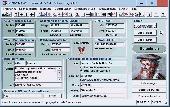
TOPOWIN is a state-wide register of the German Topographic Cartographies, the German Basic Cartography and of localities with Geo references in different coordinate systems. It is also a topographic Information system. In the division of planning and execution of economical and scientific projects frequently topographic documents are used. The program TOPOWIN makes...
Category: Home & Education / Miscellaneous
Publisher: Killet GeoSoftware Ing.-GbR, License: Shareware, Price: USD $125.00, EUR110, File Size: 4.5 MB
Platform: Windows
How MobiAudit™ helps:
On-the-spot data collection and submission
Data validation during entry
Instantaneous data submission
Increased accuracy and efficiency of the shoppers
Geo-verification and time-validation of all answers
Seamless integration with the Shopmetrics™ mystery shopping platform
Category: Home & Education / Miscellaneous
Publisher: Research Metrics, LLC, License: Freeware, Price: USD $0.00, File Size: 2.4 MB
Platform: Windows
Geographic databases management and exploitation, attribute-based and spatial queries, several join types, several classification methods, thematic cartography, statistics and Geo-statistics, spatial analysis, interpolations, digital elevation models, remote-sensing and image processing, simulation, operational research, interactive metric measurements
Category: Home & Education / Miscellaneous
Publisher: IRD, License: Freeware, Price: USD $0.00, File Size: 14.2 MB
Platform: Windows
USA Real Estate Map Pro is a premium class software for mapping: real estate properties, contact listings, offices and other Geo spatial data. Interactive Real Estate map is rather simple to integrate with database listings: both to specify the states and counties that should be active on map, and pass the selected county name or ID back, for further use. Among the benefits of US Real...
Category: Business & Finance / Database Management
Publisher: USFlashMap.com, License: Shareware, Price: USD $399.00, File Size: 10.4 MB
Platform: Windows, Mac, Linux, Unix, MS-DOS, AS, 400
HydroSHEDS is a mapping product that provides hydrographic Information for regional and global-scale applications in a consistent format. It offers a suite of Geo-referenced data sets (vector and raster) at various scales, including river networks, watershed boundaries, drainage directions, and flow accumulations. HydroSHEDS is based on high-resolution elevation data obtained...
Category: Home & Education / Miscellaneous
Publisher: WWF-CSP, License: Freeware, Price: USD $0.00, File Size: 1.7 MB
Platform: Windows
TerraView handles vector data (polygons, lines and points) and raster data (grids and images), both stored in a relational or Geo-relational database, including ACCESS, PostgreSQL, MySQL and Oracle. TerraView is able to convert to the current version of TerraLib database only databases in the immediately previous version.
Category: Home & Education / Miscellaneous
Publisher: TerraView, License: Freeware, Price: USD $0.00, File Size: 113.9 MB
Platform: Windows
Dynamic project tree
Automatically displays all files in the current project directory and its sub-directories. Geo monitors changes in these directories which makes it easy to see whether files are being added or removed. The files are ordered by file type which makes it easier to open them without having to use the "Open file" dialog. Double-clicking a file opens it,...
Category: Business & Finance / Business Finance
Publisher: SBG AB, License: Freeware, Price: USD $0.00, File Size: 1.4 MB
Platform: Windows
Freeware
Bandwidth Vista 2, The Next Generation bandwidth monitor with Geo-IP Connection Mapper. Displays Real-Time TCP and UDP Connections including Country and City. Holds a full log of bandwidth usage. New to Bandwidth Vista 2 is Voice Alerts and a Whois Lookup Tool and two kinds of graph. Bandwidth Vista 2 runs quietly from the system tray displaying network activity while you work or you can...
Category: Utilities / Network
Publisher: Bandwidth Vista, License: Freeware, Price: USD $0.00, File Size: 16.2 MB
Platform: Windows
TerraExplorer allows users to shape their own digital world.
TerraExplorer allows users to shape their own digital world.
By editing and annotating Geo-referenced 3D terrain databases created through TerraBuilder, users can customize the experience to highlight specific geographic content. By overlaying unique or proprietary Information onto a 3D map, the user creates an exciting, interactive application that can highlight...
Category: Home & Education / Miscellaneous
Publisher: Skyline Software Systems, Inc., License: Freeware, Price: USD $0.00, File Size: 29.5 MB
Platform: Windows