Free Downloads: Geo Ip Online
Create the GeoDatabase for the entire world. This program create the geographical location Latitude, Longitude, and Altitude (Elevation) for every city, village, region, state, county in the World. The program crawls the data from the website www.heavens-above.com which collect data from US Geological Survey for the USA (and dependencies) and The National Imaging and Mapping Agency for all...
Category: Software Development
Publisher: Mewsoft, License: Freeware, Price: USD $0.00, File Size: 1.1 MB
Platform: Windows
RCounter Geo is a system for gathering and reviewing statistics, analysis of web-site attendance (as well as separate web-pages). RCounter 2.0 Geo is the most powerful tool from the RCounter family. It has all features of RCounter light, plus Geographical statistics and a unique utility, which can easily export information from RCounter database in Word, Excel, or dispatch reports...
Category: Internet / Tools & Utilities
Publisher: NooLab, License: Shareware, Price: USD $125.00, File Size: 1.6 MB
Platform: Windows, Linux,
GTrek-IV, is a digital Image Viewer and Geo Tagging tool!
GTrek-IV, is a digital Image Viewer and Geo Tagging tool! Any picture taken by you can be tagged by the program to locate it with Google Earth. Of course, the place in the picture must be visible on Google Earth. GeoTagged data is stored in textural form as geographical coordinates. The program can be used to tag it as well as to view the image along with the Google Earth photo.
Category: Multimedia & Design / Multimedia App's
Publisher: GTrek Ltd., License: Shareware, Price: USD $11.30, File Size: 5.8 MB
Platform: Windows
Create GPS enabled Geo maps directly on the background of aereal photos and road maps from the internet. Import geodata from Google-Earth, OpenStreetMap, GPS tracks and GPS logger. Map editor , manually digitizing. Specifical graphical objects (borderlines, borderareas) to guarantee exact same borders of neighbour areas..Screen calibration for true to display on the screnn.
Category: Multimedia & Design / Digital Media Editors
Publisher: GPSur Dr. Erhard Regener, License: Shareware, Price: USD $65.00, File Size: 6.4 MB
Platform: Windows
The MapSys Cadastral GIS offers specialized functionality for each stage of processing including the digital map creation, plotting cadastral and topographical plans, generating and combining Geo-referenced data in order to obtain a validated relational Geo-database. This can be used in MapSys or in other GIS programs or database application.
Category: Home & Education / Teaching Tools
Publisher: GEOTOP, License: Freeware, Price: USD $0.00, File Size: 143.9 MB
Platform: Windows
World Heroes is a fighting game series created by ADK.
World Heroes is a fighting game series created by ADK.Originally released for the Neo Geo. Also ported onto Sega Genesis on August 16, 1994 and SNES in September of 1993 by Sega Midwest Development Division/ Sega Midwest Studio and Sunsoft, respectively. The Neo-Geo version has been released through Nintendo's Virtual Console service and in SNK Arcade Classics Vol. 1 as a...
Category: Games / Misc. Games
Publisher: Sega, License: Freeware, Price: USD $0.00, File Size: 1.8 MB
Platform: Windows
GEOCatalog is an application to allow easy management of the files created by the authoring programs that comprise the Geo Software Suite.
GEOCatalog finds and collates all ODF files within any defined local or network path(s), and displays them within a customizable 'spread-sheet' format.
Category: Utilities / Misc. Utilities
Publisher: SDC Software Ltd., License: Freeware, Price: USD $0.00, File Size: 15.3 MB
Platform: Windows
Utilizing the latest Geo-Mapping technology, PhotoTrackr allows you to precisely record and review your trip no matter where you have traveled. If you took pictures on your trip, it will show you the exact location and time of your pictures. Furthermore, if you loved sharing, PhotoTrackr will enable you to share your whole vacation experience with others.
Category: Home & Education / Miscellaneous
Publisher: GiSTEQ, License: Freeware, Price: USD $0.00, File Size: 17.0 MB
Platform: Windows
RMS provides the industry's smoothest and most powerful geo-modelling workflow.
RMS provides the industry's smoothest and most powerful Geo-modelling workflow.
Reservoir models are arguably the most important decision-making tool that operators have at their disposal in the oil and gas industry today.
RMS 2010 brings you a high quality and easy-to-use reservoir modelling suite with major improvements across the entire workflow, with a wide-ranging...
Category: Business & Finance / MS Office Addons
Publisher: Roxar, License: Shareware, Price: USD $235.00, File Size: 13.7 MB
Platform: Windows
Panoply is a Java application which enables the user to plot raster images of Geo-gridded data from netCDF datasets. Panoply is an utility that enable user to plot raster image. Depending on the data, it can draw global longitude-latitude images or pole-t
Category: Multimedia & Design / Illustration
Publisher: giss.nasa.gov, License: Freeware, Price: USD $0.00, File Size: 9.4 MB
Platform: Windows, Mac, 2K, 2K3, Vista
Where are your Internet visitors coming from?
Where are your Internet visitors coming from?
Ip Address Country mapping Database can help you identify visitor's geographical location of an Ip address. The Ip Address to Country Code Database can be used for:
1>Real Time Geo-Locating ( Country )
2>Redirect based on country
3>Automatically target advertising by country
...
Category: Web Authoring / Web Design Utilities
Publisher: Jgsoft Associates, License: Shareware, Price: USD $49.95, File Size: 235.0 KB
Platform: Windows, Linux, Mac, Palm
Building on top of OSSIM and OpenSceneGraph capabilities, ossimPlanet is a rapidly evolving project for accurate, high performance, 3D Geo-spatial visualization.
It automatically intersects with DTED and/or SRTM elevation trees for topography and handles a wide range of commercial and government file formats natively.
Additionally, remote layers can be...
Category: Multimedia & Design / Multimedia App's
Publisher: OSSIM, License: Shareware, Price: USD $0.00, File Size: 995.4 MB
Platform: Windows
The database tables contains geodata of the Federal Republic of Germany with Geo referenced towns, municipalities, town quarters and other administrative units, postal codes, telephone preselections, nature areas, landscapes, climatic zones and official topographical cartographies. The data contain coordinates for navigation and Geo-coding, proximity searches and distance...
Category: Business & Finance / Database Management
Publisher: Killet GeoSoftware Ing.-GbR, License: Data Only, Price: USD $175.00, EUR150, File Size: 3.2 MB
Platform: Windows
The Orbit Visualization Tool (OVT) is a software for visualization of satellite orbits in the Earth's magnetic field. The program can display satellite orbits in five coordinate systems (GEI, Geo, GSM, SMC, GSE), satellite footprints projected on the Earth's surface and shown in either geographic (Geo) or geomagnetic (SMC) coordinates. In addition to satellite orbits the...
Category: Home & Education / Astrology & Numerology
Publisher: OVT Team, License: Freeware, Price: USD $0.00, File Size: 0
Platform: Windows
Instant QR Codes is able to generate QR codes for web url addresses, email, Geo locations, phone numbers, contact cards, me-cards, wifi configuration and even Android Marketplace. The best part is that the program does not need a active Internet connection, it is totally self-contained.
Category: Utilities / Misc. Utilities
Publisher: JettDigitals, License: Freeware, Price: USD $0.00, File Size: 2.5 MB
Platform: Windows
How MobiAudit™ helps:
On-the-spot data collection and submission
Data validation during entry
Instantaneous data submission
Increased accuracy and efficiency of the shoppers
Geo-verification and time-validation of all answers
Seamless integration with the Shopmetrics™ mystery shopping platform
Category: Home & Education / Miscellaneous
Publisher: Research Metrics, LLC, License: Freeware, Price: USD $0.00, File Size: 2.4 MB
Platform: Windows
Geographic databases management and exploitation, attribute-based and spatial queries, several join types, several classification methods, thematic cartography, statistics and Geo-statistics, spatial analysis, interpolations, digital elevation models, remote-sensing and image processing, simulation, operational research, interactive metric measurements
Category: Home & Education / Miscellaneous
Publisher: IRD, License: Freeware, Price: USD $0.00, File Size: 14.2 MB
Platform: Windows
TerraView handles vector data (polygons, lines and points) and raster data (grids and images), both stored in a relational or Geo-relational database, including ACCESS, PostgreSQL, MySQL and Oracle. TerraView is able to convert to the current version of TerraLib database only databases in the immediately previous version.
Category: Home & Education / Miscellaneous
Publisher: TerraView, License: Freeware, Price: USD $0.00, File Size: 113.9 MB
Platform: Windows
Dynamic project tree
Automatically displays all files in the current project directory and its sub-directories. Geo monitors changes in these directories which makes it easy to see whether files are being added or removed. The files are ordered by file type which makes it easier to open them without having to use the "Open file" dialog. Double-clicking a file opens it,...
Category: Business & Finance / Business Finance
Publisher: SBG AB, License: Freeware, Price: USD $0.00, File Size: 1.4 MB
Platform: Windows
 Freeware
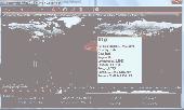
Bandwidth Vista 2, The Next Generation bandwidth monitor with Geo-Ip Connection Mapper. Displays Real-Time TCP and UDP Connections including Country and City. Holds a full log of bandwidth usage. New to Bandwidth Vista 2 is Voice Alerts and a Whois Lookup Tool and two kinds of graph. Bandwidth Vista 2 runs quietly from the system tray displaying network activity while you work or...
Category: Utilities / Network
Publisher: Bandwidth Vista, License: Freeware, Price: USD $0.00, File Size: 16.2 MB
Platform: Windows
Commercial
Rain-clouds is an online software provider for Craigslist Software. RainMaker craigslist ad posting software will automated your business marketing with minimum effort. Set up your ad, and let the software submit your ads on a scheduled basis to craigslist.
Category: Business & Finance / E-commerce
Publisher: vEva, Inc., License: Commercial, Price: USD $199.00, USD199, File Size: 2.4 MB
Platform: Windows, Linux, Unix
Freeware
There is no good rule of thumb to determine the geolocation of Internet Ip addresses. While some Ip blocks tend to belong to certain countries, other Ip blocks are distributed in an almost anarchic fashion. Moreover, the Ip distribution is not static but in a continuous mutation with new additions, reallocations and deletions. AWIPLOC allows you to resolve IPs to...
Category: Internet / Internet Phone and Teleconferencing
Publisher: AtelierWeb Software, License: Freeware, Price: USD $0.00, File Size: 2.9 MB
Platform: Windows
Commercial
AdiKit CPA Lead Script - CPA Lead: is a performance-based, Online advertising network that develops technologies to promote incentive-based advertisement. Using this service we can reward users who fill in surveys, based on a set ratio of points to $. So you determine your own profit margins! What surveys are available? : AdiKit CPA Lead Script - CPA Lead automatically Geo targets...
Category: Web Authoring / Web Design Utilities
Publisher: AdiKit, Inc., License: Commercial, Price: USD $70.95, USD70.95, File Size: 6.5 MB
Platform: Windows, Linux, Java, Unix
MapCreator 2.0 is a software to create maps and animated maps with a good quality.
MapCreator can be used in presentations because is versatile and can be adequate for any kind of presentation, from travel presentations to professional presentations.
MapCreator is Geo-referenced so any map or portion of the map will have the exactly portions of latitude and longitude, even...
Category: Home & Education / Miscellaneous
Publisher: primap software, License: Freeware, Price: USD $0.00, File Size: 103.3 MB
Platform: Windows
Commercial
CPA Lead Reward Site Script! Win Money for minutes! CPA Lead Script - CPA Lead: is a performance-based, Online advertising network that develops technologies to promote incentive-based advertisement. Using this service we can reward users who fill in surveys, based on a set ratio of points to $. So you determine your own profit margins! What surveys are available? : CPA Lead Script...
Category: Web Authoring / Scripts & CGI Tools
Publisher: vEva, Inc., License: Commercial, Price: USD $70.95, USD70.95, File Size: 2.4 MB
Platform: Windows, Linux