Free Downloads: Geo Locations
Geo estimator it is a program which measures the roof area and makes an graphic schematics of the roof. With it you can measure any home roof, from anywhere without even going there. You need maps for it and you will find them on the homepage of the application but you have to pay for them.
Category: Business & Finance / Business Finance
Publisher: Thornberry Consulting, LLC, License: Shareware, Price: USD $0.00, File Size: 0
Platform: Windows
Geo-SLOPE GeoBorrow
License borrowing allows a company that has purchased GeoStudio 2007 network licenses to have an end-user ‘check out’ a license for use while disconnected from the corporate network. This feature enables you to temporarily make use of a network license in a standalone capacity. Once a license is borrowed, the license is removed from the pool,...
Category: Business & Finance / Database Management
Publisher: GEO-SLOPE International Ltd., License: Freeware, Price: USD $0.00, File Size: 1.6 MB
Platform: Windows
For many countries house coordinates are present with coverage degrees upto 100 percent.
For many countries house coordinates are present with coverage degrees upto 100 percent. The Geo data offered here are in high-precision quality and are present in different coordinate and reference systems. House Coordinates or also called Geo Coded Building Addresses are meaning the connection between the postal addresses of buildings or building complexes and their accurate...
Category: Business & Finance / Database Management
Publisher: C. Killet Software Ing.-GbR, License: Demo, Price: USD $1420.00, File Size: 234.0 KB
Platform: Windows
USA Real Estate Map Pro is a premium class software for mapping: real estate properties, contact listings, offices and other Geo spatial data. Interactive Real Estate map is rather simple to integrate with database listings: both to specify the states and counties that should be active on map, and pass the selected county name or ID back, for further use. Among the benefits of US Real...
Category: Business & Finance / Database Management
Publisher: USFlashMap.com, License: Shareware, Price: USD $399.00, File Size: 10.4 MB
Platform: Windows, Mac, Linux, Unix, MS-DOS, AS, 400
GeoSetter is a freeware tool for Windows (XP or higher) for showing and changing Geo data and other metadata (IPTC/XMP/Exif) of image files (e.g. images taken by digital cameras).
fEATURES:
- Reads and writes the formats JPEG and TIFF as well as camera RAW formats DNG (Adobe), CRW, CR2 and THM (Canon), NEF and NRW (Nikon), MRW (Konica Minolta), PEF (Pentax), ORF (Olympus),...
Category: Multimedia & Design / Media Management
Publisher: Friedemann Schmidt, License: Freeware, Price: USD $0.00, File Size: 18.8 MB
Platform: Windows
RCounter Geo is a system for gathering and reviewing statistics, analysis of web-site attendance (as well as separate web-pages). RCounter 2.0 Geo is the most powerful tool from the RCounter family. It has all features of RCounter light, plus Geographical statistics and a unique utility, which can easily export information from RCounter database in Word, Excel, or dispatch reports...
Category: Internet / Tools & Utilities
Publisher: NooLab, License: Shareware, Price: USD $125.00, File Size: 1.6 MB
Platform: Windows, Linux,
GTrek-IV, is a digital Image Viewer and Geo Tagging tool!
GTrek-IV, is a digital Image Viewer and Geo Tagging tool! Any picture taken by you can be tagged by the program to locate it with Google Earth. Of course, the place in the picture must be visible on Google Earth. GeoTagged data is stored in textural form as geographical coordinates. The program can be used to tag it as well as to view the image along with the Google Earth photo.
Category: Multimedia & Design / Multimedia App's
Publisher: GTrek Ltd., License: Shareware, Price: USD $11.30, File Size: 5.8 MB
Platform: Windows
Create GPS enabled Geo maps directly on the background of aereal photos and road maps from the internet. Import geodata from Google-Earth, OpenStreetMap, GPS tracks and GPS logger. Map editor , manually digitizing. Specifical graphical objects (borderlines, borderareas) to guarantee exact same borders of neighbour areas..Screen calibration for true to display on the screnn.
Category: Multimedia & Design / Digital Media Editors
Publisher: GPSur Dr. Erhard Regener, License: Shareware, Price: USD $65.00, File Size: 6.4 MB
Platform: Windows
The MapSys Cadastral GIS offers specialized functionality for each stage of processing including the digital map creation, plotting cadastral and topographical plans, generating and combining Geo-referenced data in order to obtain a validated relational Geo-database. This can be used in MapSys or in other GIS programs or database application.
Category: Home & Education / Teaching Tools
Publisher: GEOTOP, License: Freeware, Price: USD $0.00, File Size: 143.9 MB
Platform: Windows
World Heroes is a fighting game series created by ADK.
World Heroes is a fighting game series created by ADK.Originally released for the Neo Geo. Also ported onto Sega Genesis on August 16, 1994 and SNES in September of 1993 by Sega Midwest Development Division/ Sega Midwest Studio and Sunsoft, respectively. The Neo-Geo version has been released through Nintendo's Virtual Console service and in SNK Arcade Classics Vol. 1 as a...
Category: Games / Misc. Games
Publisher: Sega, License: Freeware, Price: USD $0.00, File Size: 1.8 MB
Platform: Windows
GEOCatalog is an application to allow easy management of the files created by the authoring programs that comprise the Geo Software Suite.
GEOCatalog finds and collates all ODF files within any defined local or network path(s), and displays them within a customizable 'spread-sheet' format.
Category: Utilities / Misc. Utilities
Publisher: SDC Software Ltd., License: Freeware, Price: USD $0.00, File Size: 15.3 MB
Platform: Windows
GeoBlock filters all traffic from the client to your web-server based on Locations that you select. You can even block Locations all the way down to the state and city level! It is a fact that most hack attempts come from certain areas and countries. Stop them before they start and protect your site with GeoBlock! How does it work? In terms of its implementation model and...
Category: Internet / Proxy Servers
Publisher: Tometa Software, Inc., License: Shareware, Price: USD $498.00, File Size: 13.1 MB
Platform: Unknown
Utilizing the latest Geo-Mapping technology, PhotoTrackr allows you to precisely record and review your trip no matter where you have traveled. If you took pictures on your trip, it will show you the exact location and time of your pictures. Furthermore, if you loved sharing, PhotoTrackr will enable you to share your whole vacation experience with others.
Category: Home & Education / Miscellaneous
Publisher: GiSTEQ, License: Freeware, Price: USD $0.00, File Size: 17.0 MB
Platform: Windows
 Shareware
With AnyMP4 iPhone GPS Spoofer for Mac, you own one of the best GPS location spoofers for iOS devices. It lets you set the virtual GPS location within a few clicks. Whats more, you can play location-based games from anywhere in the world easily. Key Functions: 1. Fake yours iPhone location easily. AnyMP4 iPhone GPS Spoofer for Mac is an easy-to-use location changer that you can hide...
Category: Software Development
Publisher: AnyMP4 Studio, License: Shareware, Price: USD $9.96, File Size: 72.5 MB
Platform: Mac
RMS provides the industry's smoothest and most powerful geo-modelling workflow.
RMS provides the industry's smoothest and most powerful Geo-modelling workflow.
Reservoir models are arguably the most important decision-making tool that operators have at their disposal in the oil and gas industry today.
RMS 2010 brings you a high quality and easy-to-use reservoir modelling suite with major improvements across the entire workflow, with a wide-ranging...
Category: Business & Finance / MS Office Addons
Publisher: Roxar, License: Shareware, Price: USD $235.00, File Size: 13.7 MB
Platform: Windows
"Automatically Copy Files to Multiple Folder Locations Software" offers a convenient solution for those who need to copy files to alternate Locations. With this program the interval for copying, can be set between 30 seconds and 24 hours. This application sits in the system tray at the bottom right corner of the screen.
Category: Business & Finance / MS Office Addons
Publisher: Sobolsoft, License: Shareware, Price: USD $19.99, File Size: 2.9 MB
Platform: Windows
Panoply is a Java application which enables the user to plot raster images of Geo-gridded data from netCDF datasets. Panoply is an utility that enable user to plot raster image. Depending on the data, it can draw global longitude-latitude images or pole-t
Category: Multimedia & Design / Illustration
Publisher: giss.nasa.gov, License: Freeware, Price: USD $0.00, File Size: 9.4 MB
Platform: Windows, Mac, 2K, 2K3, Vista
Where are your Internet visitors coming from?
Where are your Internet visitors coming from?
IP Address Country mapping Database can help you identify visitor's geographical location of an IP address. The IP Address to Country Code Database can be used for:
1>Real Time Geo-Locating ( Country )
2>Redirect based on country
3>Automatically target advertising by country
4>Geo targeting for...
Category: Web Authoring / Web Design Utilities
Publisher: Jgsoft Associates, License: Shareware, Price: USD $49.95, File Size: 235.0 KB
Platform: Windows, Linux, Mac, Palm
Building on top of OSSIM and OpenSceneGraph capabilities, ossimPlanet is a rapidly evolving project for accurate, high performance, 3D Geo-spatial visualization.
It automatically intersects with DTED and/or SRTM elevation trees for topography and handles a wide range of commercial and government file formats natively.
Additionally, remote layers can be...
Category: Multimedia & Design / Multimedia App's
Publisher: OSSIM, License: Shareware, Price: USD $0.00, File Size: 995.4 MB
Platform: Windows
It is utility to save/recover desktop icon locations.
It is utility to save/recover desktop icon Locations. It provide easy recovery of icon Locations and additionally, it provides showing desktop icon in front or hide desktop icon.
Category: Utilities / Misc. Utilities
Publisher: Docs, License: Freeware, Price: USD $0.00, File Size: 985.0 KB
Platform: Windows
The board is a hexagonal field representing the Sumo arena.
The board is a hexagonal field representing the Sumo arena.
There are 4 interlaced different size hexagons, where the most exterior hexagon has 5 circular Locations at each side. In the middle there is a single location. As a total, there are 61 circular board Locations.
Each player has fourteen pieces that can rest in these Locations. In initial...
Category: Games / Misc. Games
Publisher: Ihsan Ul Haque, License: Shareware, Price: USD $0.00, File Size: 0
Platform: Windows
The Orbit Visualization Tool (OVT) is a software for visualization of satellite orbits in the Earth's magnetic field. The program can display satellite orbits in five coordinate systems (GEI, Geo, GSM, SMC, GSE), satellite footprints projected on the Earth's surface and shown in either geographic (Geo) or geomagnetic (SMC) coordinates. In addition to satellite orbits the...
Category: Home & Education / Astrology & Numerology
Publisher: OVT Team, License: Freeware, Price: USD $0.00, File Size: 0
Platform: Windows
PrintWhere enables you to print from any Windows application to PrinterOn print Locations anywhere in the world. PrinterOn Locations include hotels, wireless hotspots, corporations and home offices.
Once installed, PrintWhere automatically reconfigures itself for correct operation at any PrinterOn location. Never again will you need to locate and install print drivers...
Category: Utilities / Printers
Publisher: PrinterOn Corporation, License: Freeware, Price: USD $0.00, File Size: 9.0 MB
Platform: Windows
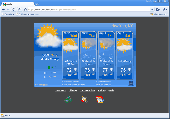
AniWeather animates weather in vivid animations for worldwide locations worldwide.
AniWeather animates weather in vivid animations for worldwide Locations worldwide. It switches different Locations in one click. Aniweather provides flexible weather reports, from real time current condition, radar/satellite map, to 5-day forecast, and to more detailed hourly report. It is quite customizable to fit your preference (temperature unit, location list, animation...
Category: Internet / Browsers
Publisher: AniWeather, License: Freeware, Price: USD $0.00, File Size: 101.0 KB
Platform: Windows
How MobiAudit™ helps:
On-the-spot data collection and submission
Data validation during entry
Instantaneous data submission
Increased accuracy and efficiency of the shoppers
Geo-verification and time-validation of all answers
Seamless integration with the Shopmetrics™ mystery shopping platform
Category: Home & Education / Miscellaneous
Publisher: Research Metrics, LLC, License: Freeware, Price: USD $0.00, File Size: 2.4 MB
Platform: Windows