Free Downloads: Geodetic
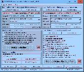
GROMA is a program designed for geodetic calculations.
GROMA is a program designed for Geodetic calculations. It works under all versions of 32bit MS Windows. System is designed for processing of Geodetic measurements from raw fieldbook data to result coordinates, reports and check graphics. This system is used at all Czech Cadastral Offices and its branches all over the Czech Republic as well as at hundreds of private surveying...
Category: Business & Finance / Applications
Publisher: GEOLINE, spol. s r.o., License: Shareware, Price: USD $0.00, File Size: 0
Platform: Windows
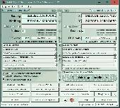
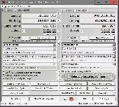
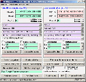
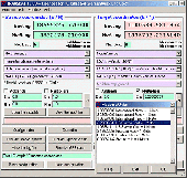
WGS-84 Calculator is used to calculate Geodetic distance and azimuth between two points (latitude and longitude). In addition, it can calculate a new point from origin using the given azimuth and distance.
Lat/long values can be inserted using three different formats; DD:MM:SS.ssss, DD:MM.mmmmmm or DD.dddddddd.
Calculations are based on WGS-84 (World...
Category: Home & Education / Mathematics
Publisher: MR Soft Tmi, License: Freeware, Price: USD $0.00, File Size: 502.0 KB
Platform: Windows


 Shareware
GeoDLL is a Geodetic Development Kit / Geodetic Function Library with worldwide 2D and 3D Coordinate Transformation, Datum Shift, Meridian Convergence and Extra Parameter with highest accuracy. Furthermore: Helmert and Molodensky Parameters, NTv2, HARN, INSPIRE, EPSG, Digital Elevation Model (DEM), distance and Time Zone calculations and much more. GeoDLL for Geodetic and...
Category: Software Development / Components & Libraries
Publisher: Killet GeoSoftware Ing.-GbR, License: Shareware, Price: USD $560.00, EUR500, File Size: 5.4 MB
Platform: Windows
With this FREE AutoCAD add-on you can create terrain sections
from Geodetic points(heights) in the drawing. You can also
specify position of pipe(cable, road, ...) or set auxiliary
marks in the section.
Text settings, scale in X,Y axis, height of the reference
plane and type of the terrain section can be set at start-up.
There are two ways how you can create...
Category: Multimedia & Design / Multimedia App's
Publisher: Cadhedral, License: Freeware, Price: USD $0.00, File Size: 69.0 KB
Platform: Windows
This softwareis a program specially designed to convert MapInfo files from the old Australian Geodetic Datum (AGD) to the new Geocentric Datum of Australia (GDA) using the distortion modeling method which is the most accurate method possible. It provides consistency of Australia's mapping datum with international coordinate systems.
Category: Home & Education / Miscellaneous
Publisher: Peter Meier, License: Shareware, Price: USD $1582.19, File Size: 9.8 MB
Platform: Windows
Survey Maker is a program dedicated to the survey field, which includes solutions for the land surveyor, engineering surveyor, surface and underground mining surveyor, Geodetic surveyor and hydro-surveyor. This program is a new addition to the range of software developed by Model Maker Systems and currently undergoing many development changes as users request enhancements.
The...
Category: Business & Finance / Business Finance
Publisher: Model Maker Systems, License: Freeware, Price: USD $0.00, File Size: 33.2 MB
Platform: Windows
This program facilitates the process of edtiting, formatting and checking digital leveling observation data and creates abstracts, bok files, and VERTOBS datasets for submission to the National Geodetic Survey (NGS). The program includes many built-in functions such as predicting temperature differences, refaction corrections, rod corrections and plotting. Also included are routines for...
Category: Business & Finance / Applications
Publisher: National Geodetic Survey, License: Freeware, Price: USD $0.00, File Size: 6.2 MB
Platform: Windows
MOVE3 is a software package for the design, adjustment and quality control of 3D, 2D and 1D Geodetic networks in compliance with the procedures of the "Delft School" of geodesy. MOVE3 allows fully integrated processing of GPS and terrestrial observations.
Benefits:
- True 3D - No compromises
MOVE3 development started from the conviction...
Category: Business & Finance / Applications
Publisher: Grontmij, License: Demo, Price: USD $0.00, File Size: 12.6 MB
Platform: Windows
SEVENPAR is a tool for the calculation of highly exact transformation parameters for the Spatial Helmert and Molodensky Transformation, which make possible precise coordinate transformations from one reference system into another. The determined transformation parameters can be entered directly into suitable transformation software, e.g. TRANSDAT Coordinate Transformations, or into the...
Category: Home & Education / Science
Publisher: Killet GeoSoftware Ing.-GbR, License: Shareware, Price: USD $285.00, EUR240, File Size: 7.6 MB
Platform: Windows
TRANSDAT Geosoftware executes coordinate transformations and Geodetic datum shifts between lots of coordinate and reference systems of Germany, Europe, America, Australia and world wide in high quality and with high performance: 1. The German Coordinate and Reference Systems of the old and new Federal Countries including the 40 Prussian Soldner Land Registers and Soldner Berlin and...
Category: Business & Finance / Applications
Publisher: Killet Softwareentwicklung GbR, License: Shareware, Price: USD $230.00, File Size: 2.6 MB
Platform: Windows
TRANSDATpro can prove a helpful tool for professionals, providing them with the possibility to perform coordinate transformations fast and easy by use of the coordinate reference systems of their choice. TRANSDATpro performs Coordinate Transformations fast and with high accuracy. The coordinate conversion software supports worldwide thousands of Coordinate Systems, Geodetic Reference...
Category: Home & Education / Science
Publisher: Killet GeoSoftware Ing.-GbR, License: Shareware, Price: USD $270.00, EUR240, File Size: 5.3 MB
Platform: Windows
TRANSDAT geosoftware executes coordinate transformations and Geodetic datum shifts between many coordinate and reference systems of America, Australasia, Europe, Germany special and world-wide, with high precision and high speed: 1.The current and historical coordinate and reference systems of all countries of the European Union (EU) including the eastern extensions and the systems of...
Category: Home & Education / Science
Publisher: Killet Software Ing.-GbR, License: Shareware, Price: USD $170.00, EUR160, File Size: 4.4 MB
Platform: Windows
The Geocentric Datum of Australia (GDA) is a coordinate reference system that best fits the shape of the earth as a whole. It has an origin that coincides with the centre of mass of the earth, hence the term 'geocentric'.
The state datum in Queensland is the Geocentric Datum of Australia 1994 (GDA94) replacing the previously adopted Australian Geodetic Datum 1984 (AGD84).
Category: Home & Education / Miscellaneous
Publisher: Department of Natural Resources and Mines, License: Freeware, Price: USD $0.00, File Size: 7.7 MB
Platform: Windows
In the Dynamic Link Library GeoDLL geodesic functions like coordinate transformation, datum changes, meridian strip changes, user defined coordinate and reference systems, distance calculation, maps functions, Digital Elevation Models and more geodesic functions are contained to bind them into own applications. WINDOWS operating system allows building of function libraries intended for use by...
Category: Software Development
Publisher: Killet Softwareentwicklung GbR, License: Shareware, Price: USD $290.00, File Size: 999.9 KB
Platform: Windows
Coordinate Conversion for Object Oriented Programming!
Coordinate Conversion for Object Oriented Programming! GeoCalc.NET is the latest drag-and-drop component for .NET application development. GeoCalc.NET provides .NET developers seamless coordinate conversion when creating custom GIS software for said development platform.
The latest version of GeoCalc.NET has full support for HTDP Reference Frames and coordinate reference systems. Support...
Category: Software Development / Misc. Programming
Publisher: Blue Marble Geographics, License: Demo, Price: USD $0.00, File Size: 48.8 MB
Platform: Windows
T2K Pro integrates the rich world of GIS datasets and transfers your Geographic information data into Google earth. T2K Pro handles rich data types and access large volumes of geographic data stored in files and databases; T2K PRO handles raster (imagery), Vector Map data and GPS Tracks/ Waypoints/ Routes. Tiles2kml Pro provides a complete suite of conversion tools to easily visualize and...
Category: Multimedia & Design / Authoring Tools
Publisher: Tiles2kml, License: Demo, Price: USD $90.00, File Size: 20.9 MB
Platform: Windows
The CANVAS 9 GIS Mapping Edition adds native support for Geographic Information System (GIS) data to Canvas. You can take measurements in geographic coordinates, import industry standard SHAPE and GeoTIFF files into unlimited numbers of automatically aligned overlapping layers and choose among the following options: 2,104 Coordinate Reference Systems 67 Operation Methods (like Mercator, Albers...
Category: Multimedia & Design / Multimedia App's
Publisher: ACD Systems, License: Shareware, Price: USD $549.99, File Size: 51.9 MB
Platform: Mac, PPC
GART-2000® for the recording, processing and visual representation of geodata is an innovative survey software that is continually adapted to the latest standards by highly qualified software engineers. As you wish, you can use the software in its Windows® 9x/NT/2000/XP version on a robust field computer or in its Windows® CE version on a lightweight Pocket PC optimized for mobile...
Category: Home & Education / Science
Publisher: ALLSAT GmbH, License: Shareware, Price: USD $0.00, File Size: 0
Platform: Windows
CopanMobile for Palm OS is a very functional and easy-to-use geomatics engineering tool for computing and managing plane surveying and mapping coordinates. It does numerous coordinate geometry (COGO) calculations, processes and adjusts raw field survey data, computes and adjusts map traverse data, performs map or deed checks, calculates curves, areas and perimeters, performs coordinate...
Category: Multimedia & Design / Multimedia App's
Publisher: Underhill Geomatics Ltd., License: Freeware, Price: USD $0.00, File Size: 341.0 KB
Platform: Palm
CopanMobile for Pocket PC is a very functional and easy-to-use geomatics engineering tool for computing and managing plane surveying and mapping coordinates. It does numerous coordinate geometry (COGO) calculations, processes and adjusts raw field survey data, computes and adjusts map traverse data, performs map or deed checks, calculates curves, areas and perimeters, performs coordinate...
Category: Business & Finance / Applications
Publisher: Underhill Geomatics Ltd., License: Freeware, Price: USD $0.00, File Size: 341.0 KB
Platform: Windows
Copan for Pocket PC is a very functional and easy-to-use geomatics engineering tool for computing and managing plane surveying and mapping coordinates.
It does numerous coordinate geometry (COGO) calculations, processes and adjusts raw field survey data, computes and adjusts map traverse data, performs map or deed checks, calculates curves, areas and perimeters, performs coordinate...
Category: Multimedia & Design / Multimedia App's
Publisher: Underhill Geomatics Ltd, License: Freeware, Price: USD $0.00, File Size: 662.0 KB
Platform: Windows
Copan for Mobile 6 is a very functional and easy-to-use geomatics engineering tool for computing and managing plane surveying and mapping coordinates.
It does numerous coordinate geometry (COGO) calculations, processes and adjusts raw field survey data, computes and adjusts map traverse data, performs map or deed checks, calculates curves, areas and perimeters, performs coordinate...
Category: Multimedia & Design / Multimedia App's
Publisher: Underhill Geomatics Ltd, License: Freeware, Price: USD $0.00, File Size: 662.0 KB
Platform: Windows
The CANVAS 9 Advanced GIS Mapping Edition adds native support for Geographic Information System (GIS) data to Canvas. You can take measurements in geographic coordinates, import industry standard SHAPE and GeoTIFF files into unlimited numbers of automatically aligned overlapping layers and choose among the following options:2,104 Coordinate Reference Systems67 Operation Methods (like Mercator,...
Category: Multimedia & Design / Multimedia App's
Publisher: ACD Systems, License: Shareware, Price: USD $999.95, File Size: 54.2 MB
Platform: Windows


