Free Downloads: Geographic Information System
The leading GPS interface tool for Windows!
The leading GPS interface tool for Windows! GPS answers the significant world demand for accurate, viable and cost effective positioning systems. The Geographic Tracker delivers all of the power and utility of GPS to the Windows environment by allowing you to link a GPS receiver to other Microsoft Windows applications through standard Windows DDE messaging.
Category: Home & Education / Miscellaneous
Publisher: Bluemarble Geographics, License: Shareware, Price: USD $0.00, File Size: 0
Platform: Windows
The Geospatial Toolkit (GsT) is an NREL-developed map-based software application that integrates resource data and other Geographic Information systems (GIS) data for integrated resource assessment. The non-resource, country-specific data for each GsT comes from a variety of agencies within each country as well as from global datasets.
Category: Home & Education / Miscellaneous
Publisher: National Renewable Energy Laboratory, License: Freeware, Price: USD $0.00, File Size: 39.6 MB
Platform: Windows
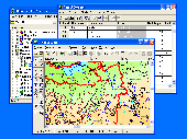
GIS ObjectLand is a universal Geographic Information System for Windows. Key features: - creation of vector-raster maps with arbitrary structure of layers and feature types; - creation of themes. Theme is a user presentation of a map; - control of displaying features depending on the chosen scale; - spatial data input and editing by assigning feature coordinates and...
Category: Business & Finance
Publisher: Radom-T, License: Shareware, Price: USD $99.00, File Size: 24.0 MB
Platform: Windows
HEC-EFM analyses involve: 1) statistical analyses of relationships between hydrology and ecology, 2) hydraulic modeling, and 3) use of Geographic Information Systems (GIS) to display results and other relevant spatial data.
Most features in the main interface of HEC-EFM focus on the first step in this process (statistical analyses). The main interface has four tabs:...
Category: Home & Education / Miscellaneous
Publisher: Hydrologic Engineering Center, License: Freeware, Price: USD $0.00, File Size: 9.0 MB
Platform: Windows
Amazing photos, the most successful, incredible views and precise focuses.
Amazing photos, the most successful, incredible views and precise focuses. There?s no need to tell a lot about the quality of National Geographic?s pictures.
Category: Desktop Enhancements / Screensavers
Publisher: 3d-screensaver-jam.com, License: Freeware, Price: USD $0.00, File Size: 3.4 MB
Platform: Windows, Mac, Vista, 2008

IPSearchLight is a software component used to identify the Geographic location of website visitors, often within a few miles from the exact location. The process utilizes each visitor's IP address; this technique is silent and unintrusive. IPSearchLight is ideal for practical applications like the delivery of localized content, targeted advertising, multi-lingual websites, e-commerce...
Category: Software Development
Publisher: IPSearchLight, License: Freeware, Price: USD $0.00, File Size: 8.5 MB
Platform: Windows

You can think of the Tometa WhereIs service as the Internet's telephone directory. It gives you Information on the geographical location of an IP address based on Internet infrastructure Information With a free SDK, email support and code examples in almost any language WhereIs easily provides Information on the Geographic location of Internet visitors and IP...
Category: Internet
Publisher: Tometa Software, Inc., License: Shareware, Price: USD $9.95, File Size: 2.2 MB
Platform: Windows, Mac, Linux, Palm,
GeoVISTA Studio is an open software development environment designed for geospatial data.
GeoVISTA Studio is an open software development environment designed for geospatial data. Studio is a programming-free environment that allows users to quickly build applications for geocomputation and Geographic visualization.
Studio is a modularly designed interface that allows the integration of various forms of Geographic data to be analyzed and displayed in a dynamic...
Category: Multimedia & Design / Image Editing
Publisher: GeoVista, License: Shareware, Price: USD $0.00, File Size: 0
Platform: Windows
An incredibly easy app to watch and listen to your favorite video and music from around the world without annoying Geographic restrictions. Its interface is designed in an easy manner and also when you register you get 500 MB traffic as a free plan. It is easy to install and use.
Category: Audio / Utilities & Plug-Ins
Publisher: TunnelBear, License: Freeware, Price: USD $0.00, File Size: 13.1 MB
Platform: Windows
CoordTrans converts geographic coordinates between different coordinate systems.
CoordTrans converts Geographic coordinates between different coordinate systems.
CoordTrans is very easy to use, and full of Wizards to help you with more complex tasks.
Convert between UTM, WGS84 and NAD27 / NAD83, and more... almost all projections and datums on Earth are supported. See complete list..
You can convert single coordinates, or...
Category: Business & Finance / Business Finance
Publisher: Franson, License: Shareware, Price: USD $49.00, File Size: 6.5 MB
Platform: Windows
Track your websites growth and forecast internet trends with integrated features like Geographic reporting, and enhanced data mining. SmarterStats 3.x is the perfect solution for individuals, small businesses, and hosting companies who are looking for an enterprise-level web analytics application without the inflated price.
Category: Web Authoring / Web Design Utilities
Publisher: SmarterTools Inc., License: Freeware, Price: USD $0.00, File Size: 8.8 MB
Platform: Windows
Image files, such as pictures or photos, may include metadata Information that most people normally ignore or do not even know it exists. This metadata is a set of fields with very detailed Information about your images, including a description, key words, Geographic Information, Information about the camera, just to name a few. Image Metadata Manager is an...
Category: Multimedia & Design / Digital Media Editors
Publisher: Felipe Martino Gagno Ceotto, License: Shareware, Price: USD $0.00, File Size: 2.0 MB
Platform: Windows
Demonstrates visual representation of scalar values over a grid of geographic positions.
Demonstrates visual representation of scalar values over a grid of Geographic positions. AnalyticSurface supports dynamic scalar data by providing a simple, high throughput rendering pipeline for the application. This demonstrates two unique surface types:
- A dynamic surface representing random altitudes over the Coast of Florida, USA.
- A static surface representing annual...
Category: Home & Education / Teaching Tools
Publisher: NASA, License: Shareware, Price: USD $0.00, File Size: 0
Platform: Windows
T2K Pro integrates the rich world of GIS datasets and transfers your Geographic Information data into Google earth. T2K Pro handles rich data types and access large volumes of Geographic data stored in files and databases; T2K PRO handles raster (imagery), Vector Map data and GPS Tracks/ Waypoints/ Routes. Tiles2kml Pro provides a complete suite of conversion tools to...
Category: Multimedia & Design / Authoring Tools
Publisher: Tiles2kml, License: Demo, Price: USD $90.00, File Size: 20.9 MB
Platform: Windows
MapInfo Professional® is a powerful Microsoft® Windows®–based mapping and Geographic analysis application. Designed to easily visualise the relationships between data and geography, MapInfo Professional 11 makes it faster and easier than ever to create, share and use maps.
Category: Software Development / Misc. Programming
Publisher: Pitney Bowes Software, Inc, License: Shareware, Price: USD $1950.00, File Size: 15.1 MB
Platform: Windows
Appraisal Atlas software included with Appraiser’s Portfolioto uploads the date and location data of your work history to produce a visual map of your entire work history so businesses in the industry can instantly see your Geographic competency!
Appraisal Atlas also uses this Information to generate your personal experience score. Displayed in the AppraisalWorld...
Category: Business & Finance / Database Management
Publisher: AppraisalWorld, Inc., License: Shareware, Price: USD $0.00, File Size: 0
Platform: Windows
World Wind is a collection of components that interactively display 3D Geographic Information within Java applications or applets. Applications and applets use World Wind by placing one or more WorldWindow components in their user interface. The World Wind components are extensible. The API is defined primarily by interfaces, so components can be selectively replaced by...
Category: Multimedia & Design / Graphics Viewers
Publisher: NASA, License: Freeware, Price: USD $0.00, File Size: 73.5 MB
Platform: Windows
The Blue Marble Desktop is the all in one geospatial data management platform for Blue Marble’s popular data transformation tools.The Geographic Calculator and Geographic Transformer reside in the same desktop window along with a Spatial Connect module for working directly with spatial databases. Access all of these available features in a single interface through a combined...
Category: Multimedia & Design / Image Editing
Publisher: Blue Marble Geographics, License: Shareware, Price: USD $7.50, File Size: 191.9 MB
Platform: Windows
Macau GeoGuide PC version, developed and maintained by the Macao Cartography and Cadastre Bureau (DSCC), is an interactive map navigation System running on desktop PC. The main functions are map navigation, feature searching and path finding. The software contains rich Geographic Information and allows the users to explore and search for Macao maps without connecting to the...
Category: Home & Education / Miscellaneous
Publisher: DSCC, License: Freeware, Price: USD $0.00, File Size: 29.5 MB
Platform: Windows
IPSearchLight (www.ipsearchlight.com) for ASP.NET gives you real-time feedback on the Geographic location of website visitors by their IP address alone. The technology is completely unintrusive, yet can often track a person's location to a few miles radius on the planet. Some potential uses: - Localization of website language, content and currency. - Targeted advertising. -...
Category: Internet
Publisher: IPSearchLight, License: Freeware, Price: USD $0.00, File Size: 8.5 MB
Platform: Windows

Computer spyware virus which is also known as adware, is a program or script that secretly gathers Information about you, your computer and online habits and using your internet connection relay it to advertisers and other interested parties. Some forms of computer spyware gather basic Information such as operating System type, browser type, screen size, general...
Category: Security & Privacy / Spyware Removal
Publisher: www.free-adware-spyware-blocker.com, License: Freeware, Price: USD $0.00, File Size: 542.7 KB
Platform: Windows

Go-Liberty software protects you and helps you to surf the Internet, download, chat without being tracked and keep your online activities private. With Go-Liberty 1.0 protect your personal Information, IP address, credit card numbers and Geographic location from online snoops. Protect your computer from hackers and spammers. Go-Liberty is compatible with all the navigators, peer...
Category: Internet
Publisher: The MOBI Web, License: Demo, Price: USD $14.65, File Size: 819.1 KB
Platform: Windows
WhereIsIP is an interesting and powerful Internet tool to help you know the Geographic location of an internet user who you are interested with . You can use it to find where a member of chatroom or email sender even ICQ friend TRULY come from , or where the website you visited is . Simplily provide one IP address , domain name or icq contact list , WhereIsIP will do a quick research in...
Category: Internet / Tools & Utilities
Publisher: Jufsoft, License: Shareware, Price: USD $19.50, File Size: 645.1 KB
Platform: Windows
 Shareware
Auslogics System Information provides you with computer and Windows details, installed devices, running processes and services, memory and CPU usage and other Information. You can explore details of your computer hardware, disk drives, processor, video card and monitor. It is much easier to use and understand than the built-in Windows System Information tool....
Category: Utilities / System Utilities
Publisher: Auslogics Software Ltd Pty, License: Shareware, Price: USD $19.95, File Size: 2.6 MB
Platform: Windows
Frequency Filer is database program designed for people who use a great many different radio frequencies. It is primarily intended for amateur radio operators, shortwave listening enthusiasts, and scanner users. The program makes it easy to keep all of your important frequency Information in one place. Geographic Information can be displayed on a high resolution globe....
Category: Home & Education / Miscellaneous
Publisher: Joel Graffman, License: Shareware, Price: USD $15.00, File Size: 819.2 KB
Platform: Windows