Free Downloads: Geographic Information Systems
IP Address Searcher is a powerful IP Address Search tool that helps you to search IP address, list all IP Address on your network, ping a host, trace IP, get MAC Information, search a ip Geographic location. Features:1).List ALL IP address of PCs on network. 2).Get IP address of a specific host or a website. 3).Get host name of a specific IP address. 4).PING a specific host or a...
Category: Utilities / System Utilities
Publisher: IToolware, Inc., License: Shareware, Price: USD $29.95, File Size: 0
Platform: Windows
 Shareware
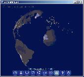
Wandering IPs is geolocation software. Once launched it monitors TCP connections made to or from your PC, identifies remote IP adresses and then tries to determine their Geographic locations. Results are displayed on textured. iluminated accordingly to time zone you're currently in, 3D globe. Apart from locating endpoinds, it can be used to determine the route taken by packets across an...
Category: Internet / Tools & Utilities
Publisher: Marek Jablonski, License: Shareware, Price: USD $12.99, File Size: 1.0 MB
Platform: Windows

TRANSDATpro can prove a helpful tool for professionals, providing them with the possibility to perform coordinate transformations fast and easy by use of the coordinate reference Systems of their choice. TRANSDATpro performs Coordinate Transformations fast and with high accuracy. The coordinate conversion software supports worldwide thousands of Coordinate Systems, geodetic...
Category: Home & Education / Science
Publisher: Killet GeoSoftware Ing.-GbR, License: Shareware, Price: USD $270.00, EUR240, File Size: 5.3 MB
Platform: Windows
Amazing photos, the most successful, incredible views and precise focuses.
Amazing photos, the most successful, incredible views and precise focuses. There?s no need to tell a lot about the quality of National Geographic?s pictures.
Category: Desktop Enhancements / Screensavers
Publisher: 3d-screensaver-jam.com, License: Freeware, Price: USD $0.00, File Size: 3.4 MB
Platform: Windows, Mac, Vista, 2008
The CANVAS 9 Advanced GIS Mapping Edition adds native support for Geographic Information System (GIS) data to Canvas. You can take measurements in Geographic coordinates, import industry standard SHAPE and GeoTIFF files into unlimited numbers of automatically aligned overlapping layers and choose among the following options:2,104 Coordinate Reference Systems67 Operation...
Category: Multimedia & Design / Multimedia App's
Publisher: ACD Systems, License: Shareware, Price: USD $999.95, File Size: 54.2 MB
Platform: Windows

You can think of the Tometa WhereIs service as the Internet's telephone directory. It gives you Information on the geographical location of an IP address based on Internet infrastructure Information With a free SDK, email support and code examples in almost any language WhereIs easily provides Information on the Geographic location of Internet visitors and IP...
Category: Internet
Publisher: Tometa Software, Inc., License: Shareware, Price: USD $9.95, File Size: 2.2 MB
Platform: Windows, Mac, Linux, Palm,
Mapyrus is software to plot Geographic Information System data, plots of points, lines, polygons and labels to PostScript (high resolution, up to A0 paper size), Portable Document Format (PDF), Scalable Vector Graphics (SVG) format and web image output fo
Category: Home & Education / Miscellaneous
Publisher: mapyrus.sourceforge.net, License: Freeware, Price: USD $0.00, File Size: 2.7 MB
Platform: Windows, Mac, Vista
GeoVISTA Studio is an open software development environment designed for geospatial data.
GeoVISTA Studio is an open software development environment designed for geospatial data. Studio is a programming-free environment that allows users to quickly build applications for geocomputation and Geographic visualization.
Studio is a modularly designed interface that allows the integration of various forms of Geographic data to be analyzed and displayed in a dynamic...
Category: Multimedia & Design / Image Editing
Publisher: GeoVista, License: Shareware, Price: USD $0.00, File Size: 0
Platform: Windows
An incredibly easy app to watch and listen to your favorite video and music from around the world without annoying Geographic restrictions. Its interface is designed in an easy manner and also when you register you get 500 MB traffic as a free plan. It is easy to install and use.
Category: Audio / Utilities & Plug-Ins
Publisher: TunnelBear, License: Freeware, Price: USD $0.00, File Size: 13.1 MB
Platform: Windows
Track your websites growth and forecast internet trends with integrated features like Geographic reporting, and enhanced data mining. SmarterStats 3.x is the perfect solution for individuals, small businesses, and hosting companies who are looking for an enterprise-level web analytics application without the inflated price.
Category: Web Authoring / Web Design Utilities
Publisher: SmarterTools Inc., License: Freeware, Price: USD $0.00, File Size: 8.8 MB
Platform: Windows
Demonstrates visual representation of scalar values over a grid of geographic positions.
Demonstrates visual representation of scalar values over a grid of Geographic positions. AnalyticSurface supports dynamic scalar data by providing a simple, high throughput rendering pipeline for the application. This demonstrates two unique surface types:
- A dynamic surface representing random altitudes over the Coast of Florida, USA.
- A static surface representing annual...
Category: Home & Education / Teaching Tools
Publisher: NASA, License: Shareware, Price: USD $0.00, File Size: 0
Platform: Windows
Map Suite™ is a full-featured mapping control that makes it easy for any Microsoft .
Map Suite™ is a full-featured mapping control that makes it easy for any Microsoft .NET developer to add mapping functionality to a Microsoft .NET application quickly and efficiently. Using the intuitive object model, even developers inexperienced in Geographic Information Systems (GIS) can have fully functional maps working in minutes.
The purpose of this guide...
Category: Web Authoring / Web Design Utilities
Publisher: ThinkGeo, License: Shareware, Price: USD $995.00, File Size: 69.1 MB
Platform: Windows
MapInfo Professional® is a powerful Microsoft® Windows®–based mapping and Geographic analysis application. Designed to easily visualise the relationships between data and geography, MapInfo Professional 11 makes it faster and easier than ever to create, share and use maps.
Category: Software Development / Misc. Programming
Publisher: Pitney Bowes Software, Inc, License: Shareware, Price: USD $1950.00, File Size: 15.1 MB
Platform: Windows

IPSearchLight is a software component used to identify the Geographic location of website visitors, often within a few miles from the exact location. The process utilizes each visitor's IP address; this technique is silent and unintrusive. IPSearchLight is ideal for practical applications like the delivery of localized content, targeted advertising, multi-lingual websites, e-commerce...
Category: Software Development
Publisher: IPSearchLight, License: Freeware, Price: USD $0.00, File Size: 8.5 MB
Platform: Windows
Appraisal Atlas software included with Appraiser’s Portfolioto uploads the date and location data of your work history to produce a visual map of your entire work history so businesses in the industry can instantly see your Geographic competency!
Appraisal Atlas also uses this Information to generate your personal experience score. Displayed in the AppraisalWorld...
Category: Business & Finance / Database Management
Publisher: AppraisalWorld, Inc., License: Shareware, Price: USD $0.00, File Size: 0
Platform: Windows
World Wind is a collection of components that interactively display 3D Geographic Information within Java applications or applets. Applications and applets use World Wind by placing one or more WorldWindow components in their user interface. The World Wind components are extensible. The API is defined primarily by interfaces, so components can be selectively replaced by...
Category: Multimedia & Design / Graphics Viewers
Publisher: NASA, License: Freeware, Price: USD $0.00, File Size: 73.5 MB
Platform: Windows
Map Suite Wpf Desktop Edition takes GIS application development for the Windows desktop to a whole new level.Using the intuitive object model, even developers inexperienced in Geographic Information Systems (GIS) can have fully functional maps working in minutes. With blazing fast rendering performance, powerful mapping features and support for the most popular data...
Category: Internet / Misc. Plugins
Publisher: ThinkGeo, License: Shareware, Price: USD $4995.00, File Size: 69.1 MB
Platform: Windows
The Blue Marble Desktop is the all in one geospatial data management platform for Blue Marble’s popular data transformation tools.The Geographic Calculator and Geographic Transformer reside in the same desktop window along with a Spatial Connect module for working directly with spatial databases. Access all of these available features in a single interface through a combined...
Category: Multimedia & Design / Image Editing
Publisher: Blue Marble Geographics, License: Shareware, Price: USD $7.50, File Size: 191.9 MB
Platform: Windows
IPSearchLight (www.ipsearchlight.com) for ASP.NET gives you real-time feedback on the Geographic location of website visitors by their IP address alone. The technology is completely unintrusive, yet can often track a person's location to a few miles radius on the planet. Some potential uses: - Localization of website language, content and currency. - Targeted advertising. -...
Category: Internet
Publisher: IPSearchLight, License: Freeware, Price: USD $0.00, File Size: 8.5 MB
Platform: Windows
Granite XP is a comprehensive data collection and management software offering unmatched flexibility, customization, and ease-of-use to meet the growing needs of the pipeline inspection industry. Built using contemporary Microsoft Visual Studio™ technologies and designed with an asset-based architecture, you can navigate to a particular asset (e.g., pipe segment or manhole) and view all...
Category: Software Development / Help File Utilities
Publisher: CUES, Inc, License: Demo, Price: USD $0.00, File Size: 44.5 MB
Platform: Windows
SWIFT eTraining - SWIFT and international payment Systems module helps explaining the role of SWIFT in international payment Systems and provides detailed Information on the major payment Systems worldwide. The training will enable the participants to see the relation between these payment Systems as well as the drivers for initiatives like SEPA.
Category: Business & Finance / Business Finance
Publisher: Swift, License: Shareware, Price: USD $0.00, File Size: 0
Platform: Windows
Image files, such as pictures or photos, may include metadata Information that most people normally ignore or do not even know it exists. This metadata is a set of fields with very detailed Information about your images, including a description, key words, Geographic Information, Information about the camera, just to name a few. Image Metadata Manager is an...
Category: Multimedia & Design / Digital Media Editors
Publisher: Felipe Martino Gagno Ceotto, License: Shareware, Price: USD $0.00, File Size: 2.0 MB
Platform: Windows
WhereIsIP is an interesting and powerful Internet tool to help you know the Geographic location of an internet user who you are interested with . You can use it to find where a member of chatroom or email sender even ICQ friend TRULY come from , or where the website you visited is . Simplily provide one IP address , domain name or icq contact list , WhereIsIP will do a quick research in...
Category: Internet / Tools & Utilities
Publisher: Jufsoft, License: Shareware, Price: USD $19.50, File Size: 645.1 KB
Platform: Windows
Shareware
TOPOWIN is a state-wide register of the German Topographic Cartographies, the German Basic Cartography and of localities with geo references in different coordinate Systems. It is also a topographic Information system. In the division of planning and execution of economical and scientific projects frequently topographic documents are used. The program TOPOWIN makes...
Category: Home & Education / Miscellaneous
Publisher: Killet GeoSoftware Ing.-GbR, License: Shareware, Price: USD $125.00, EUR110, File Size: 4.5 MB
Platform: Windows
Safir means Software Architecture For Information and Realtime Systems and is an advanced platform for command, control and communication Systems. Safir SDK is designed to meet most kinds of tough software requirements - such as distribution of large amount of data with real-time response times.
Category: Utilities / Misc. Utilities
Publisher: Saab Systems, License: Freeware, Price: USD $0.00, File Size: 85.4 MB
Platform: Windows