Free Downloads: Geographic Marketi
The Blue Marble Desktop is the all in one geospatial data management platform for Blue Marble’s popular data transformation tools.The Geographic Calculator and Geographic Transformer reside in the same desktop window along with a Spatial Connect module for working directly with spatial databases. Access all of these available features in a single interface through a combined...
Category: Multimedia & Design / Image Editing
Publisher: Blue Marble Geographics, License: Shareware, Price: USD $7.50, File Size: 191.9 MB
Platform: Windows
OpenJUMP is an open source Geographic Information System (GIS), it can read and write shapefiles and simple GML files. It has limited support for the display of images and good support for showing data retrieved from WFS and WMS web-services. So you can use it as GIS Data Viewer.OpenJUMP has limits in reading very large data files and has limited support for cartographic projections.
Category: Home & Education / Miscellaneous
Publisher: Jump Pilot Project, License: Shareware, Price: USD $0.00, File Size: 0
Platform: Windows
WhereIsIP is an interesting and powerful Internet tool to help you know the Geographic location of an internet user who you are interested with . You can use it to find where a member of chatroom or email sender even ICQ friend TRULY come from , or where the website you visited is . Simplily provide one IP address , domain name or icq contact list , WhereIsIP will do a quick research in...
Category: Internet / Tools & Utilities
Publisher: Jufsoft, License: Shareware, Price: USD $19.50, File Size: 645.1 KB
Platform: Windows
There has never been a more comprehensive, powerful, all-in-one software solution that provides an easy-to-use and intuitive user interface for digitizing, Geographic referencing, reprojection, tiling, and mosaicking.
Didger solves the problem of combining data files in different coordinate systems, by providing extensive tools to transform the data into one cohesive...
Category: Home & Education / Miscellaneous
Publisher: Golden Software, License: Shareware, Price: USD $0.00, File Size: 0
Platform: Windows
IP Address Searcher is a powerful IP Address Search tool that helps you to search IP address, list all IP Address on your network, ping a host, trace IP, get MAC information, search a ip Geographic location. Features:1).List ALL IP address of PCs on network. 2).Get IP address of a specific host or a website. 3).Get host name of a specific IP address. 4).PING a specific host or a website,...
Category: Utilities / System Utilities
Publisher: IToolware, Inc., License: Shareware, Price: USD $29.95, File Size: 0
Platform: Windows

IPSearchLight is a software component used to identify the Geographic location of website visitors, often within a few miles from the exact location. The process utilizes each visitor's IP address; this technique is silent and unintrusive. IPSearchLight is ideal for practical applications like the delivery of localized content, targeted advertising, multi-lingual websites, e-commerce...
Category: Software Development
Publisher: IPSearchLight, License: Freeware, Price: USD $0.00, File Size: 8.5 MB
Platform: Windows
Geographic databases management and exploitation, attribute-based and spatial queries, several join types, several classification methods, thematic cartography, statistics and geo-statistics, spatial analysis, interpolations, digital elevation models, remote-sensing and image processing, simulation, operational research, interactive metric measurements
Category: Home & Education / Miscellaneous
Publisher: IRD, License: Freeware, Price: USD $0.00, File Size: 14.2 MB
Platform: Windows

IPSearchLight for ASP Classic gives you real-time feedback on the Geographic location of website visitors by their IP address alone. The technology is completely uninvasive, yet can often track a person's location to a few miles radius on the planet. Some potential IPSearchLight uses: Localization of website language, content and currency. Targeted advertising. Preventing...
Category: Internet
Publisher: IPSearchLight, License: Freeware, Price: USD $0.00, File Size: 8.8 MB
Platform: Windows
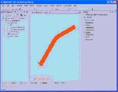
Thuban is an Interactive Geographic Data Viewer with the following features:
- Vector Data Support: Shapefile, PostGIS Layer and OGR
- Raster Data Support: GeoTIFF Layer and GDAL
- Comfortable Map Navigation
- Object Identification and Annotation
- Legend Editor and Classification
- Table Queries and Joins
- Projection Support
- Printing...
Category: Utilities / Misc. Utilities
Publisher: Intevation, License: Shareware, Price: USD $0.00, File Size: 772.9 KB
Platform: Windows
Shape2Earth leverages freely available and easy to use Geographic Information System (GIS) software to create professional visualizations for viewing in GoogleTM Earth.
Main features:
-Convert Any Shapefile to KML - Shape2Earth reprojects your data on the fly
-Apply Thematic Symbology to your Data - Color code to display information
-Present Data in Custom...
Category: Multimedia & Design / Image Editing
Publisher: Google, License: Demo, Price: USD $0.00, File Size: 9.5 MB
Platform: Windows
The ArcGIS Editor for OpenStreetMap is designed to help ArcGIS Desktop users to become active members in the growing community of users building an open and freely available database of Geographic data.
The provided tools allow you to download data from the OSM servers and store it locally in a geodatabase. You can then use the familiar editing environment of ArcGIS Desktop...
Category: Business & Finance / Business Finance
Publisher: ESRI, License: Freeware, Price: USD $0.00, File Size: 3.6 MB
Platform: Windows

New Zealand is notable for its Geographic isolation and extraordinary fauna and flora. Due to the low population New Zealand still looks like the unpolluted paradise with clear shores, crisp waters, pure white snow and lush green foliage. The New Zealand Voyage Free screensaver shows you the amazing views of differrent urban and rural corners of the country. This screensaver will help...
Category: Desktop Enhancements / Screensavers
Publisher: Savers4Free.com, License: Freeware, Price: USD $0.00, File Size: 5.1 MB
Platform: Windows
The CANVAS 9 Advanced GIS Mapping Edition adds native support for Geographic Information System (GIS) data to Canvas. You can take measurements in Geographic coordinates, import industry standard SHAPE and GeoTIFF files into unlimited numbers of automatically aligned overlapping layers and choose among the following options:2,104 Coordinate Reference Systems67 Operation Methods...
Category: Multimedia & Design / Multimedia App's
Publisher: ACD Systems, License: Shareware, Price: USD $999.95, File Size: 54.2 MB
Platform: Windows
The Geospatial Toolkit (GsT) is an NREL-developed map-based software application that integrates resource data and other Geographic information systems (GIS) data for integrated resource assessment. The non-resource, country-specific data for each GsT comes from a variety of agencies within each country as well as from global datasets.
Category: Home & Education / Miscellaneous
Publisher: National Renewable Energy Laboratory, License: Freeware, Price: USD $0.00, File Size: 39.6 MB
Platform: Windows
The AIC is an easy to use, stand-alone photogrammetry product designed to rectify, georeference, and mosaic aerial photographs, satellite images, or raster maps to a Geographic coordinate system. An unlimited number of images can be simultaneously rectified and joined to form a single image mosaic, all in the same process. The AIC can generate and efficiently handle output images of...
Category: Multimedia & Design / Multimedia App's
Publisher: TatukGIS, License: Shareware, Price: USD $290.00, File Size: 5.9 MB
Platform: Windows
The CANVAS 9 Advanced GIS Mapping Edition adds native support for Geographic Information System (GIS) data to Canvas. You can take measurements in Geographic coordinates, import industry standard SHAPE and GeoTIFF files into unlimited numbers of automatically aligned overlapping layers and choose among the following options:·2,104 Coordinate Reference Systems·67...
Category: Multimedia & Design / Multimedia App's
Publisher: ACD Systems, License: Shareware, Price: USD $999.95, File Size: 51.9 MB
Platform: Mac, PPC
HEC-EFM analyses involve: 1) statistical analyses of relationships between hydrology and ecology, 2) hydraulic modeling, and 3) use of Geographic Information Systems (GIS) to display results and other relevant spatial data.
Most features in the main interface of HEC-EFM focus on the first step in this process (statistical analyses). The main interface has four tabs: Properties,...
Category: Home & Education / Miscellaneous
Publisher: Hydrologic Engineering Center, License: Freeware, Price: USD $0.00, File Size: 9.0 MB
Platform: Windows
IPSearchLight (www.ipsearchlight.com) for ASP.NET gives you real-time feedback on the Geographic location of website visitors by their IP address alone. The technology is completely unintrusive, yet can often track a person's location to a few miles radius on the planet. Some potential uses: - Localization of website language, content and currency. - Targeted advertising. -...
Category: Internet
Publisher: IPSearchLight, License: Freeware, Price: USD $0.00, File Size: 8.5 MB
Platform: Windows
Appraisal Atlas software included with Appraiser’s Portfolioto uploads the date and location data of your work history to produce a visual map of your entire work history so businesses in the industry can instantly see your Geographic competency!
Appraisal Atlas also uses this information to generate your personal experience score. Displayed in the AppraisalWorld Directory,...
Category: Business & Finance / Database Management
Publisher: AppraisalWorld, Inc., License: Shareware, Price: USD $0.00, File Size: 0
Platform: Windows
Versamap draws outline maps on 16 map projections.
Versamap draws outline maps on 16 map projections. The program allows users to print publication quality maps; and to export maps in vector graphic (WMF, CGM, DXF, ASCII) and bitmapped (BMP) formats. Versamap is supplied with digital maps from the Versamap Micro World Database, a world map with 220,000 points in 10 Geographic features. Versamap may be ordered with more detailed digital...
Category: Home & Education / Genealogy
Publisher: Versamap, License: Shareware, Price: USD $30.00, File Size: 4.0 MB
Platform: Windows
Roof COST Estimator contains industry standard user-modifiable unit cost data for all cost categories covering roofing installation as well as local city indexes that automatically adjust costs for local Geographic area. Roof COST Estimator instantly creates user-modifiable, on-screen or printed estimate reports including price quotation. Use Roof COST Estimator as an estimating and...
Category: Business & Finance / Business Finance
Publisher: CPR, Inc., License: Shareware, Price: USD $0.00, File Size: 0
Platform: Windows
Mapyrus is software to plot Geographic Information System data, plots of points, lines, polygons and labels to PostScript (high resolution, up to A0 paper size), Portable Document Format (PDF), Scalable Vector Graphics (SVG) format and web image output fo
Category: Home & Education / Miscellaneous
Publisher: mapyrus.sourceforge.net, License: Freeware, Price: USD $0.00, File Size: 2.7 MB
Platform: Windows, Mac, Vista
T2K Pro integrates the rich world of GIS datasets and transfers your Geographic information data into Google earth. T2K Pro handles rich data types and access large volumes of Geographic data stored in files and databases; T2K PRO handles raster (imagery), Vector Map data and GPS Tracks/ Waypoints/ Routes. Tiles2kml Pro provides a complete suite of conversion tools to easily...
Category: Multimedia & Design / Authoring Tools
Publisher: Tiles2kml, License: Demo, Price: USD $90.00, File Size: 20.9 MB
Platform: Windows

You can think of the Tometa WhereIs service as the Internet's telephone directory. It gives you information on the geographical location of an IP address based on Internet infrastructure information With a free SDK, email support and code examples in almost any language WhereIs easily provides information on the Geographic location of Internet visitors and IP addresses. Cutting edge...
Category: Internet
Publisher: Tometa Software, Inc., License: Shareware, Price: USD $9.95, File Size: 2.2 MB
Platform: Windows, Mac, Linux, Palm,
World Wind is a collection of components that interactively display 3D Geographic information within Java applications or applets. Applications and applets use World Wind by placing one or more WorldWindow components in their user interface. The World Wind components are extensible. The API is defined primarily by interfaces, so components can be selectively replaced by alternative...
Category: Multimedia & Design / Graphics Viewers
Publisher: NASA, License: Freeware, Price: USD $0.00, File Size: 73.5 MB
Platform: Windows