Free Downloads: Geology
License: All | Free
The package Fabric8 for Windows consists of 30 strong computer programs for the solution of various problems in structural Geology, petrofabrics, neotectonics, rock mechanics, engeneering Geology, physical geography, geophysics, and other fields of earth sciences.
Category: Home & Education / Miscellaneous
Publisher: Geological Software, License: Shareware, Price: USD $594.72, File Size: 55.3 MB
Platform: Windows
JointMetriX3D is an innovative system for measuring and assessing rock and terrain surfaces used in geotechnics, engineering Geology, and surveying. It delivers outstanding detailed 3D images and provides 3D software for getting measurements.
The system has significant influence on safety when applied in tunnelling, mining, terrain assessments, or various documentation purposes as...
Category: Software Development / Help File Utilities
Publisher: 3GSM, License: Demo, Price: USD $0.00, File Size: 2.3 KB
Platform: Windows
Gemcom Surpac™ is a popular Geology and mine planning software suite, supporting open pit and underground operations and exploration projects in more than 110 countries. The program delivers efficiency and accuracy through ease-of-use, powerful 3D graphics and workflow automation that can be aligned to company-specific processes and data flows.
Using a modern data...
Category: Multimedia & Design / Multimedia App's
Publisher: Gemcom Software International Inc., License: Demo, Price: USD $0.00, File Size: 121.0 MB
Platform: Windows
Geosoft's Target™ for ArcGIS software, built on Geosoft's industry-leading Oasis montaj™ software, simplifies the visualization and analysis of subsurface drillhole and borehole Geology data within your ESRI GIS environment.
Target for ArcGIS processes large volume drillhole data with ease and generates professional-quality maps for presentation, adding...
Category: Software Development / Misc. Programming
Publisher: Geosoft Inc., License: Shareware, Price: USD $0.00, File Size: 0
Platform: Windows
Gemcom Surpac™ is a popular Geology and mine planning software suite, supporting open pit and underground operations and exploration projects in more than 110 countries. The program delivers efficiency and accuracy through ease-of-use, powerful 3D graphics and workflow automation that can be aligned to company-specific processes and data flows.
Surpac addresses all the...
Category: Multimedia & Design / Multimedia App's
Publisher: Surpac Minex Group, License: Demo, Price: USD $0.00, File Size: 121.0 MB
Platform: Windows
A great and interesting program.
A great and interesting program. It has a easy to use interface. Oriented System GeoOS Geology. It is a distribution-oriented earth science in general. It turns your desktop in a cube. It offers a great view over your icons, and a greater view from the space.
Category: Desktop Enhancements / Shell & Desktop Managers
Publisher: yamal pineda, License: Shareware, Price: USD $0.00, File Size: 33.3 MB
Platform: Windows
This is another series of TrendySavers.
This is another series of TrendySavers.com's free nature screensavers. In this screensaver you will find 18 high quality images of nature pictures.Within the various uses of the word today, "nature" may refer to the general realm of various types of living plants and animals, and in some cases to the processes associated with inanimate objects ? the way that particular types of things...
Category: Desktop Enhancements / Screensavers
Publisher: TrendySavers, License: Freeware, Price: USD $0.00, File Size: 3.5 MB
Platform: Windows
CAP4 is a general multivariate analysis package for Windows PCs, with excellent graphics.
CAP4 is a general multivariate analysis package for Windows PCs, with excellent graphics. It is easy to use and affordable. It offers all the analytical techniques commonly used by community ecologists, and all other fields of research that use multivariate methods, including biology, Geology, archaeology, anthropology, economics and sociology.
Category: Business & Finance / Business Finance
Publisher: PISCES Conservation Ltd, License: Shareware, Price: USD $298.93, File Size: 11.4 MB
Platform: Windows
Blueback Toolbox is a new and useful software that you can easy get it on your computers.
Blueback Toolbox is a new and useful software that you can easy get it on your computers. A powerful software that you can get it for free.
The Blueback Toolbox suite includes the following 4 different modules:
- Blueback Geophysics Toolbox
- Blueback Geology Toolbox
- Blueback Project Management Toolbox
- Blueback Reservoir Engineering Toolbox
Category: Multimedia & Design / Multimedia App's
Publisher: Blueback Reservoir AS, License: Freeware, Price: USD $0.00, File Size: 6.0 MB
Platform: Windows
Coltop3D is a full featured LIDAR data processing and analyzing software for geologists.
Coltop3D is a full featured LIDAR data processing and analyzing software for geologists. It is designed for the interactive analysis of orientation of airborne and terrestrial LiDAR data and digital elevation models (DEM) at local and regional scale. The software is capable of many applications; it is optimized for data visualization and structural analysis in different domains:
-...
Category: Business & Finance / Applications
Publisher: Terranum, License: Shareware, Price: USD $2522.02, File Size: 3.7 MB
Platform: Windows
Encom PA provides advanced interactive visualisation in one-, two-, and three-dimensions with support for most geophysical and geological information types used by companies to cover regional exploration through to mine development.
Encom PA is an interactive geophysical interpretation tool for the analysis of data in point, profile, drillholes, grid, RGB image, remote sensing, GIS...
Category: Multimedia & Design / Graphics Viewers
Publisher: Encom Technology Pty Ltd, License: Freeware, Price: USD $0.00, File Size: 36.5 MB
Platform: Windows
A photo slideshow screen saver with beautiful NASA/JPL radar images of geological formations around the world, including volcanoes, rivers, mountains, and more. The false-color palettes used in these images make them beautiful to look at as well as interesting to study. All photos are 800x600 high-quality images. (a 1024x768 version is also available, see our web site). Other screen saver...
Category: Desktop Enhancements / Screensavers
Publisher: Cottonwood Software, License: Freeware, Price: USD $0.00, File Size: 1.7 MB
Platform: Windows
My World GIS™ is a Geographic Information System (GIS) designed specifically for use in middle school through college classrooms. It has been developed by the GEODE Initiative at Northwestern University as part of a research program on the adaptation of scientific visualization and data analysis tools to support inquiry-based learning.
My World gives learners access to...
Category: Home & Education / Miscellaneous
Publisher: Northwestern University, License: Shareware, Price: USD $59.00, File Size: 100.2 MB
Platform: Windows
ROCK3D is a program for stability analysis of removable blocks on planar rock slopes.
ROCK3D is a program for stability analysis of removable blocks on planar rock slopes. It identifies and analyses all the blocks that have formed under each kinematic mode. Once the geometry of the rock blocks has been identified, the bolt forces necessary to reach a required safety factor are calculated. The structural Geology data collection is carried out through the introduction of...
Category: Multimedia & Design / Multimedia App's
Publisher: geo&soft, License: Demo, Price: USD $0.00, File Size: 3.9 MB
Platform: Windows
SplineCalc is multipurpose scientific calculator for implementation of various mathematical operations with maps (grids), data tables, lines, polygons and numbers. You can use arithmetical and logical operations with any above data types. It is possible to specify some surface with usage analytical expression or to load it from data file of various popular formats. After you can calculate...
Category: Home & Education / Mathematics
Publisher: GeoSpline.com, License: Shareware, Price: USD $75.00, File Size: 542.7 KB
Platform: Windows
 Shareware
Well Logger software lets you create soil boring logs and well construction diagrams. It boasts a simple, yet robust, user interface that features customizable layouts, user-definable fill patterns, adjustable scaling, and print preview. Well Logger has an easy-to-use spreadsheet interface, with drop-down lookup boxes to simplify data entry for each borehole. Entry information includes borehole...
Category: Multimedia & Design
Publisher: Porpoise Media, License: Shareware, Price: USD $299.00, File Size: 7.7 MB
Platform: Windows
Golden Al-Wafi Translator 6.0 is an English/Arabic translation software for advanced users and professional translators. Expanded and specialized dictionaries and multi-document translation makes this software suitable for advanced translation purposes.
FEATURES
- Fast and accurate translation
- New translation engine
- Translates thousands of words in...
Category: Home & Education / Language
Publisher: ATA Software Technology Ltd, License: Commercial, Price: USD $180.00, File Size: 0
Platform: Windows
Shareware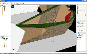
Using VisLog, the user will be able to enter borehole information including but not limited to their depth, coordinates, ground water level, etc. and have a three dimensional interactive view of the underground subject project. The ultimate aim of VisLog is to help users with making an image of the soil layers close to real condition. Input data can be taken from gINT, the most widely used...
Category: Home & Education / Science
Publisher: Novo Tech Software Ltd., License: Shareware, Price: USD $499.00, File Size: 5.5 MB
Platform: Windows
The Output Tool version 2 brings a new dimension to gINT Output, by allowing you to batch output reports from an easy to use interface - significantly improving work flow and efficiency.
Key Features
- Configure and output (PDF, Raster, Preview or Print) multiple reports grouped by Key Set (PointID, Sample etc), by each Report, or by Range Filter (such as...
Category: Business & Finance / Business Finance
Publisher: Datgel, License: Shareware, Price: USD $400.00, File Size: 28.1 MB
Platform: Windows
An Australian photo collection of 1400 high-quality images with a distinctly Australian flavour and education focus that will enhance the quality of your desktop publishing as well as multimedia and web pages. for Desktop Publishing and Multimedia.
Australian Photo Library Deluxe features 44 categories including Animals, Architecture, Astronomy, Autumn, Beaches, Bicentenary, Birds,...
Category: Multimedia & Design / Multimedia App's
Publisher: Edalive, License: Demo, Price: USD $0.00, File Size: 3.2 MB
Platform: Windows, Mac
In areas where the geological structures are approximately two-dimensional (2D), conventional 2D electrical imaging surveys have been successfully used. The main limitation of such surveys is probably the assumption of a 2D structure. In areas with complex structures, there is no substitute for a fully 3D survey. This program is designed to invert data collected with a rectangular grid of...
Category: Multimedia & Design / Image Editing
Publisher: geoelectrical, License: Shareware, Price: USD $5100.00, File Size: 10.7 MB
Platform: Windows
This universal software package for the analysis of signals and time series data of any kindwas developed in cooperation with different research institutes. Possible fields of application include the analysis of biological and physiological systems, mechanical vibrations, electromagnetic signals, epidemiological studies, time series in Geology, financial management, economy and many...
Category: Business & Finance / Applications
Publisher: ixellence GmbH, License: Shareware, Price: USD $979.88, File Size: 2.4 MB
Platform: Windows
License: All | Free