Free Downloads: Geotechnical Software
Rapid Geotechnical Reporting has been designed to minimize the amount of time required to generate Geotechnical engineering reports and to maximize the flexibility of the final report. A variety of reports can be created, the program currently comes with templates for conventional shallow and deep foundations. More templates are always being added and we welcome your suggestions.
Category: Multimedia & Design / Multimedia App's
Publisher: GAEA Technologies, License: Shareware, Price: USD $0.00, File Size: 0
Platform: Windows
FLAC3D is a numerical modeling code for advanced Geotechnical analysis of soil, rock, and structural support in three dimensions.
FLAC3D is used in analysis, testing, and design by Geotechnical, civil, and mining engineers. It is designed to accommodate any kind of Geotechnical engineering project where continuum analysis is necessary.
Category: Home & Education / Science
Publisher: Itasca Consulting Group, Inc., License: Shareware, Price: USD $18000.00, File Size: 80.1 MB
Platform: Windows
GEO5 is a suite of programs for geotechnical analysis.
GEO5 is a suite of programs for Geotechnical analysis. It includes individual programs that are closely linked to each other and run in the same environment. Each program solves a specific Geotechnical problem.
Analytical methods of computation (e.g. slope stability, sheeting design) allow users to design and check structures quickly and efficiently. The designed structure...
Category: Multimedia & Design / Image Editing
Publisher: Fine LTD, License: Shareware, Price: USD $1100.00, File Size: 1.1 MB
Platform: Windows
Midas GTS is a Geotechnical and Tunnel analysis System, based on state-of-the-art finite element and graphical technology.
Midas GTS enables the engineers to intuitively generate complex Geotechnical models. Outstanding geometrical modelling and meshing features are complemented by powerful analysis capabilities and a fast Multi-frontal solver able to handle large 3D...
Category: Business & Finance / Applications
Publisher: MIDAS Information Technology Co., Ltd, License: Shareware, Price: USD $0.00, File Size: 0
Platform: Windows
GEF is an acronym for Geotechnical Exchange Format.
GEF is an acronym for Geotechnical Exchange Format. GEF facilitates a structured method for passing data between phases in the evolution of experiments, from measurement via analysis and archiving to report. This website will present the visitor with information about the format, tips and tools for creating GEF files and Software for the common day use of GEF files.
Category: Utilities / Misc. Utilities
Publisher: GEF, License: Freeware, Price: USD $0.00, File Size: 9.8 MB
Platform: Windows
This is a Software for the computation of limit load in loose soils or rock, according Terzaghi, Meyerhof, Hansen, Vesic, Brinch-Hansen, Richards, the computation of bearing capacity factors (according to the instructions for the Geotechnical design in seismic areas - Italian Association of Geotechnical Engineering). The settlements can be calculated at any point either...
Category: Business & Finance / Business Finance
Publisher: geostru, License: Shareware, Price: USD $327.62, File Size: 13.8 MB
Platform: Windows
GeoUtility - Software collection, support for the professionals working in geological and Geotechnical fields.
Software for measurement units conversion, also realizes the conversion for geographical coordinates.
Thrust computation in both static and dynamic conditions.
Category: Audio / Utilities & Plug-Ins
Publisher: Geostru Software, License: Shareware, Price: USD $99.00, File Size: 64.4 MB
Platform: Windows
LogPlot Software has been used by geoscientists since 1983 to display their Geotechnical, environmental, geophysical, mud/gas, and mining data as a graphic boring log.
Compile the data into the design at any vertical scale for single-page, multi-page, or continuous logs. Distribute the free LogView program with your logs so your clients can view and print your LogPlot...
Category: Multimedia & Design / Multimedia App's
Publisher: RockWare, Inc., License: Shareware, Price: USD $699.00, File Size: 11.9 MB
Platform: Windows
 Shareware
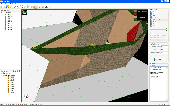
Using VisLog, the user will be able to enter borehole information including but not limited to their depth, coordinates, ground water level, etc. and have a three dimensional interactive view of the underground subject project. The ultimate aim of VisLog is to help users with making an image of the soil layers close to real condition. Input data can be taken from gINT, the most widely used...
Category: Home & Education / Science
Publisher: Novo Tech Software Ltd., License: Shareware, Price: USD $499.00, File Size: 5.5 MB
Platform: Windows
LimitState:GEO is the revolutionary Geotechnical stability analysis Software that can be used to rapidly determine the critical failure mechanism and margin of safety for any type of problem, including those involving:
* slope stability
* retaining walls
* deep excavations
* reinforced earth
* gabion walls
* foundations
* rock...
Category: Multimedia & Design / Multimedia App's
Publisher: LimitState Ltd, License: Shareware, Price: USD $3600.00, File Size: 40.4 MB
Platform: Windows
Shareware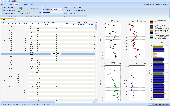
NovoCPT is designed for processing CPT files and calculating soil parameters such as friction angle, relative density, unit weight, fines content, shear wave velocity, Gmax, N60, clay sensitivity, OCR, undrained shear strength, soil behavior type (SBT), Ic, at-rest earth pressure coefficient Ko and ... Soil Behavior Type: 1- Robertson 1990 2- Jefferies & Been 2004...
Category: Home & Education / Science
Publisher: Novo Tech Software Ltd., License: Shareware, Price: USD $549.00, File Size: 3.8 MB
Platform: Windows
This is a finite element package intended for three-dimensional analysis of deformation and stability in Geotechnical engineering. The 64-bit calculation kernel is only available for Plaxis 3DFoundation VIP users. The 64-bit calculation kernel only works with Plaxis 3DFoundation version 2.2. Please make sure that 3DFoundation Version 2.2 is installed prior to installing the 64-bit...
Category: Business & Finance / Applications
Publisher: Plaxis BV, License: Shareware, Price: USD $0.00, File Size: 2.8 MB
Platform: Windows
AGS Toolkit
Equips Geotechnical and geoenvironmental practitioners to validate AGS files and use them in Excel
Quickly validate AGS 3.1 and AGS 4 files and convert them to the Excel format
Bentley's AGS Toolkit checks any number of AGS files at the same time, to:
-Detect file errors
-Find conditions that could compromise data quality
-Find...
Category: Business & Finance / MS Office Addons
Publisher: Bentley Systems, Incorporated, License: Freeware, Price: USD $0.00, File Size: 7.9 MB
Platform: Windows
The INSITU program interprets statical and dynamical geotechnical in situ tests.
The INSITU program interprets statical and dynamical Geotechnical in situ tests. In order to interpret the SPT tests, the program utilises the main correlations that are normally used to determine the Geotechnical parameters of a soil.
One should enter the geometrical and Geotechnical parameters pertaining to the stratigraphy surveyed trough drilling and the...
Category: Business & Finance / Applications
Publisher: GEOSoft, License: Shareware, Price: USD $741.57, File Size: 3.9 MB
Platform: Windows
GeoStudio 2007 is an integrated powerful tool for running the leading suite of Geotechnical modeling Software products: SLOPE/W, SEEP/W, SIGMA/W, QUAKE/W, TEMP/W, CTRAN/W, AIR/W and VADOSE/W. Geo studio is primarily used for analyzing the stability of natural and man-made earth slopes, but can also be used as a common tendency when using such powerful modeling Software to...
Category: Multimedia & Design / Image Editing
Publisher: GEO-SLOPE International Ltd., License: Shareware, Price: USD $995.00, File Size: 69.9 MB
Platform: Windows
Shareware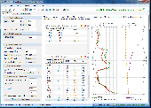
NovoSPT is designed for analyzing Standard Penetration Test (SPT/ DCPT) blow counts and correlating N to soil engineering properties using about 285 formulas. The following features are incorporated: - All corrections factors including rod length, sampling method and borehole diameter, depth, correction for ground water table - Bearing Capacity - Wildcat & DCP penetrometer modules -...
Category: Home & Education / Science
Publisher: Novo Tech Software Ltd., License: Shareware, Price: USD $580.00, File Size: 11.6 MB
Platform: Windows, iPhone, iPod
Safe is a program designed to carry out finite element computations for a wide range of Geotechnical problems. The program enables the user to study the soil stresses and strains and deformations through one or more sequences of events. The events may include excavation or filling, insertion or removal of nodal restraints, application or removal of loads, or changes in material...
Category: Business & Finance / Applications
Publisher: Oasys Ltd., License: Shareware, Price: USD $5387.00, File Size: 17.2 MB
Platform: Windows
The GEOTEC Office package, developed for Geotechnical and design engineering, contains a suite of five programs and associated tools to assist you in analyzing raft foundations, drawing soil layers, analyzing piles, solving soil problems, and it even includes a word processing program for your project data.
The first program included in the suite is EPLA and this program...
Category: Business & Finance / Business Finance
Publisher: GEOTEC Software, License: Freeware, Price: USD $0.00, File Size: 0
Platform: Windows
NovoLiq is designed as a very flexible and comprehensive soil liquefaction analysis Software which can compare more than 10 different methods. NovoLiq covers the following field tests: -Standard Penetration Test (SPT) -Becker Penetration Test (BPT) -Shear Wave Velocity (Vs) Soil resistance (CRR) is calculated based on: -Japanese Bridge Code -Chinese Code -Seed et...
Category: Home & Education / Science
Publisher: Novo Tech Software Ltd., License: Shareware, Price: USD $0.00, CAD690, File Size: 7.2 MB
Platform: Windows
3DEC simulates the response of discontinuous media (such as jointed rock) that is subject to either static or dynamic loading.
3DEC is a numerical modeling code for advanced Geotechnical analysis of soil, rock, and structural support in three dimensions.
Category: Multimedia & Design / Image Editing
Publisher: Itasca Consulting Group, Inc., License: Shareware, Price: USD $0.00, File Size: 11.3 MB
Platform: Windows
CRISP2D for Windows comprises Pre- and Post-Processing Graphical User Interfaces (GUIs), the finite element analysis program and a dedicated spreadsheet utility for printing data. The Pre-Processor offers an intuitive, interactive environment in which analyses can be quickly and easily created and viewed. The Post-Processor operates in a similar environment, incorporating interactive data...
Category: Home & Education / Science
Publisher: The CRISP Consortium Ltd, License: Freeware, Price: USD $0.00, File Size: 34.2 MB
Platform: Windows
Shareware
Well Logger Software lets you create soil boring logs and well construction diagrams. It boasts a simple, yet robust, user interface that features customizable layouts, user-definable fill patterns, adjustable scaling, and print preview. Well Logger has an easy-to-use spreadsheet interface, with drop-down lookup boxes to simplify data entry for each borehole. Entry information includes...
Category: Multimedia & Design
Publisher: Porpoise Media, License: Shareware, Price: USD $299.00, File Size: 7.7 MB
Platform: Windows
Advanced capabilities include rapid input, e.
Advanced capabilities include rapid input, e.g., typing "f to m sa" will pop out "fine to medium sand." The abbreviation list can be personalized by the user. Automatic depth generation, boilerplate, and spell check make the input fast and enjoyable. The average time to learn the program is 15 minutes. The average time to generate a log is 5 minutes. All the symbols and soil...
Category: Business & Finance / Business Finance
Publisher: CivilTech Software, License: Shareware, Price: USD $600.00, File Size: 895.6 KB
Platform: Windows
CPTest© forms the Windows based CPT acquisition Software recorded with the Geomil GME 500 data acquisition systems, both for the 19" industrial built-in as well as for the portable IP 65 version.
The application provides a versatile and easy to use recording tool for mechanical as well as electrical Cone Penetration Tests (CPT) and Piezocone Tests (CPTU). Data from add-on...
Category: Business & Finance / Business Finance
Publisher: GeoMil Equipment B.V., License: Freeware, Price: USD $0.00, File Size: 15.6 MB
Platform: Windows
Open Mind Solutions provides the most flexible and adaptable standards management system Software solutions for your business. Quality Management Software, Environmental Management Software, HACCP Software, Health and Safety management Software, 1 CFR Part 11 Compliant, Business process management Software, Capa Software, Compliance Management...
Category: Business & Finance / Project Management
Publisher: OPEN MIND SOLUTIONS, License: Demo, Price: USD $280.00, File Size: 29.1 MB
Platform: Windows