Free Downloads: Gis For Water Distribution
Map Suite Wpf Desktop Edition takes Gis application development for the Windows desktop to a whole new level.Using the intuitive object model, even developers inexperienced in Geographic Information Systems (Gis) can have fully functional maps working in minutes. With blazing fast rendering performance, powerful mapping features and support for the most popular data formats, Map...
Category: Internet / Misc. Plugins
Publisher: ThinkGeo, License: Shareware, Price: USD $4995.00, File Size: 69.1 MB
Platform: Windows
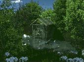
The Water Garden Screen Saver is a virtual Water garden with flowing Water, birds, butterflies, and several varieties of Koi. Advanced 3D graphics, true Water physics, sound effects, and detailed 3D plants that sway in the wind provide a surprisingly realistic experience. The registered version includes four Water gardens, adjustable zoom and camera...
Category: Desktop Enhancements / Screensavers
Publisher: Idea Spectrum, License: Shareware, Price: USD $9.95, File Size: 24.3 MB
Platform: Windows
ArcGIS Workflow Manager (formerly Job Tracking for ArcGIS [JTX]) is an extension to ArcGIS Desktop and ArcGIS Server that lets organizations develop and enforce standard, repeatable Gis workflows across the enterprise.
Workflow Manager greatly improves the efficiency of Gis operations by organizing and automating the relationships between the activities in a Gis...
Category: Home & Education / Miscellaneous
Publisher: ESRI, License: Shareware, Price: USD $2500.00, File Size: 1.1 MB
Platform: Windows
AEGIS– the leading GIS software in UK secondary schools.
AEGIS– the leading Gis software in UK secondary schools.
One-off software purchase and free upgrades – no subscriptions.
Brings industry-standard Gis maps to the classroom – Goad town plans, large-scale OS MasterMaps.
Try before you buy with the free AEGIS Viewer download.
Free materials: resources, help sheets,...
Category: Home & Education / Miscellaneous
Publisher: AU Enterprises Limited, License: Shareware, Price: USD $0.00, File Size: 0
Platform: Windows
My World Gis™ is a Geographic Information System (Gis) designed specifically for use in middle school through college classrooms. It has been developed by the GEODE Initiative at Northwestern University as part of a research program on the adaptation of scientific visualization and data analysis tools to support inquiry-based learning.
My World gives learners...
Category: Home & Education / Miscellaneous
Publisher: Northwestern University, License: Shareware, Price: USD $59.00, File Size: 100.2 MB
Platform: Windows
Tankless water heater toolbar for Internet Explorer.
Tankless Water heater toolbar for Internet Explorer. Tankless Water heater toolbar for Internet Explorer. Find a tankless hot Water heater that can save your energy bill and cold shower syndrome. Get an on demand tankless Water heater today and eliminate your old, inefficient hot Water tank. Discover tankless hot Water heaters directly from your browser...
Category: Internet / Browsers
Publisher: Tankless Water Heater, License: Freeware, Price: USD $0.00, File Size: 1.1 MB
Platform: Windows
ArcGIS Explorer is a free, downloadable Gis viewer that gives you an easy way to explore, visualize and share Gis information. ArcGIS Explorer adds value to any Gis because it helps you deliver your authoritative data to a broad audience.
The ArcGIS Explorer Desktop Current User setup is intended for users who do not have administrator access on their computers and...
Category: Desktop Enhancements / Shell & Desktop Managers
Publisher: Environmental Systems Research Institute, Inc., License: Freeware, Price: USD $0.00, File Size: 94.0 MB
Platform: Windows
Christine-GIS is a useful, easy-to-use tool that brings geographic information to your desktop.
Christine-Gis is a useful, easy-to-use tool that brings geographic information to your desktop. Christine gives you the power to visualize, explore, query and analyze data spatially. A key feature of Christine is that it's easy to load tabular data, such as dBASE files and data from database servers.
Category: Home & Education / Miscellaneous
Publisher: christine-gis.com, License: Shareware, Price: USD $0.00, File Size: 0
Platform: Windows
Quantum Gis provides a continously growing number of capabilities provided by core functions and plugins. You can visualize, manage, edit, analyse data, and compose printable maps. QGIS is an official project of the Open Source Geospatial Foundation (OSGeo). It runs on Linux, Unix, Mac OSX, and Windows and supports numerous vector, raster, and database formats and functionalities.
Category: Home & Education / Miscellaneous
Publisher: qgis.org, License: Freeware, Price: USD $0.00, File Size: 92.2 MB
Platform: Windows
 Shareware
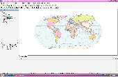
AvisMap Desktop Professional 5 is a professional desktop Gis software for map editing, managing, analysis attribute data, aid decision-making transactions and output map, print tables, 3D modeling, and other functions. As a complete analysis management tool, AvisMap Despro 5 is applicable in land management, forestry, electric power, telecom, traffic, city pipe network, resource...
Category: Multimedia & Design / Graphics Viewers
Publisher: AvisMap GIS Technologies, License: Shareware, Price: USD $499.00, File Size: 22.2 MB
Platform: Windows
Run Car on Water Toolbar - The Newst Water Car Updates and News.
Run Car on Water Toolbar - The Newst Water Car Updates and News. Get information on new ater car plans and do it yourself kits. Learn how to run your car on Water. Get industry news, tips tricks and links to the best run your car on Water sites.
Category: Internet / Browsers
Publisher: ASC Network, License: Freeware, Price: USD $0.00, File Size: 1.1 MB
Platform: Windows
ArcGIS Explorer Desktop is a free Gis viewer that gives you an easy way to explore, visualize, and share Gis information. ArcGIS Explorer adds value to any Gis because it helps you deliver your authoritative data to a broad audience.
Easy and intuitive to use it's easy for anyone to begin working with ArcGIS Explorer, with its intuitive and easy to use...
Category: Home & Education / Miscellaneous
Publisher: Environmental Systems Research Institute, Inc., License: Freeware, Price: USD $0.00, File Size: 100.5 MB
Platform: Windows
This water screensaver will be a welcome retreat throughout your busy day.
This Water screensaver will be a welcome retreat throughout your busy day.
Beautiful mountain lakes with rippling Water and animated ducks, geese, and birds create a peaceful mood and a sense of well being.
Includes nine different scenes, sounds, music and more!
By Water Screensaver - a breath taking collection of beautiful lake...
Category: Desktop Enhancements / Screensavers
Publisher: Delfyn Software, License: Shareware, Price: USD $10.00, File Size: 2.0 MB
Platform: Windows
"Water Mill" - Animated Desktop Wallpaper by EleFun Multimedia.
"Water Mill" - Animated Desktop Wallpaper by EleFun Multimedia. Do you enjoy your desktop having beautiful wallpaper? Just have a look at the Animated Desktop Wallpaper "Water Mill". Don?t you think that the gentle murmur of Water and slowly turning wheels of the Water-mill help you to relax? Water is flowing slowly, and the wheel of the...
Category: Desktop Enhancements / Wallpaper
Publisher: Elefun Multimedia, License: Shareware, Price: USD $14.95, File Size: 4.7 MB
Platform: Windows
Shareware
Total Gis Converter is an affordable converter of Gis files. It converts AEP, GRD, ADF, E00, FLT, APR, SHP, DXF, BT, TOC, RT1, DEM, DLG, ECW, IMG, DGF, GML, SID, MIF, TAB, WOR, DNG, DDF, BIL, TIF, JPEG, TTKPS, TTKGP, TTKLS, LFT, PFT, and TFT files. The target formats are TIFF, PNG, JPEG, BMP. The program can scale your Gis files to optimize their size. Besides, it can slice...
Category: Multimedia & Design / Graphics Viewers
Publisher: Softplicity, License: Shareware, Price: USD $99.90, File Size: 7.6 MB
Platform: Windows
InstantAtlas™ DeskTop, a product developed by GeoWise and which you can buy from ESRI (UK), enables information analysts and Gis professionals to create highly-interactive web solutions that combine statistics and Gis data to improve visualisation, enhance communication, and engage people in more informed decision making.
InstantAtlas DeskTop is quick and easy...
Category: Multimedia & Design / Multimedia App's
Publisher: GeoWise, License: Demo, Price: USD $0.00, File Size: 552.0 KB
Platform: Windows
PocketGIS is a powerful mobile Geographical Information System (Gis) for field data capture which can display and edit map geometry and attributes. PocketGIS brings real Gis functionality to highly portable handheld devices which are lightweight, convenient and have a long battery life.
Category: Utilities / Misc. Utilities
Publisher: Pocket Systems Ltd, License: Shareware, Price: USD $499.00, File Size: 42.8 MB
Platform: Windows
3D Water Effects brings new realistic 3D effects to your desktop.
3D Water Effects brings new realistic 3D effects to your desktop. Watch raindrops that keep falling and sliding down the window glass, realistic ripples on the crystal clear Water, and waves that make you want to take a swim. Every effect can be applied to any image you choose. Very relaxing and nice-looking screensaver!
Category: Desktop Enhancements / Shell & Desktop Managers
Publisher: 3DRelax, License: Shareware, Price: USD $5.99, File Size: 8.6 MB
Platform: Windows
Six beautiful nature scenes of water features with realistic water movement and sounds.
Six beautiful nature scenes of Water features with realistic Water movement and sounds. Sound and music can be disabled from screensaver settings. This screensaver should work with all Windows versions.
Category: Desktop Enhancements / Screensavers
Publisher: screensavers-online.com, License: Freeware, Price: USD $0.00, File Size: 2.0 MB
Platform: Windows, Mac, 2K
GenesisIV understands GIS concepts like layers, shape objects and georeferencing.
GenesisIV understands Gis concepts like layers, shape objects and georeferencing. It interfaces to industry standard Gis systems such as MapInfo and ArcView so you can use your existing data without having to learn new concepts or perform difficult manipulations.
GenesisIV is the only landscape product designed specifically to help teach geographical concepts....
Category: Multimedia & Design / Multimedia App's
Publisher: Geomantics, License: Freeware, Price: USD $0.00, File Size: 17.6 MB
Platform: Windows
In its product range the Elefun Company has released a new theme "Water-mill" for the Animated Desktop Wallpapers and Screensavers. Preserving photographic quality of the picture "Water-mill" is full of vivid colours and those who enjoy watching the Water flow will like it very much. All the animated objects, butterflies and birds, were made with the 3d...
Category: Desktop Enhancements / Screensavers
Publisher: Elefun Multimedia, License: Shareware, Price: USD $9.95, File Size: 2.6 MB
Platform: Windows
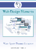
Water sports themed graphic images and web elements, including HTML web templates with a Water sports theme, stock photos of all types of Water activities and sports. Great collection for Water sports enthusiasts, or Water sports rental companies.. A fantastic collection of all web elements needed to build a website designed specifically for Water...
Category: Multimedia & Design / Button Creators
Publisher: DR Management, License: Demo, Price: USD $59.95, File Size: 496.4 KB
Platform: Windows, Mac
The Microdrone Airborne Mapping extension to Orbit Gis provides the tools required for automated flight and high precision mapping. It contains a Waypoint Generator, a Microdrone in-flight tracker, and a captation tool. Further image-, stereoprocessing and orthorectification can be executed using the Strabo Photogrammetry extension to Orbit Gis.
Category: Multimedia & Design / Multimedia App's
Publisher: Orbit GeoSpatial Technologies, License: Freeware, Price: USD $0.00, File Size: 30.0 MB
Platform: Windows
Animated Water Screen will use your existing desktop,add Water rippling effects,and make it look like your desktop is filled with Water.Also you can run a slide show of your images in the Water with a particular effect,and play your favorite Mp3 files in the background. You can even use your own images and Mp3 files to build standalone executables and screensavers...
Category: Desktop Enhancements / Screensavers
Publisher: Longgame Software, License: Shareware, Price: USD $19.95, File Size: 409.6 KB
Platform: Unknown
The Keymap SDK is a set of C classes designed with the purpose of simplifying the development process of Gis applications for programmers. It supports a wide range of Gis features, include built-in GPS support, symbology and advanced road styles. Unlike other Gis products which are usually shipped as ActiveX components, Keymap SDK is a set of C classes that can be easily...
Category: Software Development / Misc. Programming
Publisher: 17 Degree Inc., License: Demo, Price: USD $0.00, File Size: 0
Platform: Windows