Free Downloads: Google Earth Pro
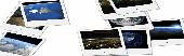
JCapPM allows you to associate coordinate information (x/y) to each photo.
JCapPM allows you to associate coordinate information (x/y) to each photo. JCapPM can communicate with Google Earth which allows you to geotag all your files using Google Earth. You can use JCapPM's filter in order to geotag only filtered photos at once.
Category: Home & Education / Miscellaneous
Publisher: ZeroG Software, License: Freeware, Price: USD $0.00, File Size: 2.5 MB
Platform: Windows
EarthShape is a new and useful software which enables you to easily create polygon objects in Google Earth. It's free and easy to download and simple to install.
It has some new and interesting features and has a very fiendly user interface.Download it and try it
Category: Multimedia & Design / Multimedia App's
Publisher: EarthPlot Software, License: Freeware, Price: USD $0.00, File Size: 205.3 KB
Platform: Windows
FlightSim Commander is a professional flight planner, GPS, Moving Map and navigation tool for Flight Simulator 2004 and Flight Simulator X. Plan a flight professionally using entire routes or route segments. Insert North Atlantic Tracks, PACOTs and SID´s and STAR´s. Save or convert your flight plans in various formats such as FSX, PMDG, Radar Contact, Sqawk Box, IVAO or LevelD.
Category: Games / Simulations
Publisher: aerosoft, License: Shareware, Price: USD $0.00, File Size: 0
Platform: Windows
Earth 2160 is the official sequel of the award winning, very popular and top selling Earth series and continues the brand of Earth 2140 and Earth 2150.
Only a few thousand humans managed to escape from the Earth before its collapse in 2150 A.D. They spent the next few years on the terra forming of the red planet, developing new technologies and building...
Category: Games / Strategy & War
Publisher: ZUXXEZ Entertainment AG, License: Demo, Price: USD $0.00, File Size: 3.5 MB
Platform: Windows
KMLCSV Converter is a tool that enables you to convert the KML file generated from Google Earth (free version) into a formatted CSV file (and vice versa). This CSV file can then be uploaded into your Garmin GPS by using Garmin POI Loader, which can be downloaded for free. This allows you to plot all the custom point of interests (POI) with Google Earth first. Then,...
Category: Business & Finance / Calculators
Publisher: Choon-Chern Lim, License: Freeware, Price: USD $0.00, File Size: 2.3 MB
Platform: Windows
Free Earth Screensaver will bring the blue planet to your desktop.
Free Earth Screensaver will bring the blue planet to your desktop. You can view the Earth from the night side, the day side and from the moon. This screensaver lets you see the pictures of our planet that you have never seen before. Earth is the third planet from the Sun and is the densest and fifth-largest of the eight planets in the Solar System. This unique Earth...
Category: Desktop Enhancements / Misc. Themes
Publisher: CustomAquariumScr, License: Freeware, Price: USD $0.00, File Size: 3.0 MB
Platform: Windows
 Demo
Demo
Visualize your data in 3D! Quick, easy and inexpensive. Graph Earth enables management, marketing and other business professionals to create stunning visual representations of their data, all without the time and costs associated with a full-featured GIS. Viewable by Everyone! Create one of a kind deliverables and distribute them to the world, recipients need only install Google...
Category: Business & Finance / MS Office Addons
Publisher: Deer Creek Marketing LLC, License: Demo, Price: USD $24.95, File Size: 469.0 KB
Platform: Windows
Beautiful Earth is a Wallpaper generator and Screen Saver.
Beautiful Earth is a Wallpaper generator and Screen Saver. Beautiful Earth shows you how the Earth looks like from the space at this very moment. You can see which parts of the Earth are enjoying the sun light. And in night areas you can see the city lights. Based on NASA's Blue Marble and City Lights satellite images.
Category: Desktop Enhancements / Screensavers
Publisher: GimmeGoody.com, License: Shareware, Price: USD $24.99, File Size: 2.7 MB
Platform: Windows
See our Earth?s beauty in high-resolution! Fully customizable by you - you can change the size of the images as well as the transitions of the slide show. Download this screensaver and enjoy it today!
Category: Desktop Enhancements / Screensavers
Publisher: leetsoftware.com, License: Freeware, Price: USD $0.00, File Size: 3.5 MB
Platform: Windows, Mac, 2K, 2K3
Ais Decoder accepts AIS data from an AIS Receiver, the Internet or a Local Network connection, decodes the data and presents the decoded data in a form suitable for display and analysis by mapping program (eg Google Earth or Google Maps), or for analysis using Excel, or by a database (eg MySql).
The decoder will decode all the NMEA content of all 27 AIS mesage types....
Category: Business & Finance / Business Finance
Publisher: Neal Arundale, License: Freeware, Price: USD $0.00, File Size: 2.8 MB
Platform: Windows
With Cartopro Evolution create,modify and save routes, tracks, and waypoints by simple click on the screen.
Main features:
-Simple and reliable.
-Scan your maps directly from Cartopro
-3 types of powerful calibrations are available
-Large number of Datums available. You can also add them manually.
-Import and Export your track, routes and waypoints as...
Category: Home & Education / Miscellaneous
Publisher: Sigrist Alain, License: Shareware, Price: USD $0.00, File Size: 0
Platform: Windows
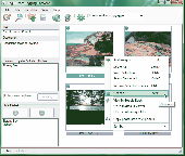
Photo viewer providing a quick access to the Panoramio Photo Database (normally accessible through Google Earth®)
- Choice of 4 different photo sizes: 1=thumbnail (max. 100 px), 2=small (max. 240 px), 3=medium (max. 500 px), 4=original (as uploaded by the user)
- Mode 1: Access by photo index and display of the photos only (very fast with photo sizes 1,2,3)
-...
Category: Multimedia & Design / Multimedia App's
Publisher: MichaelGraphics, License: Freeware, Price: USD $0.00, File Size: 1005.0 KB
Platform: Windows
iTag is a utility that allows you to easily add title, description and keyword tags to your digital photos. The data you enter is stored into the actual photo file itself - using the open standards of IPTC and XMP. Many applications can read and write the IPTC/XMP data, but iTag is especially powerful at editing a group of photos all at once. Geocoding your photos is also straight forward...
Category: Multimedia & Design / Media Catalogers
Publisher: iTag Software, License: Freeware, Price: USD $0.00, File Size: 576.9 KB
Platform: Windows
T2K PLUS or Tiles2Kml PLUS enables you to efficiently load large set of imagery or raster maps very quickly into Google Earth using Region-Based Network Links. This method has an onRegion option, which specifically loads the Region data only when the Region is active. Thus only the needed set of data is loaded with multiple levels of detail, larger amounts of data are loaded only...
Category: Multimedia & Design / Authoring Tools
Publisher: Tiles2kml, License: Demo, Price: USD $40.00, File Size: 8.4 MB
Platform: Windows
Avisoft-SASLab Pro is a powerful Windows application (compatible to Windows 98/2000/XP/Vista/7) for investigating animal acoustic communication. It provides a broad range of processing and analysis tools that can greatly increase the efficiency in extensive sound analysis projects.
Avisoft-SASLab Pro is compatible:
- Supports all common soundcards and...
Category: Audio / Utilities & Plug-Ins
Publisher: Avisoft Bioacoustics, License: Demo, Price: USD $0.00, File Size: 5.6 MB
Platform: Windows
Shape2Earth Globe lets you quickly and easily capture Google Earth images for your personal use.
Shape2Earth Globe lets you quickly and easily capture Google Earth images for your personal use. Capture images for use in popular applications like Microsoft Office and ESRI's ArcMap.
Shape2Earth Globe also saves the bounding box of the image in a kml file. This data is then used to generate a world file and projection file so that your image can be loaded into a GIS,...
Category: Multimedia & Design / Multimedia App's
Publisher: Shape2Earth, License: Freeware, Price: USD $0.00, File Size: 402.5 KB
Platform: Windows
The KML Generator is a useful and reliable utility which enables you to easily analyze GPS log files containing NMEA string data and then generate Google Earth (TM) compatible KML files. It is a free to use application and has a simple and friendly interface. It has low system requirements too, and works on all windows operating systems.
Category: Software Development / Misc. Programming
Publisher: Jacob Madsen, License: Shareware, Price: USD $0.00, File Size: 0
Platform: Windows
Shareware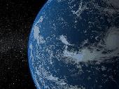
Solar System - Earth 3D screensaver invites you for an instant trip to space where you can admire the magnificent view of our planet shown against the twinkling stars. You can see the change of night and day along with the play of sunrays, as the Earth slowly revolves round the Sun. The screensaver uses modern shader technologies to produce photo-realistic effects. It's one of the...
Category: Desktop Enhancements / Screensavers
Publisher: Rixane Interactive, License: Shareware, Price: USD $17.95, EUR17.95, File Size: 16.2 MB
Platform: Windows
The Earth is probably the best planet I?
The Earth is probably the best planet I?ve ever been to, so I like to keep abreast of what?s going on in the world. I found this desktop background great for monitoring cloud cover, the advance of day and night and nocturnal lights around the globe.
Category: Desktop Enhancements / Wallpaper
Publisher: codefromthe70s.org, License: Freeware, Price: USD $0.00, File Size: 6.2 MB
Platform: Windows
The Earth Screensaver is a screensaver for your computer that will help you relax and get away from your everyday routine by means of watching our planet from space. You will see the Earth with its continents, seas and oceans, clouds and lights of big cities, notice the miraculous glow of the atmosphere, feel the endless space filled with countless stars and mysterious nebulae....
Category: Desktop Enhancements / Screensavers
Publisher: IndaSoftware, License: Shareware, Price: USD $14.00, File Size: 1.0 MB
Platform: Windows
ARSights is a project by Inglobe Technologies, an Italian company specialized in the development of Virtual and Augmented Reality applications. It is based on ARmedia, Inglobe's platform for Augmented Reality (AR), which allows a simple and astonishing way of integrating digital content in real world. ARSights aims at extending Google Earth (GE) wih AR functionality.
...
Category: Home & Education / Miscellaneous
Publisher: Inglobe Technologies S.r.l., License: Freeware, Price: USD $0.00, File Size: 10.6 MB
Platform: Windows
IndexSWF Pro plug-in provides extended support for flash files in Windows Explorer and in Google Desktop Search. IndexSWF Pro plug-in can be used with: - Google Desktop Search to provide advanced indexing of flash (.SWF and ..FLV) files: - plain and HTML text extraction support; - thumbnails for flash files; - width, height and duration information displayed for SWF...
Category: Desktop Enhancements
Publisher: ByteScout, License: Demo, Price: USD $12.95, File Size: 1.9 MB
Platform: Windows
Panorado Flyer is a simple geocoding tool for linking JPEG image files to the location where the picture was taken, using precise geographical coordinates. It can be lauched from the Windows Explorer's context menu. The coordinates of the place where the photo was taken are stored within the JPEG file in EXIF format - either manually or automatically from Google Earth. Later,...
Category: Multimedia & Design / Multimedia App's
Publisher: Karl Maloszek - Simple Software, License: Shareware, Price: USD $0.00, File Size: 223.5 KB
Platform: Windows
Live Satellite Maps or Google maps is a web server mapping applications.
Live Satellite Maps or Google maps is a web server mapping applications.Provides scrolling map images and satellite photos around the Earth and even the route between different places.Since 6 October 2005, live satellite Maps is part of local Google.Google live satellite Map provides the ability to zoom in or zoom out to show the map.The user can control the map with...
Category: Home & Education / Science
Publisher: www.satelliteview-of-my-house.com, License: Freeware, Price: USD $0.00, File Size: 643.0 KB
Platform: Windows
A Journey To The Center Of The Earth, by Jules Verne (1864)Prof.
A Journey To The Center Of The Earth, by Jules Verne (1864)Prof. Lindenbrook leads his intrepid party on an expedition to the centre of the Earth, via a volcano in Iceland, encountering all manner of prehistoric monsters and life-threatening hazards on the way.
Category: Home & Education / Miscellaneous
Publisher: Southern Ocean Software, License: Freeware, Price: USD $0.00, File Size: 747.5 KB
Platform: Windows