Free Downloads: Gps Autocad Points
GPSCAD Transfer is an application for transferring points between a gps device and autocad.
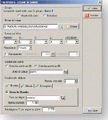
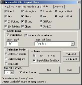
GPSCAD Transfer is an application for transferring Points between a Gps device and Autocad. The present version works with a Magellan Gps device, but the next release will also work with a Garmin Gps device. It allows you to convert latitude and longitude to utm zone nad 83 in either the US or in metric measurement system.
Category: Multimedia & Design / Image Editing
Publisher: Timberwolf Software Solutions, LLC, License: Shareware, Price: USD $0.00, File Size: 2.6 MB
Platform: Windows
FlashPoints is a tool for creating and managing Points Groups (topographic Points for example). FlashPoints allows you to : * import/export Points coordinates from and to a file * create Points and their attributes "Number", "Elevation" and "Description" by clicking * modify the Points elevation * modify the height and rotation of the...
Category: Multimedia & Design
Publisher: DeliCAD, License: Shareware, Price: USD $49.00, File Size: 1.2 MB
Platform: Windows
 Shareware
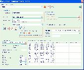
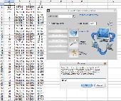
The Advanced Points manager imports Points to Autocad drawing from different data sources. OLE-DB database, SHP (ESRI shape file), GPX (Gps eXchange format), KML (Keyhole Markup Language), GML (Geography Markup Language), TXT, CSV. Additional options: savable configurations, point coordinate transformation from/to any world coordinate system, point can be ACAD point...
Category: Business & Finance / Vertical Markets
Publisher: CADdicted inc., License: Shareware, Price: USD $119.00, File Size: 609.8 KB
Platform: Windows
Terrain for AutoCAD is a terrain modeling plug-in for AutoCAD.
Terrain for Autocad is a terrain modeling plug-in for Autocad. This plug-in gives Autocad the ability to create a terrain mesh from a set of unordered Points, lines, polylines and splines. The terrain mesh is created as a Delaunay Triangulation, which is regarded as the best method to create a terrain mesh from unorganized point data. Terrain for Autocad can...
Category: Multimedia & Design / Multimedia App's
Publisher: SYCODE, License: Commercial, Price: USD $195.00, File Size: 2.6 MB
Platform: Windows
Draw points in AutoCAD and generate 3D models using data in Excel.
XLPoints Plus is the easiest way to massively draw Points in Autocad and generate 3D models using coordinate data in Excel. Key Features: - Quickly draw Points using coordinate data in Excel. - Create new drawings or update existing ones by establishing an open channel with Autocad. - Create "true" 3D faces or simply connect all Points with a 3D...
Category: Multimedia & Design
Publisher: Productivity Tools, License: Shareware, Price: USD $30.00, File Size: 1.7 MB
Platform: Windows
Shareware
Gps Mapping Software for Windows, Loading topographic maps, manage Gps devices and more. The software can be used with various map formats including: GeoTiff, BSB Nautical Charts, Autocad DXF files, ESRI Shapefiles. Using calibration you can also use scanned or downloaded JPG, BMP, GIF, PNG and TIF maps. The software can be used for survey, research, track and trace, real...
Category: Home & Education / Science
Publisher: Eye4Software B.V., License: Shareware, Price: USD $75.04, EUR49, File Size: 6.7 MB
Platform: Windows
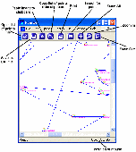
Pointor imports text files which are lists of Points (2D or 3D) and saves them as a DXF file. The DXF file can then be read by other applications, for example Autocad, MicroStation or PaintShopPro. If you have a text file which is a list of geographical Points simply open it using the file open menu item, or the open icon. You can also drag files into the Pointor window. If...
Category: Audio
Publisher: Ransen Software, License: Shareware, Price: USD $59.95, File Size: 517.6 KB
Platform: Windows
Kinomap Gps File Fixer allows you to process some treatments on Gps file:
- convert almost any Gps file to standard NMEA 0183, compatible with Kinomap
- fill the gaps between Points when your file is not 1Hertz: the extra point will be recreated by interpolation
- cut a long file in which there are loops of data (example: race) in several parts
Category: Home & Education / Miscellaneous
Publisher: ExcelLance, License: Freeware, Price: USD $0.00, File Size: 19.6 MB
Platform: Windows
Autocad 2011 now contains a native point cloud engine which is powerful enough to handle up to 2 billion Points of scan data. Currently, Autocad only supports a few data formats for import to .PCG.
kubit is happy to fill this gap by providing many more import options with our new PointCloud FreeEdition. Users can now take advantage of the powerful Autocad .PCG...
Category: Multimedia & Design / Image Editing
Publisher: kubit GmbH, Germany, License: Freeware, Price: USD $0.00, File Size: 107.4 MB
Platform: Windows
Shareware
Gps Mapping Software for Windows, Loading topographic maps, realtime navigation, track recording, manage Gps devices and more. The software can be used with various map formats including: GeoTiff, BSB Nautical Charts, Autocad DXF files, ESRI Shapefiles. Using calibration you can also use scanned or downloaded JPG, BMP, GIF, PNG and TIF maps. The software can be used for...
Category: Home & Education / Science
Publisher: Eye4Software B.V., License: Shareware, Price: USD $149.00, EUR99, File Size: 11.1 MB
Platform: Windows
!SlingShot introduces more than 60 new commands to your Autocad. Make the most of your Autocad LT software.
!Slingshot provides the most popular set of useful enhancemnt tools for use in Autocad and Autocad LT. Maximise your Autocad software with this seamless tool - available for versions 2000 - 2010 and beyond.
!SlingShot offers a generous...
Category: Multimedia & Design / Image Editing
Publisher: drcauto, License: Demo, Price: USD $0.00, File Size: 7.0 MB
Platform: Windows
This applications is the software for X-Guider, which is a multi-purpose handheld GPS receiver.
This applications is the software for X-Guider, which is a multi-purpose handheld Gps receiver.
This program will help you to set up a route, planning a trip and share it with your friends.
You can calculate the distance between the Points and even name the Points.
Category: Home & Education / Miscellaneous
Publisher: unknown, License: Freeware, Price: USD $0.00, File Size: 6.1 MB
Platform: Windows
TpSelect is a convenient utility which you can use to choose a subset of the BGA turning point database for download to your Gps.
TpSelect allows you to specify a particular location (for example your home club site) and to select turning Points from the main file that are within a certain range of this point. You can then review the list of selected Points and add...
Category: Home & Education / Miscellaneous
Publisher: Enborne Computing, License: Freeware, Price: USD $0.00, File Size: 388.0 KB
Platform: Windows
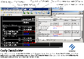
TableBuilder is designed to export Autocad table and the table drawn with lines and text in Autocad (LT)/MicroStation to Excel. Also you can convert the table drawn with lines and text to Autocad native table. == http://www.cadig.com == ======== Key Features ======== .Export the table drawn with lines and text in Autocad (LT) / MicroStation to Excel....
Category: Multimedia & Design
Publisher: cadig.com, License: Shareware, Price: USD $99.00, File Size: 1.6 MB
Platform: Windows
InnerSoft CAD is a add-on for AutoCAD.
InnerSoft CAD is a add-on for Autocad. This group of tools will allows you to: Export to a Excel Sheet the values of Area/Length property or coordinates for various Autocad entities. Import from a Excel Sheet the vertex coordinates for a set of 2D polylines or 3D polylines (you can choose between 3 different methods). You can also import a set of Points from Excel or a set...
Category: Multimedia & Design / Multimedia App's
Publisher: InnerSoft, License: Demo, Price: USD $100.00, File Size: 443.0 KB
Platform: Windows
InnerSoft CAD is a add-on for AutoCAD.
InnerSoft CAD is a add-on for Autocad. This group of tools will allows you to: Export to a Excel Sheet the values of Area/Length property or coordinates for various Autocad entities. Import from a Excel Sheet the vertex coordinates for a set of 2D polylines or 3D polylines (you can choose between 3 different methods). You can also import a set of Points from Excel or a set...
Category: Multimedia & Design / Multimedia App's
Publisher: InnerSoft, License: Demo, Price: USD $100.00, File Size: 430.0 KB
Platform: Windows
InnerSoft CAD is a add-on for AutoCAD.
InnerSoft CAD is a add-on for Autocad. This group of tools will allows you to: Export to a Excel Sheet the values of Area/Length property or coordinates for various Autocad entities. Import from a Excel Sheet the vertex coordinates for a set of 2D polylines or 3D polylines (you can choose between 3 different methods). You can also import a set of Points from Excel or a set...
Category: Multimedia & Design / Multimedia App's
Publisher: InnerSoft, License: Demo, Price: USD $100.00, File Size: 443.0 KB
Platform: Windows
FREE GPS Software for your Garmin, Magellan or Lowrance GPS.
FREE Gps Software for your Garmin, Magellan or Lowrance Gps.
EasyGPS is the fast and easy way to upload and download waypoints, routes, and tracks between your Windows computer and your Garmin, Magellan, or Lowrance Gps. EasyGPS lists all of your waypoints on the left side of the screen, and shows a plot of your Gps data on the right. Use EasyGPS to back up...
Category: Internet / Communications
Publisher: TopoGrafix, License: Freeware, Price: USD $0.00, File Size: 3.9 MB
Platform: Windows
ExpertGPS is helpful in viewing map points, Topo Maps, arial photos and many more.
ExpertGPS is helpful in viewing map Points, Topo Maps, arial photos and many more. This is a revolutionary product called Expert Gps, Expert Gps is highly useful for people interested in Hunting, Scouting, Mountain biking, Fishing, Tracking, state and local agencies in the US as well as geometric studies.
Category: Internet / Communications
Publisher: TopoGrafix, License: Shareware, Price: USD $200.00, File Size: 9.2 MB
Platform: Windows
My Gps Logger 1.01 is a program designed to be used with My Fuel Tax 4.0. With My Gps Logger you can log all the locations where your truck has been to a monthly data file. This data file can later be imported into My Fuel Tax 4.0 by calculating the miles in state using Microsoftâ Mappoint. This is what you will need to use My Gps Logger with My Fuel Tax:a laptop with...
Category: Home & Education / Miscellaneous
Publisher: Spinnaker Software Solutions, License: Freeware, Price: USD $0.00, File Size: 477.7 KB
Platform: Windows

InnerSoft CAD is a add-on for Autocad. This group of tools will allows you to: Export to a Excel Sheet the values of Area/Length property or coordinates for various Autocad entities. Import from a Excel Sheet the vertex coordinates for a set of 2D polylines or 3D polylines (you can choose between 3 different methods). You can also import a set of Points from Excel or a set...
Category: Multimedia & Design
Publisher: InnerSoft, License: Demo, Price: USD $100.00, File Size: 444.0 KB
Platform: Windows

InnerSoft CAD is a add-on for Autocad. This group of tools will allows you to: Export to a Excel Sheet the values of Area/Length property or coordinates for various Autocad entities. Import from a Excel Sheet the vertex coordinates for a set of 2D polylines or 3D polylines (you can choose between 3 different methods). You can also import a set of Points from Excel or a set...
Category: Multimedia & Design
Publisher: InnerSoft, License: Demo, Price: USD $100.00, File Size: 430.9 KB
Platform: Windows
VisualGPSXP is a general purpose utility for monitoring the output of a GPS receiver.
VisualGPSXP is a general purpose utility for monitoring the output of a Gps receiver. Using the NMEA data from the Gps receiver, VisualGPSXP will display various statuses graphically.
Tools such as a survey utility average the position and shows accuracy of the Gps receiver in a static application.
Main features:
- Multiple connection...
Category: Home & Education / Miscellaneous
Publisher: VisualGPC, License: Shareware, Price: USD $25.00, File Size: 1.1 MB
Platform: Windows