Free Downloads: Gps Coordinate Calculator
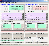
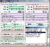
Gps Express provides a feature rich interface to serial NMEA-0183 protocol data and works with most NMEA-0183 devices, including Gps Receivers. Gps Express is available in three versions (Standard, Professional, Graphical). STANDARD displays the title, value, and units for each parameter. Manual,Scan operation. Navigation buttons. Manual,automatic sentence triggering....
Category: Utilities
Publisher: Steelwater Solutions Corporation, License: Shareware, Price: USD $65.00, File Size: 2.1 MB
Platform: Windows
Are you looking for a Gps tracking system or a Gps tracker but haven't found the one that is ideal for you? Then, look no further as our site has the best deals and information about the kind of Gps tracker you should buy.
Category: Security & Privacy / Other
Publisher: Top GPS Tracking Srl., License: Freeware, Price: USD $0.00, File Size: 722.0 KB
Platform: Windows
Gps Software for Garmin. Download waypoints, routes and tracks from Garmin Gps. Upload waypoints, routes and tracks to Garmin Gps. Excel and Text files supported! This software is very easy to use!
Category: Utilities / System Utilities
Publisher: Oy Frontbase Ltd, License: Shareware, Price: USD $29.95, File Size: 1.4 MB
Platform: Windows
Portable GPS Navigation toolbar for Internet Explorer.
Portable Gps Navigation toolbar for Internet Explorer. Find portable Gps units for your car, truck or minvan from top name brands including Tom Tom, Magellan and Garmin. Discover the world of eBay and shop for portable Gps navigation systems directly from your browser toolbar.
Category: Internet / Browsers
Publisher: Portable GPS Navigation System, License: Freeware, Price: USD $0.00, File Size: 1.1 MB
Platform: Windows
Geocache Supplies Calculator. Find all your geocaching needs at geocachinggear.net. Discount Gps, GeoCoins, GeoSwags, GeoCache Containers, travel bug, stickers and decals, geocaching clothing, log books and more.
Category: Internet / Browsers
Publisher: Geocache Supplies, License: Freeware, Price: USD $0.00, File Size: 414.0 KB
Platform: Windows
In the Dynamic Link Library GeoDLL geodesic functions like Coordinate transformation, datum changes, meridian strip changes, user defined Coordinate and reference systems, distance calculation, maps functions, Digital Elevation Models and more geodesic functions are contained to bind them into own applications. WINDOWS operating system allows building of function libraries...
Category: Software Development
Publisher: Killet Softwareentwicklung GbR, License: Shareware, Price: USD $290.00, File Size: 999.9 KB
Platform: Windows
Gps Express provides a feature rich interface to serial NMEA-0183 protocol data and works with most NMEA-0183 devices, including Gps Receivers. Gps Express is available in three versions (Standard, Professional, Graphical). STANDARD displays the title, value, and units for each parameter. Manual,Scan operation. Navigation buttons. Manual,automatic sentence triggering....
Category: Internet / Dial-up & Connectivity
Publisher: Steelwater Solutions Corporation, License: Shareware, Price: USD $30.00, File Size: 2.1 MB
Platform: Windows, Vista
Gps Express provides a feature rich interface to serial NMEA-0183 protocol data and works with most NMEA-0183 devices, including Gps Receivers. Gps Express is available in three versions (Standard, Professional, Graphical). STANDARD displays the title, value, and units for each parameter. Manual,Scan operation. Navigation buttons. Manual,automatic sentence triggering....
Category: Internet / Communications
Publisher: Steelwater Solutions Corporation, License: Shareware, Price: USD $65.00, File Size: 2.1 MB
Platform: Windows

Gps/J is a console for all Bluetooth-enabled Gps receivers (now with 20000 European towns and cities!), a mobile navigation tool for cellular phone owners and the most affordable and convenient way to use location services.
It is a J2ME application for JSR82-compliant devices, which means "devices with a programmable Bluetooth interface".
Saying...
Category: Home & Education / Miscellaneous
Publisher: GPS/J Project, License: Demo, Price: USD $0.00, File Size: 281.0 KB
Platform: Windows
Gps Tracker Data Logger acts as the server and allows you to collect data from an unlimited number of various Gps trackers simultaneously. The obtained data is processed, uniformed and written to a log file or a database. Also, the program has a set of interfaces so other applications can get data in real time.
Gps Tracker Data Logger can convert data into other...
Category: Internet / Misc. Servers
Publisher: AGG Software, License: Shareware, Price: USD $80.83, File Size: 11.8 MB
Platform: Windows
GPS Tuner was first launched in 2003.
Gps Tuner was first launched in 2003. Success followed introduction shortly. Over the years it became a best-selling favourite Gps software among off-roaders as a reliable, versatile feature-packed application suiting the needs of outdoor enthusiasts and professional off-road users alike. After five years of continuous development of previous Gps Tuner versions Gps...
Category: Web Authoring / Web Design Utilities
Publisher: GPS Tuner Ltd., License: Freeware, Price: USD $0.00, File Size: 4.5 MB
Platform: Windows
PrimaCode Transform for Windows is a Windows based computer solution built using the Microsoft .
PrimaCode Transform for Windows is a Windows based computer solution built using the Microsoft .Net Framework and designed to best-fit one Coordinate system to another using a least-squares two-dimensional conformal Coordinate transformation.
When the transformation is complete, the two surveys (Coordinate systems) share the same meridian and the same origin, that is...
Category: Business & Finance / Business Finance
Publisher: PrimaCode Technologies, License: Shareware, Price: USD $445.00, File Size: 11.0 MB
Platform: Windows
 Shareware
HsGpsDll is a Windows Dynamic Link Library which provides access to any NMEA-183 compliant Gps receiver via a serial communications port. HsGpsDll is designed for use from Visual C, C Sharp .NET, Visual Basic or other programming languages. HsGpsDll allows a user application to easily read from a Gps device the current Gps position fix and current velocity over ground...
Category: Software Development / Components & Libraries
Publisher: Hillstone Software, License: Shareware, Price: USD $160.00, EUR210, File Size: 1.4 MB
Platform: Windows
GeoDataSource Cities Database Gold Edition contains 2.9+ million entries with city names in original language and English, feature type classifications, country names in FIPS and ISO, regions, sub-regions, state or First-Order Administrative Division, county or Second-Order Administrative Division, longitude and latitude in degree and decimal, Univeral Transverse Mercator Coordinate grid...
Category: Security & Privacy / Other
Publisher: GeoDataSource.com, License: Data Only, Price: USD $1049.95, File Size: 160.3 KB
Platform: Windows, Mac, Linux, Palm,
The Gps Detector software is used to update the Gps detector's database , updating maps , routes and camera locations . The device itself is based on pre-installed Gps coordinates, the device can indicate various road hazards like: Fixed cameras, Red light speed cameras and bus lane cameras, Usual speed measurement places and dangerous zones.
Category: Business & Finance / Business Finance
Publisher: Euro Noliker Kft., License: Freeware, Price: USD $0.00, File Size: 5.5 MB
Platform: Windows
Big Calculator is a large calculator for Windows.
Big Calculator is a large Calculator for Windows.
You can either click on the buttons with the mouse or use the numeric keypad to perform calculations. The size of the Calculator buttons is determined by the width of the Calculator window.
Big Calculator will use Sensory Speech engines if they are installed on your computer.
Category: Home & Education / Mathematics
Publisher: Sensory Software International, License: Freeware, Price: USD $0.00, File Size: 1.3 MB
Platform: Windows
The Gps Controller software is a free program designed to allow you to configure a range of Gps receivers. There are versions that run on Windows desktop computers, or Windows Mobile devices.
Before downloading the software, it recommend downloading and reading the documentation to confirm which version you need.
Category: Home & Education / Miscellaneous
Publisher: Trimble Navigation, License: Freeware, Price: USD $0.00, File Size: 30.9 MB
Platform: Windows
DraftSight is a drafting automation software tool.
DraftSight is a drafting automation software tool.A Coordinate system determines each point of a drawing surface or entity unambiguosly.DraftSight uses the Cartesian Coordinate system consisting of three Coordinate axes.Axes are arranged orthogonally crossing at the origin.
Category: Multimedia & Design / Image Editing
Publisher: Dassault Systemes, License: Freeware, Price: USD $0.00, File Size: 66.5 MB
Platform: Windows
GPS-CCD:is a novel computational program for the
Prediction of Calpain Cleavage Sites.
Gps-CCD:is a novel computational program for the
Prediction of Calpain Cleavage Sites.
The online service and local packages of Gps-CCD 1.0 were
implemented in JAVA/. For the online service, we tested the Gps-CCD1.0 on a variety of internet browsers, including Internet Explorer 6.0, Netscape Browser 8.1.3 and Firefox 2 under the Windows XPOperating System...
Category: Web Authoring / JavaScript
Publisher: The CUCKOO Workgroup, License: Freeware, Price: USD $0.00, File Size: 19.2 MB
Platform: Windows
Shareware
The Advanced points manager imports points to AutoCAD drawing from different data sources. OLE-DB database, SHP (ESRI shape file), GPX (Gps eXchange format), KML (Keyhole Markup Language), GML (Geography Markup Language), TXT, CSV. Additional options: savable configurations, point Coordinate transformation from/to any world Coordinate system, point can be ACAD point or ACAD...
Category: Business & Finance / Vertical Markets
Publisher: CADdicted inc., License: Shareware, Price: USD $119.00, File Size: 609.8 KB
Platform: Windows
ThinkVantage Gps (Global Positioning System) receives signals from the Gps satellites and determines the location of your ThinkPad. This program is easy to install and easy to manipulate.
This package installs the software (Gps driver) to enable the following devices:
- Ericsson F3507g
- Ericsson F3607gw
- Ericsson F5521gw
-...
Category: Utilities / System Utilities
Publisher: Lenovo, License: Freeware, Price: USD $0.00, File Size: 20.6 MB
Platform: Windows

Gps Navigator with using a scanned maps and possibility to open a lot of maps together. - you can show a current Gps data (Speed, Direction, Longitude, Latitude, Time, Date, Height); - you can open any of scanned maps (in a "bmp" or "dib" format); - you can calibrate the scanned maps yourself by two calibration points only (left-top and right-bottom); - calibrations are...
Category: Home & Education
Publisher: Valeri Vlassov, License: Demo, Price: USD $19.00, File Size: 4.6 MB
Platform: Windows

Overview Gps Simulator is software that generates a virtual Gps data Used to develop and simulation of Gps applications -Save testing and development time -No location restriction or work everywhere -No Gps device needed Feature Easy routing Selectable map(7EA Map) Support speed control Support 10EA NMEA protocol messages(GGA, GNS, GLL, RMC, VTG,...
Category: Desktop Enhancements / Shell & Desktop Managers
Publisher: NMEAsoft, License: Demo, Price: USD $150.00, File Size: 3.3 MB
Platform: Windows
Have a Gps and a laptop? Use this to find your way. Make patterns or a trail to share with others. When the application starts, you may pick your area of operations - be it North America, South America, Europe and Asia, or Australia. Your quadrant is determined by where you are in relation to the Equator and the Prime Meridian. Tracking of your position is automatically enabled when the...
Category: Home & Education / Miscellaneous
Publisher: LogicAll Solutions, LLC, License: Freeware, Price: USD $0.00, File Size: 4.6 MB
Platform: Windows