Free Downloads: Gps Earth Software
StarTraX is a real-time GPS track animator which works through Google Earth.
StarTraX is a real-time Gps track animator which works through Google Earth.
It allows you to relive your Gps journey in real time.
High definition images from Google Earth combine with StarTraX to show you exactly where you’ve been. Whether you are a pilot, a skier or cyclist, as long as you have a Gps recording of your...
Category: Multimedia & Design / Multimedia App's
Publisher: GPSAnimator, License: Shareware, Price: USD $0.00, File Size: 0
Platform: Windows
Track-Album is a paragliding/hanggliding Software - flight log for pilots, and logbook for cyclists/skiers, it is also Gps Software - easy to use, sufficient for most needs, allows you to download Gps tracks and view them in 3D in Google Earth.Rich statistics is specialy usefull for paragliding/hanggliding pilots. It is calculated instantly by entries in log...
Category: Home & Education / Miscellaneous
Publisher: Track-Album, License: Shareware, Price: USD $39.00, File Size: 2.0 MB
Platform: Windows
MB-GPS2KML converts a GPS log file (in plain NMEA format) to a KML file (placemark file for Google Earth) and opens this file in Google Earth. Velocity, number of satellites and HDOP are interpreted as height, color and size of the icons.
Category: Home & Education
Publisher: Markus Bader, License: Freeware, Price: USD $0.00, File Size: 441.4 KB
Platform: Windows
Create Gps enabled geo maps directly on the background of aereal photos and road maps from the internet. Import geodata from Google-Earth, OpenStreetMap, Gps tracks and Gps logger. Map editor , manually digitizing. Specifical graphical objects (borderlines, borderareas) to guarantee exact same borders of neighbour areas..Screen calibration for true to display on the...
Category: Multimedia & Design / Digital Media Editors
Publisher: GPSur Dr. Erhard Regener, License: Shareware, Price: USD $65.00, File Size: 6.4 MB
Platform: Windows
An easy to use Gps downloading utility that lets you download your Gps waypoints easily and export them into a variety of formats useful for editing, display and importing into many different mapping programs.
Use Lobal to save Gps waypoints as:
- Text Files
- HTML Tables
- Shape Files
- Google Earth KML
- DBase Files.
Category: Utilities / Misc. Utilities
Publisher: Ecological Software Solutions, License: Freeware, Price: USD $0.00, File Size: 2.2 MB
Platform: Windows
DNRGarmin is a smart tool used to directly transfer data between Garmin Gps handheld receivers and various GIS Software packages.
DNRGarmin was built to provide users the ability to directly transfer data between Garmin Gps handheld receivers and various GIS Software packages. Using DNRGarmin a user can use point features (graphics or shapefile) and...
Category: Utilities / Misc. Utilities
Publisher: GIS Section, Minnesota Department of Natural Resources, License: Freeware, Price: USD $0.00, File Size: 11.3 MB
Platform: Windows
FREE GPS Software for your Garmin, Magellan or Lowrance GPS.
FREE Gps Software for your Garmin, Magellan or Lowrance Gps.
EasyGPS is the fast and easy way to upload and download waypoints, routes, and tracks between your Windows computer and your Garmin, Magellan, or Lowrance Gps. EasyGPS lists all of your waypoints on the left side of the screen, and shows a plot of your Gps data on the right. Use EasyGPS to...
Category: Internet / Communications
Publisher: TopoGrafix, License: Freeware, Price: USD $0.00, File Size: 3.9 MB
Platform: Windows
OziPhotoTool combines the technology of a Gps receiver and a digital camera to automatically keep a record of where digital photos were taken. It is designed to be used in conjunction with OziExplorer. Most digital cameras have EXIF metadata stored as part of the photo. This includes is the date and time the photo was taken. Many Gps units have 'tracklogs'. The Gps keeps a...
Category: Utilities
Publisher: OziPhotoTool, License: Shareware, Price: USD $25.00, File Size: 14.3 MB
Platform: Windows


 Shareware
Virtual Gps is a Gps simulator Software. You can use it to simulate a Gps receiver unit connected to your system. It's ideal when you need Gps input, but you have no signal or for development purposes. It supports various NMEA sentences, so it can be used with any Gps mapping Software. You can use it using a null-modem cable connected to two...
Category: Internet / RSS & Web Blog Tools
Publisher: Zyl Soft, License: Shareware, Price: USD $39.99, File Size: 856.0 KB
Platform: Windows
Eye4Software Gps Mapping is a professional Gps mapping Software tool that can be used in numerous applications. Use the Software to load, view and edit your maps, display your position realtime and record all your movements.
The Software will work with almost any Gps and can be used on any desktop, laptop or needbook computer running...
Category: Home & Education / Miscellaneous
Publisher: Eye4Software B.V., License: Shareware, Price: USD $130.61, File Size: 14.6 MB
Platform: Windows
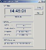
Gps Clock Software is a freeware utility that runs on any Windows NT/2000/XP/2003 workstation or server. The Software polls time from a standard NMEA Gps time receiver connected to the host PC's serial port and optionally allows time to be synchronised on the host PC. The Gps clock utility polls GPRMC messages from a standard NMEA Gps time receiver....
Category: Utilities
Publisher: ntp time server, License: Freeware, Price: USD $0.00, File Size: 1.9 MB
Platform: Windows
My Gps Logger 1.01 is a program designed to be used with My Fuel Tax 4.0. With My Gps Logger you can log all the locations where your truck has been to a monthly data file. This data file can later be imported into My Fuel Tax 4.0 by calculating the miles in state using Microsoftâ Mappoint. This is what you will need to use My Gps Logger with My Fuel Tax:a laptop with...
Category: Home & Education / Miscellaneous
Publisher: Spinnaker Software Solutions, License: Freeware, Price: USD $0.00, File Size: 477.7 KB
Platform: Windows
GPSMaster.NET can best be described as a mixture of Google Earth, World Wind, SeeYou, OziExplorer and Garmin Mapsource. GPSMaster.NET is a Windows application (for both x86 and x64) and can communicate (via serial or USB) with any Garmin Gps that implements the Garmin communication protocol. Support for other brands of Gps or logger will be added in future releases.
Category: Internet / Communications
Publisher: Edwin Oude Vrielink, License: Shareware, Price: USD $141.85, File Size: 11.6 MB
Platform: Windows
FlightSim Commander is a professional flight planner, Gps, Moving Map and navigation tool for Flight Simulator 2004 and Flight Simulator X. Plan a flight professionally using entire routes or route segments. Insert North Atlantic Tracks, PACOTs and SID´s and STAR´s. Save or convert your flight plans in various formats such as FSX, PMDG, Radar Contact, Sqawk Box, IVAO or...
Category: Games / Simulations
Publisher: aerosoft, License: Shareware, Price: USD $0.00, File Size: 0
Platform: Windows
OkMap is a Gps and map Software that:
-Works with vectorial maps and calibrates raster maps
-Organizes paths by creating waypoints, routes and tracks
-Uploads/downloads data to/from your Gps
-Uses altitude DEM data
-Supports Gps real-time navigation
-Sends/receives vehicles position and display tracks on maps in real time
-Provides autorouting...
Category: Business & Finance / Applications
Publisher: Gian Paolo Saliola, License: Freeware, Price: USD $0.00, File Size: 20.2 MB
Platform: Windows
With PixGPS it's easy to track the exact positioin where you took your photos.
With PixGPS it's easy to track the exact positioin where you took your photos. You need a Gps Receiver. All you need to do is to have the Gps turned on when you ake the photos. After your photo session, download the photos from your camera and the track file from the Gps. PixGPS will calculate the position of each photo and insert this in the EXIF data of each photo....
Category: Multimedia & Design / Multimedia App's
Publisher: BR Software, License: Shareware, Price: USD $0.00, File Size: 1.5 MB
Platform: Windows
Gps Software for Garmin. Download waypoints, routes and tracks from Garmin Gps. Upload waypoints, routes and tracks to Garmin Gps. Excel and Text files supported! This Software is very easy to use!
Category: Utilities / System Utilities
Publisher: Oy Frontbase Ltd, License: Shareware, Price: USD $29.95, File Size: 1.4 MB
Platform: Windows
The program accepts NMEA GPS sentences from most GPS receivers that connect to a USB port.
The program accepts NMEA Gps sentences from most Gps receivers that connect to a USB port.
The program can display satellite images of waypoint locations on the track plotter.
Is a free Software for recording , monitoring and plotting Gps data, very useful and very easy.
Category: Home & Education / Miscellaneous
Publisher: Club Cruceros de La Paz A.C., License: Freeware, Price: USD $0.00, File Size: 10.6 MB
Platform: Windows
KMLCSV Converter is a tool that enables you to convert the KML file generated from Google Earth (free version) into a formatted CSV file (and vice versa). This CSV file can then be uploaded into your Garmin Gps by using Garmin POI Loader, which can be downloaded for free. This allows you to plot all the custom point of interests (POI) with Google Earth first. Then, you can...
Category: Business & Finance / Calculators
Publisher: Choon-Chern Lim, License: Freeware, Price: USD $0.00, File Size: 2.3 MB
Platform: Windows
VisualGPSXP is a general purpose utility for monitoring the output of a GPS receiver.
VisualGPSXP is a general purpose utility for monitoring the output of a Gps receiver. Using the NMEA data from the Gps receiver, VisualGPSXP will display various statuses graphically.
Tools such as a survey utility average the position and shows accuracy of the Gps receiver in a static application.
Main features:
- Multiple connection...
Category: Home & Education / Miscellaneous
Publisher: VisualGPC, License: Shareware, Price: USD $25.00, File Size: 1.1 MB
Platform: Windows
View amazing satellite images of earth with the free version of google earth software.
View amazing satellite images of Earth with the free version of google Earth Software.Google Earth is a totally free Software which enables you zoom in from satellite,view,rotate or tilt just like a camera of the entire Earth inside your pc.It works just point and click on any part of Earth or by typing addrees name of city or country and google...
Category: Home & Education / Miscellaneous
Publisher: www.satelliteimage-of-my-house.com, License: Freeware, Price: USD $0.00, File Size: 798.0 KB
Platform: Windows
The KML Generator is a useful and reliable utility which enables you to easily analyze Gps log files containing NMEA string data and then generate Google Earth (TM) compatible KML files. It is a free to use application and has a simple and friendly interface. It has low system requirements too, and works on all windows operating systems.
Category: Software Development / Misc. Programming
Publisher: Jacob Madsen, License: Shareware, Price: USD $0.00, File Size: 0
Platform: Windows
GPS Tuner was first launched in 2003.
Gps Tuner was first launched in 2003. Success followed introduction shortly. Over the years it became a best-selling favourite Gps Software among off-roaders as a reliable, versatile feature-packed application suiting the needs of outdoor enthusiasts and professional off-road users alike. After five years of continuous development of previous Gps Tuner versions...
Category: Web Authoring / Web Design Utilities
Publisher: GPS Tuner Ltd., License: Freeware, Price: USD $0.00, File Size: 4.5 MB
Platform: Windows
Golf GPS Devices toolbar for internet explorer.
Golf Gps Devices toolbar for internet explorer. Find golf Gps devices are great bargain prices. We have all the latest golf Gps devices for sale both new and used. Whether you're looking for the iGolf, Golf Buddy, GolfLogix, SonoCaddie, or SkyCaddie, you can find it here along with their accessories. We are always searching our networks to bring you the best deals on golf...
Category: Internet / Browsers
Publisher: Golf GPS Devices, License: Freeware, Price: USD $0.00, File Size: 1.1 MB
Platform: Windows
This Software is designed specifically to make the whole process of downloading data from a group of Gps devices, formatting the data into a race replay and then watching the replay as fast and pain free as possible.
Main Features:
- One-click Gps data downloading from up to 21 Velocitek devices in one batch ( USB hub required)
- Automatic...
Category: Internet / Download Managers
Publisher: Velocitek, License: Shareware, Price: USD $0.00, File Size: 5.4 MB
Platform: Windows


