Free Downloads: Gps Flight Maps
Furthermore the Skylab Gps Simulator contains a full featured interoperable OGC WMS client for receiving Maps from a standardized WMS server.
Within a map you are able to navigate (zoom, pan) and to select your favorite layers provided by the WMS server. During the simulation there are realtime debugging helpers like position and raw NMEA-0183 output.
Category: Home & Education / Miscellaneous
Publisher: Skylab Mobilesystems, License: Shareware, Price: USD $99.00, File Size: 4.9 MB
Platform: Windows
Flight Tracker is an innovative Microsoft Flight Simulator 2000/2002/2004/X Add-On that is much more than a Flight log. Flight Tracker actually records Flight information from your active Flight Simulator Flight automatically!
Flight Tracker includes a log converter so you can convert your existing FS2000/2002/2004/X logbook...
Category: Games / Simulations
Publisher: Chanticleer Software, License: Shareware, Price: USD $0.00, File Size: 0
Platform: Windows
GeoBuddy is a complete geocaching solution that can display all of the geocaches in your area, as well as your own personal Gps data, over USGS topo Maps, aerial photos, your own scanned paper trail and road Maps. A built-in Web browser lists all of the information about each geocache, including pictures and hints left by the cache owner, and logs by recent visitors to the...
Category: Internet / Communications
Publisher: TopoGrafix, License: Shareware, Price: USD $49.95, File Size: 10.3 MB
Platform: Windows
ExpertGPS is helpful in viewing map points, Topo Maps, arial photos and many more.
ExpertGPS is helpful in viewing map points, Topo Maps, arial photos and many more. This is a revolutionary product called Expert Gps, Expert Gps is highly useful for people interested in Hunting, Scouting, Mountain biking, Fishing, Tracking, state and local agencies in the US as well as geometric studies.
Category: Internet / Communications
Publisher: TopoGrafix, License: Shareware, Price: USD $200.00, File Size: 9.2 MB
Platform: Windows
The fast track to GPS success.
The fast track to Gps success. The Linx MDEV-Gps-SR contains everything needed to rapidly evaluate the SR Series Gps modules and implement them in record time. This all-inclusive Master Development System features a pre-assembled development board with an on-board OLED display for standalone testing. The system can also be attached to a PC via USB and operated using the...
Category: Software Development / Misc. Programming
Publisher: Linx Technologies, Inc., License: Freeware, Price: USD $0.00, File Size: 98.5 MB
Platform: Windows

OkMap is a Gps and map software that:
-Works with vectorial Maps and calibrates raster Maps
-Organizes paths by creating waypoints, routes and tracks
-Uploads/downloads data to/from your Gps
-Uses altitude DEM data
-Supports Gps real-time navigation
-Sends/receives vehicles position and display tracks on Maps in real time
-Provides...
Category: Business & Finance / Applications
Publisher: Gian Paolo Saliola, License: Freeware, Price: USD $0.00, File Size: 20.2 MB
Platform: Windows
GPSCommunicator is a FREE utility to visually represent NMEA GPS position data in realtime.
GPSCommunicator is a FREE utility to visually represent NMEA Gps position data in realtime. It works with NMEA 0183 Gps receivers connected via a serial port. GPSCommunicator has the following features:
- Vessel position display over moving map.
- User selectable Maps.
- Create and save Waypoints.
- Graphical Gps data display
- .NET...
Category: Internet / Misc. Plugins
Publisher: Panazzolo.Com, License: Freeware, Price: USD $0.00, File Size: 772.5 KB
Platform: Windows
vroute.info 1.0.7.5 is an online Flight planning tool used for Flight simulation and gathering of data. This tool features standard, fixed-size Maps with online traffic which can be used to calculate fuel. The fuel can be either calculated or the plane can be filled to the maximum quantity. The accuracy has never let the plane run out of fuel when airborne.
...
Category: Games / Simulations
Publisher: vroute, License: Freeware, Price: USD $0.00, File Size: 1.0 MB
Platform: Windows
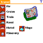
Traveling application for people on the move. Record all your travel needs and visualice your more important Maps and sketch them. Enter your Flight data, cruises, train, road, hotel and itineraries of Traveling application for people on the move.
Category: Home & Education / Hobbies
Publisher: Alvaro Adarraga, License: Shareware, Price: USD $11.99, File Size: 2.2 MB
Platform: Unknown
With our locr PC software "locr Gps Photo for Windows" you can manage to automatically geotag numerous photos simultaneously. You just require a digital camera, a Gps data logger and the application "locr Gps Photo for Windows".
There are two ways to geotag your photos: The photos can be tagged manually or automatically. For automatic geotagging...
Category: Multimedia & Design / Multimedia App's
Publisher: locr, License: Freeware, Price: USD $0.00, File Size: 490.8 KB
Platform: Windows
Nokia Map Manager is a program that allows you to manage and transfer GPS maps to mobile phone.
Nokia Map Manager is a program that allows you to manage and transfer Gps Maps to mobile phone. The Map Manager is for the 6110 Navigator only. The program is provided with scan function to search Maps on the computer and DVD. Nokia Map Manager is an additional application and is used together with Nokia PC Suite 6.86 and later versions.
Nokia Map Manager helps you to...
Category: Internet / Communications
Publisher: Nokia, License: Freeware, Price: USD $0.00, File Size: 0
Platform: Windows
Used Magellan toolbar for Internet Explorer.
Used Magellan toolbar for Internet Explorer. Find great deals on used Magellan Gps devices at prices you can afford. Whether your looking for the Magellan Roadmate, Magellan Maestro, or Magellan CrossoverGPS you'll find it here at low prices. We are always searching our networks on a daily basis to bring you the best prices in used Magellan Gps devices for your car. Find a great...
Category: Internet / Browsers
Publisher: Used Magellan, License: Freeware, Price: USD $0.00, File Size: 1.1 MB
Platform: Windows
The Stratomaster Flight Log program can be used for the extraction and viewing of all your Flight data from one of the following instruments:
-Stratomaster Flight
-Stratomaster Extreme
-Stratomaster Ultra (all types).
Features:
-Easy maintenance of your Flight log
-The Flight log can be printed
...
Category: Multimedia & Design / Graphics Viewers
Publisher: MGL Avionics, License: Freeware, Price: USD $0.00, File Size: 1.1 MB
Platform: Windows
A very powerful plugin that seamlessly integrates Gps waypoints and Garmin courses into SportTracks, features for which you would have to use Garmin Mapsource™ and Garmin TrainingCenter™ or similar 3rd party applications otherwise.
Category: Home & Education / Miscellaneous
Some of the outstanding features of this plugin are:
-create courses with autorouting
-create waypoints from addresses
Publisher: Old Man Biking's SportTracks Plugins, License: Shareware, Price: USD $13.08, File Size: 1.4 MB
Platform: Windows

OziPhotoTool combines the technology of a Gps receiver and a digital camera to automatically keep a record of where digital photos were taken. It is designed to be used in conjunction with OziExplorer. Most digital cameras have EXIF metadata stored as part of the photo. This includes is the date and time the photo was taken. Many Gps units have 'tracklogs'. The Gps keeps a...
Category: Utilities
Publisher: OziPhotoTool, License: Shareware, Price: USD $25.00, File Size: 14.3 MB
Platform: Windows
My Gps Logger 1.01 is a program designed to be used with My Fuel Tax 4.0. With My Gps Logger you can log all the locations where your truck has been to a monthly data file. This data file can later be imported into My Fuel Tax 4.0 by calculating the miles in state using Microsoftâ Mappoint. This is what you will need to use My Gps Logger with My Fuel Tax:a laptop with...
Category: Home & Education / Miscellaneous
Publisher: Spinnaker Software Solutions, License: Freeware, Price: USD $0.00, File Size: 477.7 KB
Platform: Windows
FS2002 Regional IFR Adventure - Eastern126.
FS2002 Regional IFR Adventure - Eastern126. Airline Flight from Sydney to Coffs Harbour. Command an Eastern Australia Airlines De Havilland Dash-8 on an IFR Flight to a smaller regional airport on the northern coast of NSW, Australia.
Follow real world procedures using a variety of navaids and Gps navigation, making a non-precision approach to minimums....
Category: Games / Simulations
Publisher: CMAA - Custom Made ATC Adventures, License: Shareware, Price: USD $0.00, File Size: 0
Platform: Windows
You will be able to enjoy many of CompeGPS Lands features such as waypoint and route creation and edition, full communication between PDA and Gps, use of Maps and the moving map (real-time navigation). CompeGPS Pocket Land allows full communication between Gps and PDA (tracks, waypoints and routes). You will be able to create waypoints and routes, use Maps...
Category: Home & Education
Publisher: CompeGPS TEAM S.L., License: Shareware, Price: USD $76.00, File Size: 3.9 MB
Platform:
RouteBuddy is the only modern, advanced digital map application for Windows and Mac OS X.
RouteBuddy is the only modern, advanced digital map application for Windows and Mac OS X. It doesn't matter on which platform you wish to use the application as it sports a universal toolbar and comparable features throughout.
- High resolution Road, Topo and Satellite Maps can be viewed in the same application using our state-of-the-art animated layer technology.
...
Category: Home & Education / Miscellaneous
Publisher: RouteBuddy Ltd, License: Shareware, Price: USD $59.99, File Size: 121.5 MB
Platform: Windows
Terrain Tools - Create maps quickly and easily!
Terrain Tools - Create Maps quickly and easily!
Terrain Tools is the ideal tool for outdoor recreationists, real-estate professionals, farmers, ecologists, archaeologists and others who need to create basic Maps, calculate areas, lengths, bearings and distances.
Overlay Gps tracks on scanned images such as USGS or Canadian NTS topos. Import and...
Category: Business & Finance / Applications
Publisher: Softree, License: Shareware, Price: USD $124.00, File Size: 15.0 MB
Platform: Windows
VisualGPSXP is a general purpose utility for monitoring the output of a GPS receiver.
VisualGPSXP is a general purpose utility for monitoring the output of a Gps receiver. Using the NMEA data from the Gps receiver, VisualGPSXP will display various statuses graphically.
Tools such as a survey utility average the position and shows accuracy of the Gps receiver in a static application.
Main features:
- Multiple connection...
Category: Home & Education / Miscellaneous
Publisher: VisualGPC, License: Shareware, Price: USD $25.00, File Size: 1.1 MB
Platform: Windows
GolfLogix is the most precise, durable, and user-friendly golf GPS on the market today.
GolfLogix is the most precise, durable, and user-friendly golf Gps on the market today. Wherever you are on the course, GolfLogix displays the key distances to hazards and the green in big bold numbers all on a sleek black palm-sized device. The screen advances automatically to all of the targets on the golf course so there are no buttons to push or lasers to point during your round.
Category: Home & Education / Hobbies
Publisher: Garmin Ltd or its subsidiaries, License: Freeware, Price: USD $0.00, File Size: 12.2 MB
Platform: Windows
Live!Flight allows that everyone can track your Flight in Flight simulator in real-time, all over the world. Your aircraft is displayed as a 3D-model in a map of NASA World Wind.
For that purpose Live!Flight transmits position and Flight attitude information. With a refreshing rate of 2 times per second you can see every aircraft's movement....
Category: Business & Finance / Business Finance
Publisher: Christoph Paulus, License: Shareware, Price: USD $29.00, File Size: 4.2 MB
Platform: Windows
GPSMapEdit is an application designed for visual authoring of Gps-Maps in various cartographic formats: Polish format, Garmin MapSource, Lowrance MapCreate, Navitel Navigator (navigation software for Windows Mobile, Android, Symbian, iPhone), ALAN Map 500/600, Holux MapSho, and custom POIs and speedcams.
The program may also load and convert Gps-tracks,...
Category: Utilities / Misc. Utilities
Publisher: Konstantin Galichsky, License: Shareware, Price: USD $65.00, File Size: 2.4 MB
Platform: Windows
All measurements, GPS-protocols and own informations in a single map.
All measurements, Gps-protocols and own informations in a single map.
Several enterprise Maps in one program without additional costs.
No limitation of the area quantity
Tile and join fields.
Multilingual: currently in english, german, spanish, french, greek, polish.
International: over 80 coordinate reference systems of 26 european countries...
Category: Audio / Utilities & Plug-Ins
Publisher: GPSur Dr. Erhard Regener, License: Shareware, Price: USD $449.00, File Size: 7.9 MB
Platform: Windows