Free Downloads: Gps Plugin For Ms Excel
ThinkVantage Gps (Global Positioning System) receives signals from the Gps satellites and determines the location of your ThinkPad. This program is easy to install and easy to manipulate.
This package installs the software (Gps driver) to enable the following devices:
- Ericsson F3507g
- Ericsson F3607gw
- Ericsson F5521gw
-...
Category: Utilities / System Utilities
Publisher: Lenovo, License: Freeware, Price: USD $0.00, File Size: 20.6 MB
Platform: Windows
The OSTN02 extension for ArcPad is a FREE tool that automatically transforms Gps data and aligns it with Ordnance Survey (OS) background map. This easy-to-use extension removes the need to manually post-process Gps data by providing’ on the fly’ transformation of WGS84 latitude and longitude into OSTN02 corrected British National Grid coordinate. Data capture using...
Category: Home & Education / Miscellaneous
Publisher: ESRI (UK) Ltd, License: Freeware, Price: USD $0.00, File Size: 8.0 MB
Platform: Windows
Overview Gps Simulator is software that generates a virtual Gps data Used to develop and simulation of Gps applications -Save testing and development time -No location restriction or work everywhere -No Gps device needed Feature Easy routing Selectable map(7EA Map) Support speed control Support 10EA NMEA protocol messages(GGA, GNS, GLL, RMC, VTG,...
Category: Desktop Enhancements / Shell & Desktop Managers
Publisher: NMEAsoft, License: Demo, Price: USD $150.00, File Size: 3.3 MB
Platform: Windows
Have a Gps and a laptop? Use this to find your way. Make patterns or a trail to share with others. When the application starts, you may pick your area of operations - be it North America, South America, Europe and Asia, or Australia. Your quadrant is determined by where you are in relation to the Equator and the Prime Meridian. Tracking of your position is automatically enabled when the...
Category: Home & Education / Miscellaneous
Publisher: LogicAll Solutions, LLC, License: Freeware, Price: USD $0.00, File Size: 4.6 MB
Platform: Windows
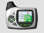
Improve your golf game with a handheld Gps that gives distance to pin, club suggestions, locations of hazards and much more. Wherever in the world you play golf, the sureshotgps will allow you to obtain distances from tee to green. Experience the difference with better club selection, speedier play and statistical information per round of golf. The sureshotgps relies on Gps...
Category: Home & Education
Publisher: Absolute Software Pty Ltd, License: Shareware, Price: USD $399.00, File Size: 3.8 MB
Platform: Windows


 Shareware
MarshallSoft Gps Component Visual Basic and .NET toolkit to read and decode industry standard Gps NMEA 183 navigation sentences from the RS232 serial port as well as computes great circle distances and bearings. Features include: - Supports both 32-bit and 64-bit Windows. - Uses the Windows API for serial port input. No special Windows driver is required. - Runs as a...
Category: Software Development / Components & Libraries
Publisher: MarshallSoft Computing, License: Shareware, Price: USD $115.00, File Size: 476.8 KB
Platform: Windows
GPSCAD Transfer is an application for transferring points between a gps device and autocad.
GPSCAD Transfer is an application for transferring points between a Gps device and autocad. The present version works with a Magellan Gps device, but the next release will also work with a Garmin Gps device. It allows you to convert latitude and longitude to utm zone nad 83 in either the US or in metric measurement system.
Category: Multimedia & Design / Image Editing
Publisher: Timberwolf Software Solutions, LLC, License: Shareware, Price: USD $0.00, File Size: 2.6 MB
Platform: Windows
GPS Send Map is a Windows interface program which uses (sendmap.
Gps Send Map is a Windows interface program which uses (sendmap.exe) to load the IMG maps to the Gps.This program works well and setup is easy, although there seams to be minor issues in some windows OS.The Gps acted as usual and my maps appeared on the screen as usual. NICE.
Category: Security & Privacy / Other
Publisher: DougsBrat, License: Freeware, Price: USD $0.00, File Size: 1.5 MB
Platform: Windows
Kinomap Gps File Fixer allows you to process some treatments on Gps file:
- convert almost any Gps file to standard NMEA 0183, compatible with Kinomap
- fill the gaps between points when your file is not 1Hertz: the extra point will be recreated by interpolation
- cut a long file in which there are loops of data (example: race) in several parts
Category: Home & Education / Miscellaneous
Publisher: ExcelLance, License: Freeware, Price: USD $0.00, File Size: 19.6 MB
Platform: Windows


 Shareware
Gps Mapping Software for Windows, Loading topographic maps, realtime navigation, track recording, manage Gps devices and more. The software can be used with various map formats including: GeoTiff, BSB Nautical Charts, AutoCad DXF files, ESRI Shapefiles. Using calibration you can also use scanned or downloaded JPG, BMP, GIF, PNG and TIF maps. The software can be used for survey,...
Category: Home & Education / Science
Publisher: Eye4Software B.V., License: Shareware, Price: USD $149.00, EUR99, File Size: 11.1 MB
Platform: Windows
Keep track of discount Garmin GPS deals on with this Firefox toolbar.
Keep track of discount Garmin Gps deals on with this Firefox toolbar.compare and buy all the latest Garmin satellite navigation systems. If you want a discount Garmin Gps system this is the Firefox toolbar to use. We also provide information on the latest offers, price cuts and discount voucher codes to help you buy the latest Garmin Gps at the cheapest price possible in...
Category: Internet / Browsers
Publisher: Discount Garmin GPS, License: Freeware, Price: USD $0.00, File Size: 1.1 MB
Platform: Windows


 Shareware
With AnyMP4 iPhone Gps Spoofer for Mac, you own one of the best Gps location spoofers for iOS devices. It lets you set the virtual Gps location within a few clicks. Whats more, you can play location-based games from anywhere in the world easily. Key Functions: 1. Fake yours iPhone location easily. AnyMP4 iPhone Gps Spoofer for Mac is an easy-to-use...
Category: Software Development
Publisher: AnyMP4 Studio, License: Shareware, Price: USD $9.96, File Size: 72.5 MB
Platform: Mac
An easy to use Gps downloading utility that lets you download your Gps waypoints easily and export them into a variety of formats useful for editing, display and importing into many different mapping programs.
Use Lobal to save Gps waypoints as:
- Text Files
- HTML Tables
- Shape Files
- Google Earth KML
- DBase Files.
Category: Utilities / Misc. Utilities
Publisher: Ecological Software Solutions, License: Freeware, Price: USD $0.00, File Size: 2.2 MB
Platform: Windows
Multicam or multiple video source capable webcam/video capture application with Gps filter support, and supports most codecs such as DivX, XViD, FFDShow, etc.
DSGPS.ax - Gps Video Overlay, a DirectShow filter which retrieves Gps and OBD-II data from XPort and/either/or XOBD, and imprints Gps speed, time, date, course, longitude, latitude, MPG, RPM, AIT,...
Category: Multimedia & Design / Video
Publisher: Curious Technology, License: Freeware, Price: USD $0.00, File Size: 78.9 KB
Platform: Windows
The fast track to GPS success.
The fast track to Gps success. The Linx MDEV-Gps-SR contains everything needed to rapidly evaluate the SR Series Gps modules and implement them in record time. This all-inclusive Master Development System features a pre-assembled development board with an on-board OLED display for standalone testing. The system can also be attached to a PC via USB and operated using the...
Category: Software Development / Misc. Programming
Publisher: Linx Technologies, Inc., License: Freeware, Price: USD $0.00, File Size: 98.5 MB
Platform: Windows
Gps Egypt brings you the best Gps mapping and navigation package on the Egyptian market today with over 55,000 km of road coverage. The package offers the best map coverage available in Egypt, in addition to a cutting-edge software package for voice-based routing and navigation.
Category: Internet / Communications
Publisher: GPS Egypt, License: Freeware, Price: USD $0.00, File Size: 135.6 MB
Platform: Windows
VIETMAP Gps Fleet Management is a great Gps tracking software for companies that need to know where are all the cars in some moment. It is a great and helpful software when you want to check out if your drivers are on schedule. This software also helps you if your car is stolen.
Category: Business & Finance / Business Finance
Publisher: VIETMAP, License: Demo, Price: USD $0.00, File Size: 111.6 MB
Platform: Windows
With our locr PC software "locr Gps Photo for Windows" you can manage to automatically geotag numerous photos simultaneously. You just require a digital camera, a Gps data logger and the application "locr Gps Photo for Windows".
There are two ways to geotag your photos: The photos can be tagged manually or automatically. For automatic geotagging...
Category: Multimedia & Design / Multimedia App's
Publisher: locr, License: Freeware, Price: USD $0.00, File Size: 490.8 KB
Platform: Windows
A program for converting OLEX files into GPS Utility Format Files.
A program for converting OLEX files into Gps Utility Format Files.
Gps Utility is an easy-to-use application that allows you to manage, manipulate and map your Gps information.
When you convert the OLEX files you can use the source file name or enter a new target file name.
Category: Audio / Rippers & Encoders
Publisher: GPS Utility Ltd., License: Freeware, Price: USD $0.00, File Size: 404.5 KB
Platform: Windows


 Shareware
Gps Mapping Software for Windows, Loading topographic maps, manage Gps devices and more. The software can be used with various map formats including: GeoTiff, BSB Nautical Charts, AutoCad DXF files, ESRI Shapefiles. Using calibration you can also use scanned or downloaded JPG, BMP, GIF, PNG and TIF maps. The software can be used for survey, research, track and trace, real time...
Category: Home & Education / Science
Publisher: Eye4Software B.V., License: Shareware, Price: USD $75.04, EUR49, File Size: 6.7 MB
Platform: Windows
WP Simplicity Plugin is the perfect time saving Plugin for any internet marketer who loves saving time. With this Plugin you will realize how easy it can be set up and get a site running without spending a ton of time online.
When you get the WP Simplicity Plugin you will get more done online without having to worry about finding all the plugins that you will...
Category: Games / Puzzles
Publisher: WP Simplicity Plugin, License: Freeware, Price: USD $0.00, File Size: 697.0 KB
Platform: Windows
Create Gps enabled geo maps directly on the background of aereal photos and road maps from the internet. Import geodata from Google-Earth, OpenStreetMap, Gps tracks and Gps logger. Map editor , manually digitizing. Specifical graphical objects (borderlines, borderareas) to guarantee exact same borders of neighbour areas..Screen calibration for true to display on the screnn.
Category: Multimedia & Design / Digital Media Editors
Publisher: GPSur Dr. Erhard Regener, License: Shareware, Price: USD $65.00, File Size: 6.4 MB
Platform: Windows
Gps-X is a modular, multi-purpose computer program for the modeling and simulation of municipal and industrial wastewater treatment plants. Whether you are designing a new facility, or simulating an existing plant, Gps-X will help you improve your design and operating efficiency.
Category: Business & Finance / Business Finance
Publisher: Hydromantis Inc., License: Demo, Price: USD $0.00, File Size: 34.6 KB
Platform: Windows
The Gps map will help you give you with turn by turn directions to your destination using a POI, city point and/or longitude and latitude.It has the ability to preplan driving destinations before getting into your car. Compatible with ALL Garmin Gps units. Don't pay more than US$10 per day when you already own a Garmin, this is the most comprehensive Gps map available...
Category: Home & Education / Miscellaneous
Publisher: GPSTravelMaps.com, License: Shareware, Price: USD $0.00, File Size: 0
Platform: Windows
GPSCommunicator is a FREE utility to visually represent NMEA GPS position data in realtime.
GPSCommunicator is a FREE utility to visually represent NMEA Gps position data in realtime. It works with NMEA 0183 Gps receivers connected via a serial port. GPSCommunicator has the following features:
- Vessel position display over moving map.
- User selectable maps.
- Create and save Waypoints.
- Graphical Gps data display
- .NET components...
Category: Internet / Misc. Plugins
Publisher: Panazzolo.Com, License: Freeware, Price: USD $0.00, File Size: 772.5 KB
Platform: Windows


