Free Downloads: Gps Signal Trsnsmitter And Receiver
NMEATime will automatically set your PC clock using a Gps Receiver connected to the serial port of a PC or to the National Institute of Standards and Technology (NIST) time servers over the Internet.
Features:
- Digital desktop time code clock - like NASA has!
- Analog desktop clock
- Uses Gps Time to set your PC clock
- NMEA...
Category: Home & Education / Alarm Applications
Publisher: VisualGPS, LLC., License: Shareware, Price: USD $20.00, File Size: 1.1 MB
Platform: Windows

HS Gps is a software library (with full C source code) which provides access to a NMEA-183 compliant Gps Receiver via a serial communications port, decoding NMEA sentences: $GPGGA, $GPGSA, $GPGSV, $GPGLL, $GPRMC and $GPVTG. Decoded parameters include: time, date, position, altitude, speed, course and heading, according to standard - NMEA-183 (National Marine Electronics...
Category: Software Development
Publisher: Hillstone Software, License: Freeware, Price: USD $0.00, File Size: 309.3 KB
Platform: Windows
The XDS Receiver Discovery Tool allows the user to view details about X-Digital receivers connected to the local network, including:
- The Receiver’s IP address
- The Receiver’s station name
- The type of Receiver
- The code version the Receiver is currently running
- The Receiver’s board...
Category: Utilities / Misc. Utilities
Publisher: X-Digital Systems, License: Freeware, Price: USD $0.00, File Size: 598.0 KB
Platform: Windows
The WiNRADiO Digital Bridge Virtual Sound Card is a software option designed to transfer digitized audio Signal streams exclusively from the WiNRADiO G3-series receivers to other applications. It does so by creating a Windows multimedia driver with a pair of Wave In/Out Windows devices.
The WiNRADiO Receiver software can send an audio stream to the Out device, and any...
Category: Audio / Utilities & Plug-Ins
Publisher: WiNRADiO Communications, License: Shareware, Price: USD $0.00, File Size: 0
Platform: Windows
The Link Budget program is a calculator for computing Signal strength through a microwave link using various components and determine whether an acceptable video Signal can be received.
Link Budget is an easy to use program that will compute received Signal strength on several factors, such as Receiver sensitivity, cable type, length of cable, antenna...
Category: Business & Finance / Calculators
Publisher: TRON-Tek, License: Freeware, Price: USD $0.00, File Size: 1.4 MB
Platform: Windows
Marine POI Database Recovery is a free software tool that allows you to recover the POI database if the MapSource data is loaded to your Gps Receiver.This file is intended to reload the Point of Interest database that came preloaded in your eTrex Venture, eTrex Mariner, eTrex Legend, eTrex Legend etc.
Category: Utilities / Misc. Utilities
Publisher: Garmin Ltd or its subsidiaries, License: Freeware, Price: USD $0.00, File Size: 3.8 MB
Platform: Windows
Trap Receiver stands alone with its extensive set of actions.
Trap Receiver stands alone with its extensive set of actions. Trap Receiver gets the data into your back office systems where it can be put to use. Trap Receiver was created by network, systems, and management professionals used to producing and consuming these messages to get the job done.
Category: Business & Finance / Business Finance
Publisher: Network Computing Technologies, Inc., License: Freeware, Price: USD $0.00, File Size: 2.0 MB
Platform: Windows
Microsoft Streets & Trips with Gps Locator pairs the trip-planning features of Streets & Trips software with a compact, cable-free Global Positioning System (Gps) Receiver.
This device plugs directly into your laptop and when used with Streets & Trips gives you spoken driving guidance plus automatic rerouting if you miss a turn, making it easier to...
Category: Home & Education / Miscellaneous
Publisher: Microsoft, License: Shareware, Price: USD $69.95, File Size: 1.2 GB
Platform: Windows
With PixGPS it's easy to track the exact positioin where you took your photos.
With PixGPS it's easy to track the exact positioin where you took your photos. You need a Gps Receiver. All you need to do is to have the Gps turned on when you ake the photos. After your photo session, download the photos from your camera and the track file from the Gps. PixGPS will calculate the position of each photo and insert this in the EXIF data of each...
Category: Multimedia & Design / Multimedia App's
Publisher: BR Software, License: Shareware, Price: USD $0.00, File Size: 1.5 MB
Platform: Windows
SmartComGPS is a Gps mapping/tracking/navigation software for Symbian smartphones. It is one of most advanced Gps mapping software on the market. SmartComGPS designed for the all Symbian phones. It is compatible with external BT Gps receivers, and internal aGPS Receiver of Motorola A920/925/1000. SmartComGPS can run without Gps Receiver, as "mapping"...
Category: Multimedia & Design
Publisher: SmartCom Ltd GPS Mobile Solutions, License: Shareware, Price: USD $29.95, File Size: 291.1 KB
Platform: Unknown
SmartComGPS is a Gps mapping/tracking/navigation software for Symbian smartphones. It is one of most advanced Gps mapping software on the market. SmartComGPS designed for the all Symbian phones. It is compatible with external BT Gps receivers, and internal aGPS Receiver of Motorola A920/925/1000. SmartComGPS can run without Gps Receiver, as "mapping"...
Category: Multimedia & Design
Publisher: SmartCom Ltd GPS Mobile Solutions, License: Shareware, Price: USD $29.95, File Size: 284.7 KB
Platform: Unknown
SmartComGPS is a Gps mapping/tracking/navigation software for Symbian smartphones. It is one of most advanced Gps mapping software on the market. SmartComGPS designed for the all Symbian phones. It is compatible with external BT Gps receivers, and internal aGPS Receiver of Motorola A920/925/1000. SmartComGPS can run without Gps Receiver, as "mapping"...
Category: Multimedia & Design
Publisher: SmartCom Ltd GPS Mobile Solutions, License: Shareware, Price: USD $29.95, File Size: 299.4 KB
Platform: Unknown
Remote control software for R&S®EM100 Digital Compact Receiver.
Remote control software for R&S®EM100 Digital Compact Receiver.
The R&S®EM100 digital compact Receiver has been specifically designed as a cost-efficient mobile radiomonitoring solution. The Receiver’s operation via remote control software and its monitoring functionality have been optimized for tasks requiring a handoff Receiver in...
Category: Business & Finance / Business Finance
Publisher: Rohde & Schwarz GmbH & Co KG, License: Freeware, Price: USD $0.00, File Size: 118.1 MB
Platform: Windows
The receiver portion of AirLink STL is very very smart.
The Receiver portion of AirLink STL is very very smart. It will constantly monitor and wait for your stream to reconnect. But while your connection is lost, the AirLink STL Receiver will begin playing local audio files that have been pre-loaded injecting a liner or sweep after XX number of songs and let's not forget your Legal ID at the top of the hour.
Category: Audio / Utilities & Plug-Ins
Publisher: Spry Group Multimedia, License: Shareware, Price: USD $125.00, File Size: 8.4 MB
Platform: Windows
It is a little utility to automate the reception of the APT Signal transmitted by the low orbit Weather satellites. It will:
Set the Receiver to the correct frequency just before the satellite pass (using a serial connection).
Record the audio Signal during the pass. (Using the line in input of the sound card). Create overlay for pass using David Taylor's...
Category: Business & Finance / Applications
Publisher: K.S., License: Freeware, Price: USD $0.00, File Size: 43.4 KB
Platform: Windows
The program accepts NMEA GPS sentences from most GPS receivers that connect to a USB port.
The program accepts NMEA Gps sentences from most Gps receivers that connect to a USB port.
The program can display satellite images of waypoint locations on the track plotter.
Is a free software for recording , monitoring and plotting Gps data, very useful and very easy.
Category: Home & Education / Miscellaneous
Publisher: Club Cruceros de La Paz A.C., License: Freeware, Price: USD $0.00, File Size: 10.6 MB
Platform: Windows
Golf GPS Devices toolbar for internet explorer.
Golf Gps Devices toolbar for internet explorer. Find golf Gps devices are great bargain prices. We have all the latest golf Gps devices for sale both new and used. Whether you're looking for the iGolf, Golf Buddy, GolfLogix, SonoCaddie, or SkyCaddie, you can find it here along with their accessories. We are always searching our networks to bring you the best deals on golf...
Category: Internet / Browsers
Publisher: Golf GPS Devices, License: Freeware, Price: USD $0.00, File Size: 1.1 MB
Platform: Windows
 Shareware
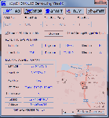
HsGpsDll is a Windows Dynamic Link Library which provides access to any NMEA-183 compliant Gps Receiver via a serial communications port. HsGpsDll is designed for use from Visual C, C Sharp .NET, Visual Basic or other programming languages. HsGpsDll allows a user application to easily read from a Gps device the current Gps position fix and current velocity over...
Category: Software Development / Components & Libraries
Publisher: Hillstone Software, License: Shareware, Price: USD $160.00, EUR210, File Size: 1.4 MB
Platform: Windows
Freeware
DreamBoxTools - a program for tuning your DreamBox satellite Receiver. Control your Receiver right from the computer. Main features: - Lyngsat-to-Dreambox transponders parser. Update data about satellites and transponders to your Receiver directly from the site Lyngsat.com - Satellite filter - Europe, Asia, Atlantic, America, only HD, manual choice, saved...
Category: DVD & Video / Video Conversion
Publisher: Protectedsoft Ltd., License: Freeware, Price: USD $0.00, File Size: 1014.4 KB
Platform: Windows

OziPhotoTool combines the technology of a Gps Receiver and a digital camera to automatically keep a record of where digital photos were taken. It is designed to be used in conjunction with OziExplorer. Most digital cameras have EXIF metadata stored as part of the photo. This includes is the date and time the photo was taken. Many Gps units have 'tracklogs'. The Gps...
Category: Utilities
Publisher: OziPhotoTool, License: Shareware, Price: USD $25.00, File Size: 14.3 MB
Platform: Windows
Automatic NCDXF beacon monitor for Radio Amateurs,
Category: Audio / Utilities & Plug-Ins
SWL'ers and HF communication engineers
Features:
- continuously monitors 18 NCDXF beacons on five bands;
automatically detects the presence of the beacon signals, even in QRM and noise;
- measures the Signal-to-noise ratio, the QSB index, and the propagation delay of the Signal;
Publisher: Afreet Software, Inc., License: Shareware, Price: USD $25.00, File Size: 1.8 MB
Platform: Windows
The Windows PC shareware program for Garmin and Magellan GPS receivers.
The Windows PC shareware program for Garmin and Magellan Gps receivers.
Main Features:
- transfer your waypoints, routes, and tracks from and to the Gps Receiver, and save it on your computer disk
- review your waypoints
- enter and edit your waypoints
- define your routes and get the estimated traveling time
- review and...
Category: Home & Education / Miscellaneous
Publisher: Heinrich Pfeifer, License: Freeware, Price: USD $0.00, File Size: 2.9 MB
Platform: Windows
JSR Control Panel will allow you to control the PRC50 Pulser-Receiver Card, the DPR500 Dual Pulser/Receiver or the DPR300 Pulser/Receiver from your PC. In addition, a Simulation Mode is included within this application that will allow you to view and change settings without having hardware in place.Windows Support for PRC50, DPR500 and DPR300 instruments
Category: Internet / Communications
Publisher: Imaginant Inc., License: Freeware, Price: USD $0.00, File Size: 19.8 MB
Platform: Windows
Eye4Software Gps Mapping is a professional Gps mapping software tool that can be used in numerous applications. Use the software to load, view and edit your maps, display your position realtime and record all your movements.
The software will work with almost any Gps and can be used on any desktop, laptop or needbook computer running Windows XP or higher. The...
Category: Home & Education / Miscellaneous
Publisher: Eye4Software B.V., License: Shareware, Price: USD $130.61, File Size: 14.6 MB
Platform: Windows