Free Downloads: Gps Simulator Nmea
 Shareware
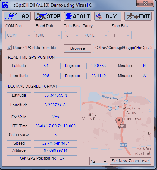
HsGpsDll is a Windows Dynamic Link Library which provides access to any Nmea-183 compliant Gps receiver via a serial communications port. HsGpsDll is designed for use from Visual C, C Sharp .NET, Visual Basic or other programming languages. HsGpsDll allows a user application to easily read from a Gps device the current Gps position fix and current velocity over...
Category: Software Development / Components & Libraries
Publisher: Hillstone Software, License: Shareware, Price: USD $160.00, EUR210, File Size: 1.4 MB
Platform: Windows
HsGpsDll is a Windows Dynamic Link Library which provides access to any Nmea-183 compliant Gps receiver via a serial communications port.
HsGpsDll is designed for use from Visual C, C++, Visual C Sharp .NET, Visual Basic or other programming languages, capable of calling DLL functions.
HsGpsDll allows a user application to easily read from a Gps...
Category: Business & Finance / Business Finance
Publisher: Hillstone Software, License: Shareware, Price: USD $270.58, File Size: 700.6 KB
Platform: Windows
Have a Gps and a laptop? Use this to find your way. Make patterns or a trail to share with others. When the application starts, you may pick your area of operations - be it North America, South America, Europe and Asia, or Australia. Your quadrant is determined by where you are in relation to the Equator and the Prime Meridian. Tracking of your position is automatically enabled when the...
Category: Home & Education / Miscellaneous
Publisher: LogicAll Solutions, LLC, License: Freeware, Price: USD $0.00, File Size: 4.6 MB
Platform: Windows
MarshallSoft Gps Component VB (and VB.NET) library toolkit (MGC4VB) reads and decodes industry standard Gps Nmea 183 sentences from the RS232 serial port as well as computing great circle distances and bearings. Features of MGC4VB include: The most current Gps data is always available on demand * Runs as a background thread unattended * Works with Bluetooth virtual...
Category: Software Development
Publisher: MarshallSoft Computing, License: Shareware, Price: USD $105.00, File Size: 233.4 KB
Platform: Windows
Shareware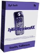
ZylGPSReceiverAX is an an award-winning ActiveX control that communicates with a serial Gps receiver. It returns latitude, longitude, altitude, speed, heading and many other parameters of the position. This control works with any Nmea compatible receiver connected to one of the serial ports. You can use it also with USB devices, because these devices usually have a driver...
Category: Software Development / ActiveX
Publisher: Zyl Soft, License: Shareware, Price: USD $99.99, File Size: 863.4 KB
Platform: Windows
The fast track to GPS success.
The fast track to Gps success. The Linx MDEV-Gps-SR contains everything needed to rapidly evaluate the SR Series Gps modules and implement them in record time. This all-inclusive Master Development System features a pre-assembled development board with an on-board OLED display for standalone testing. The system can also be attached to a PC via USB and operated using the...
Category: Software Development / Misc. Programming
Publisher: Linx Technologies, Inc., License: Freeware, Price: USD $0.00, File Size: 98.5 MB
Platform: Windows
Gps log-maker. Software creates *.plt track file, *.rte route file and, optionally, Nmea-log file.
Category: Internet / SMS
Publisher: dxsoft.com, License: Freeware, Price: USD $0.00, File Size: 85.8 KB
Platform: Unknown
NMEATime will automatically set your PC clock using a Gps receiver connected to the serial port of a PC or to the National Institute of Standards and Technology (NIST) time servers over the Internet.
Features:
- Digital desktop time code clock - like NASA has!
- Analog desktop clock
- Uses Gps Time to set your PC clock
- Nmea...
Category: Home & Education / Alarm Applications
Publisher: VisualGPS, LLC., License: Shareware, Price: USD $20.00, File Size: 1.1 MB
Platform: Windows
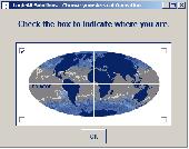
Have a Gps and a laptop? Use this to find your way. Make patterns or a trail to share with others. When the application starts, you may pick your area of operations - be it North America, South America, Europe and Asia, or Australia. Your quadrant is determined by where you are in relation to the Equator and the Prime Meridian. Tracking of your position is automatically enabled when the...
Category: Home & Education / Miscellaneous
Publisher: LogicAll Solutions, LLC, License: Freeware, Price: USD $0.00, File Size: 4.6 MB
Platform: Windows
The KML Generator is a useful and reliable utility which enables you to easily analyze Gps log files containing Nmea string data and then generate Google Earth (TM) compatible KML files. It is a free to use application and has a simple and friendly interface. It has low system requirements too, and works on all windows operating systems.
Category: Software Development / Misc. Programming
Publisher: Jacob Madsen, License: Shareware, Price: USD $0.00, File Size: 0
Platform: Windows
NemaTalker provides both user and developer of Nmea soft and hardware with a very powerful development and testing tool by simulating the output of a large number of nautical instruments, including Gps.
The program can be successfully used for educational purposes as well.
Category: Internet / Misc. Plugins
Publisher: Sailsoft, License: Shareware, Price: USD $59.00, File Size: 1.8 MB
Platform: Windows
Diffusion is done by sending sentences at format NMEA 0183 using UDP protocol .
Diffusion is done by sending sentences at format Nmea 0183 using UDP protocol .Diffused data come either from a Gps receiver or source issuing on UDP in real time navigation mode, either from a replayed file. In case of replay, position and speed settings are modifiable.GpsDiffuser is at least compatible with itself, GeoVisu and GpsGate.
Category: Utilities / Misc. Utilities
Publisher: GeoVisu team, License: Freeware, Price: USD $0.00, File Size: 1.7 MB
Platform: Windows
The Gps TrackManager is an application for planning routes and managing routes, waypoints and trackpoints.
The application support functions such as: open and save trackpoints files in various formats (GPX, Ozi Trackpoint file, Ozi Waypoint file, Nmea log, EasyGPS file), transmit Trackpoints, Waypoints and Routes to Garmin Gps receivers (Geko 201, GPSmap 60C), saves...
Category: Internet / Communications
Publisher: Frank Hamaekers, Write4u, License: Freeware, Price: USD $0.00, File Size: 4.8 MB
Platform: Windows
NemaStudio provides the professional developer of Nmea products with a very powerful development and testing tool by simulating the output of various nautical instruments and target objects including Gps, AIS and Radar.
All instruments, targets and ports can be matched and mixed, meaning you can have multiple instances of several objects transmitting over the same or...
Category: Software Development / Misc. Programming
Publisher: Sailsoft, License: Shareware, Price: USD $345.31, File Size: 2.4 MB
Platform: Windows

MB-GPS2KML converts a GPS log file (in plain NMEA format) to a KML file (placemark file for Google Earth) and opens this file in Google Earth. Velocity, number of satellites and HDOP are interpreted as height, color and size of the icons.
Category: Home & Education
Publisher: Markus Bader, License: Freeware, Price: USD $0.00, File Size: 441.4 KB
Platform: Windows
Yet another tool to read and convert Gps logs from Royaltek RGM-3800 and RBT-2300 (using serial communication), from RBT-3000 (using files), from Nmea logs files (comming from AMOD 3080 datalogger for example). Free download and easy to install. Enjoy.
Category: Utilities / Misc. Utilities
Publisher: eXtraGPS, License: Freeware, Price: USD $0.00, File Size: 2.5 MB
Platform: Windows
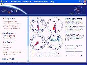
VisualGPS incorporates many advanced features found in professional programs.
VisualGPS incorporates many advanced features found in professional programs. Its sole purpose is to display graphically specific Nmea 0183 sentences and show the effects of selective availability (SA).
Main Features:
- Azimuth and Elevation Graph - View all satellites that are in view. Each satellite identifies its pseudo random number (PRN) and its azimuth and...
Category: Home & Education / Miscellaneous
Publisher: VisualGPSLLC, License: Freeware, Price: USD $0.00, File Size: 1.7 MB
Platform: Windows
FlightSim Commander is a professional flight planner, Gps, Moving Map and navigation tool for Flight Simulator 2004 and Flight Simulator X. Plan a flight professionally using entire routes or route segments. Insert North Atlantic Tracks, PACOTs and SID´s and STAR´s. Save or convert your flight plans in various formats such as FSX, PMDG, Radar Contact, Sqawk Box,...
Category: Games / Simulations
Publisher: aerosoft, License: Shareware, Price: USD $0.00, File Size: 0
Platform: Windows
Shareware
ZylGPSReceiver.NET is an event driven .NET component that communicates with a Gps receiver. It returns latitude, longitude, altitude, speed, heading and many other useful parameters of the current position and the parameters of the satellites in view. The component is extended to calculate distances and make conversions between different measurement units. This component works with...
Category: Software Development / Components & Libraries
Publisher: Zyl Soft, License: Shareware, Price: USD $99.99, File Size: 1.1 MB
Platform: Windows
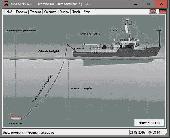
DRAGSENS Geo Software is used for the exact position estimation of a towed body, sensor, camera, array or net, dragged behind a ship, aircraft or vehicle. The software allows a real-time estimation of the position of a dragged sensor based on the location of a Gps-receiver. The sensor thereby can be dragged underwater, at water or earth surface or be airborne. The software calculates the...
Category: Home & Education / Science
Publisher: Killet Software Ing.-GbR, License: Shareware, Price: USD $145.00, EUR130, File Size: 2.0 MB
Platform: Windows
Develop precise, efficient, and reliable Gps software in record time with this multithreaded component for desktop and mobile devices, including PocketPC, Windows CE, Tablet PC, Smartphone and now Windows Mobile! Over fifty classes in one lightweight assembly give you unparalleled features while saving you hundreds of dollars in Gps device testing. Gps.NET is loaded...
Category: Software Development
Publisher: GeoFrameworks, LLC, License: Commercial, Price: USD $199.00, File Size: 8.5 MB
Platform: Windows,
GeoVisu is a program that displays georeferenced data (images, graphics) and downloads data recorded by some Gps devices.
GeoVisu has a "Moving map" navigation function, which can be used with any Nmea 0183 compatible or Garmin USB Gps device.
Main features:
- Displays georeferenced image formats : GeoTiff, ECW and ECWP,...
Category: Multimedia & Design / Graphics Viewers
Publisher: GeoVisu, License: Freeware, Price: USD $0.00, File Size: 1.7 MB
Platform: Windows
FREE GPS Software for your Garmin, Magellan or Lowrance GPS.
FREE Gps Software for your Garmin, Magellan or Lowrance Gps.
EasyGPS is the fast and easy way to upload and download waypoints, routes, and tracks between your Windows computer and your Garmin, Magellan, or Lowrance Gps. EasyGPS lists all of your waypoints on the left side of the screen, and shows a plot of your Gps data on the right. Use EasyGPS to back up...
Category: Internet / Communications
Publisher: TopoGrafix, License: Freeware, Price: USD $0.00, File Size: 3.9 MB
Platform: Windows
Shareware
With AnyMP4 iPhone Gps Spoofer for Mac, you own one of the best Gps location spoofers for iOS devices. It lets you set the virtual Gps location within a few clicks. Whats more, you can play location-based games from anywhere in the world easily. Key Functions: 1. Fake yours iPhone location easily. AnyMP4 iPhone Gps Spoofer for Mac is an easy-to-use...
Category: Software Development
Publisher: AnyMP4 Studio, License: Shareware, Price: USD $9.96, File Size: 72.5 MB
Platform: Mac
My Gps Logger 1.01 is a program designed to be used with My Fuel Tax 4.0. With My Gps Logger you can log all the locations where your truck has been to a monthly data file. This data file can later be imported into My Fuel Tax 4.0 by calculating the miles in state using Microsoftâ Mappoint. This is what you will need to use My Gps Logger with My Fuel Tax:a laptop with...
Category: Home & Education / Miscellaneous
Publisher: Spinnaker Software Solutions, License: Freeware, Price: USD $0.00, File Size: 477.7 KB
Platform: Windows