Free Downloads: Graphic Map Tool Jpg
The Logo Factory is an easy to use manager for your Win95/98 Startup and Shutdown screens. With it you can easily create, install and manage your Logos. Use your favorite photographs, wallpaper or any .gif, .bmp, .Jpg or .jpeg Graphic to replace the standard Windows Logos. TNS ANYONE CAN CREATE THEIR OWN LOGOS> All you have to do is choose a Graphic and the Creator will...
Category: Desktop Enhancements / Shell & Desktop Managers
Publisher: Camtech 2000, License: Shareware, Price: USD $19.95, File Size: 2.1 MB
Platform: Unknown
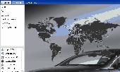
World Map Pro in Flash is a dynamic mapping solution to show any information worldwide Use our Map: - to show international offices (international affiliates, hotel networks, etc) - to show worldwide communities and information on them - to improve search by providing information on any country or region - as a real estate or any other Map/catalogue - to show zones...
Category: Internet
Publisher: USFlashMap.com, License: Shareware, Price: USD $199.00, File Size: 120.0 KB
Platform: Windows, Mac, Linux, Unix, MS-DOS, AS/400, OS/2
Map of Africa is one of the many maps created for GPS TrackMaker.
Map of Africa is one of the many maps created for GPS TrackMaker. You are able to download the installation package from the TrackMaker website. In order to preview the contents of this package, you need to install GPS TrackMaker.
Using the above mentioned application, you will be able to see the Map of Africa. Just click on the "Open Temporary...
Category: Home & Education / Miscellaneous
Publisher: Geo Studio Technology, License: Freeware, Price: USD $0.00, File Size: 18.3 MB
Platform: Windows
This new edition adds 5,200 new records, with the total database now at over 138,000 records.
This new edition adds 5,200 new records, with the total database now at over 138,000 records.
The Antique Map Price Record (and Map Collection Manager) is now available as either a CD-ROM or as a USB flash drive.
The AMPR is issued annually, and is recognized as the most comprehensive reference work of its kind in the antiquarian Map field.
...
Category: Home & Education / Miscellaneous
Publisher: MapRecord Publications, License: Shareware, Price: USD $0.00, File Size: 0
Platform: Windows
W3M Map Utilities is a Tool for editing maps, spells, graphics , actions , units and other things for warcraft 3. W3M Map Utilities includes : BLP Converter, Edit Button, BLP Viewer,
it has Fixed Map Detail Setting Bug, Added Remove Loading Screen, Convert to BLP in Change Loading Screen.
Category: Games / Misc. Games
Publisher: w3m.co.kr, License: Shareware, Price: USD $0.00, File Size: 0
Platform: Windows
Program shows you an actual X3 sector-map, with detailed information about most in-game objects.
Program shows you an actual X3 sector-Map, with detailed information about most in-game objects. The Map is based on a log-file that is created with an in-game script (by Andrei[<>Ace]). If you just want to view the standard Map (or if you don’t have the game) the program will work with the included default Map, which was created with an English X3 game...
Category: Games / Misc. Games
Publisher: SUU Design, License: Freeware, Price: USD $0.00, File Size: 1.4 MB
Platform: Windows
 Shareware
MindOnMap starts with a main idea in the center of your mind Map. You can add Main Nodes and some Sub or Free Nodes as needed, showing relationships between parts of the whole. Main features: 1. Bring efficiency to both your work and your life. MindOnMap allows you to visually generate your ideas on an infinite canvas. This allows you to continually track a project/program....
Category: Multimedia & Design
Publisher: MindOnMap Studio, License: Shareware, Price: USD $8.00, File Size: 1.9 MB
Platform: Windows
New Zealand Map Reference Converter (NZMapConv) is software that LINZ provides to convert Map references between the old NZMS260 Map series and the new NZTopo50 Map series.NZMapConv is a Windows programme designed to convert individual coordinates entered manually.
Category: Multimedia & Design / Media Management
Publisher: Land Information New Zealand, License: Freeware, Price: USD $0.00, File Size: 2.4 MB
Platform: Windows
With links and additional information on important topics for geography lessons.
With links and additional information on important topics for geography lessons. 3D-view of atlas (book) maps on a virtual globe, high resolution physical Map, political Map, satellite images, land coverage and earth-at-night Map. Create your own Map legend, use the drawing Tool, move and insert atlas symbols and much more.
Category: Multimedia & Design / Fonts
Publisher: Imagon GmbH, License: Freeware, Price: USD $0.00, File Size: 6.1 MB
Platform: Windows
When the XMAP software is communicating with an XEDE via the comms cable each Map will show, at the top of the Map display, an RPM and load value (x and y axis for the Map) in real time. Also in each Map a yellow highlighted block will show the current position within the Map. Beside the real-time display on each Map are the undo and redo buttons which...
Category: Home & Education / Miscellaneous
Publisher: ChipTorque, License: Freeware, Price: USD $0.00, File Size: 1.7 MB
Platform: Windows
Sig Panama Has :
Digital maps of Panama, Digital Map of Panama-City, digital Map of Taboga, digital Map of Bocas del Toro, digital Map of Colon and Free Zone, digital Map of Contadora Island, digital Map of Coronado, Panama, Zona Libre, Map of Panama, Map of Panama City, Map of Colon, Map of Zona Libre, Map of...
Category: Internet / Misc. Plugins
Publisher: DP Imperial, LLC., License: Freeware, Price: USD $0.00, File Size: 44.9 MB
Platform: Windows
b4Look is a simple Graphic viewer with support of most popular formats like as Jpg, TIF, PNG, GIF, BMP. Program uses GDI+ for most quick file parsing. It is compatible with Windows XP and Windows Vista.
Category: Multimedia & Design / Graphics Viewers
Publisher: b4Soft, License: Freeware, Price: USD $0.00, File Size: 86.0 KB
Platform: Windows
i-Fun Viewer is fast, image viewer with support for all common image formats. It has an streamlined interface and is simple to use. It supports thumbnail browsing, image editing and slideshows. Other features include: Ability to assign text descriptions to images, Support for all common image formats, such as Jpg, gif, Animated GIF, bmp, png, tif etc, Twain Scanner and digital camera...
Category: Multimedia & Design
Publisher: Xequte Software, License: Freeware, Price: USD $0.00, File Size: 1.1 MB
Platform: Windows
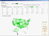
Region Map Generator is a Tool to make region Map with self-definition color. The original maps in the software are blank political region ones for different countries or areas. You can color any region with whatever color as you like. By this software, you can easily make lively maps. These maps can be used as data analysis charts, teaching materials, business chart, web...
Category: Business & Finance / Applications
Publisher: cciyy, License: Shareware, Price: USD $36.95, File Size: 1.3 MB
Platform: Windows
Argumentative is a practical application that will help you create argument maps, which will represent any issue/idea in a graphical way. You will be able to add reasons, premises, objections, and commentary to support your arguments. At the end, you will be able to get a better understanding of the issue by means of its graphical representation.
Once the program is installed, you will be...
Category: Home & Education / Teaching Tools
Publisher: Argumentative, License: Shareware, Price: USD $0.00, File Size: 1.7 MB
Platform: Windows
Easily Draw and Create Graphic Images. DrawPad is an easy-to-use image composition and manipulation program, and an essential Tool for all types of Graphic design projects, including: Creating banner ads or invitations, Make sketches and paintings on your computer, Draw diagrams, icons and other web graphics. DrawPad is ideal for creating images, drawings, and for...
Category: Multimedia & Design / Graphics Viewers
Publisher: NCH Software, License: Freeware, Price: USD $0.00, File Size: 1.7 MB
Platform: Windows
Freeware
Arm Map Explorer recreates all the functionalities of Google Maps on your desktop while expanding them with new extras. Map Explorer lets you locate and view any place on the planet using dynamic interactive maps. These maps are draggable, which means there is no need for you to click and wait for graphics to reload each time you want to view adjacent parts of a Map....
Category: Internet / Flash Tools
Publisher: ArmCode, License: Freeware, Price: USD $0.00, File Size: 5.5 MB
Platform: Windows
Imperium is a game of intergalactic conquest and exploration played by up to 253 players at a time. ImpFE is currently the most advanced client for Imperium. ImpFE allows you to play Imperium in a native GUI environment with Graphic display for the Map. Additional features include queued commands, auto login, a built-in help file, seperate windows for the Map, ship census,...
Category: Games / Strategy & War
Publisher: Pocketfiction, License: Commercial, Price: USD $2.00, File Size: 191.0 KB
Platform: Linux
Time Zones Map is the flash world time Map featuring the time peculiarities of more then 50 cities all over the world. Its eye-catching but still pleasant design, varied functions and multiple application abilities combine everything the ultra-modern flash world time Map must have. You can put our Time Zone Map either on one of your website?s pages or put a banner,...
Category: Web Authoring / Flash Utilities
Publisher: USFlashMap.com, License: Shareware, Price: USD $249.00, File Size: 45.0 KB
Platform: Windows, Mac, Linux, Unix, MS-DOS, AS, 400
Quickly and easily create professional outline-Map worksheets for lessons in geography, history, social studies, and current events. See exactly what your maps will look like as you design them with the WYSIWYG interface. Zoom and pan to select a Map area from high quality and detailed world maps. Adjust the size of the Map and add symbols, labels, and numbers. Switch...
Category: Home & Education / Genealogy
Publisher: Schoolhouse Technologies Inc., License: Demo, Price: USD $34.95, File Size: 6.1 MB
Platform: Windows
CompeGPS is an essential software to make the most of your GPS. With this PC software you will be able to download a wide variety of cartography from the internet and also analyse your routes. This software has been specially designed for 4x4 lovers, bike tourists, excursionists and, in general, everyone who uses GPS, likes to create and accomplish their own routes and then later on...
Category: Home & Education
Publisher: CompeGPS TEAM S.L., License: Shareware, Price: USD $106.00, File Size: 14.9 MB
Platform: Windows
The easiest way to get a paper map with MapPlot is the Plot Map menu.
The easiest way to get a paper Map with MapPlot is the Plot Map menu.
On the following dialog, simply paper size and scale have to be chosen - the result is ready to be printed directly, edited (e.g. for additional entries) or to be displayed as a preview.
Category: Utilities / Misc. Utilities
Publisher: AGIS GmbH, License: Freeware, Price: USD $0.00, File Size: 5.4 MB
Platform: Windows
Easily Draw and Create Graphic Images. DrawPad is an easy-to-use image composition and manipulation program, and an essential Tool for all types of Graphic design projects, including: Creating banner ads or invitations, Make sketches and paintings on your computer, Draw diagrams, icons and other web graphics. DrawPad is ideal for creating images, drawings, and for...
Category: Multimedia & Design / Graphics Viewers
Publisher: NCH Software, License: Freeware, Price: USD $0.00, File Size: 12.7 MB
Platform: Mac
With LocationWizard you can easily map multiple addresses on a map.
With LocationWizard you can easily Map multiple addresses on a Map. LocationWizard helps you visualize the locations of customers or shops. LocationWizard supports the following database formats: MySQL, PostgreSQL, SQLite, FireBird, InterBase, Microsoft Access, Microsoft Excel and CSV.
Category: Business & Finance / Business Finance
Publisher: Location Wizard team, License: Shareware, Price: USD $85.00, File Size: 7.3 MB
Platform: Windows
OziExplorer3D is an impeccable application for viewing Map images in 3D, along with the options of rotating it in every possible direction, zoom in/out and lots more. The application actually creates grid of heights using the height data that has been obtained and writes it to a file, along with the other required information, loads the file and the Map image or the image section...
Category: Multimedia & Design / Multimedia App's
Publisher: Des Newman, License: Shareware, Price: USD $30.00, File Size: 1.9 MB
Platform: Windows