Free Downloads: Grid Coordinates
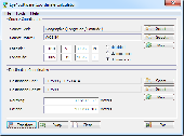
The Grid InQuest software provides a means for transforming Coordinates between ETRS89 (WGS84) and the National coordinate systems of Great Britain, Northern Ireland and the Republic of Ireland. It provides a fully three dimensional transformation incorporating the latest geoid model and is the nationally recognised software for performing these conversions.
In...
Category: Home & Education / Miscellaneous
Publisher: Quest Geo Solutions Ltd, License: Freeware, Price: USD $0.00, File Size: 0
Platform: Windows
Cartesian Coordinates, spherical Coordinates und cylindrical Coordinates can be transformed into each other. (5 languages, 2 and 3 dimensions)
Category: Home & Education / Miscellaneous
Publisher: Greuer Andreas, License: Shareware, Price: USD $11.00, File Size: 993.3 KB
Platform: Windows
Grid Imp - imports gridded data into MS-MapPoint, to produce attractive data maps.
Grid Imp - imports gridded data into MS-MapPoint, to produce attractive data maps. Can handle imperfect data, holes, re-gridding, etc. Can be used to import such attributes as pollution data, seismic hazard, geological information, customer/population distribution, etc. Grid Imp is a software that allows you to import data and produce maps. Various text formats supported using...
Category: Home & Education / Science
Publisher: Winwaed Software Technology, License: Shareware, Price: USD $75.00, File Size: 2.0 MB
Platform: Windows
The Surface Area Calculator is a tool for easily calculating surface and planimetric areas, as well as volumes.
The extent and shape of the area in question are given in terms of the Coordinates of a number of points throughout the area.
These Coordinates can be specified as either latitude, longitude, and height, as GPS Coordinates (geocentric Cartesian...
Category: Business & Finance / Calculators
Publisher: Microsearch Corp, License: Shareware, Price: USD $134.00, File Size: 1.2 MB
Platform: Windows


 Freeware
Arm Map Explorer recreates all the functionalities of Google Maps on your desktop while expanding them with new extras. Map Explorer lets you locate and view any place on the planet using dynamic interactive maps. These maps are draggable, which means there is no need for you to click and wait for graphics to reload each time you want to view adjacent parts of a map. Basically, viewing...
Category: Internet / Flash Tools
Publisher: ArmCode, License: Freeware, Price: USD $0.00, File Size: 5.5 MB
Platform: Windows
Imports gridded data into Microsoft MapPoint, to produce attractive data maps that resemble contour maps.
Can handle imperfect data, holes, re-gridding, etc. Can be used to import such attributes as pollution data, seismic hazard, geological information, customer/population distribution, etc.
Data can be interpolated to different Grid spacings if required. Polygon optimization...
Category: Business & Finance / Applications
Publisher: Winwaed Software Technology, License: Shareware, Price: USD $75.00, File Size: 2.2 MB
Platform: Windows
- Plot regular and parametric equations.
- Plot regular and parametric equations.
- Plot Coordinates tables.
Graphing Calculator 3D is an easy-to-use tool that plots 2D and 3D functions.
Graphing Calculator 3D features :
- Instant quick plotting after each key stroke.
- Cartesian/Polar Coordinates in 2D.
- Cart/Cylindrical/Spherical Coordinates in 3D.
- Inequalities in 2D...
Category: Home & Education / Mathematics
Publisher: Runiter Company, License: Shareware, Price: USD $49.95, File Size: 4.3 MB
Platform: Windows
CoordTrans converts geographic coordinates between different coordinate systems.
CoordTrans converts geographic Coordinates between different coordinate systems.
CoordTrans is very easy to use, and full of Wizards to help you with more complex tasks.
Convert between UTM, WGS84 and NAD27 / NAD83, and more... almost all projections and datums on Earth are supported. See complete list..
You can convert single Coordinates, or...
Category: Business & Finance / Business Finance
Publisher: Franson, License: Shareware, Price: USD $49.00, File Size: 6.5 MB
Platform: Windows
Aerial, topograhpic, and other types of maps are an important resource in the visualization of your information. HuntSmart big game hunting software gives you the ability to view your information on maps. Once you enter information with Coordinates into the system, this information can be viewed on all available maps that contain those Coordinates. One thing to remember is that...
Category: Multimedia & Design / Multimedia App's
Publisher: HuntingSouth, License: Shareware, Price: USD $0.00, File Size: 17.1 MB
Platform: Windows
Grid Matrix is a Graphical Grid simulator for Windows that is implemented over SimGrid.
Grid Matrix is a Graphical Grid simulator for Windows that is implemented over SimGrid.
Grid Matrix uses SimGrid toolkit to run the simulation. The network can be defined using a graphic interface and run within the application.
The simulation code is written in Python using bindings to SimGrid.
Category: Software Development / Misc. Programming
Publisher: Pablo Yabo, License: Freeware, Price: USD $0.00, File Size: 5.7 MB
Platform: Windows
DXF2XYZ converts a DXF file to an XYZ file, ie a comma delimited text file containing just xyz Coordinates. It can be useful for extracting the raw XYZ Coordinates from a DXF file containing say contours or other elevation entities.
This utility it limited to extracting the XYZ Coordinates from the following DXF entity types:
POINT, LINE, POLYLINE /...
Category: Business & Finance / Calculators
Publisher: H. Wind, License: Freeware, Price: USD $0.00, File Size: 657.6 KB
Platform: Windows
Detail Grid – The detail grid holds the details of data read from the meter.
Detail Grid – The detail Grid holds the details of data read from the meter. You can navigate, via he expandable Grid layout, to see individual Session, Run and Data Point information. You can even click on a Chart button on a Run Grid row to see a chart of the Run’s data points.
Category: Internet / Misc. Plugins
Publisher: Allen Face and Companies LLC, License: Freeware, Price: USD $0.00, File Size: 2.9 MB
Platform: Windows
Omni Grid is a plug-in for SU Podium V2 or for SU Walk that allows you to create a Grid of point lights or omni lights above or below a planar surface (SketchUp face). By creating a Grid of omni lights Omni Grid creates a relatively even source of light over a wide space. It is best for interior rendering. An alternative to omni Grid is Hidden LEM.
Category: Multimedia & Design / Multimedia App's
Publisher: Cadalog Inc., License: Freeware, Price: USD $0.00, File Size: 328.5 KB
Platform: Windows
The OSTN02 extension for ArcPad is a FREE tool that automatically transforms GPS data and aligns it with Ordnance Survey (OS) background map. This easy-to-use extension removes the need to manually post-process GPS data by providing’ on the fly’ transformation of WGS84 latitude and longitude into OSTN02 corrected British National Grid coordinate. Data capture using GPS and...
Category: Home & Education / Miscellaneous
Publisher: ESRI (UK) Ltd, License: Freeware, Price: USD $0.00, File Size: 8.0 MB
Platform: Windows
GoArrow displays an arrow on your screen that points towards coordinates that you specify.
GoArrow displays an arrow on your screen that points towards Coordinates that you specify. This is very handy if you have to run to Coordinates with obstacles in the way (like mountains), or if you're just directionally-challenged.
GoArrow has the ability to find a route between any two locations in Dereth, as well as look up locations' details from either the...
Category: Home & Education / Miscellaneous
Publisher: Digero of Leafcull, License: Freeware, Price: USD $0.00, File Size: 7.7 MB
Platform: Windows


 Shareware
iGrid plots drawing Grid right over your desktop, so you can use it everywhere, with any drawing application without any special plugins for different graphics applications. Just install and run iGrid and you'll see Grid plotted over entire screen: Click left mouse button on the iGrid's tray icon to show/hide the Grid or right mouse button to see iGrid's menu. Choose...
Category: Multimedia & Design / Image Editing
Publisher: Greatis Software, License: Shareware, Price: USD $13.00, File Size: 428.8 KB
Platform: Windows
The CooRecorder program is used for registration of coordinates taken from images.
The CooRecorder program is used for registration of Coordinates taken from images.
You can use your computer scanner to take interesting photos of things which can be placed on the top of your scanner. If the things are transparent and small, they can be taped up on transparent film and then inserted into a film scanner. An image scanned as a photo from such a thing can be...
Category: Home & Education / Science
Publisher: Cybis Elektronik & Data AB, License: Shareware, Price: USD $68.00, File Size: 0
Platform: Windows
Design Grid is an easy to use design tool.
Design Grid is an easy to use design tool. The program allows you to control the sizes and proportions in your design. It has an austere design with auto-hide controls.
Design Grid will be useful in designing user interfaces, web interfaces, graphic elements, for photo editing and analyzing graphs.
You can download and try program for free!
Category: Multimedia & Design / Multimedia App's
Publisher: Softaddress, License: Shareware, Price: USD $19.95, File Size: 928.0 KB
Platform: Windows
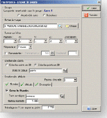
FlashPoints is a tool for creating and managing points Groups (topographic points for example). FlashPoints allows you to : * import/export points Coordinates from and to a file * create points and their attributes "Number", "Elevation" and "Description" by clicking * modify the points elevation * modify the height and rotation of the attributes * create...
Category: Multimedia & Design
Publisher: DeliCAD, License: Shareware, Price: USD $49.00, File Size: 1.2 MB
Platform: Windows
Do you have coordinates for some places of interest?
Do you have Coordinates for some places of interest? Do you want to find them on Earth's surface? There are more than 2,000 coordinate systems available to make Google Earth follow your interests! Plex.Mark! simply placemarks your world!
Have you found a place in Google Earth and you would like to have the Coordinates in your coordinate system? Plex.Mark! will now make...
Category: Internet / Browser Accessories
Publisher: Plexscape, License: Freeware, Price: USD $0.00, File Size: 601.9 KB
Platform: Windows
Fura is a self-contained Grid middleware that allows the Grid enablement and distribution of applications on heterogeneous computational resources. Fura features a web-based GUI, wizard-guided installation and configuration, and Web Services compliance.
Fura is for developers or highly technical enthusiasts who want the open and latest Grid technology early and often...
Category: Business & Finance / Business Finance
Publisher: FuraJedi, GFA, GSsystems, License: Shareware, Price: USD $0.00, File Size: 34.5 MB
Platform: Windows


 Shareware
The Eye4Software Coordinate Calculator is an easy to use tool to perform map or GPS coordinate conversions. The software can be used to transform a single coordinate or a batch of Coordinates read from a comma separated, database or ESRI shapefiles. The software is shipped with a MS Access database file, containing more then 3500 ellipsoid, map datum and map Grid definitions...
Category: Business & Finance / Calculators
Publisher: Eye4Software B.V., License: Shareware, Price: USD $49.00, EUR39, File Size: 3.2 MB
Platform: Windows
Defense Grid: Gold is the bundle including DG: The Awakening, DG: Borderlands, and DG: Resurgence all in one package. All this three Defense Grid games will offer you a memorable experience. Defense Grid: The Awakening is a unique spin on tower defense gameplay that will appeal to players of all skill levels.
Category: Games / Arcade
Publisher: Hidden Path Entertainment, License: Shareware, Price: USD $6.99, File Size: 1024.0 MB
Platform: Windows
Archim is a program for drawing the graphs of all kinds of functions. You can define a graph explicitly and parametrically, in polar and spherical Coordinates, on a plane and in space (surface). Archim will be useful for teachers and students, as well as for everyone who is interested min geometry. With Archim, you will draw the graph of any function and form, just use your imagination....
Category: Home & Education
Publisher: Stochastic Lab, License: Freeware, Price: USD $0.00, File Size: 479.6 KB
Platform: Windows
This program calculates the location of almost any tipe of locator.
This program calculates the location of almost any tipe of locator. It also calculates the distance, azimuth, longitude and latitude betweent two locators. The software converts latitude/longitude Coordinates to Maidenhead locators and vice versa. It converts IARU locator and longitude/latitude Coordinates ti UI-View format Coordinates.
Category: Home & Education / Miscellaneous
Publisher: ON6MU Group, License: Freeware, Price: USD $0.00, File Size: 367.8 KB
Platform: Windows


