Free Downloads: Image Map Creation Tool
zMapper is general purpose Map database creation program.
zMapper is general purpose Map database Creation program. Create your own maps of games or real-life from scratch. Overlay your Map database on any graphical Image. Enhance maps with shapes, icons, and text. Supports Cartesian, hexagonal, or octagonal Map layouts. Maps are compatible with zMUD and zExplorer. Windows 95, 98, ME, 2000, NT and XP.
Category: Audio / Music Creation
Publisher: Zugg Software, License: Shareware, Price: USD $20.00, File Size: 4.1 MB
Platform: Windows
Create Image maps for your website with this easy-to-use Tool from Multimedia Australia. Simply select the Image you want to use, choose a shape, then visually draw the Image Map regions. The Image Map coordinates can be copied to the clipboard for insertion into your favourite text editor.
Category: Web Authoring / Web Design Utilities
Publisher: Multimedia Australia, License: Shareware, Price: USD $24.95, File Size: 931.8 KB
Platform: Unknown
The D2D Map Editor enables the rapid creation of multilayered tile based map grids.
The D2D Map Editor enables the rapid Creation of multilayered tile based Map grids. It’s easy to learn and can be used by programmers and non-programmers alike. The maps generated can be deployed in games and applications developed in C++, C#, Actionscript and XML.
D2D Map Editor has been developed in C# and is currently released as a Beta version.
Category: Games / Tools & Editors
Publisher: D2D Map Editor, License: Freeware, Price: USD $0.00, File Size: 2.5 MB
Platform: Windows
 Shareware
Visual Imagemapper is an Image Map editor; easy to use for the amateur, but still powerful enough for the professional developer. An Image Map is an Image that contains one or more clickable areas, also known as hotspots. Adding hotspots is both quick and easy when using Visual Imagemapper. You no longer have to cut and paste incomprehensible html code between...
Category: Internet / RSS & Web Blog Tools
Publisher: Vicentas, License: Shareware, Price: USD $30.00, File Size: 4.6 MB
Platform: Windows
This program is a Tool for stretching a bitmap Image (a raster Image), trimming it to a box, and calibrating it. This is primarily of use when dealing with a scanned Image of a paper Map. Often when making a scan it is hard to get the Image precisely aligned; sometimes with old maps the paper has stretched. It can be useful where you want to make a...
Category: Multimedia & Design / Multimedia App's
Publisher: Map Library, License: Freeware, Price: USD $0.00, File Size: 755.8 KB
Platform: Windows
The VB Image Map OCX is an ActiveX Control designed to provide your applications with the ability to display interactive images. Hotspots, or specially designated areas on your Image, can be defined that will react to various mouse events. It is easily integrated into your existing applications - just drop the control on a form, assign a background picture, and assign the...
Category: Software Development / Tools & Editors
Publisher: Silverband Software, License: Demo, Price: USD $49.95, File Size: 512.0 KB
Platform: Windows
OziExplorer3D is an impeccable application for viewing Map images in 3D, along with the options of rotating it in every possible direction, zoom in/out and lots more. The application actually creates grid of heights using the height data that has been obtained and writes it to a file, along with the other required information, loads the file and the Map Image or the...
Category: Multimedia & Design / Multimedia App's
Publisher: Des Newman, License: Shareware, Price: USD $30.00, File Size: 1.9 MB
Platform: Windows
GenealogMap is an easy-to-use genealogy program with a flexible user interface, visual representations, and publishing and web site Creation features. The process of creating a genealogical Map is a visual experience. You simply "draw" the area corresponding to information on your relatives. A wizard-like dialog guides you through the process of gathering the genealogical...
Category: Home & Education
Publisher: BondarSoft, License: Shareware, Price: USD $25.00, File Size: 2.2 MB
Platform: Windows, Unix
Region Map Generator is a Tool to make region Map with self-definition color. The original maps in the software are blank political region ones for different countries or areas. You can color any region with whatever color as you like. By this software, you can easily make lively maps. These maps can be used as data analysis charts, teaching materials, business chart, web...
Category: Business & Finance / Applications
Publisher: cciyy, License: Shareware, Price: USD $36.95, File Size: 1.3 MB
Platform: Windows
Commercial
Bas-relief is intended for 2D to 3D conversion using the depth Map. The application opens two images: one is a coloured flat Image, the other is its depth Map, which shows us what areas are closer to us, and what are more distant. The white area is located at the foreground, the black one is at the background. Thereby, the general task is the acceptable depth Map...
Category: Multimedia & Design / Image Editing
Publisher: 3Dmix, License: Commercial, Price: USD $103.00, File Size: 1000 B
Platform: Windows
Shareware
CoffeeCup Image Mapper has mouseover HTML capability, includes a fully functional Image Map wizard, and enables users to attach parts of an Image to different links. Image Mapper can Map any noninterlaced GIF, interlaced GIF, standard JPEG, and progressive JPEG, as well as the first frame of an animated GIF. Users can choose from three different shape...
Category: Multimedia & Design / Button Creators
Publisher: CoffeeCup Software, License: Shareware, Price: USD $24.00, File Size: 3.8 MB
Platform: Windows
Cool Flash Map Maker is a powerful Flash Map software for developing interactive flash mapping solutions and products for Real Estate, Spacial Statistics, Business Locator Applications, Vector USA Map,World Map, Germany Map,ASIA Map, Canada Map, Europe Map, Australia Map, Austria Map, Africa Map, UK Map, South...
Category: Multimedia & Design / Multimedia App's
Publisher: Go2Share, License: Shareware, Price: USD $29.95, File Size: 17.9 MB
Platform: Windows
Shareware
Create HTML Image Maps of any shape in just a few clicks! Map Designer automates the Creation of HTML Image Maps, making it easy for designers and Web developers to specify hot-links and clickable areas within images. Map Designer helps Web developers specify rectangular, round or arbitrary-shape areas in a what-you-see-is-what-you-get mode. Specifying an...
Category: Web Authoring / HTML Editors
Publisher: ForthTech Software, License: Shareware, Price: USD $23.00, File Size: 1.1 MB
Platform: Windows
CoffeeCup Image Mapper++ has MouseOver HTML capability, includes a fully functional Image Map wizard, and it enables you to assign parts of an Image to different links. Image Mapper++ can Map any interlaced GIF, non-interlaced GIF, standard JPEG, progressive JPEG, or even the first frame of an Animated GIF. There are three different shape methods you...
Category: Multimedia & Design / Media Management
Publisher: Idyle Software, License: Shareware, Price: USD $0.00, File Size: 4.0 MB
Platform: Windows
MapCreator 2.0 is a software to create maps and animated maps with a good quality.
MapCreator can be used in presentations because is versatile and can be adequate for any kind of presentation, from travel presentations to professional presentations.
MapCreator is geo-referenced so any Map or portion of the Map will have the exactly portions of latitude and longitude,...
Category: Home & Education / Miscellaneous
Publisher: primap software, License: Freeware, Price: USD $0.00, File Size: 103.3 MB
Platform: Windows
Map Calibrator is a surprisingly pleasant freeware for creating Map slices from large bitmap Image files, and doing all kinds of Map calibration work. The application can handle .jpg, .bmp as well as .gif Image files and all that the user needs to do is to fix up couple of points to get the calibrated Image. Even it facilitates provision for converting...
Category: Multimedia & Design / Multimedia App's
Publisher: Megalith, License: Shareware, Price: USD $0.00, File Size: 0
Platform: Windows
Shareware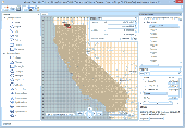
Manco Shapefile Editor is a powerful Tool for creating and editing shapefiles, with easy, almost ââ¬Åon the flyââ¬Â, geometry and data editing and possibility of direct Creation of the shapefiles from the Image files by Image processing algorithms. This product is constantly developing and you will receive free updates just when they come. Since itââ¬â¢s...
Category: Multimedia & Design / Image Editing
Publisher: Manco Software, License: Shareware, Price: USD $100.00, File Size: 6.1 MB
Platform: Windows
You will be able to enjoy many of CompeGPS Lands features such as waypoint and route Creation and edition, full communication between PDA and GPS, use of maps and the moving Map (real-time navigation). CompeGPS Pocket Land allows full communication between GPS and PDA (tracks, waypoints and routes). You will be able to create waypoints and routes, use maps and real-time...
Category: Home & Education
Publisher: CompeGPS TEAM S.L., License: Shareware, Price: USD $76.00, File Size: 3.9 MB
Platform:
Trellian Image Mapper is the quickest way to create image mapped images for your website.
Trellian Image Mapper is the quickest way to create Image mapped images for your website. Full support for hyperlinked rectangles, circles and even polygon regions is provided and you can import all your current Image maps. After you have created your Image Map, Trellian Image Mapper will generate the required HTML code ready to be pasted directly into...
Category: Multimedia & Design / Multimedia App's
Publisher: Trellian, License: Shareware, Price: USD $19.95, File Size: 1.8 MB
Platform: Windows
OpenSpace is a powerful framework for the Flash platform for rapid development of isometric multiplayer virtual worlds and MMO communities. The OpenSpace engine leverages the power of ActionScript 3 and SmartFoxServer, offering an unprecedented level of features and customizations to make your virtual world look unique.
OpenSpace allows the Creation of advanced Map...
Category: Multimedia & Design / Digital Media Editors
Publisher: GOTOANDPLAY s.n.c, License: Shareware, Price: USD $3045.00, File Size: 32.6 MB
Platform: Windows
iMapBuilder Interactive Flash Map Builder creates interactive flash Map and Image maps, with clickable regions, editable points and icons. You can easily embed online maps to your website for showing facts and figures interactively. It is easy to use and requires no coding or flash knowledge.
Map templates gallery are included for easy editing and...
Category: Multimedia & Design / Animation
Publisher: WebUnion Media Ltd., License: Shareware, Price: USD $0.00, File Size: 0
Platform: Windows
Image viewer CP is a simple and easy ActiveX OCX control to creates, displays, edits, flips, resizes and rotates Image, photo and graphic. It supports BMP, GIF, ICO, JPG/ JPEG, PNG, PSD, TIFF, and others and can convert between them. Images can be printed to printer. Moreover, it provides some helpful source code sample includes Access, Delphi, VB, VB.net, VFP and Web Page. With...
Category: Software Development / ActiveX
Publisher: Viscom Software, License: Shareware, Price: USD $60.00, File Size: 21.0 KB
Platform: Windows
Pictorial Image Processor is an image processing tool.
Pictorial Image Processor is an Image processing Tool. It will be a useful program for students studying Image processing. Engineers and algorithm developers would find it to be a simple and cost effective prototyping Tool. A wide range of built-in Image analysis operations facilitate the Creation of sophisticated algorithms with intermediary...
Category: Audio / Utilities & Plug-Ins
Publisher: Retiarius Pty Ltd, License: Shareware, Price: USD $55.00, File Size: 12.7 MB
Platform: Windows
TexturePacker is the most complete tool for sprite sheet creation and image optimization.
TexturePacker is the most complete Tool for sprite sheet Creation and Image optimization.
The effect of the dithering may give the sprite a bit of a grainy look – but if the sprites are moved even slow this won’t be recognizable to the user.
TexturePacker can directly export the following Image formats : PNG,PVR, PVR.CCZ, JPG-JPEG.
Category: Multimedia & Design / Media Catalogers
Publisher: Andreas Loew, License: Shareware, Price: USD $26.16, File Size: 15.3 MB
Platform: Windows
Shareware
Google Satellite Maps Downloader is a cute Tool that can automatically download Google Maps satellite tile images and then combine them into one big Map Image. It supports multithreads, so the download speed is very fast. And it is very easy to use. All downloaded small images are saved on the disk. You can combine them after downloading or later. Isn't it very cool that...
Category: Internet / Download Managers
Publisher: allmapsoft.com, License: Shareware, Price: USD $39.00, File Size: 30.6 MB
Platform: Windows