Free Downloads: Image Maps
OziExplorer3D is an impeccable application for viewing map images in 3D, along with the options of rotating it in every possible direction, zoom in/out and lots more. The application actually creates grid of heights using the height data that has been obtained and writes it to a file, along with the other required information, loads the file and the map Image or the Image section...
Category: Multimedia & Design / Multimedia App's
Publisher: Des Newman, License: Shareware, Price: USD $30.00, File Size: 1.9 MB
Platform: Windows
The Fugawi ADRG Viewer is licensed without charge to examine ADRG maps.
The Fugawi ADRG Viewer is licensed without charge to examine ADRG Maps.
This viewer has been tested with the ADRG CDs currently licensed by Natural Resources Canada.
An advantage of the ADRG format is that a single Image frequently includes multiple paper charts that have been stitched together to form a single ADRG Image.
Category: Multimedia & Design / Multimedia App's
Publisher: Northport Systems Inc, License: Freeware, Price: USD $0.00, File Size: 1.1 MB
Platform: Windows
Nokia Maps 3D browser plugin is a free mapping product and service by Nokia for its mobile phones and for internet browsers. Nokia Maps includes voice guided navigation for both pedestrians and drivers for 74 countries in 46 different languages and there are Maps for over 180 countries.
See the world in high-resolution 3D. Everything from the sky to the street. Plan...
Category: Internet / Browser Accessories
Publisher: Nokia, License: Freeware, Price: USD $0.00, File Size: 9.8 MB
Platform: Windows
From the Sacre Coeur to the Arc de Triomphe, your holiday to Paris starts from the moment you open your guide, plus you get Paris Maps and transport Maps.
Discover the best cafe terraces, unmissable museums and galleries, loveliest parks and gardens, best areas to shop or browse, unforgettable shows and live music venues, most fun places for children, and best restaurants to...
Category: Internet / Communications
Publisher: Mobile Systems, License: Shareware, Price: USD $9.80, File Size: 0
Platform: Windows
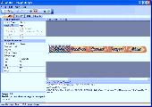
Trellian Image Mapper is the quickest way to create image mapped images for your website.
Trellian Image Mapper is the quickest way to create Image mapped images for your website. Full support for hyperlinked rectangles, circles and even polygon regions is provided and you can import all your current Image Maps. After you have created your Image map, Trellian Image Mapper will generate the required HTML code ready to be pasted directly into...
Category: Multimedia & Design / Multimedia App's
Publisher: Trellian, License: Shareware, Price: USD $19.95, File Size: 1.8 MB
Platform: Windows
MapCreator combines a cartography and a graphics programme.
MapCreator combines a cartography and a graphics programme. The software is designed to create Maps and animated Maps of the highest quality as often required for presentations. For example, this could be Maps needed for a travel presentation. But also in
Category: Multimedia & Design
Publisher: primap.com, License: Freeware, Price: USD $0.00, File Size: 103.3 MB
Platform: Windows, Vista
CacheMaps retreives a variety of maps for your caches from the Internet.
CacheMaps retreives a variety of Maps for your caches from the Internet.
CacheMaps uses the Geocaching loc- or gpx-files as input. Directely from the Geocaching site or as exported from GSAK.CacheMaps v4 has been designed to be used next to GSAK. A lot of the functionality that was available in previous versions of CacheMaps, is available in GSAK now in a much better form. What...
Category: Audio / Utilities & Plug-Ins
Publisher: BigBird Productions, License: Freeware, Price: USD $0.00, File Size: 153.2 KB
Platform: Windows

OkCustomMap is a software to produce Garmin Custom Maps.
OkCustomMap is a software to produce Garmin Custom Maps.
Supports many map formats:
- OkMap
- Ecw
- GeoTiff
- World files
- OziExplorer
- GpsTuner
You can customize:
- The quality of the output JPEG images (0=Bad, 100=Good)
- The KML transparency (0=Transparent, 255=Opaque)
- The KML draw order (0=Invisible, 1-49=Under the vectorial data,...
Category: Business & Finance / Applications
Publisher: Gian Paolo Saliola, License: Freeware, Price: USD $0.00, File Size: 3.2 MB
Platform: Windows
MAPC2MAPC is a program to manipulate digital Maps,it loads map images and calibrate them,loads calibrations in many different formats and Datums,view the calibrated map,crop and rescale Maps whilst preserving the calibration,reproject Maps to 'Plate Carre' (Equirectangular),rotate Maps to true North.
Category: Multimedia & Design / Digital Media Editors
Publisher: Thorn, License: Shareware, Price: USD $0.00, File Size: 1.6 MB
Platform: Windows
Easily create HTML Image/photo Maps with this free friendly Image mapping utility from the authors of the best free photo editing software - Photo Pos Pro photo editor . Pos HTML Image Mapper includes WYSIWYG interface allowing you mapping images and photos fast and easy. Using the software you can easily create graphic toolbars to your website; you can easily...
Category: Web Authoring / HTML Color Pickers
Publisher: PowerOfSoftware Ltd., License: Freeware, Price: USD $0.00, File Size: 7.9 MB
Platform: Windows
Create GPS enabled geo Maps directly on the background of aereal photos and road Maps from the internet. Import geodata from Google-Earth, OpenStreetMap, GPS tracks and GPS logger. Map editor , manually digitizing. Specifical graphical objects (borderlines, borderareas) to guarantee exact same borders of neighbour areas..Screen calibration for true to display on the screnn.
Category: Multimedia & Design / Digital Media Editors
Publisher: GPSur Dr. Erhard Regener, License: Shareware, Price: USD $65.00, File Size: 6.4 MB
Platform: Windows
Terrain Tools - Create maps quickly and easily!
Terrain Tools - Create Maps quickly and easily!
Terrain Tools is the ideal tool for outdoor recreationists, real-estate professionals, farmers, ecologists, archaeologists and others who need to create basic Maps, calculate areas, lengths, bearings and distances.
Overlay GPS tracks on scanned images such as USGS or Canadian NTS topos. Import and export...
Category: Business & Finance / Applications
Publisher: Softree, License: Shareware, Price: USD $124.00, File Size: 15.0 MB
Platform: Windows
Free Imagemapper is one of the most user-friendly tools available to produce HTML image maps.
Free Imagemapper is one of the most user-friendly tools available to produce HTML Image Maps. Its simplicity of use makes it suitable for all types of users, novice and expert alike. This application allows you to add hyperlinks and comments to specific sections of an Image, so that you can then navigate from each of them to their corresponding destination.
In...
Category: Multimedia & Design / Multimedia App's
Publisher: 4dots Software, License: Freeware, Price: USD $0.00, File Size: 2.4 MB
Platform: Windows
 Shareware
Offline Map Maker is a tool that help you to get offline tile images from Google Maps, Openstreetmap, Yandex Maps, Yahoo Maps, Mapquest, Gaode map, Tencent Maps, Baidu Maps, Tianditu, Arcgis Online, OneMap, Whereis, mapy.cz, Mappy, Waze, Sentinel-2 map, Strava Gloabal Heatmap, Wikimapia, GoMap.Az, Longdo Map, Bhuvan, National Map Australia, New Zealand...
Category: Internet / Download Managers
Publisher: allmapsoft.com, License: Shareware, Price: USD $79.00, File Size: 31.1 MB
Platform: Windows
With MapAuthor you can create, print and save desktop Maps, using data that you obtain from commercial sources or perhaps your in-hous GIS department as shapefiles (shapefiles are a very common GIS exchange format.) You can also produce internet-based Maps based on Google Maps, for use on your web site.
MapAuthor allows you to link your own data to Maps, for...
Category: Internet / Misc. Plugins
Publisher: MapAuthor.com, License: Freeware, Price: USD $0.00, File Size: 6.3 MB
Platform: Windows
Freeware
Free standalone software DataPult Desktop creates heat Maps from your data quickly and efficiently. Key features: Direct data import from MS Excel with one click. The ability to create animated Maps of data over several years. Interactive Maps and diagrams. 39 map colorings for making heat Maps. Intelligent identification of input...
Category: Business & Finance / MS Office Addons
Publisher: DataPult, License: Freeware, Price: USD $0.00, File Size: 21.0 MB
Platform: Windows
PowerMapper allows information architects, usability analysts and web developers to create graphical site Maps with one click, providing site visualization and simple navigation. Maps show thumbnails of web pages and can be tailored using 11 different styles then printed or copied into another application. Key Features: Mapping - create Maps of any site on the World...
Category: Internet
Publisher: Electrum, License: Shareware, Price: USD $349.00, File Size: 1.3 MB
Platform: Windows
It Contains radius maps from modules 1-3 and runs from 1- 4.
It Contains radius Maps from modules 1-3 and runs from 1- 4. Creates random written exams to the same format as the PCO using WizAnn Radius Maps and automatically marks them. Drag and drop points onto the map and type in runs and compare with inbuilt runs. Perfect for Written test preparation.
Category: Multimedia & Design / Fonts
Publisher: WizAnn Publications Design, License: Shareware, Price: USD $0.00, File Size: 0
Platform: Windows
You will either mess up your work place with huge Maps and travel guides or just switch on to Schmap Player to guide you for your travel.
This amazing travel guide with elaborated Maps and destinations can be downloaded and used for free. The main interface of this application comprises the guide menu with: European guides, US guides, Canadian guides, Australian guides, and...
Category: Internet / Web Search Utilities
Publisher: Schmap, Inc., License: Freeware, Price: USD $0.00, File Size: 2.0 MB
Platform: Windows
Mscgen is a small program that parses Message Sequence Chart descriptions and produces PNG, SVG, EPS or server side Image Maps (ismaps) as the output. Message Sequence Charts (MSCs) are a way of representing entities and interactions over some time period and are often used in combination with SDL. MSCs are popular in Telecoms to specify how protocols operate although MSCs need...
Category: Internet / Communications
Publisher: Michael McTernan, License: Freeware, Price: USD $0.00, File Size: 369.5 KB
Platform: Windows
Microsoft MapPoint software gives you the power to turn tabular data into informative Maps to communicate insights with instant impact. You can easily integrate Maps into your Office projects to show your business insights with clarity. Plus, get updated Maps of the US and Canada, with trip routing, turn-by-turn directions, and the ability to share routes with your GPS device.
Category: Business & Finance / MS Office Addons
Publisher: Microsoft, License: Shareware, Price: USD $0.00, File Size: 0
Platform: Windows
From Gothic St. Stephens Cathedral to the Imperial Palace - the 10 best of everything to see, buy, do, taste and avoid in Vienna, plus Maps and transport Maps.
Discover the best historic palaces and gardens, great walks and itineraries, most fun places for kids, venues for concerts and opera, liveliest beer halls, tastiest schnitzel and Viennese cakes, best hotels on every...
Category: Internet / Communications
Publisher: Mobile Systems, License: Shareware, Price: USD $9.80, File Size: 0
Platform: Windows
With SMART Ideas, you can create multilevel concept Maps that take students through concepts one step at a time for greater clarity. And you can easily convert the Maps into a multipage website for everyone to share.
A bank of colorful and descriptive graphics helps teachers break down information in highly visual ways so students can understand each element of a...
Category: Home & Education / Teaching Tools
Publisher: SMART Technologies Inc., License: Shareware, Price: USD $59.00, File Size: 39.5 MB
Platform: Windows
Aerial, topograhpic, and other types of Maps are an important resource in the visualization of your information. HuntSmart big game hunting software gives you the ability to view your information on Maps. Once you enter information with coordinates into the system, this information can be viewed on all available Maps that contain those coordinates. One thing to remember is...
Category: Multimedia & Design / Multimedia App's
Publisher: HuntingSouth, License: Shareware, Price: USD $0.00, File Size: 17.1 MB
Platform: Windows
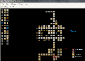
MUD Map Designer is a tool that was developed for MUD programmers that wish to make Maps for plotting or simply beneficial reasons. All files can be exported to several different Image types. You can create your own setup files and map icons to use to customize each game!
Here are some key features:
-You can save, load, or export Maps. You can export Maps...
Category: Software Development / Help File Utilities
Publisher: Stonefall Studios, License: Freeware, Price: USD $0.00, File Size: 455.0 KB
Platform: Windows