Free Downloads: Interactive Global Map
 Freeware
An Interactive Flash USA Map with all the features you need for your web site or project. This is the ideal solution for dealer maps, real-estate listings, or visualizing state statistics. Nearly every aspect of the Map is customizable. However, unlike competing products, our Map is very simple to install and edit. Just upload XML and SWF files and embed.
Category: Internet / Flash Tools
Publisher: http://www.flashusamap.com/trial/flashus, License: Freeware, Price: USD $0.00, File Size: 93.8 KB
Platform: Unknown
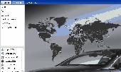
Cool Flash Map Maker is a powerful Flash Map software for developing Interactive flash mapping solutions and products for Real Estate, Spacial Statistics, Business Locator Applications, Vector USA Map,World Map, Germany Map,ASIA Map, Canada Map, Europe Map, Australia Map, Austria Map, Africa Map, UK Map,...
Category: Multimedia & Design / Multimedia App's
Publisher: Go2Share, License: Shareware, Price: USD $29.95, File Size: 17.9 MB
Platform: Windows
iMapBuilder Interactive Flash Map Builder creates Interactive flash Map and image maps, with clickable regions, editable points and icons. You can easily embed online maps to your website for showing facts and figures interactively. It is easy to use and requires no coding or flash knowledge.
Map templates gallery are included for easy editing and...
Category: Multimedia & Design / Animation
Publisher: WebUnion Media Ltd., License: Shareware, Price: USD $0.00, File Size: 0
Platform: Windows
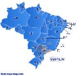
Dongsoft Interactive Brazil Flash Maps for websites, Interactive Map applications, presentations, and more.
The innovation of this fully-clickable Map will revolutionize your website navigation and provide visitors with a simple and seamless method of accessing information. Using the Map as a central navigation tool, information can be accessed with greater...
Category: Software Development / Help File Utilities
Publisher: maps flash, License: Freeware, Price: USD $0.00, File Size: 156.0 KB
Platform: Windows
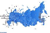
Dongsoft Interactive Russia Flash Maps for websites, Interactive Map applications, presentations, and more.
The innovation of this fully-clickable Map will revolutionize your website navigation and provide visitors with a simple and seamless method of accessing information. Using the Map as a central navigation tool, information can be accessed with greater...
Category: Software Development / Help File Utilities
Publisher: clickable map, License: Freeware, Price: USD $0.00, File Size: 156.0 KB
Platform: Windows
The C-Map Chart Catalog allows you to view, navigate, select and order C-Map electronic charts, or various weather options, in an Interactive way. After selection of required items is completed, simply press the 'E-mail order' button, and enter the address of your local C-Map distributor.
Category: Home & Education / Hobbies
Publisher: Jeppesen Marine, License: Freeware, Price: USD $0.00, File Size: 6.1 MB
Platform: Windows

Commercial realtors require accurate and reliable tools to publish available properties online and show them on the website (specifying region, county, state, and city). We have created a unique Interactive Real Estate Map with all USA states and counties on it for real estate business. USA Real Estate Map is a unique and amazing vector-based tool that is very simple...
Category: Internet
Publisher: USFlashMap.com, License: Shareware, Price: USD $399.00, File Size: 3.9 MB
Platform: Windows, Mac, Linux, Unix, MS-DOS, AS/400, OS/2
U.S. Interactive Map for embedding into websites. State and county selection. Useful for real estate websites. FLA source files included. Among other implementation, it can be employed as: Interactive Real Estate Listing Map, Appraisal Search Software, Traveling/Timeshares Directory, Country Selector enable fast selection of the state and county, or any other purpose
Category: Software Development
Publisher: FutureVision Web Solutions, License: Commercial, Price: USD $199.00, File Size: 167.3 KB
Platform: Unknown
Interactive white-boards provide a cost effective and real-time global teleconferencing advantage.
Interactive white-boards provide a cost effective and real-time Global teleconferencing advantage. From Remote PC operation that lets you use an electronic pen like a mouse to email distribution of board notes, Interactive white-boards offer all the options to keep ideas and information flowing.
By connecting the Interactive Panaboard to a computer, the...
Category: Multimedia & Design / Multimedia App's
Publisher: Panasonic, License: Freeware, Price: USD $0.00, File Size: 37.6 KB
Platform: Windows
Earth time zone is an Interactive 3D Global Time zone,show more than 250 countries local standard times,allows you to add any country Timezone, Find time zone information by country name around the world.As a high resolution Interactive 3D world Map clocks,including countries, lakes, rivers, and political boundaries,Config to show day/night shadow effect; or...
Category: Desktop Enhancements
Publisher: Timezonesoft, License: Shareware, Price: USD $29.95, File Size: 2.6 MB
Platform: Windows
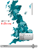
United Kingdom Interactive Flash Map.
United Kingdom Interactive Flash Map.
Suitable for Real-Estate, Dealer Maps, Branch Offices Locators.
With this fully-clickable Map you will be able to improve navigation and provide visitors with better and quicker access to information as well as improve the way you present the information. The Map can be used "as is" however it is also easily...
Category: Web Authoring / Web Design Utilities
Publisher: Fla-shop.com, License: Demo, Price: USD $44.90, File Size: 319.0 KB
Platform: Windows
The VB Image Map OCX is an ActiveX Control designed to provide your applications with the ability to display Interactive images. Hotspots, or specially designated areas on your image, can be defined that will react to various mouse events. It is easily integrated into your existing applications - just drop the control on a form, assign a background picture, and assign the hotspot...
Category: Software Development / Tools & Editors
Publisher: Silverband Software, License: Demo, Price: USD $49.95, File Size: 512.0 KB
Platform: Windows
Spikey is an onscreen Interactive Map showing each of the keys that correspond to the characters in the SPIonic font.
This is not simply an inert Map. It is a Windows application which you will need to download from this site. Once the program is installed, the shift keys and the CapsLock key "work." You can click them to show how that changes the...
Category: Desktop Enhancements / Shell & Desktop Managers
Publisher: David Howorth, License: Shareware, Price: USD $0.00, File Size: 0
Platform: Windows
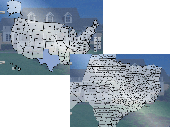
Interactive Flash maps US States.
Interactive Flash maps US States.
Suitable for Real-Estate, Dealer Maps, Branch Offices Locators.
With this fully-clickable Map you will be able to improve navigation and provide visitors with better and quicker access to information as well as improve the way you present the information. The Map can be used "as is" however it is also easily customizable....
Category: Web Authoring / Web Design Utilities
Publisher: Fla-shop.com, License: Demo, Price: USD $24.90, File Size: 229.0 KB
Platform: Windows
Global Operations Update enhances the game and updates it accordingly.
Global Operations Update enhances the game and updates it accordingly.
Features:
-Remote admin password hack
-Moneycheat bug
-Map objective removal problem
-Added missing sounds/textures
-Fixed attributes script
-Fixed a crash/remote code execution bug
-Allow running Windows server and client simultaneously
Category: Games / Misc. Games
Publisher: The Lost Paradise, License: Freeware, Price: USD $0.00, File Size: 17.7 MB
Platform: Windows
The Microsoft Office 2007 Interactive Developer Map is a Windows Presentation Foundation (WPF) application that helps developers visualize the different programs, servers, services, and tools that will help them build solutions. It allows them to drill down to each product and technology and learn about new features, objects, Web services, namespaces, and schemas required to...
Category: Utilities / System Utilities
Publisher: Microsoft, License: Freeware, Price: USD $0.00, File Size: 18.7 KB
Platform: Windows
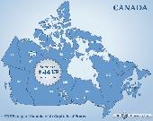
Canada Flash map (with FLA source) for web sites, interactive applications, presentations, and more.
Canada Flash Map (with FLA source) for web sites, Interactive applications, presentations, and more.
With this fully-clickable Map you will be able to improve navigation and provide visitors with better and quicker access to information as well as improve the way you present the information. The Map can be easily customizable. In just a few minutes you can make...
Category: Web Authoring / Web Design Utilities
Publisher: Fla-shop.com, License: Demo, Price: USD $44.90, File Size: 83.0 KB
Platform: Windows
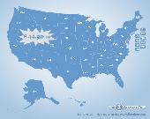
US States Flash Map Silver (with FLA source)
for web sites, Interactive applications, presentations, and more.
With this fully-clickable Map you will be able to improve navigation and provide visitors with better and quicker access to information as well as improve the way you present the information. The Map can be easily customizable. In just a few minutes...
Category: Web Authoring / Web Design Utilities
Publisher: Fla-shop.com Inc., License: Demo, Price: USD $44.90, File Size: 140.0 KB
Platform: Windows
Freeware
Arm Map Explorer recreates all the functionalities of Google Maps on your desktop while expanding them with new extras. Map Explorer lets you locate and view any place on the planet using dynamic Interactive maps. These maps are draggable, which means there is no need for you to click and wait for graphics to reload each time you want to view adjacent parts of a Map....
Category: Internet / Flash Tools
Publisher: ArmCode, License: Freeware, Price: USD $0.00, File Size: 5.5 MB
Platform: Windows
Representing a new concept in the field of Ham Maps, the Global Overlay Mapping System is packed full of features for all Ham Radio enthusiasts, including : 1 World Map, with specialised satellite images and world region-boundaries. 8 Continental Maps - Europe, Asia, Africa, North and South America, Oceania, Arctic, Antarctica. 29 Sub Continental Maps, with Single Click Navigation...
Category: Home & Education / Miscellaneous
Publisher: MapAbility, License: Freeware, Price: USD $0.00, File Size: 4.9 MB
Platform: Windows
Anychart is a flexible Macromedia Flash based-solution, which allows you to easily display any sort of data dealing with geographical locations. It contains United States Maps with Counties, World Map, etc. XML data file and a set of customizable options make AnyChart Maps a universal solution for web developers. AnyChart allows you to create superb, compact, Interactive maps....
Category: Software Development
Publisher: AnyChart.Com, License: Shareware, Price: USD $199.00, File Size: 2.8 MB
Platform: Windows, Mac, Linux, Palm,
StatPlanet Map Maker is a free program for creating highly Interactive Flash maps which can be published online. A stand-alone offline version is also included.
Category: Home & Education / Miscellaneous
Publisher: sacmeq.org, License: Freeware, Price: USD $0.00, File Size: 6.5 MB
Platform: Windows, Mac, Vista
Diamond Map of the World. Selector area Interactive Map of the World with zoom and hotspots!Easy adjustment.Variants of using a Map locator:- Real-Estate websites- Quick access to contact organization data, having affiliated network in IrelandWith this fully-clickable Map you will be able to improve navigation and provide visitors with a better and faster...
Category: Web Authoring / Flash Utilities
Publisher: Fla-shop.com Inc., License: Demo, Price: USD $249.00, File Size: 583.7 KB
Platform: Windows
World Map Pro in Flash is a dynamic mapping solution to show any information worldwide Use our Map: - to show international offices (international affiliates, hotel networks, etc) - to show worldwide communities and information on them - to improve search by providing information on any country or region - as a real estate or any other Map/catalogue - to show zones...
Category: Internet
Publisher: USFlashMap.com, License: Shareware, Price: USD $199.00, File Size: 120.0 KB
Platform: Windows, Mac, Linux, Unix, MS-DOS, AS/400, OS/2
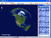
This educational program brings a plethora of geographic information right to your desktop. After you launch Earth Explorer, you'll be greeted by a 3D rendition of the Earth spinning in space. To the right of the globe sits a table of information on countries, cities, and islands. Simply clicking on one of the entries shows you its location on the globe, and scrolling over the table gives you...
Category: Audio
Publisher: Motherplanet, Inc, License: Shareware, Price: USD $59.95, File Size: 7.4 MB
Platform: Windows, Mac