Free Downloads: Java Draw Coordinates
Draw points in AutoCAD and generate 3D models using data in Excel.
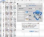
XLPoints Plus is the easiest way to massively Draw points in AutoCAD and generate 3D models using coordinate data in Excel. Key Features: - Quickly Draw points using coordinate data in Excel. - Create new drawings or update existing ones by establishing an open channel with AutoCAD. - Create "true" 3D faces or simply connect all points with a 3D polyline. For the 3D...
Category: Multimedia & Design
Publisher: Productivity Tools, License: Shareware, Price: USD $30.00, File Size: 1.7 MB
Platform: Windows
Cartesian Coordinates, spherical Coordinates und cylindrical Coordinates can be transformed into each other. (5 languages, 2 and 3 dimensions)
Category: Home & Education / Miscellaneous
Publisher: Greuer Andreas, License: Shareware, Price: USD $11.00, File Size: 993.3 KB
Platform: Windows
Draw attention to your photos or create your own slideshow with the free Java Slideshow Applet.
Draw attention to your photos or create your own slideshow with the free Java Slideshow Applet. Java Slideshow Applet displays a sequence of images enhanced with a fading effect.
Category: Internet / Misc. Plugins
Publisher: Sureshot, License: Freeware, Price: USD $0.00, File Size: 260.0 KB
Platform: Windows, Linux, Mac
World Wind Java Line Builder Demo is a simple example that allows you to interactively Draw a path over the terrain surface.
This small application developed in Java demonstrates how can you use and consume mouse events before they get to the default view input handler.
Category: Multimedia & Design / Multimedia App's
Publisher: NASA, License: Shareware, Price: USD $0.00, File Size: 0
Platform: Windows
The Surface Area Calculator is a tool for easily calculating surface and planimetric areas, as well as volumes.
The extent and shape of the area in question are given in terms of the Coordinates of a number of points throughout the area.
These Coordinates can be specified as either latitude, longitude, and height, as GPS Coordinates (geocentric Cartesian...
Category: Business & Finance / Calculators
Publisher: Microsearch Corp, License: Shareware, Price: USD $134.00, File Size: 1.2 MB
Platform: Windows
Plot4j is a Java library that permits to draw two-variables diagrams in a Cartesian plan.
Plot4j is a Java library that permits to Draw two-variables diagrams in a Cartesian plan. The diagrams can be exported as images or visualized on Java Swing panels.
Category: Software Development / Misc. Programming
Publisher: brusoftware.com, License: Freeware, Price: USD $0.00, File Size: 84.9 KB
Platform: Mac, Linux, Windows
Aspose.Imaging for Java is an easy-to-use, high-performance and well-documented imaging library, that provides the most flexible group of routines for the developers to create, manipulate, save and convert images in their Java applications with ease and performance. Aspose.Imaging provides features that go beyond the native capabilities of the development platform. It works...
Category: Software Development / Components & Libraries
Publisher: Aspose Pty Ltd, License: Shareware, Price: USD $599.00, File Size: 3.2 MB
Platform: Windows, Linux, Java
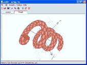
Archim is a program for drawing the graphs of all kinds of functions. You can define a graph explicitly and parametrically, in polar and spherical Coordinates, on a plane and in space (surface). Archim will be useful for teachers and students, as well as for everyone who is interested min geometry. With Archim, you will Draw the graph of any function and form, just use your...
Category: Home & Education
Publisher: Stochastic Lab, License: Freeware, Price: USD $0.00, File Size: 479.6 KB
Platform: Windows
Paint online bear. Lessons on drawing and sketching the face.How to Draw a Cartoon Free graphics Free Graphics Purchase products How to Draw with Gary. Full 10 step art lesson. How to Draw free lessons. How to Draw a Big Ban free lesson; How to Draw a house (Empire street building) free lesson; How to Draw a village house 01. How to Draw a. Learn...
Category: Games / Kids
Publisher: Paint online, License: Freeware, Price: USD $0.00, File Size: 10.0 KB
Platform: Windows, Mac
- Plot regular and parametric equations.
- Plot regular and parametric equations.
- Plot Coordinates tables.
Graphing Calculator 3D is an easy-to-use tool that plots 2D and 3D functions.
Graphing Calculator 3D features :
- Instant quick plotting after each key stroke.
- Cartesian/Polar Coordinates in 2D.
- Cart/Cylindrical/Spherical Coordinates in 3D.
- Inequalities in 2D...
Category: Home & Education / Mathematics
Publisher: Runiter Company, License: Shareware, Price: USD $49.95, File Size: 4.3 MB
Platform: Windows
Create image maps for your website with this easy-to-use tool from Multimedia Australia. Simply select the image you want to use, choose a shape, then visually Draw the image map regions. The image map Coordinates can be copied to the clipboard for insertion into your favourite text editor.
Category: Web Authoring / Web Design Utilities
Publisher: Multimedia Australia, License: Shareware, Price: USD $24.95, File Size: 931.8 KB
Platform: Unknown
CoordTrans converts geographic coordinates between different coordinate systems.
CoordTrans converts geographic Coordinates between different coordinate systems.
CoordTrans is very easy to use, and full of Wizards to help you with more complex tasks.
Convert between UTM, WGS84 and NAD27 / NAD83, and more... almost all projections and datums on Earth are supported. See complete list..
You can convert single Coordinates, or...
Category: Business & Finance / Business Finance
Publisher: Franson, License: Shareware, Price: USD $49.00, File Size: 6.5 MB
Platform: Windows
Draw on top of almost any application.
Draw on top of almost any application.Drawing freely on your computer screen without damage .Screen Pen lets you Draw on screen. you can Draw, or hide your drawing, or save it to a file. Choose from different width pens to Draw in your choice of color.
Category: Multimedia & Design / Multimedia App's
Publisher: 678soft, License: Shareware, Price: USD $17.95, File Size: 587.9 KB
Platform: Windows
Aerial, topograhpic, and other types of maps are an important resource in the visualization of your information. HuntSmart big game hunting software gives you the ability to view your information on maps. Once you enter information with Coordinates into the system, this information can be viewed on all available maps that contain those Coordinates. One thing to remember is that...
Category: Multimedia & Design / Multimedia App's
Publisher: HuntingSouth, License: Shareware, Price: USD $0.00, File Size: 17.1 MB
Platform: Windows
The Image Recognition Plugin is a powerful add-on that uses machine vision technology for web testing sites that contain non-HTML elements. The Plugin supports Flash applets, Java applets, Movie Player Applets, ActiveX, and all other controls. The Image Recognition Plugin is the world's first technology that allows you to automate and test web sites using images instead of cumbersome...
Category: Software Development
Publisher: iMacros WebSite Testing and Web Scraping, License: Shareware, Price: USD $998.00, File Size: 389.6 KB
Platform: Windows
Allows you to Draw simple images on your Windows screen that appear in front of whatever programs are running. Besides just for fun, it can useful for people who are giving a presentation by projecting a computer screen for a group of people to see. The user can Draw circles, arrows, or other symbols on the screen to emphasize or clarify the text or diagrams on the screen....
Category: Audio / Music Management
Publisher: Leithauser Research, License: Shareware, Price: USD $14.98, File Size: 471.0 KB
Platform: Windows
DXF2XYZ converts a DXF file to an XYZ file, ie a comma delimited text file containing just xyz Coordinates. It can be useful for extracting the raw XYZ Coordinates from a DXF file containing say contours or other elevation entities.
This utility it limited to extracting the XYZ Coordinates from the following DXF entity types:
POINT, LINE, POLYLINE /...
Category: Business & Finance / Calculators
Publisher: H. Wind, License: Freeware, Price: USD $0.00, File Size: 657.6 KB
Platform: Windows
- it shows the Alarm level and all last quakes around the place you have selected
- you can select any place at the Earth from the list or add any new places you need for (full version only)
- the place you have selected is shown as a little circle in the center of window
- the quakes around selected place are shown as a lines with a direction, size and color according...
Category: Home & Education / Miscellaneous
Publisher: Valeri Vlassov, License: Shareware, Price: USD $29.00, File Size: 4.6 MB
Platform: Windows
CMP Screws and Screwdrivers draws eight types of screwheads.
CMP Screws and Screwdrivers draws eight types of screwheads. It is a teaching example for how to use Java Canvas,fillRect, fillOval, fillPoly and AffineTransform to Draw. Java source is included for you to cannibalise. It draws 8 types of screw heads. see http://mindprod.com/bgloss/cables.html#SCREWDRIVERSfor more information on the cosmic significanceof the output. To run...
Category: Multimedia & Design / Multimedia App's
Publisher: Canadian Mind Products, License: Freeware, Price: USD $0.00, File Size: 509.0 KB
Platform: Windows
Bouncy Draw is an entertaining funny game.
Bouncy Draw is an entertaining funny game. You will like it from the first time you play! Play Bouncy Draw Game and Draw lines to propel the raccoon up in the air within the canyon, watch out for vultures and tree branches, there is a spiky dragon waiting at the bottom so watch out. Use mouse. Click on your raccoon to start bouncing and Draw lines for him to bounce...
Category: Games / Misc. Games
Publisher: freeworldgroup, License: Freeware, Price: USD $0.00, File Size: 931.8 KB
Platform: Windows
GoArrow displays an arrow on your screen that points towards coordinates that you specify.
GoArrow displays an arrow on your screen that points towards Coordinates that you specify. This is very handy if you have to run to Coordinates with obstacles in the way (like mountains), or if you're just directionally-challenged.
GoArrow has the ability to find a route between any two locations in Dereth, as well as look up locations' details from either the...
Category: Home & Education / Miscellaneous
Publisher: Digero of Leafcull, License: Freeware, Price: USD $0.00, File Size: 7.7 MB
Platform: Windows
The CooRecorder program is used for registration of coordinates taken from images.
The CooRecorder program is used for registration of Coordinates taken from images.
You can use your computer scanner to take interesting photos of things which can be placed on the top of your scanner. If the things are transparent and small, they can be taped up on transparent film and then inserted into a film scanner. An image scanned as a photo from such a thing can be...
Category: Home & Education / Science
Publisher: Cybis Elektronik & Data AB, License: Shareware, Price: USD $68.00, File Size: 0
Platform: Windows


 Commercial
Java Barcode to generate barcode images, supports Linear (1D), PDF417, Data Matrix, QACode. Developer can use this Java barcode generator to generate high quality 1D and 2D barcode, also Java barcode can generating barcode in Java server side environment, Java application and Java reporting. For the Java server side environment, it's support...
Category: Software Development / Components & Libraries
Publisher: Pefetic.com, License: Commercial, Price: USD $59.00, File Size: 97.7 KB
Platform: Windows, Mac, Linux, Palm,
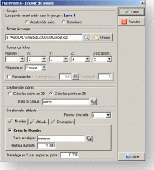
FlashPoints is a tool for creating and managing points Groups (topographic points for example). FlashPoints allows you to : * import/export points Coordinates from and to a file * create points and their attributes "Number", "Elevation" and "Description" by clicking * modify the points elevation * modify the height and rotation of the attributes * create...
Category: Multimedia & Design
Publisher: DeliCAD, License: Shareware, Price: USD $49.00, File Size: 1.2 MB
Platform: Windows
Do you have coordinates for some places of interest?
Do you have Coordinates for some places of interest? Do you want to find them on Earth's surface? There are more than 2,000 coordinate systems available to make Google Earth follow your interests! Plex.Mark! simply placemarks your world!
Have you found a place in Google Earth and you would like to have the Coordinates in your coordinate system? Plex.Mark! will now make...
Category: Internet / Browser Accessories
Publisher: Plexscape, License: Freeware, Price: USD $0.00, File Size: 601.9 KB
Platform: Windows

