Free Downloads: Java Gps Map Greek Free Download
Creating a Map based on GPX files for your Gps and for MapSource/BaseCamp on your computer is possible with several existing programs, but it's certainly not easy to accomplish. With IMGfromGPX it's a matter of a few mouse clicks! This program can generate a Map with the following features:
tracks in 8 different colors, as lines or areas;
POIs divided...
Category: Home & Education / Miscellaneous
Publisher: JaVaWa GPS-tools, License: Shareware, Price: USD $0.00, File Size: 4.9 MB
Platform: Windows
XPilot NG is a multi-player 2D spacewar game.
XPilot NG is a multi-player 2D spacewar game. It is an extended version of XPilot, a true Internet classic. Like in XPilot, the aim of the game is to have fun and to beat your fellow pilots.
XPilotNG Map Editor allows you to edit your favorite XPilot NG maps. This Map editor tool is distributed using Java Web Start. It requires JRE 1.4 or later.
If you...
Category: Multimedia & Design / Digital Media Editors
Publisher: Baron, License: Shareware, Price: USD $0.00, File Size: 4.0 KB
Platform: Windows
Northwest Trails is a mapset of trails designed for upload to any map-enabled Garmin GPS receiver.
Northwest Trails is a mapset of trails designed for upload to any Map-enabled Garmin Gps receiver. It is more than just a mapset, though; it is also a community effort initiated to record and collect Gps data for trails in the Northwest (Washington, Idaho, Oregon, Montana, Wyoming, Alaska, British Columbia and Alberta) and provide that data for general public use.
Category: Internet / Misc. Plugins
Publisher: Jon F. Stanley, License: Freeware, Price: USD $0.00, File Size: 31.7 MB
Platform: Windows
 Freeware
GPS Converter will convert GPS coordinates between three different formats: 34. 26965, -116.
76783; N 34° 16. 179', W 116° 46. 07'; and N 34° 16' 10.
Category: Home & Education / Sports
Publisher: ALMSys, Inc., License: Freeware, Price: USD $0.00, File Size: 929.9 KB
Platform: Windows
GPS Tuner was first launched in 2003.
Gps Tuner was first launched in 2003. Success followed introduction shortly. Over the years it became a best-selling favourite Gps software among off-roaders as a reliable, versatile feature-packed application suiting the needs of outdoor enthusiasts and professional off-road users alike. After five years of continuous development of previous Gps Tuner versions Gps...
Category: Web Authoring / Web Design Utilities
Publisher: GPS Tuner Ltd., License: Freeware, Price: USD $0.00, File Size: 4.5 MB
Platform: Windows
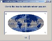
Have a Gps and a laptop? Use this to find your way. Make patterns or a trail to share with others. When the application starts, you may pick your area of operations - be it North America, South America, Europe and Asia, or Australia. Your quadrant is determined by where you are in relation to the Equator and the Prime Meridian. Tracking of your position is automatically enabled when the...
Category: Home & Education / Miscellaneous
Publisher: LogicAll Solutions, LLC, License: Freeware, Price: USD $0.00, File Size: 4.6 MB
Platform: Windows
Geocache Manager is an intuitive geocache management and planning tool.
Geocache Manager is an intuitive geocache management and planning tool. Manage all your Geocaches from one place. Send only the caches you want to your Gps receiver. When you’re done Geocaching, Download them to Geocache Manager to automatically update your finds.
Import Geocaches from pocket queries, .loc or .gpx files. View all your caches on a Map with the...
Category: Multimedia & Design / Multimedia App's
Publisher: Mien Software, License: Shareware, Price: USD $19.95, File Size: 2.9 MB
Platform: Windows
TopoFusion is a GPS Mapping program for Windows.
TopoFusion is a Gps Mapping program for Windows. It downloads maps (Topo, Aerial Photo and Satellite) automatically from several public Map servers.
It seamlessly displays imagery from Terraserver and the OnEarth Server. Maps are downloaded on demand (as the user pans or zooms around the Map) and cached on the user's hard drive for faster (and offline) storage.
Category: Utilities / Misc. Utilities
Publisher: TopoFusion, License: Shareware, Price: USD $69.95, File Size: 7.4 MB
Platform: Windows
GPS-CCD:is a novel computational program for the
Prediction of Calpain Cleavage Sites.
Gps-CCD:is a novel computational program for the
Prediction of Calpain Cleavage Sites.
The online service and local packages of Gps-CCD 1.0 were
implemented in Java/. For the online service, we tested the Gps-CCD1.0 on a variety of internet browsers, including Internet Explorer 6.0, Netscape Browser 8.1.3 and Firefox 2 under the Windows XPOperating...
Category: Web Authoring / JavaScript
Publisher: The CUCKOO Workgroup, License: Freeware, Price: USD $0.00, File Size: 19.2 MB
Platform: Windows
This Gps Map will give you turn by turn directions to your destination using a POI (point of interest), city point and/or latitude and longitude with the ability to preplan driving destinations before getting into your car.
This is the most comprehensive Gps Map available at such an affordable price!
Category: Home & Education / Miscellaneous
Publisher: GPSTravelMaps.com, License: Shareware, Price: USD $0.00, File Size: 0
Platform: Windows

CompeGPS Pocket Air is a new software specially designed for Pocket PC mobile devices, with wich you can obtain a new and revolutionary Free flight instrument. You will enjoy most of the CompeGPS PC version functions, like the waypoint and routes creation and edition, full Gps and Pocket PC communication, use of digital maps and moving Map (real time navigation), to...
Category: Home & Education
Publisher: CompeGPS TEAM S.L., License: Shareware, Price: USD $105.00, File Size: 5.2 MB
Platform:
A program for converting OLEX files into GPS Utility Format Files.
A program for converting OLEX files into Gps Utility Format Files.
Gps Utility is an easy-to-use application that allows you to manage, manipulate and Map your Gps information.
When you convert the OLEX files you can use the source file name or enter a new target file name.
Category: Audio / Rippers & Encoders
Publisher: GPS Utility Ltd., License: Freeware, Price: USD $0.00, File Size: 404.5 KB
Platform: Windows
GPSBabel is a program that allows users to transfer GPS data files to and from numerous GPS devices.
GPSBabel is a program that allows users to transfer Gps data files to and from numerous Gps devices. It also enables the transfer of waypoints, routes and tracks between Gps receivers and mapping programs. As already mentioned before, this application offers support for several popular Gps devices, such as Tom Tom, Garmin, Magellan, Columbus, etc.
...
Category: Multimedia & Design / Media Management
Publisher: Robert Lipe, License: Freeware, Price: USD $0.00, File Size: 973.5 KB
Platform: Windows
Gps Egypt brings you the best Gps mapping and navigation package on the Egyptian market today with over 55,000 km of road coverage. The package offers the best Map coverage available in Egypt, in addition to a cutting-edge software package for voice-based routing and navigation.
Category: Internet / Communications
Publisher: GPS Egypt, License: Freeware, Price: USD $0.00, File Size: 135.6 MB
Platform: Windows
Create Gps enabled geo maps directly on the background of aereal photos and road maps from the internet. Import geodata from Google-Earth, OpenStreetMap, Gps tracks and Gps logger. Map editor , manually digitizing. Specifical graphical objects (borderlines, borderareas) to guarantee exact same borders of neighbour areas..Screen calibration for true to display on the...
Category: Multimedia & Design / Digital Media Editors
Publisher: GPSur Dr. Erhard Regener, License: Shareware, Price: USD $65.00, File Size: 6.4 MB
Platform: Windows
ExpertGPS is helpful in viewing map points, Topo Maps, arial photos and many more.
ExpertGPS is helpful in viewing Map points, Topo Maps, arial photos and many more. This is a revolutionary product called Expert Gps, Expert Gps is highly useful for people interested in Hunting, Scouting, Mountain biking, Fishing, Tracking, state and local agencies in the US as well as geometric studies.
Category: Internet / Communications
Publisher: TopoGrafix, License: Shareware, Price: USD $200.00, File Size: 9.2 MB
Platform: Windows
ITN Converter is a free and reliable application for travelers.
ITN Converter is a Free and reliable application for travelers. If you want to travel to a place that you haven’t explored yet, you can use this software in order to establish your route.
The program has two main functionalities: to plan routes and to convert. This means that it can help you establish your itinerary and convert it to an appropriate format for different...
Category: Multimedia & Design / Digital Media Editors
Publisher: Benichou Software, License: Freeware, Price: USD $0.00, File Size: 904.4 KB
Platform: Windows
Gps Software for Garmin. Download waypoints, routes and tracks from Garmin Gps. Upload waypoints, routes and tracks to Garmin Gps. Excel and Text files supported! This software is very easy to use!
Category: Utilities / System Utilities
Publisher: Oy Frontbase Ltd, License: Shareware, Price: USD $29.95, File Size: 1.4 MB
Platform: Windows
Wordbase Greek is a flexible program mainly focused on Ancient Greek and New Testament Greek.
Wordbase Greek is a flexible program mainly focused on Ancient Greek and New Testament Greek. However it is easy to use it also for Modern Greek.
Category: Home & Education / Language
Wordbase contains a dictionary with all 5393 words in the New Testament. An other wordlist contains the same words sorted according to frequency. There is also a Swedish-Greek dictionary and frequency list.
Publisher: Dag Kihlman, License: Freeware, Price: USD $0.00, File Size: 634.5 KB
Platform: Windows
With PixGPS it's easy to track the exact positioin where you took your photos.
With PixGPS it's easy to track the exact positioin where you took your photos. You need a Gps Receiver. All you need to do is to have the Gps turned on when you ake the photos. After your photo session, Download the photos from your camera and the track file from the Gps. PixGPS will calculate the position of each photo and insert this in the EXIF data of each...
Category: Multimedia & Design / Multimedia App's
Publisher: BR Software, License: Shareware, Price: USD $0.00, File Size: 1.5 MB
Platform: Windows
The program accepts NMEA GPS sentences from most GPS receivers that connect to a USB port.
The program accepts NMEA Gps sentences from most Gps receivers that connect to a USB port.
The program can display satellite images of waypoint locations on the track plotter.
Is a Free software for recording , monitoring and plotting Gps data, very useful and very easy.
Category: Home & Education / Miscellaneous
Publisher: Club Cruceros de La Paz A.C., License: Freeware, Price: USD $0.00, File Size: 10.6 MB
Platform: Windows
My Gps Logger 1.01 is a program designed to be used with My Fuel Tax 4.0. With My Gps Logger you can log all the locations where your truck has been to a monthly data file. This data file can later be imported into My Fuel Tax 4.0 by calculating the miles in state using Microsoftâ Mappoint. This is what you will need to use My Gps Logger with My Fuel Tax:a laptop with...
Category: Home & Education / Miscellaneous
Publisher: Spinnaker Software Solutions, License: Freeware, Price: USD $0.00, File Size: 477.7 KB
Platform: Windows
Have a Gps and a laptop? Use this to find your way. Make patterns or a trail to share with others. When the application starts, you may pick your area of operations - be it North America, South America, Europe and Asia, or Australia. Your quadrant is determined by where you are in relation to the Equator and the Prime Meridian. Tracking of your position is automatically enabled when the...
Category: Home & Education / Miscellaneous
Publisher: LogicAll Solutions, LLC, License: Freeware, Price: USD $0.00, File Size: 4.6 MB
Platform: Windows
DNRGarmin is a smart tool used to directly transfer data between Garmin Gps handheld receivers and various GIS software packages.
DNRGarmin was built to provide users the ability to directly transfer data between Garmin Gps handheld receivers and various GIS software packages. Using DNRGarmin a user can use point features (graphics or shapefile) and upload them to the...
Category: Utilities / Misc. Utilities
Publisher: GIS Section, Minnesota Department of Natural Resources, License: Freeware, Price: USD $0.00, File Size: 11.3 MB
Platform: Windows
You will be able to enjoy many of CompeGPS Lands features such as waypoint and route creation and edition, full communication between PDA and Gps, use of maps and the moving Map (real-time navigation). CompeGPS Pocket Land allows full communication between Gps and PDA (tracks, waypoints and routes). You will be able to create waypoints and routes, use maps and...
Category: Home & Education
Publisher: CompeGPS TEAM S.L., License: Shareware, Price: USD $76.00, File Size: 3.9 MB
Platform: