Free Downloads: Jpeg Editing Maps
 Shareware
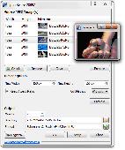
Do you have a large batch of image files that you want, within a few clicks, to share with your friends via email, publish on the Web or send to mobile device? Do you have a large batch of image files that you want to quickly resize? Jpeg Resize helps you in Editing a large number of image files. They can be resized with high quality, cropped or renamed using a predefined...
Category: Multimedia & Design / Image Editing
Publisher: Posibolt Software, License: Shareware, Price: USD $9.59, EUR6.59, File Size: 2.5 MB
Platform: Windows
When you are looking for a powerful tool to satisfy various needs regarding vectors, raster and satellite imagery, you will find ILWIS Academic an efficient application. The program comes with such useful features as points to create Maps, lines for segment Maps, closed area segments for polygon Maps, spatial operations for raster Maps and so on. Whilst using images...
Category: Home & Education / Miscellaneous
Publisher: ITC, License: Freeware, Price: USD $0.00, File Size: 19.4 MB
Platform: Unknown
Conzilla is a knowledge management tool with many purposes.
Conzilla is a knowledge management tool with many purposes. Among other things, it aims to be an efficient collaborative knowledge environment / modeling tool, a versatile interface for Editing and styling RDF.
The program presents knowledge in terms of specific Maps, Context-Maps. A Context-map displays nodes and arcs, from now on referred to as concepts and...
Category: Multimedia & Design / Multimedia App's
Publisher: KMR group at KTH (Royal Institute of Technology), License: Freeware, Price: USD $0.00, File Size: 3.3 KB
Platform: Windows
GDS Images and Document Maps is a unique document search utility.
GDS Images and Document Maps is a unique document search utility. GDS Images and Document Maps is a rather unique application that will enable you to store all your documents and images alongside other important files and folders right on your desktop so that you can use it straight from there, without the need to bother around with looking with looking for every single file...
Category: Utilities / Misc. Utilities
Publisher: toggle, License: Freeware, Price: USD $0.00, File Size: 558.8 KB
Platform: Windows
iMapBuilder Interactive Flash Map Builder creates interactive flash map and image Maps, with clickable regions, editable points and icons. You can easily embed online Maps to your website for showing facts and figures interactively. It is easy to use and requires no coding or flash knowledge.
Map templates gallery are included for easy Editing and instant usage...
Category: Multimedia & Design / Animation
Publisher: WebUnion Media Ltd., License: Shareware, Price: USD $0.00, File Size: 0
Platform: Windows
MapCreator combines a cartography and a graphics programme.
MapCreator combines a cartography and a graphics programme. The software is designed to create Maps and animated Maps of the highest quality as often required for presentations. For example, this could be Maps needed for a travel presentation. But also in
Category: Multimedia & Design
Publisher: primap.com, License: Freeware, Price: USD $0.00, File Size: 103.3 MB
Platform: Windows, Vista
CacheMaps retreives a variety of maps for your caches from the Internet.
CacheMaps retreives a variety of Maps for your caches from the Internet.
CacheMaps uses the Geocaching loc- or gpx-files as input. Directely from the Geocaching site or as exported from GSAK.CacheMaps v4 has been designed to be used next to GSAK. A lot of the functionality that was available in previous versions of CacheMaps, is available in GSAK now in a much better form. What...
Category: Audio / Utilities & Plug-Ins
Publisher: BigBird Productions, License: Freeware, Price: USD $0.00, File Size: 153.2 KB
Platform: Windows
Shareware
CoffeeCup Image Mapper has mouseover HTML capability, includes a fully functional image map wizard, and enables users to attach parts of an image to different links. Image Mapper can map any noninterlaced GIF, interlaced GIF, standard Jpeg, and progressive Jpeg, as well as the first frame of an animated GIF. Users can choose from three different shape methods for mapping those...
Category: Multimedia & Design / Button Creators
Publisher: CoffeeCup Software, License: Shareware, Price: USD $24.00, File Size: 3.8 MB
Platform: Windows
MAPC2MAPC is a program to manipulate digital Maps,it loads map images and calibrate them,loads calibrations in many different formats and Datums,view the calibrated map,crop and rescale Maps whilst preserving the calibration,reproject Maps to 'Plate Carre' (Equirectangular),rotate Maps to true North.
Category: Multimedia & Design / Digital Media Editors
Publisher: Thorn, License: Shareware, Price: USD $0.00, File Size: 1.6 MB
Platform: Windows
Shareware
JBatch It! is an automated Batch Imaging Editor which allows you to resize, rename, add captions and more. It is a must-have tool for webmasters and digital photographers alike. It supports Dot Per Inch modification, Jpeg quality and smoothing properties and allows resizing which image aspects ratio. It allows adding of drop shadow and perform several fundamental batch Editing...
Category: Multimedia & Design / Image Editing
Publisher: iRedSoft Technology Inc, License: Shareware, Price: USD $25.95, File Size: 5.9 MB
Platform: Windows
Create GPS enabled geo Maps directly on the background of aereal photos and road Maps from the internet. Import geodata from Google-Earth, OpenStreetMap, GPS tracks and GPS logger. Map editor , manually digitizing. Specifical graphical objects (borderlines, borderareas) to guarantee exact same borders of neighbour areas..Screen calibration for true to display on the screnn.
Category: Multimedia & Design / Digital Media Editors
Publisher: GPSur Dr. Erhard Regener, License: Shareware, Price: USD $65.00, File Size: 6.4 MB
Platform: Windows
Shareware
A PhotoInfoEx is digital photo software that will allow Editing or modifying some of the EXIF or IPTC infos of your Jpeg and Tiff image files. PhotoInfoEx able to read EXIF, IPTC and Maker Notes fields, contained in RAW photo files. PhotoInfoEx provides powerful import/export features, allows export Exif, IPTC data as a template file or a Microsoft Excel XLS format file or a RTF...
Category: Games / Tools & Editors
Publisher: Exsoftware, License: Shareware, Price: USD $50.00, USD25, File Size: 5.4 MB
Platform: Windows
Terrain Tools - Create maps quickly and easily!
Terrain Tools - Create Maps quickly and easily!
Terrain Tools is the ideal tool for outdoor recreationists, real-estate professionals, farmers, ecologists, archaeologists and others who need to create basic Maps, calculate areas, lengths, bearings and distances.
Overlay GPS tracks on scanned images such as USGS or Canadian NTS topos. Import and export...
Category: Business & Finance / Applications
Publisher: Softree, License: Shareware, Price: USD $124.00, File Size: 15.0 MB
Platform: Windows
Shareware
Offline Map Maker is a tool that help you to get offline tile images from Google Maps, Openstreetmap, Yandex Maps, Yahoo Maps, Mapquest, Gaode map, Tencent Maps, Baidu Maps, Tianditu, Arcgis Online, OneMap, Whereis, mapy.cz, Mappy, Waze, Sentinel-2 map, Strava Gloabal Heatmap, Wikimapia, GoMap.Az, Longdo Map, Bhuvan, National Map Australia, New Zealand...
Category: Internet / Download Managers
Publisher: allmapsoft.com, License: Shareware, Price: USD $79.00, File Size: 31.1 MB
Platform: Windows
With MapAuthor you can create, print and save desktop Maps, using data that you obtain from commercial sources or perhaps your in-hous GIS department as shapefiles (shapefiles are a very common GIS exchange format.) You can also produce internet-based Maps based on Google Maps, for use on your web site.
MapAuthor allows you to link your own data to Maps, for...
Category: Internet / Misc. Plugins
Publisher: MapAuthor.com, License: Freeware, Price: USD $0.00, File Size: 6.3 MB
Platform: Windows
Download, View, and Print Maps with the MrSID Viewer.
Download, View, and Print Maps with the MrSID Viewer.
To download and view Maps offline you need a special viewer. Maps are stored in MrSID format. The MRSID Viewer is a freeware tool. This library provides access to the MrSID viewer developed by LizardTech.
NOTE:
LizardTech dropped the link for that stand-alone viewer download from...
Category: Multimedia & Design / Graphics Viewers
Publisher: Lizardtech, License: Freeware, Price: USD $0.00, File Size: 2.0 MB
Platform: Windows
ChromasPro includes most of the functionality of Chromas and some powerful new features.
ChromasPro includes most of the functionality of Chromas and some powerful new features.
Open and save sequences in Applied Biosystems, Staden Chromatogram (SCF), FASTA, EMBL, GenBank, SwissProt, GenPept, GCG RSF and plain text formats. Assemble overlapping sequences into a consensus and automatically display ambiguities for Editing. View Genescan genotype files.Generate...
Category: Audio / Utilities & Plug-Ins
Publisher: Technelysium Pty Ltd, License: Shareware, Price: USD $69.00, File Size: 885.4 KB
Platform: Windows
Freeware
Free standalone software DataPult Desktop creates heat Maps from your data quickly and efficiently. Key features: Direct data import from MS Excel with one click. The ability to create animated Maps of data over several years. Interactive Maps and diagrams. 39 map colorings for making heat Maps. Intelligent identification of input...
Category: Business & Finance / MS Office Addons
Publisher: DataPult, License: Freeware, Price: USD $0.00, File Size: 21.0 MB
Platform: Windows
PowerMapper allows information architects, usability analysts and web developers to create graphical site Maps with one click, providing site visualization and simple navigation. Maps show thumbnails of web pages and can be tailored using 11 different styles then printed or copied into another application. Key Features: Mapping - create Maps of any site on the World...
Category: Internet
Publisher: Electrum, License: Shareware, Price: USD $349.00, File Size: 1.3 MB
Platform: Windows
Shareware
AnyMap JS Maps is an advanced JavaScript/HTML5 mapping library which makes you able to easily create interactive Maps that look great on any device including PCs, Macs, iPhones, iPads, Android devices and others - on any platform and in any browser. AnyMap JS is perfect for interactive dashboards and side-by-side reporting. You can use it to display sales by region, election...
Category: Web Authoring / JavaScript
Publisher: AnyChart JavaScript Charts, License: Shareware, Price: USD $49.00, File Size: 23.3 MB
Platform: Windows, Mac, Linux,
It Contains radius maps from modules 1-3 and runs from 1- 4.
It Contains radius Maps from modules 1-3 and runs from 1- 4. Creates random written exams to the same format as the PCO using WizAnn Radius Maps and automatically marks them. Drag and drop points onto the map and type in runs and compare with inbuilt runs. Perfect for Written test preparation.
Category: Multimedia & Design / Fonts
Publisher: WizAnn Publications Design, License: Shareware, Price: USD $0.00, File Size: 0
Platform: Windows
You will either mess up your work place with huge Maps and travel guides or just switch on to Schmap Player to guide you for your travel.
This amazing travel guide with elaborated Maps and destinations can be downloaded and used for free. The main interface of this application comprises the guide menu with: European guides, US guides, Canadian guides, Australian guides, and...
Category: Internet / Web Search Utilities
Publisher: Schmap, Inc., License: Freeware, Price: USD $0.00, File Size: 2.0 MB
Platform: Windows
Microsoft MapPoint software gives you the power to turn tabular data into informative Maps to communicate insights with instant impact. You can easily integrate Maps into your Office projects to show your business insights with clarity. Plus, get updated Maps of the US and Canada, with trip routing, turn-by-turn directions, and the ability to share routes with your GPS device.
Category: Business & Finance / MS Office Addons
Publisher: Microsoft, License: Shareware, Price: USD $0.00, File Size: 0
Platform: Windows
Img2CAD is a stand-alone program that converts scanned drawings, Maps and raster images into AutoCAD formats (such as DXF, HPGL, etc) for Editing in any CAD application. Key Features: a. Input image formats: BMP, JPG, TIF, GIF, PNG, PCX, TGA, RLE, JPE, J2K, JAS, JBG, MNG and more. b. Output formats: DXF, HPGL, and others. c. Outline solid raster areas. d....
Category: Multimedia & Design
Publisher: Img2cad, Inc., License: Shareware, Price: USD $99.00, File Size: 530.2 KB
Platform: Windows
From Gothic St. Stephens Cathedral to the Imperial Palace - the 10 best of everything to see, buy, do, taste and avoid in Vienna, plus Maps and transport Maps.
Discover the best historic palaces and gardens, great walks and itineraries, most fun places for kids, venues for concerts and opera, liveliest beer halls, tastiest schnitzel and Viennese cakes, best hotels on every...
Category: Internet / Communications
Publisher: Mobile Systems, License: Shareware, Price: USD $9.80, File Size: 0
Platform: Windows