Free Downloads: Kml Text Editor Earth
Kml Builder makes it easy to create and edit KML files to be viewed in Google Earth.
Kml Builder makes it easy to create and edit Kml files to be viewed in Google Earth.
Places you create with Kml Builder can be emailed to your friends or co-workers and can even be published on the Internet or on Intranets for a broader audience.
Anyone who has Google Earth Desktop installed on their computer can open your created Kml files...
Category: Utilities / Misc. Utilities
Publisher: NorthGates Systems, License: Shareware, Price: USD $0.00, File Size: 0
Platform: Windows
This application will measure paths in Google Earth, either saved in Kml Files, or copied from the clipboard. The application uses the haversine formula to measure distances between points on a spherical object. These distances are approximate, but some test calculations I have made, show that they are in line with Google Earth's built in measuring tool calculations....
Category: Home & Education / Miscellaneous
Publisher: Whaleycopter, License: Freeware, Price: USD $0.00, File Size: 457.5 KB
Platform: Windows
The Kml Generator is a useful and reliable utility which enables you to easily analyze GPS log files containing NMEA string data and then generate Google Earth (TM) compatible Kml files. It is a free to use application and has a simple and friendly interface. It has low system requirements too, and works on all windows operating systems.
Category: Software Development / Misc. Programming
Publisher: Jacob Madsen, License: Shareware, Price: USD $0.00, File Size: 0
Platform: Windows
EasyAcreage is program for WinXP or Vista program that allows you to calculate area from Kml files exported out of Google Earth. This means you do not even have to leave your house to measure a field anymore. Simply use the free version of Google Earth, mark the area you wish to measure, save it as a Kml file and drag and drop it onto EasyAcreage.
Category: Home & Education / Miscellaneous
Publisher: Wildsoft, License: Shareware, Price: USD $20.00, File Size: 817.1 KB
Platform: Windows
Easy way to convert Waypoints from KMZ or Kml to GPX file format with the Kml/KMZ to GPX Converter free.
Easy Steps :
- Save your waypoints in KMZ or Kml format with google Earth
- Import that format in the Kml/KMZ to GPX Converter free
- Then select waypoint you want to convert to GPX format
- Export the GPX format
- Upload...
Category: Audio / Rippers & Encoders
Publisher: HotelResortClub.com, License: Freeware, Price: USD $0.00, File Size: 656.6 KB
Platform: Windows
 Shareware
KMLReduce optimizes the size of Kml files by analyzing, reducing, and removing coordinates from polygons contained within the file. This allows you to distribute the Kml file online and use less traffic for users and services accessing the fille. KMLReduce works on Kml files that contian polygon shapes with many coordinates. KMLReduce analyzes the points for each polygon...
Category: Web Authoring / XML/CSS Utilities
Publisher: ksoft, License: Shareware, Price: USD $24.95, File Size: 636.7 KB
Platform: Windows

MB-GPS2KML converts a GPS log file (in plain NMEA format) to a KML file (placemark file for Google Earth) and opens this file in Google Earth. Velocity, number of satellites and HDOP are interpreted as height, color and size of the icons.
Category: Home & Education
Publisher: Markus Bader, License: Freeware, Price: USD $0.00, File Size: 441.4 KB
Platform: Windows
Superoverlay software is a Google Earth application for tiling raster datasets and creating view based regions in Kml or KMZ files.
Also Superoverlay can generate world files for all images in ArcView style (jgw, tfw,...). It helps you put large image overlays into Google Earth (for example alternative maps or aerial photography). GE Sky mode is supported.
Category: Home & Education / Miscellaneous
Publisher: GIS Center, License: Shareware, Price: USD $0.00, File Size: 0
Platform: Windows
Demo
Visualize your data in 3D! Quick, easy and inexpensive. Graph Earth enables management, marketing and other business professionals to create stunning visual representations of their data, all without the time and costs associated with a full-featured GIS. Viewable by Everyone! Create one of a kind deliverables and distribute them to the world, recipients need only install Google...
Category: Business & Finance / MS Office Addons
Publisher: Deer Creek Marketing LLC, License: Demo, Price: USD $24.95, File Size: 469.0 KB
Platform: Windows
Korti is a Google Earth plugin which allows you to see the unique 3D satellite map of Korti within your Google Earth application.
Korti provides you a detailed satellite imagery and geographic information about this geographic place.
To have Korti installed on your PC, first install for free Google Earth and then Korti 3D map plugin. After that, simply double...
Category: Multimedia & Design / Multimedia App's
Publisher: Maplandia, License: Freeware, Price: USD $0.00, File Size: 309 B
Platform: Windows
KMLCSV Converter is a tool that enables you to convert the Kml file generated from Google Earth (free version) into a formatted CSV file (and vice versa). This CSV file can then be uploaded into your Garmin GPS by using Garmin POI Loader, which can be downloaded for free. This allows you to plot all the custom point of interests (POI) with Google Earth first. Then, you can...
Category: Business & Finance / Calculators
Publisher: Choon-Chern Lim, License: Freeware, Price: USD $0.00, File Size: 2.3 MB
Platform: Windows
With the help of Kml Color Converter you can pick and mix colors and get the respective codes in 7 systems: Kml, RGB, VB, HTM, CMY, CMYK and HSL. You can also adjust the transparency of the resulted color. When you want to change the chosen color, all you have to do is increase/decrease the intensity of the RGB colors by means of the correspondent up/down arrows.
Category: Multimedia & Design / Media Management
Publisher: Ricardo Sgrillo, License: Freeware, Price: USD $0.00, File Size: 1.9 MB
Platform: Windows
T2K Pro integrates the rich world of GIS datasets and transfers your Geographic information data into Google Earth. T2K Pro handles rich data types and access large volumes of geographic data stored in files and databases; T2K PRO handles raster (imagery), Vector Map data and GPS Tracks/ Waypoints/ Routes. Tiles2kml Pro provides a complete suite of conversion tools to easily visualize...
Category: Multimedia & Design / Authoring Tools
Publisher: Tiles2kml, License: Demo, Price: USD $90.00, File Size: 20.9 MB
Platform: Windows
Shape2Earth leverages freely available and easy to use Geographic Information System (GIS) software to create professional visualizations for viewing in GoogleTM Earth.
Main features:
-Convert Any Shapefile to Kml - Shape2Earth reprojects your data on the fly
-Apply Thematic Symbology to your Data - Color code to display information
-Present Data in...
Category: Multimedia & Design / Image Editing
Publisher: Google, License: Demo, Price: USD $0.00, File Size: 9.5 MB
Platform: Windows
iTag is a utility that allows you to easily add title, description and keyword tags to your digital photos. The data you enter is stored into the actual photo file itself - using the open standards of IPTC and XMP. Many applications can read and write the IPTC/XMP data, but iTag is especially powerful at editing a group of photos all at once. Geocoding your photos is also straight forward...
Category: Multimedia & Design / Media Catalogers
Publisher: iTag Software, License: Freeware, Price: USD $0.00, File Size: 576.9 KB
Platform: Windows
Text Editor Anywhere allows you to edit text anywhere with your favorite text editor.
Text Editor Anywhere allows you to edit Text anywhere with your favorite Text Editor. It can give you the ability to use some advanced features (like auto-completing, spell checking and syntax highlighting) that are only available in an external Text Editor. It may also save you from web browser crashes.
Category: Utilities / System Utilities
Publisher: Bopsoft, License: Freeware, Price: USD $0.00, File Size: 5.6 MB
Platform: Windows
Earth 2160 is the official sequel of the award winning, very popular and top selling Earth series and continues the brand of Earth 2140 and Earth 2150.
Only a few thousand humans managed to escape from the Earth before its collapse in 2150 A.D. They spent the next few years on the terra forming of the red planet, developing new technologies and building...
Category: Games / Strategy & War
Publisher: ZUXXEZ Entertainment AG, License: Demo, Price: USD $0.00, File Size: 3.5 MB
Platform: Windows
Free Earth Screensaver will bring the blue planet to your desktop.
Free Earth Screensaver will bring the blue planet to your desktop. You can view the Earth from the night side, the day side and from the moon. This screensaver lets you see the pictures of our planet that you have never seen before. Earth is the third planet from the Sun and is the densest and fifth-largest of the eight planets in the Solar System. This unique Earth...
Category: Desktop Enhancements / Misc. Themes
Publisher: CustomAquariumScr, License: Freeware, Price: USD $0.00, File Size: 3.0 MB
Platform: Windows

OkCustomMap is a software to produce Garmin Custom Maps.
OkCustomMap is a software to produce Garmin Custom Maps.
Supports many map formats:
- OkMap
- Ecw
- GeoTiff
- World files
- OziExplorer
- GpsTuner
You can customize:
- The quality of the output JPEG images (0=Bad, 100=Good)
- The Kml transparency (0=Transparent, 255=Opaque)
- The Kml draw order (0=Invisible, 1-49=Under the vectorial...
Category: Business & Finance / Applications
Publisher: Gian Paolo Saliola, License: Freeware, Price: USD $0.00, File Size: 3.2 MB
Platform: Windows
Shareware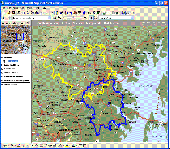
MPSuperShape is a shape manipulation tool for Microsoft MapPoint. MPSuperShape can be used to combine multiple shapes into one large shape, find the intersections (overlaps) between shapes, find boundary shapes around groups of pushpins, simplify shapes, delete multiple shapes, change shape colors, import/export shape files, and to create web pages. Import shape options include ESRI Shape (SHP)...
Category: Business & Finance / Business Finance
Publisher: Winwaed Software Technology LLC, License: Shareware, Price: USD $75.00, File Size: 13.6 MB
Platform: Windows
NMEA Converter is a product to convert various types of data NMEA to UDP Converter UDP to NMEA Converter(Reserved) GPS to HDT Converter(Reserved) NMEA to Kml Converter(Reserved) NMEA to KMZ Converter(Reserved) Kml to NMEA Converter(Reserved) KMZ to NMEA Converter(Reserved)
Category: Audio / MP3 Search Tools
Publisher: NMEAsoft, License: Demo, Price: USD $29.00, File Size: 509.0 KB
Platform: Windows
Shareware
An add-on for AUTOCAD or BricsCAD, which makes the triangulation of a set of POINT entities, the intersection curves (isolines) between a set of 3DFACE entities and a set of equidistance plans, horizontally or vertically and the volume and center of gravity of a set of bodies or between surfaces composed of 3DFACE entities. You can also load and draw a file of points having the format: Number...
Category: Multimedia & Design / Graphics Viewers
Publisher: Rcad Software, License: Shareware, Price: USD $64.00, EUR59, File Size: 2.5 MB
Platform: Windows
Sublime Text is a text editor and source editor for Windows.
Sublime Text is a Text Editor and source Editor for Windows. At first sight, you will notice something that is not usually on your regular Text editors. The background is black and the Text is white, and uses color coding for certain things. That is because Sublime Text aims at being a Text Editor with no graphical distractions for...
Category: Software Development / Tools & Editors
Publisher: Sublime Text, License: Shareware, Price: USD $59.00, File Size: 4.9 MB
Platform: Windows
View amazing satellite images of earth with the free version of google earth software.
View amazing satellite images of Earth with the free version of google Earth software.Google Earth is a totally free software which enables you zoom in from satellite,view,rotate or tilt just like a camera of the entire Earth inside your pc.It works just point and click on any part of Earth or by typing addrees name of city or country and google Earth...
Category: Home & Education / Miscellaneous
Publisher: www.satelliteimage-of-my-house.com, License: Freeware, Price: USD $0.00, File Size: 798.0 KB
Platform: Windows
Beautiful Earth is a Wallpaper generator and Screen Saver.
Beautiful Earth is a Wallpaper generator and Screen Saver. Beautiful Earth shows you how the Earth looks like from the space at this very moment. You can see which parts of the Earth are enjoying the sun light. And in night areas you can see the city lights. Based on NASA's Blue Marble and City Lights satellite images.
Category: Desktop Enhancements / Screensavers
Publisher: GimmeGoody.com, License: Shareware, Price: USD $24.99, File Size: 2.7 MB
Platform: Windows