Free Downloads: Kml To Img
Kml Builder makes it easy to create and edit KML files to be viewed in Google Earth.
Kml Builder makes it easy to create and edit Kml files to be viewed in Google Earth.
Places you create with Kml Builder can be emailed to your friends or co-workers and can even be published on the Internet or on Intranets for a broader audience.
Anyone who has Google Earth Desktop installed on their computer can open your created Kml files with just a...
Category: Utilities / Misc. Utilities
Publisher: NorthGates Systems, License: Shareware, Price: USD $0.00, File Size: 0
Platform: Windows
 Shareware
KMLReduce optimizes the size of Kml files by analyzing, reducing, and removing coordinates from polygons contained within the file. This allows you to distribute the Kml file online and use less traffic for users and services accessing the fille. KMLReduce works on Kml files that contian polygon shapes with many coordinates. KMLReduce analyzes the points for each polygon...
Category: Web Authoring / XML/CSS Utilities
Publisher: ksoft, License: Shareware, Price: USD $24.95, File Size: 636.7 KB
Platform: Windows
Easy way to convert Waypoints from KMZ or Kml to GPX file format with the Kml/KMZ to GPX Converter free.
Easy Steps :
- Save your waypoints in KMZ or Kml format with google earth
- Import that format in the Kml/KMZ to GPX Converter free
- Then select waypoint you want to convert to GPX format
- Export the GPX format
- Upload the...
Category: Audio / Rippers & Encoders
Publisher: HotelResortClub.com, License: Freeware, Price: USD $0.00, File Size: 656.6 KB
Platform: Windows
With the help of Kml Color Converter you can pick and mix colors and get the respective codes in 7 systems: Kml, RGB, VB, HTM, CMY, CMYK and HSL. You can also adjust the transparency of the resulted color. When you want to change the chosen color, all you have to do is increase/decrease the intensity of the RGB colors by means of the correspondent up/down arrows.
Category: Multimedia & Design / Media Management
Publisher: Ricardo Sgrillo, License: Freeware, Price: USD $0.00, File Size: 1.9 MB
Platform: Windows
The Kml Generator is a useful and reliable utility which enables you to easily analyze GPS log files containing NMEA string data and then generate Google Earth (TM) compatible Kml files. It is a free to use application and has a simple and friendly interface. It has low system requirements too, and works on all windows operating systems.
Category: Software Development / Misc. Programming
Publisher: Jacob Madsen, License: Shareware, Price: USD $0.00, File Size: 0
Platform: Windows
Shareware
Img to PDF Converter is a Windows application which can directly convert dozens of image formats, such as TIF, TIFF, JPG, JPEG, GIF, PNG, BMP, PSD, WMF, EMF, PCX, PIC and so on, into PDF format. Img to PDF can automatically clear and skew-correct B/W images to insure high quality output after conversion. Img to PDF can operate independently of Adobe Acrobat. Img...
Category: Business & Finance / Document Management
Publisher: http://www.imagepdf.com, License: Shareware, Price: USD $59.95, File Size: 4.9 MB
Platform: Windows
Allows to display and register rasters of ERDAS Imagine (*.
Allows to display and register rasters of ERDAS Imagine (*.Img files) in MapInfo. Georeferenced *.Img images will be displayed directly in MapInfo Professional, MapX, and MapXtreme environments. Additional utilities for free: img2tab utility - creates *.TAB file for each *.Img file in batch mode. MapInfo Table is created automatically and then can be used to open the...
Category: Utilities / System Utilities
Publisher: MicroOLAP Technologies LTD, License: Shareware, Price: USD $99.95, File Size: 1.1 MB
Platform: Windows
Img to ISO is a free small software utility, that, as its name suggests, can convert Img image files into ISO image files.
The ISO format file that is created by this program can conform to the standard ISO-9660 format. You can also use this software to open ima files.
Category: Utilities / Misc. Utilities
Publisher: imgtoiso, License: Freeware, Price: USD $0.00, File Size: 1.3 MB
Platform: Windows

IMG-Bar v1. 0 provides a convenient way for visitors to navigate your site. .
Category: Software Development
Publisher: Spriteworks Developments, License: Demo, Price: USD $4.95, File Size: 46.0 KB
Platform: Unknown
With DESK-IMG you can automatically zoom your images to fit on desktop’s height or width.
With DESK-Img you can automatically zoom your images to fit on desktop’s height or width. DESK-Img can remember your last choice.
You can also automatically change your desktop wallpaper after a specified time and simply take control over your desktop wallpapers.
Category: Desktop Enhancements / Shell & Desktop Managers
Publisher: DESK-IMG Project Team, License: Freeware, Price: USD $0.00, File Size: 418.5 KB
Platform: Windows
This application will measure paths in Google Earth, either saved in Kml Files, or copied from the clipboard. The application uses the haversine formula to measure distances between points on a spherical object. These distances are approximate, but some test calculations I have made, show that they are in line with Google Earth's built in measuring tool calculations. The application...
Category: Home & Education / Miscellaneous
Publisher: Whaleycopter, License: Freeware, Price: USD $0.00, File Size: 457.5 KB
Platform: Windows
EasyAcreage is program for WinXP or Vista program that allows you to calculate area from Kml files exported out of Google Earth. This means you do not even have to leave your house to measure a field anymore. Simply use the free version of Google Earth, mark the area you wish to measure, save it as a Kml file and drag and drop it onto EasyAcreage.
Category: Home & Education / Miscellaneous
Publisher: Wildsoft, License: Shareware, Price: USD $20.00, File Size: 817.1 KB
Platform: Windows
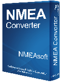
NMEA Converter is a product to convert various types of data NMEA to UDP Converter UDP to NMEA Converter(Reserved) GPS to HDT Converter(Reserved) NMEA to Kml Converter(Reserved) NMEA to KMZ Converter(Reserved) Kml to NMEA Converter(Reserved) KMZ to NMEA Converter(Reserved)
Category: Audio / MP3 Search Tools
Publisher: NMEAsoft, License: Demo, Price: USD $29.00, File Size: 509.0 KB
Platform: Windows
Convert IMG is an image converter.
Convert Img is an image converter. It currently can convert .gif to .bmp (bitmap) and the reverse.
Category: Utilities / File Compression
Publisher: sourceforge.net, License: Freeware, Price: USD $0.00, File Size: 2.0 KB
Platform: Windows, Mac, 2K, 2K3
This tool massively automatically sets and updates the height and width attributes of Img tags of HTML documents based on the original height and width of the source image. It is a good practice to set the height and width of Img tags to allow the browser to display the webpage more smoothly while the webpage is being loaded. With this tool you do not need to find and set the...
Category: Internet / Misc. Plugins
Publisher: 4dots Software, License: Freeware, Price: USD $0.00, File Size: 135.0 KB
Platform: Windows

MB-GPS2KML converts a GPS log file (in plain NMEA format) to a KML file (placemark file for Google Earth) and opens this file in Google Earth. Velocity, number of satellites and HDOP are interpreted as height, color and size of the icons.
Category: Home & Education
Publisher: Markus Bader, License: Freeware, Price: USD $0.00, File Size: 441.4 KB
Platform: Windows
Img To Html easily can convert any of your image files to complete html source.
Img To Html easily can convert any of your image files to complete html source. You can choose to either convert your imageto a sequence of chars or to a table. You can also grayscale your images, chose the fonts and even let them internally be compressed by JavaScript.
Category: Utilities / System Utilities
Publisher: Alpha Interactive, License: Freeware, Price: USD $0.00, File Size: 798.7 KB
Platform: Windows
Superoverlay software is a Google Earth application for tiling raster datasets and creating view based regions in Kml or KMZ files.
Also Superoverlay can generate world files for all images in ArcView style (jgw, tfw,...). It helps you put large image overlays into Google Earth (for example alternative maps or aerial photography). GE Sky mode is supported.
Category: Home & Education / Miscellaneous
Publisher: GIS Center, License: Shareware, Price: USD $0.00, File Size: 0
Platform: Windows
Demo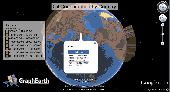
Visualize your data in 3D! Quick, easy and inexpensive. Graph Earth enables management, marketing and other business professionals to create stunning visual representations of their data, all without the time and costs associated with a full-featured GIS. Viewable by Everyone! Create one of a kind deliverables and distribute them to the world, recipients need only install Google Earth to view...
Category: Business & Finance / MS Office Addons
Publisher: Deer Creek Marketing LLC, License: Demo, Price: USD $24.95, File Size: 469.0 KB
Platform: Windows
Shareware
An add-on for AUTOCAD or BricsCAD, which makes the triangulation of a set of POINT entities, the intersection curves (isolines) between a set of 3DFACE entities and a set of equidistance plans, horizontally or vertically and the volume and center of gravity of a set of bodies or between surfaces composed of 3DFACE entities. You can also load and draw a file of points having the format: Number...
Category: Multimedia & Design / Graphics Viewers
Publisher: Rcad Software, License: Shareware, Price: USD $64.00, EUR59, File Size: 2.5 MB
Platform: Windows
Shareware
Convert PDF to Text, Img or RTF on-the-fly PDF Converter XP program can convert PDF to Text (TXT files), RTF (Rich Text Format), Img ( TIF or TIFF files) on-the-fly. If you want to read PDF file while no PDF reader installed on your computer, or if you want to use the text included in the PDF file, but it can not support copy and paste, then you may use PDF Converter XP to...
Category: Business & Finance / Calculators
Publisher: download-converter, License: Shareware, Price: USD $19.95, EUR18.95, File Size: 1.8 MB
Platform: Windows

OkCustomMap is a software to produce Garmin Custom Maps.
OkCustomMap is a software to produce Garmin Custom Maps.
Supports many map formats:
- OkMap
- Ecw
- GeoTiff
- World files
- OziExplorer
- GpsTuner
You can customize:
- The quality of the output JPEG images (0=Bad, 100=Good)
- The Kml transparency (0=Transparent, 255=Opaque)
- The Kml draw order (0=Invisible, 1-49=Under the vectorial...
Category: Business & Finance / Applications
Publisher: Gian Paolo Saliola, License: Freeware, Price: USD $0.00, File Size: 3.2 MB
Platform: Windows
The purpose of this software is provide support for cartographic formats like Garmin® Img, or Polish cGPSmapper files. Provides a plataform for designing plugins that allow increase the features of the application, such as AVL support and monitoring.
This software allow the user to simplify certain tasks that require cartographic support. In this situation we offer a...
Category: Home & Education / Miscellaneous
Publisher: Movilbit, Inc., License: Shareware, Price: USD $18.00, File Size: 3.7 MB
Platform: Windows
KMLCSV Converter is a tool that enables you to convert the Kml file generated from Google Earth (free version) into a formatted CSV file (and vice versa). This CSV file can then be uploaded into your Garmin GPS by using Garmin POI Loader, which can be downloaded for free. This allows you to plot all the custom point of interests (POI) with Google Earth first. Then, you can transfer all...
Category: Business & Finance / Calculators
Publisher: Choon-Chern Lim, License: Freeware, Price: USD $0.00, File Size: 2.3 MB
Platform: Windows
Freeware
The DMG Extractor can extract DMG files as used by Apple computers on a Windows PC. The software works with all types of DMG files including Raw, Zlib, Bzip2, and Zero block type DMG files. The DMG Extractor can open and extract files from a wide variety of Mac OS X Disk Image files, without having to first convert them to ISO or Img files first. Other benefits are: Easy to use...
Category: Utilities / File Compression
Publisher: Reincubate Ltd, License: Freeware, Price: USD $24.95, GBP15, File Size: 1.7 MB
Platform: Windows