Free Downloads: Kriging
License: All | Free
WinGslib is toolbox of Geostatistical software algorithms written for Windows 95/98/NT.
WinGslib is toolbox of Geostatistical software algorithms written for Windows 95/98/NT. It provides a front-end to all the GSLIB programs.
Available tools:
- Data manipulation
- Change Coordinates System
- Cell Declustering
- Normal Score Transform
- Normal Score Back-Transformation
- General Transformation
- Markov-Bayes...
Category: Business & Finance / Business Finance
Publisher: Statios, License: Shareware, Price: USD $250.00, File Size: 8.0 MB
Platform: Windows
Isoliner is the ArcGIS extension for make grids and points theme with interpolate by Kriging's and triangulation method. Last version of extension include Slide Analyst as free function.
Isoliner include additional 3D functions, interpolation by features, generation of random points.
Category: Multimedia & Design / Multimedia App's
Publisher: GIS Planet, License: Shareware, Price: USD $0.00, File Size: 0
Platform: Windows
 Shareware
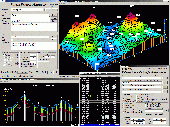
SurGe is a computer program which enables to generate surface as an interpolation (approximation) function of two independent variables. The program has the following basic features: - Implements an interpolation / approximation method called ABOS. - Basic input is a simple ASCII file containing X, Y and Z coordinates of points irregularly spaced in some region. - The surface can be...
Category: Home & Education / Science
Publisher: MD, License: Shareware, Price: USD $20.00, File Size: 3.0 MB
Platform: Windows
Point Analyst is an extension to the ArcView® GIS designed for the exploratory analysis of spatial sampling and analysis methods.
New users should read the concepts section to understand the motivation and principles behind the stratified interpolation function provided in the extension.
-Stratified interpolation: Point interpolation using ordinary point or...
Category: Software Development / Misc. Programming
Publisher: Dr. Rob Rempel, License: Demo, Price: USD $0.00, File Size: 739.8 KB
Platform: Windows
The variogram is a simple tool for analyzing spatial variability.
The variogram is a simple tool for analyzing spatial variability. When properly understood, the variogram will allow the determination of adequate sample spacing, and provide the model parameters required for Kriging.
OmniVar is a very simple variogram analysis tool. Although quite efficient, it should not be substituted for more robust programs where required. If the data under...
Category: Home & Education / Astrology & Numerology
Publisher: EasySolve Software LLC, License: Shareware, Price: USD $69.00, File Size: 1.8 MB
Platform: Windows
License: All | Free