Free Downloads: Latitude Longitude Altitude Elevation
This converter is actually part of Balloon Track.
This converter is actually part of Balloon Track. However, I often found myself needing a quick conversion. Loading BT for this was just a bit cumbersome, so I lifted the converter and made it a program in its own right.
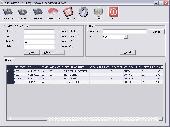
Enter Latitude and Longitude at the top and click the button corresponding to the output you wish to see.
It's simple right?
...
Category: Business & Finance / Calculators
Publisher: EOSS, License: Freeware, Price: USD $0.00, File Size: 248.1 KB
Platform: Windows
Suncycle is a calendar with the sunrise and sunset time for a latitude/longitude and timezone.
Suncycle is a calendar with the sunrise and sunset time for a Latitude/Longitude and timezone. Now with azimuth features.Suncycle can be run in the systray.Now suncycle with graphic. In the graph you see the evolution of the sunrise and sunset for 360 day
Category: Home & Education / Miscellaneous
Publisher: users.pandora.be, License: Freeware, Price: USD $0.00, File Size: 428.5 KB
Platform: Windows, Mac, 2K, 2K3, Vista
The 'Canadian Postal Codes' package will provide you with the extended Canadian Postal Codes database as well as Canadian geographical data like Latitude and Longitude. The 'Canadian Postal Codes' package includes the information on: Canadian Postal code, Latitude, Longitude. 809 036 precise records are in the 'Canadian Postal Codes' package. Canadian Postal Codes...
Category: Business & Finance / Business Finance
Publisher: Zip Postal Codes, License: Shareware, Price: USD $24.95, File Size: 5.2 MB
Platform: Windows
Astro Helper will tell you the angle of Elevation above the horizon (Altitude) and the direction in degrees from North (Azimuth) of the selected objects. It will simultaneously display the coordinates of 22 objects from a database of over 22,000 objects. With these coordinates you can point your Dobsonian mounted telescope or other "Alt/Az" mounted scope. If you have an...
Category: Home & Education / Astrology & Numerology
Publisher: Mark Casazza Consulting, License: Freeware, Price: USD $0.00, File Size: 3.3 MB
Platform: Windows
The 'German Postal Codes' package will provide you with the extended German Postal Codes database as well as german geographical data like Latitude and Longitude. The 'German Postal Codes' package includes the information on: german Postal code, Latitude, Longitude. 14 958 precise records are in the 'German Postal Codes' package. German Postal Codes are in five-digit...
Category: Business & Finance / Business Finance
Publisher: Zip Postal Codes, License: Shareware, Price: USD $24.95, File Size: 99.0 KB
Platform: Windows
Canadian postal codes database one month subscription service. The database includes Postal code, city name, province name, phone area code, timezone, Latitude, Longitude and street name in Canada. The complete database contains over 780,000 precise records. Immediate download available in several formats ie. ASCII text, Microsoft Excel, Microsoft Access and dBASE V. Annual...
Category: Business & Finance / E-commerce
Publisher: ZIPCodeWorld.com, License: Data Only, Price: USD $249.95, File Size: 26.5 KB
Platform: Windows, Linux, Palm, Unix, MS-DOS, AS/400, OS/2, Mac, OpenVMS
Geocoding is the process of matching addresses to a point on the globe (Latitude/Longitude) and using that point against known regions.
In most cases those regions are census tracts, but they may also include counties or zip-codes. Once you have established regions where the points live within, you are able to link information to that point. You can call the results...
Category: Internet / Web Search Utilities
Publisher: QuestSoft Corporation., License: Shareware, Price: USD $395.00, File Size: 116.0 MB
Platform: Windows
MyGPS is a Freeware software for the creation and the management of Longitude and Latitude calibrated maps.
The software can define points of interest obtaining their coordinates (waypoints), can create routes (routepoints), can visualize track paths (trackpoints).
Using a serial link, points routes and tracks can be shared with "eTrex" and "Geko"...
Category: Home & Education / Miscellaneous
Publisher: GPSInfo, License: Freeware, Price: USD $0.00, File Size: 2.3 MB
Platform: Windows
One stop solution for Latitude Longitude Database, Cities Database, Zipcode Database and County Database. Our product line covers a basic edition world cities database that includes major cities of the world which is perfectly suitable to capture country and city information of a visitor registering on your website. In addition, we have a detailed county/cities database called...
Category: Web Authoring / Web Design Utilities
Publisher: Best World Cities Database Ever, License: Freeware, Price: USD $0.00, File Size: 51.4 KB
Platform: Windows, Mac,
The GPS map will help you give you with turn by turn directions to your destination using a POI, city point and/or Longitude and Latitude.It has the ability to preplan driving destinations before getting into your car. Compatible with ALL Garmin GPS units. Don't pay more than US$10 per day when you already own a Garmin, this is the most comprehensive GPS map available at such...
Category: Home & Education / Miscellaneous
Publisher: GPSTravelMaps.com, License: Shareware, Price: USD $0.00, File Size: 0
Platform: Windows
IP2Location IP-COUNTRY-REGION-CITY-Latitude-Longitude-ZIPCODE-ISP-DOMAIN is commericial lookup database that 1. Provide Location Aware Content (language, currency, etc.)
2. Redirect based on country;
3. Digital rights management;
4. Prevent password sharing and abuse of service;
5. Reduce credit card fraud;
6. Web log stats and analysis;
7. Auto-selection...
Category: Internet / Misc. Plugins
Publisher: IP2Location.com, License: Data Only, Price: USD $799.00, File Size: 200.0 KB
Platform: Windows, Linux, Mac, Palm
IP2Location IP-COUNTRY-REGION-CITY-Latitude-Longitude-ZIPCODE-TIMEZONE-ISP-DOMAIN-NETSPEED-AREACODE is commercial lookup database that translates IP address to country, region, city, Latitude, Longitude, ZIP code, time zone, ISP, domain name, connection speed, IDD code and area code. Developers use this database for: 1. Provide Location Aware Content...
Category: Audio / MIDI Applications
Publisher: IP2Location.com, License: Data Only, Price: USD $1399.00, File Size: 195.3 KB
Platform: Windows, Linux, Palm, Mac, Unix, MS-DOS, AS/400, OS/2, OpenVMS
GeoDataSource Cities Database Gold Edition contains 2.9+ million entries with city names in original language and English, feature type classifications, country names in FIPS and ISO, regions, sub-regions, state or First-Order Administrative Division, county or Second-Order Administrative Division, Longitude and Latitude in degree and decimal, Univeral Transverse Mercator...
Category: Security & Privacy / Other
Publisher: GeoDataSource.com, License: Data Only, Price: USD $1049.95, File Size: 160.3 KB
Platform: Windows, Mac, Linux, Palm,
Windows DLL to find the distance in miles between 2 latitude/longitude points, specified in degrees.
Category: Home & Education / Miscellaneous
Publisher: kjlsoftware.com, License: Freeware, Price: USD $0.00, File Size: 36.0 KB
Platform: Windows, Mac, 2K
Rocanda Land Tracker software will allow you to convert any LSD location in Alberta, British Columbia, Saskatchewan or Manitoba into a corresponding Latitude/Longitude coordinate. which you can then input into mapping software such as Garmin's Mapsource products, or OziExplorer.
Category: Business & Finance / MS Office Addons
Publisher: Rocanda, License: Shareware, Price: USD $179.00, File Size: 8.6 MB
Platform: Windows
WinPilot 3D is flight analysis and planning software, that lets you zoom in from satellite Altitude into any place on Earth, leveraging Landsat satellite imagery and Shuttle Radar Topography Mission Elevation data. WinPilot 3D lets you experience Earth terrain in visually rich 3D, just as if you were really there. WinPilot 3D also shows airspace in 3D, and contains world-wide...
Category: Home & Education / Miscellaneous
Publisher: WinPilot, License: Shareware, Price: USD $59.00, File Size: 3.8 MB
Platform: Windows
WGS-84 Calculator is used to calculate geodetic distance and azimuth between two points (Latitude and Longitude). In addition, it can calculate a new point from origin using the given azimuth and distance.
Lat/long values can be inserted using three different formats; DD:MM:SS.ssss, DD:MM.mmmmmm or DD.dddddddd.
Calculations are based on WGS-84 (World...
Category: Home & Education / Mathematics
Publisher: MR Soft Tmi, License: Freeware, Price: USD $0.00, File Size: 502.0 KB
Platform: Windows
IP2Location IP-COUNTRY-REGION-CITY-Latitude-Longitude-ZIPCODE-TIMEZONE-ISP-DOMAIN-NETSPEED-AREACODE-WEATHER is commercial lookup database that translates IP address to country, region, city, Latitude, Longitude, ZIP code, time zone, ISP, domain name, connection speed, IDD code, area code, weather station code and station name. . Developers use this database for:...
Category: Audio / MIDI Applications
Publisher: IP2Location.com, License: Data Only, Price: USD $1399.00, File Size: 195.3 KB
Platform: Windows, Linux, Palm, Mac, Unix, MS-DOS, AS/400, OS/2, OpenVMS
The database includes total of 49 data fields which consists of:
ZIP Code, Classification, Primary Record, City, City Alias Name, City Type, Mailing Name, State, State FIPS, Latitude, Longitude, Elevation, Area Code, County Name, County FIPS, Time Zone, Day Light Saving, MSA, MSA Name, PMSA, PMSA Name, CSA, CBSA, CBSA Div, CBSA Type, CBSA Name, Region, Division,...
Category: Web Authoring / Web Design Utilities
Publisher: IGEOCODE, License: Demo, Price: USD $45.95, File Size: 3.0 MB
Platform: Windows, Mac, Palm
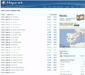
Zip Codes databases from most of the countries with all regions, cities, areas, districts, streets, block numbers, Latitude and Longitude, area code, time zone and more. Tools and formulas to calcualte distance between postal codes and or coordinates. Format UTF-8 in TXT file comma separated for easy upload to any database system.
Category: Web Authoring / Web Design Utilities
Publisher: Mapanet, S de RL, License: Data Only, Price: USD $109.00, File Size: 120.0 KB
Platform: Windows
ZIPCodeWorld Desktop is a standalone Windows application that performs several ZIP code and postal code search functions such as data query, distance calculation and store locator in one simple interface. The software can be used together with all ZIPCodeWorld and PostalCodeWorld databases. SOFTWARE FEATURES * Look up ZIPCodeWorld United State ZIP Code Database (Basic, Premium and Gold...
Category: Business & Finance
Publisher: ZIPCodeWorld.com, License: Shareware, Price: USD $99.00, File Size: 1 B
Platform: Windows
VisualGPS incorporates many advanced features found in professional programs.
VisualGPS incorporates many advanced features found in professional programs. Its sole purpose is to display graphically specific NMEA 0183 sentences and show the effects of selective availability (SA).
Main Features:
- Azimuth and Elevation Graph - View all satellites that are in view. Each satellite identifies its pseudo random number (PRN) and its azimuth and...
Category: Home & Education / Miscellaneous
Publisher: VisualGPSLLC, License: Freeware, Price: USD $0.00, File Size: 1.7 MB
Platform: Windows


 Shareware
Toolkit to add GPS functionality to your software and scripts (GPS SDK). All NMEA0183 protocol versions are supported and can be filtered by NMEA sentence type and talker ID. Information on GPS status can also be retrieved: GPS fix quality, satellites used in fix, satellites in view, satellite azimuth, Elevation and signal strengths. The toolkit also offers functionality to perform map...
Category: Software Development / ActiveX
Publisher: Eye4Software B.V., License: Shareware, Price: USD $150.81, File Size: 1.6 MB
Platform: Windows
This software was developed because from time to time, we found it necessary to convert GPS meter readings from fractional Latitude and Longitude to degrees, minutes and seconds (DMS). It only does this one thing but it does it very well. Version 2.0, just released 5/23/2007, now converts both directions (DMS to fractional and fractional to DMS). It also has a new, modern look.
Category: Home & Education / Miscellaneous
Publisher: Rad Pro Calculator, License: Freeware, Price: USD $0.00, File Size: 33.1 MB
Platform: Windows
United States ZIP codes database one month subscription service. The database includes 3-Digit ZIP code, destination name, sectional center facility, area distribution center, 5-Digit ZIP code, city name, alias city name, state code, phone area code, city type, county name, country FIPS, time zone, day light saving flag, Latitude, Longitude, county Elevation, MSA, PMSA and...
Category: Internet
Publisher: ZIPCodeWorld.com, License: Data Only, Price: USD $99.95, File Size: 289.1 KB
Platform: Windows, Linux, Palm, Unix, MS-DOS, AS/400, OS/2, Mac, OpenVMS

