Free Downloads: Leica Geo Office Combined
Geo estimator it is a program which measures the roof area and makes an graphic schematics of the roof. With it you can measure any home roof, from anywhere without even going there. You need maps for it and you will find them on the homepage of the application but you have to pay for them.
Category: Business & Finance / Business Finance
Publisher: Thornberry Consulting, LLC, License: Shareware, Price: USD $0.00, File Size: 0
Platform: Windows
Geo-SLOPE GeoBorrow
License borrowing allows a company that has purchased GeoStudio 2007 network licenses to have an end-user ‘check out’ a license for use while disconnected from the corporate network. This feature enables you to temporarily make use of a network license in a standalone capacity. Once a license is borrowed, the license is removed from the pool,...
Category: Business & Finance / Database Management
Publisher: GEO-SLOPE International Ltd., License: Freeware, Price: USD $0.00, File Size: 1.6 MB
Platform: Windows
For many countries house coordinates are present with coverage degrees upto 100 percent.
For many countries house coordinates are present with coverage degrees upto 100 percent. The Geo data offered here are in high-precision quality and are present in different coordinate and reference systems. House Coordinates or also called Geo Coded Building Addresses are meaning the connection between the postal addresses of buildings or building complexes and their accurate...
Category: Business & Finance / Database Management
Publisher: C. Killet Software Ing.-GbR, License: Demo, Price: USD $1420.00, File Size: 234.0 KB
Platform: Windows
TrendyMac is a GUI based analyzer (preview) for log files of web servers. Using its interactive view, you may browse through generated reports. Since TrendyMac is a Windows application, it doesn't require support technology like a web server to push your results to. Analyzed functionality: - Visitor - Browsers - Search phrases of Google - Requested pages - Referring pages -...
Category: Internet
Publisher: turingart, License: Freeware, Price: USD $0.00, File Size: 4.8 MB
Platform: Windows, Mac
Create the GeoDatabase for the entire world. This program create the geographical location Latitude, Longitude, and Altitude (Elevation) for every city, village, region, state, county in the World. The program crawls the data from the website www.heavens-above.com which collect data from US Geological Survey for the USA (and dependencies) and The National Imaging and Mapping Agency for all...
Category: Software Development
Publisher: Mewsoft, License: Freeware, Price: USD $0.00, File Size: 1.1 MB
Platform: Windows
RCounter Geo is a system for gathering and reviewing statistics, analysis of web-site attendance (as well as separate web-pages). RCounter 2.0 Geo is the most powerful tool from the RCounter family. It has all features of RCounter light, plus Geographical statistics and a unique utility, which can easily export information from RCounter database in Word, Excel, or dispatch reports...
Category: Internet / Tools & Utilities
Publisher: NooLab, License: Shareware, Price: USD $125.00, File Size: 1.6 MB
Platform: Windows, Linux,
GTrek-IV, is a digital Image Viewer and Geo Tagging tool!
GTrek-IV, is a digital Image Viewer and Geo Tagging tool! Any picture taken by you can be tagged by the program to locate it with Google Earth. Of course, the place in the picture must be visible on Google Earth. GeoTagged data is stored in textural form as geographical coordinates. The program can be used to tag it as well as to view the image along with the Google Earth photo.
Category: Multimedia & Design / Multimedia App's
Publisher: GTrek Ltd., License: Shareware, Price: USD $11.30, File Size: 5.8 MB
Platform: Windows
Today, businesses are going online.
Today, businesses are going online. Effective web marketing starts with the thorough analysis of your potential customers' browsing habits, web site effectiveness monitoring and Geo-targeting.
Raw web server logs offer a lot of valuable marketing information. The only question is what tool we use to extract this precious data from meaningless lines of alphanumeric characters,...
Category: Web Authoring / Web Design Utilities
Publisher: Altstone Software, License: Shareware, Price: USD $49.95, File Size: 12.2 MB
Platform: Windows
Create GPS enabled Geo maps directly on the background of aereal photos and road maps from the internet. Import geodata from Google-Earth, OpenStreetMap, GPS tracks and GPS logger. Map editor , manually digitizing. Specifical graphical objects (borderlines, borderareas) to guarantee exact same borders of neighbour areas..Screen calibration for true to display on the screnn.
Category: Multimedia & Design / Digital Media Editors
Publisher: GPSur Dr. Erhard Regener, License: Shareware, Price: USD $65.00, File Size: 6.4 MB
Platform: Windows
The MapSys Cadastral GIS offers specialized functionality for each stage of processing including the digital map creation, plotting cadastral and topographical plans, generating and combining Geo-referenced data in order to obtain a validated relational Geo-database. This can be used in MapSys or in other GIS programs or database application.
Category: Home & Education / Teaching Tools
Publisher: GEOTOP, License: Freeware, Price: USD $0.00, File Size: 143.9 MB
Platform: Windows
World Heroes is a fighting game series created by ADK.
World Heroes is a fighting game series created by ADK.Originally released for the Neo Geo. Also ported onto Sega Genesis on August 16, 1994 and SNES in September of 1993 by Sega Midwest Development Division/ Sega Midwest Studio and Sunsoft, respectively. The Neo-Geo version has been released through Nintendo's Virtual Console service and in SNK Arcade Classics Vol. 1 as a...
Category: Games / Misc. Games
Publisher: Sega, License: Freeware, Price: USD $0.00, File Size: 1.8 MB
Platform: Windows
Microsoft Office Keyfinder, as well as Key changer, Change MS Office XP, MS Office 2003, MS Office 2007, MS Office 2010 CD Keys. Office Keylite Finds your Installed MS Office Product CD Keys, Of MS Office XP, MS Office 2003, MS Project. It Supports Office 2000, 2003, and Office XP.
Category: Security & Privacy / Other
Publisher: winkeyfinder, License: Freeware, Price: USD $0.00, File Size: 16.1 KB
Platform: Windows
GEOCatalog is an application to allow easy management of the files created by the authoring programs that comprise the Geo Software Suite.
GEOCatalog finds and collates all ODF files within any defined local or network path(s), and displays them within a customizable 'spread-sheet' format.
Category: Utilities / Misc. Utilities
Publisher: SDC Software Ltd., License: Freeware, Price: USD $0.00, File Size: 15.3 MB
Platform: Windows
Utilizing the latest Geo-Mapping technology, PhotoTrackr allows you to precisely record and review your trip no matter where you have traveled. If you took pictures on your trip, it will show you the exact location and time of your pictures. Furthermore, if you loved sharing, PhotoTrackr will enable you to share your whole vacation experience with others.
Category: Home & Education / Miscellaneous
Publisher: GiSTEQ, License: Freeware, Price: USD $0.00, File Size: 17.0 MB
Platform: Windows
RMS provides the industry's smoothest and most powerful geo-modelling workflow.
RMS provides the industry's smoothest and most powerful Geo-modelling workflow.
Reservoir models are arguably the most important decision-making tool that operators have at their disposal in the oil and gas industry today.
RMS 2010 brings you a high quality and easy-to-use reservoir modelling suite with major improvements across the entire workflow, with a wide-ranging...
Category: Business & Finance / MS Office Addons
Publisher: Roxar, License: Shareware, Price: USD $235.00, File Size: 13.7 MB
Platform: Windows
CapeSoft Office Messenger is a peer to peer office instant Messaging program.
CapeSoft Office Messenger is a peer to peer Office instant Messaging program. It's great for sending all sorts of messages instantly to your Office colleagues and it's easy enough for everyone to use.
We've designed CapeSoft Office Messenger to offer you all the functionality of a high-quality Office Messenging application, while keeping the setup and...
Category: Internet / Communications
Publisher: Capesoft, License: Shareware, Price: USD $6.00, File Size: 3.0 MB
Platform: Windows
The CCCP: Combined Community Codec Pack is a codec pack specifically built for playing videos (including mkv).
The Combined Community Codec Pack is a simple playback pack for Windows with the goal of supporting the majority of video formats in use today.
Category: Audio / Utilities & Plug-Ins
Publisher: CCCP Project, License: Freeware, Price: USD $0.00, File Size: 9.4 MB
Platform: Windows
An Advanced Office Suite that is fully compatible with MS Office, MS Works, Star-Office and Open-Office. This Office suite runs on all Windows platforms and all hardware systems. With its full 32-bit architecture and stability, it can improve your product
Category: Business & Finance / Applications
Publisher: ssuitesoft.com, License: Freeware, Price: USD $0.00, File Size: 26.9 MB
Platform: Windows, Mac, 2K, 2K3, Vista
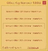
Changing Microsoft Office's product key is not as easy as it could be. Most usershave to completely reinstall their Office products in order to use another product key. Office Key Remover removes Office's license key(s) for you and the next time you start an Office product you are asked to enter a product key. Never has it been easier to change your...
Category: Utilities / System Surveillance
Publisher: pXc-coding, License: Freeware, Price: USD $0.00, File Size: 636.0 KB
Platform: Windows
Panoply is a Java application which enables the user to plot raster images of Geo-gridded data from netCDF datasets. Panoply is an utility that enable user to plot raster image. Depending on the data, it can draw global longitude-latitude images or pole-t
Category: Multimedia & Design / Illustration
Publisher: giss.nasa.gov, License: Freeware, Price: USD $0.00, File Size: 9.4 MB
Platform: Windows, Mac, 2K, 2K3, Vista
Where are your Internet visitors coming from?
Where are your Internet visitors coming from?
IP Address Country mapping Database can help you identify visitor's geographical location of an IP address. The IP Address to Country Code Database can be used for:
1>Real Time Geo-Locating ( Country )
2>Redirect based on country
3>Automatically target advertising by country
4>Geo targeting for...
Category: Web Authoring / Web Design Utilities
Publisher: Jgsoft Associates, License: Shareware, Price: USD $49.95, File Size: 235.0 KB
Platform: Windows, Linux, Mac, Palm
Building on top of OSSIM and OpenSceneGraph capabilities, ossimPlanet is a rapidly evolving project for accurate, high performance, 3D Geo-spatial visualization.
It automatically intersects with DTED and/or SRTM elevation trees for topography and handles a wide range of commercial and government file formats natively.
Additionally, remote layers can be...
Category: Multimedia & Design / Multimedia App's
Publisher: OSSIM, License: Shareware, Price: USD $0.00, File Size: 995.4 MB
Platform: Windows
The database tables contains geodata of the Federal Republic of Germany with Geo referenced towns, municipalities, town quarters and other administrative units, postal codes, telephone preselections, nature areas, landscapes, climatic zones and official topographical cartographies. The data contain coordinates for navigation and Geo-coding, proximity searches and distance...
Category: Business & Finance / Database Management
Publisher: Killet GeoSoftware Ing.-GbR, License: Data Only, Price: USD $175.00, EUR150, File Size: 3.2 MB
Platform: Windows
The Office Live Update 1.2 installs (1) performance updates to make using Office Live Workspace with Microsoft Office programs faster, (2) the latest Office Live Add-in for Microsoft Office that enables you to access your workspaces directly from Word, Ex
Category: Business & Finance / Applications
Publisher: microsoft.com, License: Freeware, Price: USD $0.00, File Size: 759.0 KB
Platform: Windows, Vista
High-quality PDF document creation and viewing software providing customers with needed business tools at affordable prices Combined with exceptional customer service.
Key Features
View, create, combine, search, print , and safely secure your PDF documents with easy to use permissions and controls
PDF Complete Key Advantages
Create PDF documents from almost...
Category: Utilities / System Utilities
Publisher: PDF Complete Inc, License: Shareware, Price: USD $49.95, File Size: 18.7 MB
Platform: Windows