Free Downloads: Localities
License: All | Free
The question for us to settle now,?
The question for us to settle now,? said Sealy, ?for it is no usewasting time in argument, is what individuals are there in thedifferent Localities that can be made tools of for our purpose?The best course, I think, to pursue is that suggested by Ginsling;that is, to make a canvass of the different Localities, and seewho can be influenced ?The question for us to settle now,? said...
Category: Home & Education / Genealogy
Publisher: goresource.info, License: Freeware, Price: USD $0.00, File Size: 532.5 KB
Platform: Windows
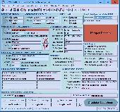
This is an astrology software for PC featuring chart calculation, files for Localities, states, time zones, transits, progressions, sun and moon returns and more. This program provides the utmost in user assistance for entering a chart. You just enter the name, date and time. AstroMart looks up the time shift (difference between legal local time and GMT, including daylight saving, etc.)....
Category: Business & Finance / Business Finance
Publisher: Frank Burns, License: Shareware, Price: USD $49.00, File Size: 18.6 MB
Platform: Windows
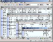
ORTWIN is a program for the state-wide inquiry of the Localities, postal codes and telephone selections in Germany. It finds postal zip codes, telephone pre selections, coordinates and ground level elevations. The program determines municipal codes, local center points, car license codes, topographic maps, Unlocodes and much more. It arranges Localities hierarchically into the...
Category: Business & Finance / Sales & Marketing Tools
Publisher: Killet GeoSoftware Ing.-GbR, License: Shareware, Price: USD $120.00, EUR110, File Size: 4.8 MB
Platform: Windows
Geodata of the Federal Republic Germany with municipalities, postal codes, telefone preselections. Suitable for branch searches, periphery searches and distance computations. Georeferences as Gauss Krueger, UTM and Geographic Coordinates and also Ground Level Elevations. ORTREF: 12.500 geocoded cities and municipalities. ORTGEM: Allocation of 12.500 cities and municipalities to the...
Category: Business & Finance
Publisher: C. Killet Software Ing.-GbR, License: Demo, Price: USD $195.00, File Size: 313.3 KB
Platform: Unknown
 Shareware
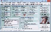
TOPOWIN is a state-wide register of the German Topographic Cartographies, the German Basic Cartography and of Localities with geo references in different coordinate systems. It is also a topographic information system. In the division of planning and execution of economical and scientific projects frequently topographic documents are used. The program TOPOWIN makes information available...
Category: Home & Education / Miscellaneous
Publisher: Killet GeoSoftware Ing.-GbR, License: Shareware, Price: USD $125.00, EUR110, File Size: 4.5 MB
Platform: Windows
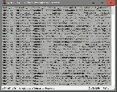
Geodata International - World-wide database of countries with georeferenced towns, municipalities, postal codes and administrative units with WGS84 and UTM coordinates and elevations for geocoding, proximity search, navigation, distance calculation. Often is it necessarily, for an address characteristic, e.g. the place name or the postal code, to establish a local relationship - a georeference....
Category: Software Development / Databases & Networks
Publisher: Killet GeoSoftware Ing.-GbR, License: Data Only, Price: USD $165.00, EUR150, File Size: 2.3 MB
Platform: Windows, Mac, Linux,
Geodata of international countries with locals, municipalities and postal codes. Georeferences as UTM- and geographic coordinates (WGS84, ETRS89). Suitable for branch searches, periphery searches and distance computations. These countries are available: Albania, Andorra, Belgium, Bosnia, Bulgaria, Denmark, Estonia, Finland, France, Georgia, Gibraltar, Greece, Great Britain, Ireland, Italy, Ex...
Category: Software Development
Publisher: Killet Software Ing.-GbR, License: Demo, Price: USD $195.00, File Size: 151.6 KB
Platform: Windows, Linux, Unix

Geodata of international countries with locals, municipalities and postal codes. Georeferences as UTM- and geographic coordinates (WGS84, ETRS89). Suitable for branch searches, periphery searches and distance computations. These countries are available: Albania, Andorra, Belgium, Bosnia, Bulgaria, Denmark, Estonia, Finland, France, Georgia, Gibraltar, Greece, Great Britain, Ireland, Italy, Ex...
Category: Business & Finance
Publisher: Killet Software Ing.-GbR, License: Demo, Price: USD $195.00, File Size: 151.6 KB
Platform: Windows, Linux, Unix, Not Applicable
License: All | Free