Free Downloads: Magellan Navigation System
Used Magellan toolbar for Internet Explorer.
Used Magellan toolbar for Internet Explorer. Find great deals on used Magellan gps devices at prices you can afford. Whether your looking for the Magellan Roadmate, Magellan Maestro, or Magellan CrossoverGPS you'll find it here at low prices. We are always searching our networks on a daily basis to bring you the best prices in used Magellan gps devices...
Category: Internet / Browsers
Publisher: Used Magellan, License: Freeware, Price: USD $0.00, File Size: 1.1 MB
Platform: Windows
Portable GPS Navigation toolbar for Internet Explorer.
Portable GPS Navigation toolbar for Internet Explorer. Find portable gps units for your car, truck or minvan from top name brands including Tom Tom, Magellan and Garmin. Discover the world of eBay and shop for portable gps Navigation systems directly from your browser toolbar.
Category: Internet / Browsers
Publisher: Portable GPS Navigation System, License: Freeware, Price: USD $0.00, File Size: 1.1 MB
Platform: Windows
With Magellan Communicator for PC you can create a direct connection between your web browser and your Magellan GPS receiver connected to PC via USB cable. Enables data transfer from Geocaching.com in GPX format.
Main features:
- Compatible with Geocaching.com
- Enable “Send to GPS" function
- Transfer GPX files
Category: Utilities / Misc. Utilities
Publisher: MiTAC International Corporation, License: Freeware, Price: USD $0.00, File Size: 8.5 MB
Platform: Windows
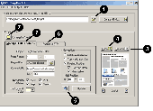
BCL Magellan converts PDF files and MS Office files to HTML format. You can also print almost any type of file directly to HTML. Magellan creates an HTML version of your document that looks just like the original. Viewers can zoom, search, and print the HTML document.
Category: Web Authoring / HTML Conversion Tools
Publisher: BCL Technologies, License: Commercial, Price: USD $129.00, File Size: 5.1 MB
Platform: Unknown
FREE GPS Software for your Garmin, Magellan or Lowrance GPS.
FREE GPS Software for your Garmin, Magellan or Lowrance GPS.
EasyGPS is the fast and easy way to upload and download waypoints, routes, and tracks between your Windows computer and your Garmin, Magellan, or Lowrance GPS. EasyGPS lists all of your waypoints on the left side of the screen, and shows a plot of your GPS data on the right. Use EasyGPS to back up and organize...
Category: Internet / Communications
Publisher: TopoGrafix, License: Freeware, Price: USD $0.00, File Size: 3.9 MB
Platform: Windows
Magellan Real Time Data Server ( RTDS ) is a new software offering land surveying companies the possibility of using GNSS equipment to build their own direct IP RTK corrections server.
The RTDS software will collect corrections sent by a GNSS base station and act as a gateway to make them available to any rover that connects to the software. Magellan RTDS is a PC...
Category: Internet / Misc. Servers
Publisher: Plaska GPS Service, Inc., License: Demo, Price: USD $0.00, File Size: 24.6 MB
Platform: Windows
Magellan Explorer makes it fun and easy to manage and organize your files. Use the built-in high-speed FTP client to update your web site, work directly with popular archive formats, and view pictures. All within a single, easy-to-use, attractive package. Whether you prefer the dual window layout of Norton Commander or are more familiar with Windows Explorer, you will feel right at...
Category: Utilities
Publisher: Enriva Development, License: Shareware, Price: USD $39.95, File Size: 4.4 MB
Platform: Windows
Magellan RoadMate
Category: Utilities / Misc. Utilities
Publisher: THALES, License: Shareware, Price: USD $0.00, File Size: 0
Platform: Windows
The ASP.NET 2.0 site Navigation System is built on a powerful and flexible architecture that has been designed to be extensible.
In addition to creating a compelling Navigation model that would appeal to both developers and web site designers, one of the other goals for the ASP.NET 2.0 Navigation System was to create an architecture that provided an...
Category: Web Authoring / Web Design Utilities
Publisher: Microsoft, License: Freeware, Price: USD $0.00, File Size: 155.5 KB
Platform: Windows
The Windows PC shareware program for Garmin and Magellan GPS receivers.
The Windows PC shareware program for Garmin and Magellan GPS receivers.
Main Features:
- transfer your waypoints, routes, and tracks from and to the GPS receiver, and save it on your computer disk
- review your waypoints
- enter and edit your waypoints
- define your routes and get the estimated traveling time
- review and edit your...
Category: Home & Education / Miscellaneous
Publisher: Heinrich Pfeifer, License: Freeware, Price: USD $0.00, File Size: 2.9 MB
Platform: Windows
AddMagMap add custom objects to Magellan MapSend maps.
AddMagMap add custom objects to Magellan MapSend maps. AddMagmap is a program with simple interface to add custom objects (lines, area, points) to MapSend maps. To use the program you should have at least one MapSend installed on your computer.
The program works on object-by-object basis: not necessary create a full custom map in one step, simply add object-by-object any...
Category: Home & Education / Miscellaneous
Publisher: msh-tools, License: Freeware, Price: USD $0.00, File Size: 1.2 MB
Platform: Windows
OziExplorer File Format Converter converts various waypoint, route and track file formats to and from OziExplorers own file formats.
Formats Supported:
- Holux wrt waypoint and tlg track file formats (read and write)
- Magellan Mapsend waypoint and track formats (read only)
- Magellan GPS memory card waypoint and track formats (read only)
-...
Category: Utilities / Misc. Utilities
Publisher: Des Newman, License: Freeware, Price: USD $0.00, File Size: 262.9 KB
Platform: Windows
The navigation device is a kind of mini computer which contains a GPS satellite navigation receiver.
The Navigation device is a kind of mini computer which contains a GPS satellite Navigation receiver. This allows the device to determine its current position. At least 4 satellites need to be received in order to be able to perform acceptable Navigation. The fifth satellite is required to obtain an altitude. As Navigation takes place in a dynamic state, there is...
Category: Business & Finance / Business Finance
Publisher: United Navigation, License: Freeware, Price: USD $0.00, File Size: 13.8 MB
Platform: Windows
AVIC FEEDS creates a link between your Pioneer AVIC Navigation system and your PC.
AVIC FEEDS creates a link between your Pioneer AVIC Navigation System and your PC.You can use AVIC FEEDS to view and edit data from your AVIC System.It allows you to bring content from your PC and the Internet to your AVIC System, import a Location from a Geo-Tagged Photo from Flickr and much more.
Category: Internet / Misc. Plugins
Publisher: PIONEER CORPORATION, License: Freeware, Price: USD $0.00, File Size: 12.8 MB
Platform: Windows
 Shareware
Take a legendary voyage around the world together with Ferdinand Magellan's crew on one of his famous galleons - the Victoria. Back in the 16th century she became the first ship to circumnavigate the globe and the only one to survive that long and exhausting expedition full of fierce battles and storms. Watch how fearlessly the beautiful galleon equipped with cannons glides over the...
Category: Desktop Enhancements / Screensavers
Publisher: Astro Gemini Software, License: Shareware, Price: USD $9.95, File Size: 14.7 MB
Platform: Windows
I-Navigation is a premium tool for all tasks of visual information management.
I-Navigation is a premium tool for all tasks of visual information management.
By absorbing the philosophy “a picture is worth a thousand words” I-Navigation will provide a comprehensive overview of a specific knowledge area and the links and interfaces between the core concepts will become apparent. It will support your decision process and the development of...
Category: Home & Education / Miscellaneous
Publisher: EXpert Software Applications, License: Shareware, Price: USD $119.00, File Size: 16.5 MB
Platform: Windows
PolarView NS is a complete user friendly on-board marine navigation system.
PolarView NS is a complete user friendly on-board marine Navigation System. It is available for Apple Mac OS X, Microsoft Windows and Linux operating systems. PolarView NS combines easy marine passage planning, tides and weather with live GPS Navigation and AIS capabilities.
Combining high-quality cartography with extensive instrument support, the applications deliver...
Category: Home & Education / Miscellaneous
Publisher: Polar Navy, License: Shareware, Price: USD $49.99, File Size: 4.0 MB
Platform: Windows
This is a different kind of chart plotting and data logging System for Navigation, pilotage and survey use in hydro graphic and also terrestrial applications. It can be run on the smallest Notebook PC for field use or larger Desktop systems. Portable Navigator is ideal for survey work because it enables users to create and update their own detailed vector charts of the area and to...
Category: Multimedia & Design / Multimedia App's
Publisher: ESL and Collins Software, License: Freeware, Price: USD $0.00, File Size: 9.9 MB
Platform: Windows
GPSCAD Transfer is an application for transferring points between a gps device and autocad.
GPSCAD Transfer is an application for transferring points between a gps device and autocad. The present version works with a Magellan GPS device, but the next release will also work with a Garmin gps device. It allows you to convert latitude and longitude to utm zone nad 83 in either the US or in metric measurement System.
Category: Multimedia & Design / Image Editing
Publisher: Timberwolf Software Solutions, LLC, License: Shareware, Price: USD $0.00, File Size: 2.6 MB
Platform: Windows
Macau GeoGuide PC version, developed and maintained by the Macao Cartography and Cadastre Bureau (DSCC), is an interactive map Navigation System running on desktop PC. The main functions are map Navigation, feature searching and path finding. The software contains rich geographic information and allows the users to explore and search for Macao maps without connecting to the...
Category: Home & Education / Miscellaneous
Publisher: DSCC, License: Freeware, Price: USD $0.00, File Size: 29.5 MB
Platform: Windows
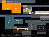
dhtmlxMenu represents an excellent solution for web navigation.
dhtmlxMenu represents an excellent solution for web Navigation. If you need to integrate Ajax-enabled DHTML Navigation System into your web application or web site you can do it easily with dhtmlxMenu.This JavaScript Navigation component enables to create attractive popup or drop down menus. It?s flexible, powerful, lightweight and easy to use. dhtmlxMenu allows to...
Category: Web Authoring / JavaScript
Publisher: DHTMLX Ltd., License: Shareware, Price: USD $49.00, File Size: 101.0 KB
Platform: Windows, Mac, Linux, Unix
OziExplorer is a flamboyant GPS Mapping Software that runs on the PC and works with varieties of GPS receivers such as Garmin, Lowrance, Magellan, Eagle, Brunton, Silva and MLR for the uploading or downloading the waypoints, routes and tracks and most brands of GPS receivers for real time tracking of GPS position.
Using this software, the user can use maps and charts that...
Category: Internet / Communications
Publisher: Des Newman, License: Shareware, Price: USD $95.00, File Size: 6.8 MB
Platform: Windows
jQuery menus are different than other plain ul' CSS and HTML menus, they bring life to your site.
jQuery menus are different than other plain ul' CSS and HTML menus, they bring life to your site. They make your site recognizable, memorable for the users. Javascript makes it possible to create more interactive, more responsive and more flexible Navigation to any website. Ranging from simple buttons and horizontal simple menus to dropdown and even menus with cool Lavalamp effect. For...
Category: Web Authoring / JavaScript
Publisher: Apycom jQuery, License: Freeware, Price: USD $0.00, File Size: 30.0 KB
Platform: Windows, Linux, Mac
The Tresco Inland ECDIS viewer is the standard software for navigation in Inland Shipping.
The Tresco Inland ECDIS viewer is the standard software for Navigation in Inland Shipping. The program is connected with a GPS System and shows continiously the ships position on screen. Everything you need for Navigation is on the map. This is information like VHF channels, radar information, radio reporting points, place names, distance marks, bridge clearance, harbour...
Category: Business & Finance / Business Finance
Publisher: Tresco Navigation Systems, License: Shareware, Price: USD $0.00, File Size: 0
Platform: Windows
When you have a Pocket PC based Navigation System and your software supports user defined POIs (Points Of Interest), you need POIView SE. This program helps you to manage, view, edit and print these POIs directly on your desktop PC. This version has direct access to the POIHandler POI collection.
Category: Utilities / Misc. Utilities
Publisher: Bluescreen, License: Freeware, Price: USD $0.00, File Size: 439.6 KB
Platform: Windows