Free Downloads: Map Garmin South America
OziExplorer is a flamboyant GPS Mapping Software that runs on the PC and works with varieties of GPS receivers such as Garmin, Lowrance, Magellan, Eagle, Brunton, Silva and MLR for the uploading or downloading the waypoints, routes and tracks and most brands of GPS receivers for real time tracking of GPS position.
Using this software, the user can use maps and charts that...
Category: Internet / Communications
Publisher: Des Newman, License: Shareware, Price: USD $95.00, File Size: 6.8 MB
Platform: Windows
Northwest Trails is a mapset of trails designed for upload to any map-enabled Garmin GPS receiver.
Northwest Trails is a mapset of trails designed for upload to any Map-enabled Garmin GPS receiver. It is more than just a mapset, though; it is also a community effort initiated to record and collect GPS data for trails in the Northwest (Washington, Idaho, Oregon, Montana, Wyoming, Alaska, British Columbia and Alberta) and provide that data for general public use.
The...
Category: Internet / Misc. Plugins
Publisher: Jon F. Stanley, License: Freeware, Price: USD $0.00, File Size: 31.7 MB
Platform: Windows
Moagu: The Mother Of All GPS Utilities.
Moagu: The Mother Of All GPS Utilities.
You can convert USGS topographic maps, aerial/satellite imagery, and any other raster Map imagery for use on Garmin handled GPS units.
Garmin maps have been in a "vector" format; Moagu creates maps using a "bitmap" format.
Category: Home & Education / Miscellaneous
Publisher: Moagu, License: Shareware, Price: USD $19.95, File Size: 38.2 MB
Platform: Windows
GeoVisu is a program that displays georeferenced data (images, graphics) and downloads data recorded by some GPS devices.
GeoVisu has a "Moving Map" navigation function, which can be used with any NMEA 0183 compatible or Garmin USB GPS device.
Main features:
- Displays georeferenced image formats : GeoTiff, ECW and ECWP, MrSID,...
Category: Multimedia & Design / Graphics Viewers
Publisher: GeoVisu, License: Freeware, Price: USD $0.00, File Size: 1.7 MB
Platform: Windows
South Point Poker is the exclusive online poker room of the South Point Hotel, Casino & Spa in Las Vegas, Nevada. Our aim is to provide all poker fans a free online destination to play and to learn poker. Players can win up to $100K in cash and prizes every month, and your wins are 100% guaranteed by the South Point Casino. Please have fun at the tables and enjoy your...
Category: Games / Cards, Casino, Lottery
Publisher: Power Play Development, License: Freeware, Price: USD $0.00, File Size: 4.9 MB
Platform: Windows
Prepare yourself for South Park Mario Brothers - Enhanced Edition.
Prepare yourself for South Park Mario Brothers - Enhanced Edition. Now Bigger and Better than ever! South Park Super Mario Brothers Enhanced Edition featuring Kenny and other pals from South Park with a mission to save the Princess while kicking a lot of butt. Now with additional worlds. Do you think you are ready?
Category: Games / Adventure & RPG
Publisher: MicroSmarts LLC, License: Freeware, Price: USD $0.00, File Size: 1.9 MB
Platform: Windows
AGIS for Windows is a mapping and simple GIS shareware package.
AGIS for Windows is a mapping and simple GIS shareware package. Plot your own geographic data on the Map of the world provided without the high cost and steep learning curve usually associated with this kind of software. Create high resolution publication quality images that can be pasted into popular packages such as MS Word. Animation, web serving, distance measuring, searching, GPS...
Category: Multimedia & Design / Multimedia App's
Publisher: AGIS Software Pty Ltd, License: Shareware, Price: USD $49.00, File Size: 3.6 MB
Platform: Windows
Hidden Expedition Everest is a hidden-oject game developed by Big Fish Studios.
Hidden Expedition Everest is a hidden-oject game developed by Big Fish Studios.
Plot:
With this game you are going to travel to one of the most exciting places of the world: the Everest. As you may know the Everest is the highest peak of the world and year after year a lot of people try to get to its top.
As a member of the Hidden Expedition Club, you've...
Category: Games / Adventure & RPG
Publisher: Big Fish Studios, License: Shareware, Price: USD $6.99, File Size: 75.3 MB
Platform: Windows
Sukhumvit is a sample Map of the area around Ploenchit and Sukhumvit Roads in Bangkok including Soi Nana/Soi 4 and Soi Cowboy.This Map - as are all Rotweiler maps - is fully routable and searchable on all Garmin GPSrs.This demo Map includes an area familiar to most residents and visitors to Bangkok
Category: Home & Education / Miscellaneous
Publisher: Rotweilermaps, License: Demo, Price: USD $0.00, File Size: 393.0 KB
Platform: Windows
South Afircan rugby is a software made for all those who are passionate about their rugby.
South Afircan rugby is a software made for all those who are passionate about their rugby. It contains a lot of interesting info about the sport, such as guidebooks and rulebooks, a schedule of the South African rugby league matches, as well as the next encounters in the Trinations cup for the Soth African National Team.
Raul Steimberg is typing...
Category: Home & Education / Miscellaneous
Publisher: D6 Technology, License: Freeware, Price: USD $0.00, File Size: 5.9 MB
Platform: Windows
Representing a new concept in the field of Ham Maps, the Global Overlay Mapping System is packed full of features for all Ham Radio enthusiasts, including : 1 World Map, with specialised satellite images and world region-boundaries. 8 Continental Maps - Europe, Asia, Africa, North and South America, Oceania, Arctic, Antarctica. 29 Sub Continental Maps, with Single Click...
Category: Home & Education / Miscellaneous
Publisher: MapAbility, License: Freeware, Price: USD $0.00, File Size: 4.9 MB
Platform: Windows
The white-tailed deer is an endangered species that lives in most of the US and some parts of Canada and Mexico, and several of its subspecies also live in parts of South America and Europe. Even in the regions where it is supposed to abound, this ruminant is very hard to see. This animated screensaver brings this beautiful species right to your desktop. It features a nice...
Category: Desktop Enhancements / Screensavers
Publisher: Freeze.com, LLC, License: Freeware, Price: USD $0.00, File Size: 1.6 MB
Platform: Windows
 Shareware
The Eye4Software Coordinate Calculator is an easy to use tool to perform Map or GPS coordinate conversions. The software can be used to transform a single coordinate or a batch of coordinates read from a comma separated, database or ESRI shapefiles. The software is shipped with a MS Access database file, containing more then 3500 ellipsoid, Map datum and Map grid...
Category: Business & Finance / Calculators
Publisher: Eye4Software B.V., License: Shareware, Price: USD $49.00, EUR39, File Size: 3.2 MB
Platform: Windows
To get started, download the free Garmin Voice Studio program and install it on your PC¹.
To get started, download the free Garmin Voice Studio program and install it on your PC¹. You will be led through a series of phrases that can be edited and reviewed directly within the application.
To achieve the best quality recordings, an external microphone is recommended. Once finished, you’ll be ready to go with custom voices on your compatible device!...
Category: Audio / Music Management
Publisher: Garmin Ltd or its subsidiaries, License: Shareware, Price: USD $0.00, File Size: 0
Platform: Windows
OZtopo provides an alternative set of maps, suitable for use on Garmin GPS units.
OZtopo provides an alternative set of maps, suitable for use on Garmin GPS units. It has been designed as a detailed set of topographical maps suitable for bushwalking, 4WDing and general touring . It is comprised of two mapsets, 10m Contours and Roads and Tracks. Both mapsets can be loaded onto a GPS at the same time. They can also be loaded concurrently with any of Garmin's...
Category: Business & Finance / Business Finance
Publisher: Oztopo, License: Shareware, Price: USD $0.00, File Size: 75.7 MB
Platform: Windows
Whether you're exploring new coastline or cruising your favorite bay, BlueChart Atlantic contains the most detailed marine cartography around. These electronic nautical maps give you peace of mind when navigating offshore.
The BlueChart Atlantic CD-ROM includes coverage for several offshore regions — select one of these regions to view and download charts with this purchase....
Category: Home & Education / Miscellaneous
Publisher: Garmin Ltd or its subsidiaries, License: Shareware, Price: USD $0.00, File Size: 0
Platform: Windows
Whether you are surfing at the beaches, climbing mountains and volcanos, or trekking through the rainforest, this Map will help you orient yourself the whole time you are exploring Costa Rica. A local, scale GPS Map of the entire country of Costa Rica in Central America with many features you would not normally have in your GPS.
In addition to roads and contours for...
Category: Internet / Misc. Plugins
Publisher: GPSTravelMaps.com, License: Shareware, Price: USD $0.00, File Size: 0
Platform: Windows
Do you need a menu based on a map of your home town?
Do you need a menu based on a Map of your home town? Do you need to navigate through a business which is geographically spread around the state or country? Are you compiling technical/scientific documentation where you need pop-up information for strangely shaped parts? Are you preparing and distributing plans of your building to emergency services? All of these situations require...
Category: Internet / Tools & Utilities
Publisher: Image Intelligence Software Ltd., License: Shareware, Price: USD $129.00, File Size: 297.0 KB
Platform: Windows, Mac, Linux,
Rails Across America is a game of railroad empires in North America, covering the period from 1830 to the near future. It is a real-time strategy game with a "sim" flavor. Rails allows hundreds of tracks with thousands of trains crossing the continent. Players focus on strategic decisions: where to expand, where to compete, and when to call in favors from government...
Category: Games / Strategy & War
Publisher: Flying Lab Software LLC, License: Demo, Price: USD $0.00, File Size: 46.2 MB
Platform: Windows
Money Saving South Beach Miami Travel Tips Ebook, FREE Download!
Money Saving South Beach Miami Travel Tips Ebook, FREE Download! Discover the money savings tips and tricks. Beaches, museums, delicious eats for many times half the cost.
Don't get taken in South Beach. With this manual you won't! How to book a hotel for
dirt cheap. Fly for a lot less and enjoy yourself twice as much. South Beach Uncovered
guides you through the...
Category: Home & Education / Miscellaneous
Publisher: SouthBeachUncovered.com, License: Freeware, Price: USD $0.00, File Size: 2.0 KB
Platform: Windows, Linux, Mac
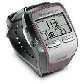
Screensaver with a Garmin Forerunner theme. .
Screensaver with a Garmin Forerunner theme.
Category: Desktop Enhancements / Screensavers
Publisher: Garmin Forerunner 305, License: Freeware, Price: USD $0.00, File Size: 1.5 MB
Platform: Windows
KANINE Software has become the most chosen K9 Records software in America.
KANINE Software has become the most chosen K9 Records software in America. KANINE tracks all K-9 requirements, is Windows 7 and Network compatible, and it produces the reports that today’s K-9 teams need for court or other reporting purposes. KANINE Software is cost effective and is the only software application on the market that has the option to include a GPS Data logging unit...
Category: Business & Finance / Business Finance
Publisher: Code Blue Designs, License: Shareware, Price: USD $175.00, File Size: 21.1 MB
Platform: Windows
DNRGarmin is a smart tool used to directly transfer data between Garmin GPS handheld receivers and various GIS software packages.
DNRGarmin was built to provide users the ability to directly transfer data between Garmin GPS handheld receivers and various GIS software packages. Using DNRGarmin a user can use point features (graphics or shapefile) and upload them to the...
Category: Utilities / Misc. Utilities
Publisher: GIS Section, Minnesota Department of Natural Resources, License: Freeware, Price: USD $0.00, File Size: 11.3 MB
Platform: Windows
Magic Map helps you locate your targets quickly by phone numbers, street addresses, or zip numbers.
Magic Map helps you locate your targets quickly by phone numbers, street addresses, or zip numbers. You can try to find anything you like around any neighborhood using the new local search feature. Flexible personal marker sets can help you create customi
Category: Internet / Tools & Utilities
Publisher: tekmagicsolutions.com, License: Freeware, Price: USD $0.00, File Size: 656.0 KB
Platform: Windows, Mac, 2K, 2K3
FREE GPS Software for your Garmin, Magellan or Lowrance GPS.
FREE GPS Software for your Garmin, Magellan or Lowrance GPS.
EasyGPS is the fast and easy way to upload and download waypoints, routes, and tracks between your Windows computer and your Garmin, Magellan, or Lowrance GPS. EasyGPS lists all of your waypoints on the left side of the screen, and shows a plot of your GPS data on the right. Use EasyGPS to back up and organize...
Category: Internet / Communications
Publisher: TopoGrafix, License: Freeware, Price: USD $0.00, File Size: 3.9 MB
Platform: Windows