Free Downloads: Marine Coordinates
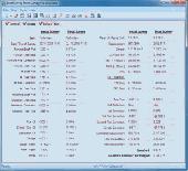
Marine Software Suite is a user-friendly Draught Survey, Lashing Calc and Marine Navigator software for Marine Surveyors and Ships Officers. Marine Software Suite is easily operated using either mouse or keyboard. It complies with the latest UNECE standards and MSC Code of Safe Practice for Cargo Stowage and Securing (2003 Edition) (Annex 13) for Draught Surveying...
Category: Desktop Enhancements / Screensavers
Publisher: ATYG Marine Software Inc., License: Shareware, Price: USD $199.00, File Size: 3.5 MB
Platform: Windows, Linux, Mac
Marine life is always an interesting topic for a research.
Marine life is always an interesting topic for a research. Start your own survey with the help of our Free 3D Marine Screensaver. It will show you one day of an underwater inhabitant's life. See how our lobster crawls on a sea bottom about its business and doesn't pay any attention on fish swimming around. Plunge into amazing Marine world with this screensaver!
Category: Desktop Enhancements / Screensavers
Publisher: 3D Savers, License: Freeware, Price: USD $0.00, File Size: 6.9 MB
Platform: Windows
Cartesian Coordinates, spherical Coordinates und cylindrical Coordinates can be transformed into each other. (5 languages, 2 and 3 dimensions)
Category: Home & Education / Miscellaneous
Publisher: Greuer Andreas, License: Shareware, Price: USD $11.00, File Size: 993.3 KB
Platform: Windows
Draft Survey and Lashing calculations
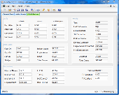
Marine Software Bundle is a user-friendly Draught Survey calculation program for Ships' Officers and Marine Surveyors. It is easily operated using either Keyboard or Mouse. Marine Software Bundle complies with the latest UN ECE standards for Draught Surveying and can print to all standard printer types.
Course and Distance...
Category: Business & Finance / MS Office Addons
Publisher: ATYG Marine Software Inc., License: Shareware, Price: USD $99.95, File Size: 5.4 MB
Platform: Windows
Draft Survey and Lashing calculations
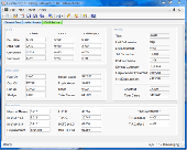
Marine Software Bundle is a user-friendly Draught Survey calculation program for Ships' Officers and Marine Surveyors. It is easily operated using either Keyboard or Mouse. Marine Software Bundle complies with the latest UN ECE standards for Draught Surveying and can print to all standard printer types.
Course...
Category: Business & Finance / MS Office Addons
Publisher: ATYG Marine Software Inc., License: Shareware, Price: USD $0.00, File Size: 7.7 MB
Platform: Windows
Space Marine is an exciting action game, with lots of weapons and mission for you to discover.
Space Marine is an exciting action game, with lots of weapons and mission for you to discover. You have to eliminate your enemies , developing your character and increasing your skill levels, confronting enemies that become harder to kill. Space Marine features a fluid combat system that allows players to seamlessly switch from ranged to melee weapons without interrupting the flow...
Category: Games / Action
Publisher: THQ, License: Shareware, Price: USD $79.99, File Size: 2.0 GB
Platform: Windows
Draft Survey and Lashing calculations
Marine Software Bundle is a user-friendly Draught Survey calculation program for Ships' Officers and Marine Surveyors. It is easily operated using either Keyboard or Mouse. Marine Software Bundle complies with the latest UN ECE standards for Draught Surveying and can print to all standard printer types.
Course and Distance...
Category: Business & Finance / MS Office Addons
Publisher: ATYG Marine Software Inc., License: Shareware, Price: USD $99.95, File Size: 5.4 MB
Platform: Windows
The Surface Area Calculator is a tool for easily calculating surface and planimetric areas, as well as volumes.
The extent and shape of the area in question are given in terms of the Coordinates of a number of points throughout the area.
These Coordinates can be specified as either latitude, longitude, and height, as GPS Coordinates (geocentric Cartesian...
Category: Business & Finance / Calculators
Publisher: Microsearch Corp, License: Shareware, Price: USD $134.00, File Size: 1.2 MB
Platform: Windows
Marine and her friends have six days to find the four remaining warriors and make it to the showdown!
With such tight schedule and dramatic events piling up, Marine's nerves are all over the place.
But Jeanne the tiny fairy is back! And this alone helps even the balance!
Category: Games / Adventure & RPG
Publisher: Aldorlea Games, License: Shareware, Price: USD $13.99, File Size: 149.7 MB
Platform: Windows
ROCKTEC Marine is a technical calculation program to be used for calculation of surface temperature, insulation thicknesses and heat loss for technical installation i.e. pipes or boilers on board ships and off shore installations. The calculations are based on our product range within Marine & offshore.
Category: Business & Finance / Calculators
Publisher: Rockwool A/S, License: Freeware, Price: USD $0.00, File Size: 3.5 MB
Platform: Windows
Living Marine Aquarium 2 is an animated screensaver that turns your screen into an aquarium.
Living Marine Aquarium 2 is an animated screensaver that turns your screen into an aquarium. When your computer becomes idle, this screensaver displays a colorful and relaxing scene with Marine plants, fish and other underwater creatures, and with a coral reef in the background. All the while you hear the sound of bubbles coming from your speakers.
You can access its...
Category: Desktop Enhancements / Screensavers
Publisher: W3i, LLC, License: Freeware, Price: USD $0.00, File Size: 1.6 MB
Platform: Windows
Draft Survey and Lashing calculationsMarine Software Bundle is a user-friendly Draught Survey calculation program for Ships' Officers and Marine Surveyors. It is easily operated using either Keyboard or Mouse. Marine Software Bundle complies with the latest UN ECE standards for Draught Surveying and can print to all standard printer types. Course and Distance calculations...
Category: Business & Finance / MS Office Addons
Publisher: ATYG Marine Software Inc., License: Shareware, Price: USD $49.99, File Size: 3.8 MB
Platform: Windows
- Plot regular and parametric equations.
- Plot regular and parametric equations.
- Plot Coordinates tables.
Graphing Calculator 3D is an easy-to-use tool that plots 2D and 3D functions.
Graphing Calculator 3D features :
- Instant quick plotting after each key stroke.
- Cartesian/Polar Coordinates in 2D.
- Cart/Cylindrical/Spherical Coordinates in 3D.
- Inequalities in 2D...
Category: Home & Education / Mathematics
Publisher: Runiter Company, License: Shareware, Price: USD $49.95, File Size: 4.3 MB
Platform: Windows
CoordTrans converts geographic coordinates between different coordinate systems.
CoordTrans converts geographic Coordinates between different coordinate systems.
CoordTrans is very easy to use, and full of Wizards to help you with more complex tasks.
Convert between UTM, WGS84 and NAD27 / NAD83, and more... almost all projections and datums on Earth are supported. See complete list..
You can convert single Coordinates, or...
Category: Business & Finance / Business Finance
Publisher: Franson, License: Shareware, Price: USD $49.00, File Size: 6.5 MB
Platform: Windows
MarineUpdater is a Windows-based PC application which works in conjunction with a Garmin USB card reader, a Garmin data card, and an Internet connection to generate software update cards for your fixed-mount Garmin Marine products. Products which support MarineUpdater will program a data card with information about your Garmin Marine product and other Garmin Marine products...
Category: Home & Education / Miscellaneous
Publisher: Garmin Ltd or its subsidiaries, License: Freeware, Price: USD $0.00, File Size: 2.0 MB
Platform: Windows
PolarView NS is a complete user friendly on-board marine navigation system.
PolarView NS is a complete user friendly on-board Marine navigation system. It is available for Apple Mac OS X, Microsoft Windows and Linux operating systems. PolarView NS combines easy Marine passage planning, tides and weather with live GPS navigation and AIS capabilities.
Combining high-quality cartography with extensive instrument support, the applications deliver the...
Category: Home & Education / Miscellaneous
Publisher: Polar Navy, License: Shareware, Price: USD $49.99, File Size: 4.0 MB
Platform: Windows
Aerial, topograhpic, and other types of maps are an important resource in the visualization of your information. HuntSmart big game hunting software gives you the ability to view your information on maps. Once you enter information with Coordinates into the system, this information can be viewed on all available maps that contain those Coordinates. One thing to remember is that...
Category: Multimedia & Design / Multimedia App's
Publisher: HuntingSouth, License: Shareware, Price: USD $0.00, File Size: 17.1 MB
Platform: Windows
DXF2XYZ converts a DXF file to an XYZ file, ie a comma delimited text file containing just xyz Coordinates. It can be useful for extracting the raw XYZ Coordinates from a DXF file containing say contours or other elevation entities.
This utility it limited to extracting the XYZ Coordinates from the following DXF entity types:
POINT, LINE, POLYLINE /...
Category: Business & Finance / Calculators
Publisher: H. Wind, License: Freeware, Price: USD $0.00, File Size: 657.6 KB
Platform: Windows
If you've ever tried to maintain cruising, fuel, maintenance and catch logs for your boat using a paper Marine log book, you understand what a chore that can be...
- It is never around when you need it.
- It doesn't exactly fit in your pocket.
- It is too inconvenient to use at a busy fuel dock.
- It is difficult to make entries during the...
Category: Business & Finance / Applications
Publisher: Gus! Communication LTD, License: Shareware, Price: USD $49.00, File Size: 2.9 MB
Platform: Windows
In Warhammer® 40,000®: Space Marine® you are Captain Titus of the Ultramarines, humanity's last hope for survival in a war-ridden future. Step into the armor of this superhuman warrior and use a lethal combination of deadly weapons to crush overwhelming alien forces. Fight against the savage Orks and the unholy forces of Chaos in a brutally violent world based on the...
Category: Games / Adventure & RPG
Publisher: Relic Entertainment, License: Shareware, Price: USD $0.00, File Size: 0
Platform: Windows
GoArrow displays an arrow on your screen that points towards coordinates that you specify.
GoArrow displays an arrow on your screen that points towards Coordinates that you specify. This is very handy if you have to run to Coordinates with obstacles in the way (like mountains), or if you're just directionally-challenged.
GoArrow has the ability to find a route between any two locations in Dereth, as well as look up locations' details from either the...
Category: Home & Education / Miscellaneous
Publisher: Digero of Leafcull, License: Freeware, Price: USD $0.00, File Size: 7.7 MB
Platform: Windows
The CooRecorder program is used for registration of coordinates taken from images.
The CooRecorder program is used for registration of Coordinates taken from images.
You can use your computer scanner to take interesting photos of things which can be placed on the top of your scanner. If the things are transparent and small, they can be taped up on transparent film and then inserted into a film scanner. An image scanned as a photo from such a thing can be...
Category: Home & Education / Science
Publisher: Cybis Elektronik & Data AB, License: Shareware, Price: USD $68.00, File Size: 0
Platform: Windows
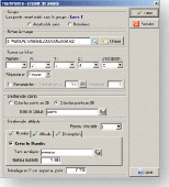
FlashPoints is a tool for creating and managing points Groups (topographic points for example). FlashPoints allows you to : * import/export points Coordinates from and to a file * create points and their attributes "Number", "Elevation" and "Description" by clicking * modify the points elevation * modify the height and rotation of the attributes * create...
Category: Multimedia & Design
Publisher: DeliCAD, License: Shareware, Price: USD $49.00, File Size: 1.2 MB
Platform: Windows
ElcoShip is a paperless solution for all your marine coating inspection requirements.
ElcoShip is a paperless solution for all your Marine coating inspection requirements.ElcoShip provides traceable real time information on the status of all coating inspections throughout the ship build – automatically generating the IMO PSPC compliant Coating Technical File.
Category: Audio / Utilities & Plug-Ins
Publisher: Elcometer Limited, License: Demo, Price: USD $0.00, File Size: 77.2 MB
Platform: Windows
Do you have coordinates for some places of interest?
Do you have Coordinates for some places of interest? Do you want to find them on Earth's surface? There are more than 2,000 coordinate systems available to make Google Earth follow your interests! Plex.Mark! simply placemarks your world!
Have you found a place in Google Earth and you would like to have the Coordinates in your coordinate system? Plex.Mark! will now make...
Category: Internet / Browser Accessories
Publisher: Plexscape, License: Freeware, Price: USD $0.00, File Size: 601.9 KB
Platform: Windows


